Энгельхартштеттен (Engelhartstetten, Engelhartstetten)

 Hiking in Энгельхартштеттен
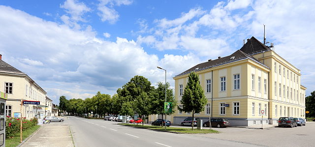
Engelhartstetten is a small village located in Austria, specifically in the state of Lower Austria. Nestled within the scenic landscapes and gently rolling hills of the region, Engelhartstetten offers a variety of outdoor activities, including hiking.
While the village itself may not boast extensive trail systems, it is situated near the Danube River and numerous nature reserves, providing opportunities for beautiful hikes. Here are some aspects to consider for hiking in and around Engelhartstetten:
-
Scenic Trails: The area features several walking and hiking trails that showcase the natural beauty of the landscape, including views of the Danube and nearby vineyards. Look for trails suitable for various skill levels.
-
Nature Reserves: The region surrounding Engelhartstetten includes protected areas, such as the Donau-Auen National Park, which is a great location for more adventurous hiking. The park is known for its diverse flora and fauna, offering opportunities for both casual walks and more challenging hikes.
-
Cultural Sites: When hiking in this area, you may also encounter historical and cultural sites, such as local churches, traditional farms, and vineyards. Incorporating these elements can enhance your hiking experience.
-
Accessibility: Engelhartstetten is conveniently located near larger towns, making it accessible for day trips or longer hikes if you choose to explore the surrounding area.
-
Seasonal Considerations: The best times for hiking are typically late spring through early autumn, when the weather is mild and the trails are most accessible. Always check the local forecast before heading out.
-
Local Guides: If you're unfamiliar with the area or want to ensure a safe and informative hike, consider hiring a local guide who can provide insights into the trails and the local environment.
Before you set off on any hike, ensure you have the proper gear, such as sturdy footwear, ample water, and snacks. Always follow local trail guidelines and respect nature to preserve the beauty of the area for future hikers!
- Страна:

- Почтовый код: 2292
- Телефонный код: 02214
- Код автомобильного номера: GF
- Координаты: 48° 11' 0" N, 16° 53' 0" E


- GPS треки (wikiloc): [Ссылка]
- Высота над уровнем моря: 143 м m
- Площадь: 65.66 кв.км
- Население: 1979
- Веб сайт: http://www.engelhartstetten.at
- Википедия русская: wiki(ru)
- Википедия английская: wiki(en)
- Википедия национальная: wiki(de)
- Хранилище Wikidata: Wikidata: Q547840
- Катеория в википедии: [Ссылка]
- код Freebase: [/m/02qtsb8]
- код GeoNames: Альт: [2780073]
- код VIAF: Альт: [237440833]
- код GND: Альт: [4481833-6]
- идентификатор местоположения ArchINFORM: [5710]
- код австрийского муниципалитета: [30814]
Граничит с регионами:
Мархег
Hiking in Мархег
Marchegg, located in Austria near the borders with Slovakia and Hungary, is an excellent destination for hiking enthusiasts, offering beautiful landscapes and diverse natural environments. Here’s what you can expect while hiking in the area:...
- Страна:
- Телефонный код: 02285
- Код автомобильного номера: GF
- Координаты: 48° 16' 37" N, 16° 54' 25" E
- GPS треки (wikiloc): [Ссылка]
- Высота над уровнем моря: 143 м m
- Площадь: 45.52 кв.км
- Население: 2960
- Веб сайт: [Ссылка]

Петронелль-Карнунтум
- ярмарочная коммуна в Австрии
Hiking in Петронелль-Карнунтум
Petronell-Carnuntum, located in Austria near the Danube River, is an area rich in history and nature, making it a fantastic destination for hiking enthusiasts....
- Страна:
- Почтовый код: 2404
- Телефонный код: 02163
- Код автомобильного номера: BL
- Координаты: 48° 6' 53" N, 16° 51' 57" E
- GPS треки (wikiloc): [Ссылка]
- Высота над уровнем моря: 175 м m
- Площадь: 25.37 кв.км
- Население: 1245
- Веб сайт: [Ссылка]

Эккартсау
- Политическая община в Австрии
Hiking in Эккартсау
Eckartsau is a charming area located in the northeastern part of Austria, known for its scenic landscapes and rich natural surroundings. Situated near the Danube River, it offers various hiking opportunities that cater to all levels of hikers, from beginners to experienced trekkers....
- Страна:
- Почтовый код: 2305
- Телефонный код: 02214
- Код автомобильного номера: GF
- Координаты: 48° 8' 43" N, 16° 47' 51" E
- GPS треки (wikiloc): [Ссылка]
- Высота над уровнем моря: 147 м m
- Площадь: 48.97 кв.км
- Население: 1283
- Веб сайт: [Ссылка]

Лассе
Hiking in Лассе
Lassee is a charming village located in Lower Austria, close to the border with the city of Vienna. While primarily known for its agricultural landscape and proximity to urban areas, Lassee and its surroundings offer a variety of hiking opportunities that cater to different skill levels....
- Страна:
- Почтовый код: 2291
- Телефонный код: 02213
- Код автомобильного номера: GF
- Координаты: 48° 13' 32" N, 16° 49' 23" E
- GPS треки (wikiloc): [Ссылка]
- Высота над уровнем моря: 148 м m
- Площадь: 55.62 кв.км
- Население: 2765
- Веб сайт: [Ссылка]

Хайнбург
Hiking in Хайнбург
Hainburg an der Donau is a charming town in Austria located near the confluence of the Danube River and the March River, and it serves as a gateway to exploring the beautiful landscapes of the surrounding region. Here are some highlights for hiking around Hainburg:...
- Страна:
- Почтовый код: 2410
- Телефонный код: 02165
- Код автомобильного номера: BL
- Координаты: 48° 8' 52" N, 16° 56' 31" E
- GPS треки (wikiloc): [Ссылка]
- Высота над уровнем моря: 161 м m
- Площадь: 25.04 кв.км
- Население: 6570
- Веб сайт: [Ссылка]