
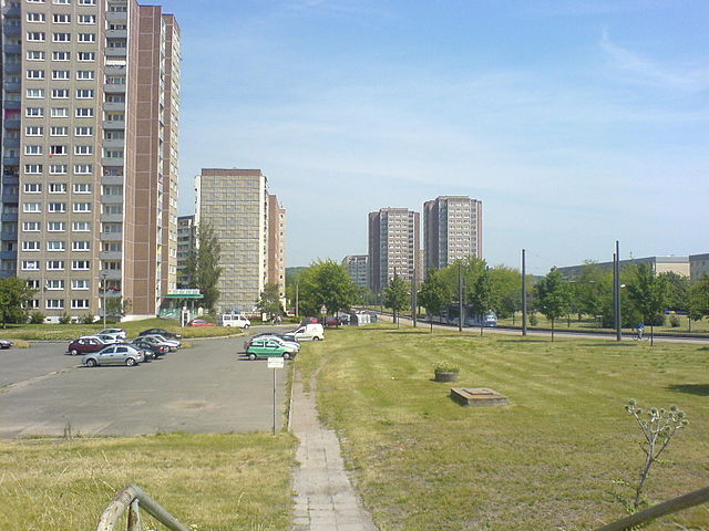
Эрфурт (Erfurt, Erfurt)


- город в земле Тюрингия, Германия
 Hiking in Эрфурт
Hiking around Erfurt, the capital of Thuringia in central Germany, offers a unique blend of natural beauty and cultural experiences. The region is characterized by picturesque landscapes, rolling hills, and charming villages, as well as numerous trails suitable for all hiking levels. Here are some highlights to consider:
Hiking Trails and Natural Areas
-
Thuringian Forest (Thüringer Wald):
- This expansive forest is located just south of Erfurt and features several hiking trails. The Rennsteig Trail, one of the most famous long-distance trails in Germany, runs through this area, providing stunning views and rich biodiversity.
-
Schwarzatal (Black Valley):
- A scenic area to the south of Erfurt, the Schwarzatal offers picturesque hiking options with beautiful valleys, streams, and ancient rock formations. Trails here vary in difficulty, making it an excellent choice for both novice and experienced hikers.
-
Weimarer Land:
- Close to Erfurt, this area features a variety of trails that connect historic towns and natural landscapes. The trails often incorporate cultural sites, making it a great option for those interested in both nature and history.
-
Ettersburg:
- A notable hill near Erfurt, it offers various hiking paths with panoramic views of the surrounding landscape, including the city and the Thuringian Forest. The area is well marked and suitable for day hikes.
Tips for Hiking in Erfurt
- Local Maps and Guides: Make sure to carry a detailed map or app (like Komoot or Outdooractive) to navigate the trails effectively.
- Weather Considerations: Check the weather ahead of time, and dress in layers. The weather can change quickly, especially in higher elevations.
- Trail Markings: Many trails in Thuringia are well marked with signposts; however, always ensure you are on the right path.
- Facilities: Some area trailheads may have amenities such as parking, restrooms, and eateries, but it's wise to pack food and water, especially for longer hikes.
- Wildlife and Flora: Keep an eye out for local wildlife and enjoy the diverse plant life along the trails.
Recommended Equipment
- Hiking Boots: Comfortable, sturdy footwear is essential for various trail conditions.
- Backpack: A lightweight pack to carry your essentials.
- Water Bottle: Hydration is key, especially in warmer months.
- Map and Compass/GPS: While trails are marked, having a map allows for better orientation.
- First Aid Kit: Always a good idea to have on hand.
Conclusion
Hiking in and around Erfurt is a rewarding experience that allows you to enjoy both the beauty of nature and the rich cultural history of the region. Whether you prefer a leisurely stroll or an adventurous trek, there are plentiful options to explore. Happy hiking!
- Страна:

- Почтовый код: 99099; 99098; 99097; 99096; 99095; 99094; 99092; 99091; 99090; 99089; 99087; 99086; 99085; 99084
- Телефонный код: 36204; 36203; 36202; 36208; 361
- Код автомобильного номера: EF; LF; L
- Координаты: 50° 58' 41" N, 11° 1' 45" E


- GPS треки (wikiloc): [Ссылка]
- Высота над уровнем моря: 194 м m
- Площадь: 269.91 кв.км
- Население: 211113
- Веб сайт: http://www.erfurt.de/
- Википедия русская: wiki(ru)
- Википедия английская: wiki(en)
- Википедия национальная: wiki(de)
- Хранилище Wikidata: Wikidata: Q1729
- Галерея изображений в википедии: [Ссылка]
- Катеория в википедии: [Ссылка]
- Карты в википедии: [Ссылка]
- код Freebase: [/m/02lbc]
- код GeoNames: Альт: [2929670]
- код BNF: [12042673m]
- код VIAF: Альт: [136679936]
- ID отношения в OpenStreetMap: [62745]
- код GND: Альт: [4015240-6]
- идентификатор местоположения ArchINFORM: [444]
- код LCNAF: Альт: [n83236143]
- место в MusicBrainz: [26649fc8-5247-491f-a0bb-d257f4942065]
- WOEID: [648351]
- код темы Quora: [Erfurt-Germany]
- код в энциклопедии «Британника онлайн»: [place/Erfurt-Germany]
- код в Encyclopædia Universalis: [erfurt]
- идентификатор HDS: [6587]
- EMLO location ID: [0edba06b-9e04-4aeb-ad37-bca1fd8a5e73]
- код места в Facebook: [106039462768303]
- код ISNI: Альт: [0000 0001 2165 3463]
- dmoz: Альт: [Regional/Europe/Germany/States/Thuringia/Localities/Erfurt/]
- код NLI: [000187637]
- код NUTS: [DEG01]
- Nomisma ID: [erfurt]
- код статьи Klexikon: [Erfurt]
- код BabelNet: [03844230n]
- FAST ID: [1227313]
- идентификатор NE.se: [erfurt]
- идентификатор муниципалитетов в Германии: 16051000
- код US National Archives: 10046672
- код района Германии: 16051
Включает регионы:
Ermstedt
Hiking in Ermstedt
Ermstedt, a small village located in Thuringia, Germany, offers various outdoor activities, primarily focused on hiking. Here are some insights to help you explore hiking options in and around Ermstedt:...
- Страна:
- Почтовый код: 99092
- Телефонный код: 036208
- Координаты: 50° 58' 6" N, 10° 52' 58" E
- GPS треки (wikiloc): [Ссылка]
- Высота над уровнем моря: 291 м m
Daberstedt
Hiking in Daberstedt
Daberstedt is a charming small village located in Thuringia, Germany. While it may not be as well-known as some larger hiking destinations, it offers a peaceful and scenic environment for outdoor enthusiasts. Here are some key points to consider when hiking in and around Daberstedt:...
- Страна:
- Почтовый код: 99096
- Телефонный код: 0361
- Координаты: 50° 57' 53" N, 11° 2' 47" E
- GPS треки (wikiloc): [Ссылка]
- Высота над уровнем моря: 210 м m
- Площадь: 3.50 кв.км
- Население: 13485


Dittelstedt
Hiking in Dittelstedt
Dittelstedt is a small village located near Erfurt, in the Thuringia region of Germany. While it may not be a widely recognized hiking destination, its location offers access to beautiful landscapes and scenic trails in the surrounding area....
- Страна:
- Почтовый код: 99099
- Телефонный код: 0361
- Координаты: 50° 57' 54" N, 11° 4' 25" E
- GPS треки (wikiloc): [Ссылка]
- Высота над уровнем моря: 227 м m
- Площадь: 1.94 кв.км
Egstedt
Hiking in Egstedt
Egstedt, a small village in Germany, offers opportunities for hiking enthusiasts to enjoy the beautiful countryside and scenic landscapes. While it may not be as widely known as larger hiking destinations, the surrounding areas provide some charming trails and outdoor experiences....
- Страна:
- Почтовый код: 99097
- Телефонный код: 0361
- Координаты: 50° 55' 5" N, 11° 3' 18" E
- GPS треки (wikiloc): [Ссылка]
- Высота над уровнем моря: 353 м m
- Площадь: 12.58 кв.км


Altstadt (Erfurt)
Hiking in Altstadt (Erfurt)
While Erfurt itself is known for its rich history, well-preserved medieval architecture, and vibrant cultural scene, it is not typically regarded as a prime hiking destination. However, it offers access to beautiful landscapes and hiking opportunities in the surrounding areas of Thuringia....
- Страна:
- Почтовый код: 99084
- Телефонный код: 0361
- Координаты: 50° 58' 41" N, 11° 1' 45" E
- GPS треки (wikiloc): [Ссылка]
- Высота над уровнем моря: 200 м m
- Площадь: 2.44 кв.км


Херренберг
- район Эрфурта
Hiking in Херренберг
Herrenberg, located near Erfurt in Germany, offers a scenic and enjoyable hiking experience that caters to various levels of hikers. The region is known for its picturesque landscapes, rolling hills, and lush forests, which create a beautiful backdrop for outdoor activities....
- Страна:
- Координаты: 50° 57' 31" N, 11° 3' 49" E
- GPS треки (wikiloc): [Ссылка]
- Площадь: 1.69 кв.км
Хоххайм
- район Эрфурта
Hiking in Хоххайм
Hochheim, a district in Erfurt, Germany, offers beautiful landscapes and various outdoor opportunities for hiking enthusiasts. Here are some key points to consider if you’re looking to hike in this area:...
- Страна:
- Почтовый код: 99094
- Телефонный код: 0361
- Координаты: 50° 57' 22" N, 11° 0' 2" E
- GPS треки (wikiloc): [Ссылка]
- Площадь: 2.84 кв.км
Hochstedt
Hiking in Hochstedt
Hochstedt is a district situated in Erfurt, the capital city of Thuringia, Germany. While it may not be as widely known as some other hiking destinations in the region, there are still opportunities for outdoor activities in and around Erfurt....
- Страна:
- Почтовый код: 99098
- Телефонный код: 0361
- Координаты: 50° 59' 7" N, 11° 8' 18" E
- GPS треки (wikiloc): [Ссылка]
- Высота над уровнем моря: 220 м m
- Площадь: 2.97 кв.км
Марбах
- район Эрфурта
Hiking in Марбах
Marbach, located near Erfurt in Germany, offers some beautiful hiking opportunities through its picturesque landscapes and surrounding nature. While the area is not as widely known for hiking as other regions in Germany, the trails in and around Marbach can provide a pleasant experience for both beginners and more experienced hikers....
- Страна:
- Почтовый код: 99092
- Телефонный код: 0361
- Координаты: 50° 59' 35" N, 10° 58' 46" E
- GPS треки (wikiloc): [Ссылка]
- Высота над уровнем моря: 215 м m
- Площадь: 5.14 кв.км
Kühnhausen
Hiking in Kühnhausen
Kühnhausen, a district of Erfurt in Germany, offers a variety of hiking opportunities that showcase the natural beauty and charm of the surrounding Thuringian landscape. While Kühnhausen itself is a small area, the surrounding region is rich in green spaces, forests, and scenic trails that are perfect for outdoor enthusiasts....
- Страна:
- Почтовый код: 99090
- Телефонный код: 036201
- Координаты: 51° 2' 6" N, 10° 58' 12" E
- GPS треки (wikiloc): [Ссылка]
- Площадь: 3.08 кв.км
Миттельхаузен
- район Эрфурта
Hiking in Миттельхаузен
Mittelhausen, a district of Erfurt in Germany, is surrounded by picturesque natural landscapes that offer a variety of hiking opportunities. While the immediate area might not be as well-known as larger national parks or mountainous regions, it provides access to beautiful trails that cater to different skill levels. Here are a few points to consider if you're planning a hike in Mittelhausen and its surroundings:...
- Страна:
- Почтовый код: 99095
- Телефонный код: 0361
- Координаты: 51° 2' 27" N, 11° 0' 19" E
- GPS треки (wikiloc): [Ссылка]
- Высота над уровнем моря: 168 м m
- Площадь: 5.14 кв.км
Moskauer Platz
Hiking in Moskauer Platz
Moskauer Platz is not typically known as a hiking destination. Instead, it is a public square located in Erfurt, Germany, primarily noted for its urban surroundings, parks, and community activities. However, if you're looking for hiking opportunities in or around Erfurt, there are some great trails and nature experiences available nearby....
- Страна:
- Координаты: 51° 0' 38" N, 10° 59' 56" E
- GPS треки (wikiloc): [Ссылка]

Ротер-Берг
- район Эрфурта
Hiking in Ротер-Берг
Erfurt-Roter Berg is a beautiful area located near Erfurt, the capital of Thuringia in Germany. The region offers a variety of hiking opportunities, thanks to its diverse landscapes, including forests, hills, and scenic views....
- Страна:
- Координаты: 51° 1' 1" N, 11° 1' 22" E
- GPS треки (wikiloc): [Ссылка]
Salomonsborn
Hiking in Salomonsborn
Salomonsborn is a small village located in Germany, known for its proximity to nature and opportunities for outdoor activities, including hiking. While it may not be as widely recognized as some major hiking destinations, it offers scenic trails and a tranquil environment perfect for outdoor enthusiasts....
- Страна:
- Почтовый код: 99090
- Телефонный код: 036208
- Координаты: 50° 59' 58" N, 10° 56' 49" E
- GPS треки (wikiloc): [Ссылка]
- Высота над уровнем моря: 301 м m
- Площадь: 4.68 кв.км
Schaderode
Hiking in Schaderode
Schaderode is a small village located in the scenic Harz region of Germany, which is known for its picturesque landscapes, dense forests, and a variety of hiking trails. Here are some key points to consider when hiking in and around Schaderode:...
- Страна:
- Почтовый код: 99090
- Телефонный код: 036208
- Координаты: 51° 0' 32" N, 10° 55' 27" E
- GPS треки (wikiloc): [Ссылка]
Frienstedt
Hiking in Frienstedt
Frienstedt, a small village in Germany, is known for its picturesque landscapes and outdoor recreational opportunities, making it a great destination for hiking enthusiasts. Here are some insights into hiking in and around Frienstedt:...
- Страна:
- Почтовый код: 99092
- Телефонный код: 036208
- Координаты: 50° 57' 20" N, 10° 54' 29" E
- GPS треки (wikiloc): [Ссылка]
- Высота над уровнем моря: 291 м m
- Площадь: 7.19 кв.км
Gispersleben
Hiking in Gispersleben
Gispersleben is a district in the city of Erfurt, Germany, situated in the Thuringia region, known for its scenic landscapes and rich cultural history. While Gispersleben itself might not be a prominent hiking destination, its proximity to various natural parks and hiking trails in the surrounding areas makes it a good starting point for exploring the region....
- Страна:
- Почтовый код: 99091
- Телефонный код: 0361
- Координаты: 51° 1' 2" N, 10° 59' 29" E
- GPS треки (wikiloc): [Ссылка]
- Площадь: 10.14 кв.км
Gottstedt
Hiking in Gottstedt
Gottstedt, located in Germany, is not widely known as a hiking destination compared to other regions, but it still offers some charming opportunities for outdoor enthusiasts. The area is characterized by picturesque landscapes, including forests, fields, and scenic countryside views....
- Страна:
- Почтовый код: 99092
- Телефонный код: 036208
- Координаты: 50° 58' 10" N, 10° 54' 39" E
- GPS треки (wikiloc): [Ссылка]
- Высота над уровнем моря: 294 м m
- Площадь: 2.1 кв.км
Hohenwinden
Hiking in Hohenwinden
Hohenwinden is a picturesque area in Germany that offers a variety of hiking opportunities. It’s known for its natural beauty, lush forests, and scenic landscapes, making it an ideal destination for outdoor enthusiasts. Here are some highlights and tips for hiking in the Hohenwinden region:...
- Страна:
- Почтовый код: 99085
- Телефонный код: 0361
- Координаты: 51° 0' 43" N, 11° 2' 2" E
- GPS треки (wikiloc): [Ссылка]
- Высота над уровнем моря: 190 м m
Ilversgehofen
Hiking in Ilversgehofen
Ilversgehofen is a small village located in Germany, specifically within the district of Gießen in Hesse. While it may not be widely known as a major hiking destination, the surrounding areas of Hesse offer beautiful landscapes and potential hiking opportunities....
- Страна:
- Почтовый код: 99086
- Телефонный код: 0361
- Координаты: 50° 59' 54" N, 11° 1' 31" E
- GPS треки (wikiloc): [Ссылка]
- Высота над уровнем моря: 190 м m
Johannesplatz
Hiking in Johannesplatz
Johannesplatz in Erfurt is not primarily known as a hiking destination, as it is more of an urban area situated within the city. However, if you're looking to explore the surrounding regions and enjoy hiking experiences in and around Erfurt, there are several options available....
- Страна:
- Почтовый код: 99086
- Телефонный код: 0361
- Координаты: 50° 59' 42" N, 11° 1' 47" E
- GPS треки (wikiloc): [Ссылка]
- Высота над уровнем моря: 180 м m
Vieselbach
Hiking in Vieselbach
Vieselbach, located in the Thuringian region of Germany, is a quaint village that offers various opportunities for hiking enthusiasts. The surrounding area is characterized by beautiful landscapes, forests, and rolling hills, making it a great spot for both casual walkers and serious hikers....
- Страна:
- Почтовый код: 99098
- Телефонный код: 036203
- Координаты: 51° 0' 4" N, 11° 8' 49" E
- GPS треки (wikiloc): [Ссылка]
- Высота над уровнем моря: 192 м m
- Площадь: 7.72 кв.км
Kerspleben
Hiking in Kerspleben
Kerspleben is a small district located near Erfurt, Germany. It's surrounded by nature, which makes it a great spot for hiking. While Kerspleben itself may not have extensive hiking trails, the surrounding Thüringen region offers beautiful landscapes and well-maintained paths for hikers of all skill levels....
- Страна:
- Почтовый код: 99098
- Телефонный код: 036203
- Координаты: 51° 0' 32" N, 11° 6' 7" E
- GPS треки (wikiloc): [Ссылка]
- Высота над уровнем моря: 191 м m
Töttleben
Hiking in Töttleben
Töttleben is a small village located in Thuringia, Germany, and while it may not be as widely recognized as major hiking destinations, it offers beautiful landscapes and opportunities for outdoor activities, including hiking....
- Страна:
- Почтовый код: 99098
- Телефонный код: 036203
- Координаты: 51° 1' 4" N, 11° 6' 55" E
- GPS треки (wikiloc): [Ссылка]
- Высота над уровнем моря: 184 м m
- Площадь: 3.34 кв.км
Krämpfervorstadt
Hiking in Krämpfervorstadt
It seems that "Krämpfervorstadt" might not be a well-known or established hiking destination, or it may not exist under that name in my current data set. It’s possible that it might be a local area or neighborhood that has not been documented widely....
- Страна:
- Почтовый код: 99085
- Телефонный код: 0361
- Координаты: 50° 58' 50" N, 11° 2' 25" E
- GPS треки (wikiloc): [Ссылка]
- Высота над уровнем моря: 200 м m
- Площадь: 4.96 кв.км
Linderbach
Hiking in Linderbach
Linderbach is a beautiful area for hiking, located near the city of Bonn in Germany. It offers a range of trails that cater to different skill levels, from beginners to more experienced hikers. The landscape is characterized by lush forests, rolling hills, and scenic views, which make for a pleasant outdoor experience....
- Страна:
- Почтовый код: 99098
- Телефонный код: 0361
- Координаты: 50° 58' 44" N, 11° 5' 59" E
- GPS треки (wikiloc): [Ссылка]
- Высота над уровнем моря: 210 м m
- Площадь: 3.12 кв.км
Löbervorstadt
Hiking in Löbervorstadt
Löbervorstadt is a district in the city of Erfurt, Germany. While it might not be known explicitly for traditional hiking trails like some of the more rural areas of the country, there are still opportunities to enjoy nature and outdoor activities in and around the district....
- Страна:
- Почтовый код: 99096
- Телефонный код: 0361
- Координаты: 50° 58' 5" N, 11° 1' 54" E
- GPS треки (wikiloc): [Ссылка]
- Высота над уровнем моря: 220 м m
- Площадь: 10.24 кв.км


Melchendorf
Hiking in Melchendorf
Melchendorf is a small suburb located near the city of Erfurt in Germany, surrounded by picturesque landscapes and natural beauty, making it an appealing destination for hiking enthusiasts. While it may not be a widely known hiking destination, its location in the Thuringian region offers several trails and opportunities for outdoor adventures....
- Страна:
- Почтовый код: 99097
- Телефонный код: 0361
- Координаты: 50° 57' 6" N, 11° 4' 20" E
- GPS треки (wikiloc): [Ссылка]
- Площадь: 5.63 кв.км
Molsdorf
Hiking in Molsdorf
Molsdorf is a charming area located in central Germany, near the city of Erfurt in the state of Thuringia. While it may not be as widely known as some major hiking destinations, it offers scenic landscapes and peaceful trails that are perfect for nature enthusiasts....
- Страна:
- Почтовый код: 99094
- Телефонный код: 036202
- Координаты: 50° 54' 8" N, 10° 57' 43" E
- GPS треки (wikiloc): [Ссылка]
- Высота над уровнем моря: 229 м m
Möbisburg-Rhoda
Hiking in Möbisburg-Rhoda
Möbisburg-Rhoda is a small area located in Germany that offers various opportunities for hiking and connecting with nature. It is part of Thuringia, known for its beautiful landscapes, diverse flora and fauna, and scenic trails....
- Страна:
- Почтовый код: 99094
- Телефонный код: 0361
- Координаты: 50° 55' 40" N, 10° 59' 50" E
- GPS треки (wikiloc): [Ссылка]
- Площадь: 8.03 кв.км
Niedernissa
Hiking in Niedernissa
Niedernissa is a charming village located in Germany, known for its beautiful landscapes and natural settings, making it an inviting destination for hikers. While specific trails in Niedernissa may not be as well-documented as those in larger national parks, the surrounding area offers plenty of opportunities for outdoor activities....
- Страна:
- Почтовый код: 99099
- Телефонный код: 0361
- Координаты: 50° 57' 1" N, 11° 6' 11" E
- GPS треки (wikiloc): [Ссылка]
- Высота над уровнем моря: 269 м m
- Площадь: 3.79 кв.км
Rieth
Hiking in Rieth
Rieth is a district in the city of Erfurt, Germany, known for its historical architecture and proximity to outdoor recreation areas. While Rieth itself is primarily urban, there are several nearby opportunities for hiking and enjoying nature....
- Страна:
- Координаты: 51° 0' 17" N, 11° 0' 56" E
- GPS треки (wikiloc): [Ссылка]
Rohda (Haarberg)
Hiking in Rohda (Haarberg)
Rohda, particularly in the Haarberg region, offers a variety of hiking opportunities that cater to different skill levels and preferences. This area, known for its scenic landscapes and diverse natural beauty, features well-marked trails that wind through forests, hills, and along waterways....
- Страна:
- Почтовый код: 99099
- Телефонный код: 0361
- Координаты: 50° 56' 44" N, 11° 7' 40" E
- GPS треки (wikiloc): [Ссылка]
- Площадь: 3.60 кв.км
Schmira
Hiking in Schmira
Schmira, a region in Germany, offers diverse landscapes and trails suitable for hikers of all levels. While specific hiking trails may not be highly publicized, the surrounding areas have numerous opportunities for exploring nature....
- Страна:
- Почтовый код: 99094
- Телефонный код: 0361
- Координаты: 50° 57' 17" N, 10° 58' 21" E
- GPS треки (wikiloc): [Ссылка]
- Высота над уровнем моря: 280 м m
- Площадь: 7.27 кв.км
Schwerborn
Hiking in Schwerborn
Schwerborn is a picturesque area, often characterized by its scenic landscapes, lush greenery, and diverse trails suitable for various skill levels. Hiking in this region can provide an excellent opportunity to engage with nature, whether you're an experienced hiker or a beginner....
- Страна:
- Почтовый код: 99095
- Телефонный код: 036204
- Координаты: 51° 2' 14" N, 11° 4' 44" E
- GPS треки (wikiloc): [Ссылка]
- Высота над уровнем моря: 188 м m
- Площадь: 6.91 кв.км
Штоттернхайм
- район Эрфурта
Hiking in Штоттернхайм
Stotternheim is a small village in central Germany, located near Erfurt in the state of Thuringia. While it might not be a widely known hiking destination, the surrounding Thuringian countryside offers some lovely trails suitable for hiking enthusiasts. Here are a few key points about hiking in and around Stotternheim:...
- Страна:
- Почтовый код: 99095
- Телефонный код: 036204
- Координаты: 51° 3' 22" N, 11° 2' 32" E
- GPS треки (wikiloc): [Ссылка]
- Высота над уровнем моря: 170 м m
Sulzer Siedlung
Hiking in Sulzer Siedlung
Sulzer Siedlung is a residential area located in the district of Wilhelmsburg in Hamburg, Germany. While it may not be as renowned for hiking as larger natural parks or mountainous regions, there are still opportunities for walking and enjoying the outdoors in and around this area....
- Страна:
- Почтовый код: 99087
- Телефонный код: 0361
- Координаты: 51° 1' 33" N, 11° 2' 28" E
- GPS треки (wikiloc): [Ссылка]
Тифталь
- район Эрфурта
Hiking in Тифталь
Tiefthal is a lesser-known hiking destination, located in a scenic area that typically offers a variety of trails suitable for different skill levels. While specific details about Tiefthal may vary, here's what you can generally expect when hiking in such regions:...
- Страна:
- Почтовый код: 99090
- Телефонный код: 036201
- Координаты: 51° 1' 20" N, 10° 56' 56" E
- GPS треки (wikiloc): [Ссылка]
- Высота над уровнем моря: 198 м m
- Площадь: 5.23 кв.км

Töttelstädt
Hiking in Töttelstädt
Töttelstädt is a small village located in Germany's Thuringia region, known for its picturesque landscapes and rural charm. While it may not have the extensive hiking trails found in larger national parks, the surrounding area offers several opportunities for hiking enthusiasts....
- Страна:
- Почтовый код: 99090
- Телефонный код: 036208
- Координаты: 51° 0' 29" N, 10° 53' 1" E
- GPS треки (wikiloc): [Ссылка]
- Высота над уровнем моря: 310 м m
- Площадь: 10.79 кв.км


Urbich
Hiking in Urbich
Urbich is not a widely recognized hiking destination, so it seems you might be referring to a local area or a less-known location. However, if it's a small town or community, there may still be trails or natural areas nearby that can be explored....
- Страна:
- Почтовый код: 99098
- Телефонный код: 0361
- Координаты: 50° 57' 38" N, 11° 5' 41" E
- GPS треки (wikiloc): [Ссылка]
- Высота над уровнем моря: 238 м m
- Площадь: 2.58 кв.км
Wallichen
Hiking in Wallichen
Wallichen, located in the picturesque landscape of Switzerland, offers a variety of hiking opportunities for outdoor enthusiasts. Here are some key points to consider when hiking in Wallichen:...
- Страна:
- Почтовый код: 99098
- Телефонный код: 036203
- Координаты: 51° 0' 41" N, 11° 9' 8" E
- GPS треки (wikiloc): [Ссылка]
- Высота над уровнем моря: 188 м m
- Площадь: 2.37 кв.км
Waltersleben
Hiking in Waltersleben
Waltersleben is a small village in Germany, located in the state of Thuringia. While not as widely known as some larger hiking destinations, it can still offer beautiful landscapes and a chance to explore the natural beauty of the region. Here are some points to consider for hiking in and around Waltersleben:...
- Страна:
- Почтовый код: 99097
- Телефонный код: 0361
- Координаты: 50° 54' 54" N, 11° 1' 32" E
- GPS треки (wikiloc): [Ссылка]
- Высота над уровнем моря: 289 м m
- Площадь: 4.84 кв.км
Wiesenhügel
Hiking in Wiesenhügel
Wiesenhügel is a beautiful hiking area that offers a variety of trails suited for different skill levels, surrounded by picturesque landscapes and diverse flora and fauna. Here are some key points to consider when hiking in Wiesenhügel:...
- Страна:
- Координаты: 50° 57' 14" N, 11° 4' 16" E
- GPS треки (wikiloc): [Ссылка]


Windischholzhausen
Hiking in Windischholzhausen
Windischholzhausen is a charming village located in Thuringia, Germany, which is surrounded by beautiful landscapes that offer various hiking opportunities. Here’s an overview of what you can expect when hiking in and around Windischholzhausen:...
- Страна:
- Почтовый код: 99099
- Телефонный код: 0361
- Координаты: 50° 56' 49" N, 11° 5' 29" E
- GPS треки (wikiloc): [Ссылка]
- Высота над уровнем моря: 268 м m
- Площадь: 2.26 кв.км
Алах
- район Эрфурта
Hiking in Алах
Hiking in Alach (or Alachua County, Florida) is a wonderful experience, as the region offers a variety of trails and natural settings that showcase the area's unique flora and fauna. Alachua County features several parks and nature preserves where you can enjoy both short leisurely walks and more challenging hikes. Here are some highlights:...
- Страна:
- Почтовый код: 99090
- Телефонный код: 036208
- Координаты: 50° 59' 12" N, 10° 55' 54" E
- GPS треки (wikiloc): [Ссылка]
- Высота над уровнем моря: 299 м m
- Площадь: 10.1 кв.км


Andreasvorstadt
Hiking in Andreasvorstadt
Andreasvorstadt is a district within the city of Chemnitz, Germany. While it may not be widely known for extensive hiking trails like natural parks or mountainous areas, there are still options for outdoor enthusiasts interested in exploring the local scenery....
- Страна:
- Почтовый код: 99089
- Телефонный код: 0361
- Координаты: 50° 59' 4" N, 11° 1' 7" E
- GPS треки (wikiloc): [Ссылка]
- Высота над уровнем моря: 190 м m
Azmannsdorf
Hiking in Azmannsdorf
Azmannsdorf is a small village located in the eastern part of Austria, and while it may not be as widely known as some of the country's larger hiking destinations, it offers beautiful landscapes and opportunities for outdoor activities....
- Страна:
- Почтовый код: 99098
- Телефонный код: 036203
- Координаты: 50° 59' 21" N, 11° 6' 24" E
- GPS треки (wikiloc): [Ссылка]
- Высота над уровнем моря: 203 м m
Берлинер-Плац
- район Эрфурта
Hiking in Берлинер-Плац
Berliner Platz in Erfurt is primarily an urban area and not known for hiking trails in the traditional sense. It is a square located in the center of Erfurt, which is the capital of the German state of Thuringia. Although there aren't hiking trails directly within Berliner Platz, Erfurt itself offers a variety of outdoor activities and nearby areas for hiking enthusiasts....
- Страна:
- Почтовый код: 99091
- Телефонный код: 0361
- Координаты: 51° 0' 13" N, 11° 0' 27" E
- GPS треки (wikiloc): [Ссылка]
- Высота над уровнем моря: 180 м m
Биндерслебен
- район Эрфурта
Hiking in Биндерслебен
Bindersleben is a small village located in Thuringia, Germany, near the city of Erfurt. While it may not be as well-known as some larger hiking destinations, the area around Bindersleben offers several opportunities for hiking enthusiasts to explore the scenic beauty of the Thuringian landscapes....
- Страна:
- Почтовый код: 99092
- Телефонный код: 0361
- Координаты: 50° 58' 27" N, 10° 57' 4" E
- GPS треки (wikiloc): [Ссылка]
- Высота над уровнем моря: 300 м m
- Площадь: 8.06 кв.км
Bischleben
Hiking in Bischleben
Bischleben is a district located near Erfurt in the state of Thuringia, Germany. While it might not be as widely known for hiking as some other regions, it does offer access to beautiful landscapes and various trails in the surrounding areas. Here are some key points to consider for hiking in and around Bischleben:...
- Страна:
- Почтовый код: 99094
- Телефонный код: 0361
- Координаты: 50° 55' 57" N, 10° 59' 5" E
- GPS треки (wikiloc): [Ссылка]
- Площадь: 6.61 кв.км
Büßleben
Hiking in Büßleben
Büßleben is a small village located near Erfurt in Thuringia, Germany. The area around Büßleben offers opportunities for hiking, particularly for those who enjoy scenic views and nature. Here are some highlights for hiking in and around Büßleben:...
- Страна:
- Почтовый код: 99098
- Телефонный код: 0361
- Координаты: 50° 57' 52" N, 11° 6' 38" E
- GPS треки (wikiloc): [Ссылка]
- Высота над уровнем моря: 234 м m
- Площадь: 6.86 кв.км
Brühlervorstadt
Hiking in Brühlervorstadt
Brühlervorstadt is a district located in the city of Dresden, Germany. While it may not be widely recognized for hiking in the traditional sense, there are still opportunities nearby for those looking to enjoy nature and outdoor activities....
- Страна:
- Почтовый код: 99084
- Телефонный код: 0361
- Координаты: 50° 58' 14" N, 10° 59' 59" E
- GPS треки (wikiloc): [Ссылка]
- Высота над уровнем моря: 220 м m
- Площадь: 7.10 кв.км
Граничит с регионами:
Зёммерда
- район земли Тюрингия, Германия
Hiking in Зёммерда
Sömmerda is a district located in the state of Thuringia, Germany. It offers a variety of hiking opportunities, with landscapes that include rural countryside, forests, and quaint villages. Here are some aspects to consider when planning a hiking trip in Sömmerda:...
- Страна:
- Код автомобильного номера: SÖM
- Координаты: 51° 9' 36" N, 11° 9' 36" E
- GPS треки (wikiloc): [Ссылка]
- Высота над уровнем моря: 138 м m
- Площадь: 806.84 кв.км
- Население: 70600
- Веб сайт: [Ссылка]
Гота
- район земли Тюрингия, Германия
Hiking in Гота
Gotha district, located in the state of Thuringia in central Germany, offers a variety of hiking opportunities for nature enthusiasts and outdoor adventurers. The region is characterized by its picturesque landscapes, historical sites, and diverse ecosystems, making it a great destination for hiking....
- Страна:
- Код автомобильного номера: GTH
- Координаты: 50° 55' 12" N, 10° 45' 0" E
- GPS треки (wikiloc): [Ссылка]
- Высота над уровнем моря: 338 м m
- Площадь: 936.08 кв.км
- Население: 136831
- Веб сайт: [Ссылка]
Ильм
- район земли Тюрингия, Германия
Hiking in Ильм
Ilm-Kreis, located in the state of Thuringia, Germany, offers a diverse range of hiking opportunities with beautiful landscapes, rich history, and charming villages. Here are some highlights of hiking in this area:...
- Страна:
- Координаты: 50° 45' 0" N, 11° 0' 0" E
- GPS треки (wikiloc): [Ссылка]
- Высота над уровнем моря: 416 м m
- Площадь: 843.71 кв.км
- Население: 109620
- Веб сайт: [Ссылка]
Ваймарер-Ланд
- район земли Тюрингия, Германия
Hiking in Ваймарер-Ланд
Weimarer Land, located in the state of Thuringia, Germany, is a picturesque region that offers a diverse range of hiking opportunities. The area is steeped in history and culture, with connections to famous figures like Goethe and Schiller who spent significant time in nearby Weimar. Here’s what you can expect when hiking in Weimarer Land:...
- Страна:
- Код автомобильного номера: APD; AP
- Координаты: 51° 0' 0" N, 11° 25' 12" E
- GPS треки (wikiloc): [Ссылка]
- Высота над уровнем моря: 263 м m
- Площадь: 804.48 кв.км
- Население: 82127
- Веб сайт: [Ссылка]