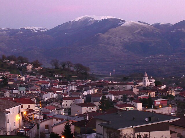
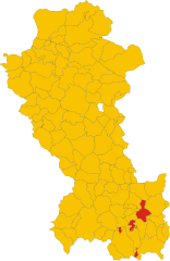
Фарделла (Fardella, Basilicata, Fardella)
.svg)
- коммуна Италии
 Hiking in Фарделла
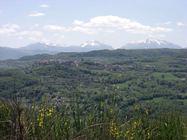
Fardella is a small village in the Basilicata region of Italy, known for its picturesque landscapes and natural beauty, making it an ideal spot for hiking enthusiasts. Here are some key highlights and tips for hiking in and around Fardella:
Hiking Trails
-
Nature Trails: The area around Fardella features several nature trails that take you through the beautiful Lucanian mountains. These trails often offer panoramic views of the surrounding valleys and hills.
-
Local Flora and Fauna: As you hike, you might encounter diverse plant life, including Mediterranean scrub and various tree species. Birdwatching can also be rewarding, as the region is home to many birds.
-
Cultural Routes: Some trails might lead to historical sites or points of interest, such as ancient ruins or local churches, providing a blend of nature and culture.
Difficulty Levels
- Trails in this region vary in difficulty from easy walks suitable for families to more challenging hikes for experienced hikers. Always check the trail difficulty before heading out and choose one that matches your fitness level.
Safety Precautions
- Weather Check: Before setting off, check the weather conditions, as they can change quickly, especially in the mountains.
- Appropriate Gear: Wear sturdy hiking boots and bring weather-appropriate clothing, as well as enough water and snacks.
- Navigation Tools: It's advisable to carry a map or a GPS device, as trails may not always be well-marked.
Accessibility
- Fardella can be accessed by car from major towns in Basilicata. Public transport options might be limited, so planning your journey is essential.
Best Time to Hike
- The best time to hike in Fardella is during the spring (April to June) and fall (September to October) months when the weather is generally mild and the countryside is vibrant with blooming flowers or autumn colors.
Local Tips
- Guided Tours: Consider joining a guided hiking tour to learn more about the local ecology and history from knowledgeable guides.
- Community Events: Check for local events that might coincide with your visit. Community festivals can provide a unique experience alongside your hiking adventure.
Overall, hiking in Fardella offers an opportunity to connect with nature while exploring the rich cultural heritage of Basilicata. Happy hiking!
- Страна:

- Почтовый код: 85030
- Телефонный код: 0973
- Код автомобильного номера: PZ
- Координаты: 40° 7' 0" N, 16° 10' 0" E


- GPS треки (wikiloc): [Ссылка]
- Высота над уровнем моря: 745 м m
- Площадь: 29.08 кв.км
- Население: 631
- Веб сайт: http://www.comune.fardella.pz.it
- Википедия русская: wiki(ru)
- Википедия английская: wiki(en)
- Википедия национальная: wiki(it)
- Хранилище Wikidata: Wikidata: Q52568
- Катеория в википедии: [Ссылка]
- код Freebase: [/m/0fh3bj]
- код GeoNames: Альт: [6537617]
- ID отношения в OpenStreetMap: [40152]
- код ISTAT: 076031
- кадастровый код Италии: D497
Граничит с регионами:
Карбоне
- коммуна Италии
Hiking in Карбоне
Hiking in Carbone, a small town in the Basilicata region of southern Italy, offers a unique experience surrounded by stunning landscapes, rich history, and a peaceful atmosphere. Here are some highlights of hiking in this area:...
- Страна:
- Почтовый код: 85030
- Телефонный код: 0973
- Код автомобильного номера: PZ
- Координаты: 40° 8' 0" N, 16° 5' 0" E
- GPS треки (wikiloc): [Ссылка]
- Высота над уровнем моря: 690 м m
- Площадь: 48.53 кв.км
- Население: 608
- Веб сайт: [Ссылка]

Кастеллуччо-Инфериоре
- коммуна Италии
Hiking in Кастеллуччо-Инфериоре
Castelluccio Inferiore is a charming village located in the Basilicata region of southern Italy, known for its picturesque landscapes and proximity to the Pollino National Park, which offers a wealth of hiking opportunities. Hikes in and around this area allow you to appreciate the stunning natural beauty, rich biodiversity, and unique geological features....
- Страна:
- Почтовый код: 85040
- Телефонный код: 0973
- Код автомобильного номера: PZ
- Координаты: 40° 0' 0" N, 15° 59' 0" E
- GPS треки (wikiloc): [Ссылка]
- Высота над уровнем моря: 495 м m
- Площадь: 28.96 кв.км
- Население: 2072
- Веб сайт: [Ссылка]

Кьяромонте
- коммуна Италии
Hiking in Кьяромонте
Chiaromonte is a charming hilltop town located in the Basilicata region of southern Italy, and it offers some fantastic opportunities for hiking. Here are some key points about hiking in and around Chiaromonte:...
- Страна:
- Почтовый код: 85032
- Телефонный код: 0973
- Код автомобильного номера: PZ
- Координаты: 40° 7' 0" N, 16° 13' 0" E
- GPS треки (wikiloc): [Ссылка]
- Высота над уровнем моря: 794 м m
- Площадь: 70.02 кв.км
- Население: 1922
- Веб сайт: [Ссылка]
Эпископия
- коммуна Италии
Hiking in Эпископия
Episcopia, a charming town in the Basilicata region of southern Italy, is not as well-known for hiking as some other areas in the country, but it offers some beautiful landscapes and trails that are perfect for outdoor enthusiasts. The region is characterized by its rolling hills, lush greenery, and scenic views of the surrounding countryside....
- Страна:
- Почтовый код: 85033
- Телефонный код: 0973
- Код автомобильного номера: PZ
- Координаты: 40° 4' 29" N, 16° 5' 53" E
- GPS треки (wikiloc): [Ссылка]
- Высота над уровнем моря: 530 м m
- Площадь: 28.64 кв.км
- Население: 1389
- Веб сайт: [Ссылка]
Франкавилла-ин-Синни
- коммуна Италии
Hiking in Франкавилла-ин-Синни
Francavilla in Sinni, located in the Basilicata region of southern Italy, offers a variety of hiking opportunities for outdoor enthusiasts. Nestled in a beautiful natural landscape, it serves as a gateway to the surrounding areas, including the Pollino National Park....
- Страна:
- Почтовый код: 85034
- Телефонный код: 0973
- Код автомобильного номера: PZ
- Координаты: 40° 5' 0" N, 16° 12' 0" E
- GPS треки (wikiloc): [Ссылка]
- Высота над уровнем моря: 421 м m
- Площадь: 46.82 кв.км
- Население: 4158
- Веб сайт: [Ссылка]


Латронико
- коммуна Италии
Hiking in Латронико
Latronico, a picturesque town in the southern Italian region of Basilicata, is an excellent destination for hiking enthusiasts. Nestled in the Pollino National Park, Latronico offers a mix of natural beauty, historical sites, and varying terrain suitable for different levels of hiking experience. Here are some key points to consider for hiking in this area:...
- Страна:
- Почтовый код: 85043
- Телефонный код: 0973
- Код автомобильного номера: PZ
- Координаты: 40° 5' 0" N, 16° 1' 0" E
- GPS треки (wikiloc): [Ссылка]
- Высота над уровнем моря: 888 м m
- Площадь: 76.66 кв.км
- Население: 4420
- Веб сайт: [Ссылка]
Сан-Северино-Лукано
- коммуна Италии
Hiking in Сан-Северино-Лукано
San Severino Lucano, located in the heart of the Basilicata region in southern Italy, is a wonderful destination for hiking enthusiasts. Nestled in the Pollino National Park, this area is known for its stunning natural landscapes, rich biodiversity, and a variety of trails suitable for different skill levels....
- Страна:
- Почтовый код: 85030
- Телефонный код: 0973
- Код автомобильного номера: PZ
- Координаты: 40° 1' 0" N, 16° 8' 0" E
- GPS треки (wikiloc): [Ссылка]
- Высота над уровнем моря: 877 м m
- Площадь: 61.16 кв.км
- Население: 1518
- Веб сайт: [Ссылка]

Теана
- коммуна Италии
Hiking in Теана
Teana, located in the region of Calabria in southern Italy, offers beautiful landscapes and a variety of hiking opportunities. The area is known for its natural beauty, featuring mountains, forests, and picturesque views of the surrounding valleys and the Tyrrhenian Sea. Here are some key points to consider when hiking in Teana:...
- Страна:
- Почтовый код: 85030
- Телефонный код: 0973
- Код автомобильного номера: PZ
- Координаты: 40° 7' 40" N, 16° 9' 19" E
- GPS треки (wikiloc): [Ссылка]
- Высота над уровнем моря: 806 м m
- Площадь: 19.3 кв.км
- Население: 585
- Веб сайт: [Ссылка]
Виджанелло
- коммуна Италии
Hiking in Виджанелло
Viggianello is a charming village located in the heart of the Pollino National Park in Calabria, southern Italy. It offers a wonderful mix of natural beauty, cultural heritage, and outdoor activities, making it a great destination for hiking enthusiasts....
- Страна:
- Почтовый код: 85040
- Телефонный код: 0973
- Код автомобильного номера: PZ
- Координаты: 39° 58' 0" N, 16° 5' 0" E
- GPS треки (wikiloc): [Ссылка]
- Высота над уровнем моря: 549 м m
- Площадь: 120.83 кв.км
- Население: 2940
- Веб сайт: [Ссылка]