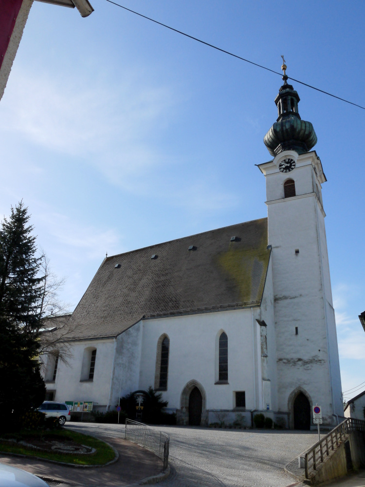
Форнах (Fornach, Fornach)
 Hiking in Форнах
Fornach is a charming area that offers beautiful hiking opportunities, especially for those who enjoy nature and scenic landscapes. Situated in Austria, it's known for its lush forests, rolling hills, and picturesque views of the surrounding mountains.
Here are some key points to consider when hiking in and around Fornach:
Hiking Trails
- Variety of Trails: There are trails suitable for all skill levels, from easy walks to more challenging hikes. Be sure to check local maps or guides for detailed trail information.
- Scenic Views: The paths often lead to stunning viewpoints where you can take in the beauty of the natural landscape, including valleys, forests, and peaks.
- Nature and Wildlife: Keep an eye out for local wildlife, such as deer and various bird species. The flora is also rich, with many wildflowers blooming in the warmer months.
Best Times to Hike
- Spring and Autumn: These seasons are particularly beautiful for hiking in Fornach. The weather is typically mild, and you can enjoy vibrant colors in spring and fall.
- Summer: This is a popular time, but it's also essential to stay hydrated and protect yourself from the sun.
Preparation
- Footwear: Good hiking boots are essential to navigate the varied terrain.
- Weather: Always check the weather forecast before heading out, as conditions can change rapidly in mountainous areas.
- Safety: Inform someone about your hiking plans, especially if you’re heading out on a less-traveled path.
Local Regulations
Be mindful of local guidelines regarding camping, fires, and wildlife protection to preserve the natural environment.
Attractions
- Cultural Sites: Incorporating visits to nearby cultural landmarks can enrich your hiking experience.
- Picnic Areas: Some trails may have designated picnic spots where you can rest and enjoy the scenery.
Conclusion
Fornach is a delightful destination for hikers looking to experience the beauty of Austria's outdoor landscapes. Whether you are trekking for a few hours or planning a longer excursion, take the time to enjoy the tranquility and natural beauty of the area. Always remember to follow leave-no-trace principles to help keep the environment pristine for future visitors. Happy hiking!
- Страна:

- Почтовый код: 4892
- Телефонный код: 07682
- Код автомобильного номера: VB
- Координаты: 48° 1' 25" N, 13° 25' 53" E


- GPS треки (wikiloc): [Ссылка]
- Высота над уровнем моря: 565 м m
- Площадь: 18 кв.км
- Население: 976
- Веб сайт: http://www.fornach.ooe.gv.at/
- Википедия русская: wiki(ru)
- Википедия английская: wiki(en)
- Википедия национальная: wiki(de)
- Хранилище Wikidata: Wikidata: Q652120
- Катеория в википедии: [Ссылка]
- код Freebase: [/m/03gvdwn]
- код GeoNames: Альт: [7873255]
- код VIAF: Альт: [247841225]
- код GND: Альт: [4654842-7]
- код австрийского муниципалитета: [41708]
Граничит с регионами:


Пфаффинг
Hiking in Пфаффинг
Pfaffing is a picturesque region located in Bavaria, Germany, known for its beautiful landscapes and opportunities for hiking. While the specific trails and features may vary, here are some general aspects you can expect when hiking in Pfaffing:...
- Страна:

- Почтовый код: 83539
- Телефонный код: 08076
- Код автомобильного номера: RO
- Координаты: 48° 3' 0" N, 12° 7' 0" E
- GPS треки (wikiloc): [Ссылка]
- Высота над уровнем моря: 492 м m
- Площадь: 35.39 кв.км
- Население: 4152
- Веб сайт: [Ссылка]
Франкенмаркт
Hiking in Франкенмаркт
Frankenmarkt is a quaint town located in the Upper Austria region, offering stunning landscapes and picturesque views that make it a wonderful destination for hiking enthusiasts. The area is characterized by its rolling hills, lush forests, and serene lakes, providing a range of trails suitable for hikers of all skill levels....
- Страна:
- Почтовый код: 4890
- Телефонный код: 07684
- Код автомобильного номера: VB
- Координаты: 47° 59' 1" N, 13° 25' 24" E
- GPS треки (wikiloc): [Ссылка]
- Высота над уровнем моря: 536 м m
- Площадь: 18 кв.км
- Население: 3636
- Веб сайт: [Ссылка]
Франкенбург-на-Хаусруке
Hiking in Франкенбург-на-Хаусруке
Frankenburg am Hausruck, located in Austria's Upper Austria region, is an excellent destination for hiking enthusiasts. The area is characterized by stunning natural landscapes, rolling hills, and picturesque views of the Hausruck mountain range. Here are some key highlights and tips for hiking in this region:...
- Страна:
- Почтовый код: 4873
- Телефонный код: 07683
- Код автомобильного номера: VB
- Координаты: 48° 4' 6" N, 13° 29' 31" E
- GPS треки (wikiloc): [Ссылка]
- Высота над уровнем моря: 519 м m
- Площадь: 49 кв.км
- Население: 4842
- Веб сайт: [Ссылка]

Пёндорф
Hiking in Пёндорф
Pöndorf, located in the Salzkammergut region of Austria, offers beautiful landscapes and a variety of hiking options for outdoor enthusiasts. The area is characterized by its stunning lakes, rolling hills, and picturesque alpine scenery, making it a great spot for both leisurely walks and more challenging hikes....
- Страна:
- Телефонный код: 07684
- Код автомобильного номера: VB
- Координаты: 47° 59' 50" N, 13° 22' 1" E
- GPS треки (wikiloc): [Ссылка]
- Высота над уровнем моря: 574 м m
- Площадь: 51 кв.км
- Население: 2386
- Веб сайт: [Ссылка]
Вальдцелль
Hiking in Вальдцелль
Waldzell is a picturesque area suited for hiking enthusiasts, known for its beautiful landscapes and a variety of trails that cater to different skill levels. While specific details about Waldzell may vary, here are some general aspects you can expect:...
- Страна:
- Почтовый код: 4924
- Телефонный код: 07754
- Код автомобильного номера: RI
- Координаты: 48° 8' 10" N, 13° 25' 45" E
- GPS треки (wikiloc): [Ссылка]
- Высота над уровнем моря: 522 м m
- Площадь: 40 кв.км
- Население: 2177
- Веб сайт: [Ссылка]
Редлайтен
Hiking in Редлайтен
Redleiten is not a widely recognized hiking destination, but if you're referring to the general concept of hiking in areas that might include scenic spots or trails known as "Redleiten" or similar, it’s likely you’re thinking of a region with natural landscapes, forests, or mountainous terrain....
- Страна:
- Почтовый код: 4875
- Телефонный код: 07683
- Код автомобильного номера: VB
- Координаты: 48° 5' 10" N, 13° 28' 23" E
- GPS треки (wikiloc): [Ссылка]
- Высота над уровнем моря: 555 м m
- Площадь: 14 кв.км
- Население: 537
- Веб сайт: [Ссылка]