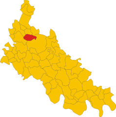
Гальганьяно (Galgagnano, Galgagnano)
.svg)
- коммуна Италии
 Hiking in Гальганьяно
Galgagnano is a small village located in the northern Italian region of Lombardy, known for its tranquil countryside and beautiful landscapes. While it may not be a highly popular hiking destination compared to some mountainous regions in Italy, it offers opportunities for nature walks and hikes through the surrounding countryside.
Hiking in Galgagnano:
-
Scenic Routes: The area around Galgagnano features picturesque rural pathways, rolling hills, and fields, which can provide a peaceful hiking experience away from the crowds.
-
Nature Reserves: Consider exploring nearby nature reserves or parks, which provide marked trails and a chance to encounter local flora and fauna. The surrounding region may have farms and vineyards that can be incorporated into your hike for a more immersive experience.
-
Cultural Points: Combine hiking with cultural exploration by visiting nearby landmarks, churches, and historical sites. The rich history of the area can make your hiking experience even more enriching.
-
Weather Considerations: The climate can vary significantly throughout the year. Spring and fall are typically the best seasons for hiking to enjoy pleasant temperatures and lush scenery. Always check the weather forecast before heading out.
-
Local Tips: Engage with local hiking clubs or community members for insights on lesser-known trails, as they can often point you to hidden gems in the area.
-
Safety and Preparation: Be sure to wear appropriate footwear, carry sufficient water, and have a map of the trails. Cell service may be limited in rural areas, so it’s wise to have a backup navigation method.
Conclusion
While Galgagnano may not be a well-known hiking destination, the surrounding landscapes and the charm of the Italian countryside make it a lovely spot for less strenuous hikes and peaceful nature walks. Be sure to explore the routes and enjoy the serene environment that the area has to offer!
- Страна:

- Почтовый код: 26832
- Телефонный код: 0371
- Код автомобильного номера: LO
- Координаты: 45° 21' 32" N, 9° 26' 47" E


- GPS треки (wikiloc): [Ссылка]
- Высота над уровнем моря: 86 м m
- Площадь: 6.01 кв.км
- Население: 1263
- Веб сайт: http://www.comune.galgagnano.lo.it/template.php?pag=1
- Википедия русская: wiki(ru)
- Википедия английская: wiki(en)
- Википедия национальная: wiki(it)
- Хранилище Wikidata: Wikidata: Q42960
- Катеория в википедии: [Ссылка]
- код Freebase: [/m/0gr5mg]
- код GeoNames: Альт: [6543685]
- ID отношения в OpenStreetMap: [44785]
- код ISTAT: 098027
- кадастровый код Италии: D868
Граничит с регионами:

Монтаназо-Лобмардо
- коммуна Италии
Hiking in Монтаназо-Лобмардо
Montanaso Lombardo, a small municipality in Italy located in the Lombardy region, is not typically known as a prime hiking destination compared to the more famous nearby areas like the Italian Alps or the Apennines. However, it can serve as a good base for exploring the surrounding countryside....
- Страна:
- Почтовый код: 26836
- Телефонный код: 0371
- Код автомобильного номера: LO
- Координаты: 45° 20' 12" N, 9° 28' 11" E
- GPS треки (wikiloc): [Ссылка]
- Высота над уровнем моря: 83 м m
- Площадь: 9.52 кв.км
- Население: 2271
- Веб сайт: [Ссылка]


Мулаццано
- коммуна Италии
Hiking in Мулаццано
Mulazzano is a small town located in the Lombardy region of Italy, not far from Milan. While its specific hiking trails may not be as famous as those found in more mountainous areas, there are still opportunities for outdoor enthusiasts to enjoy the natural beauty of the surrounding countryside....
- Страна:
- Почтовый код: 26837
- Телефонный код: 02
- Код автомобильного номера: LO
- Координаты: 45° 22' 21" N, 9° 23' 52" E
- GPS треки (wikiloc): [Ссылка]
- Высота над уровнем моря: 91 м m
- Площадь: 15.58 кв.км
- Население: 5773
- Веб сайт: [Ссылка]


Червиньяно-д'Адда
- коммуна Италии
Hiking in Червиньяно-д'Адда
Cervignano d'Adda, situated in the Lombardy region of Italy, offers a unique blend of natural beauty and cultural heritage, making it an interesting destination for hikers. While it may not be as widely known as some of the larger national parks in Italy, there are several trails and outdoor activities to explore in the surrounding area....
- Страна:
- Почтовый код: 26832
- Телефонный код: 02
- Код автомобильного номера: LO
- Координаты: 45° 18' 0" N, 9° 35' 0" E
- GPS треки (wikiloc): [Ссылка]
- Высота над уровнем моря: 87 м m
- Площадь: 4.07 кв.км
- Население: 2209
- Веб сайт: [Ссылка]


Боффалора-д'Адда
- коммуна Италии
Hiking in Боффалора-д'Адда
Boffalora d'Adda, a charming village located in the Lombardy region of Italy, is nestled along the banks of the Adda River. The area offers a variety of hiking opportunities, especially for those who enjoy exploring scenic landscapes, historical sites, and the natural beauty of the Lombardy countryside....
- Страна:
- Почтовый код: 26811
- Телефонный код: 0371
- Код автомобильного номера: LO
- Координаты: 45° 21' 39" N, 9° 29' 43" E
- GPS треки (wikiloc): [Ссылка]
- Высота над уровнем моря: 78 м m
- Площадь: 8.13 кв.км
- Население: 1770
- Веб сайт: [Ссылка]


Зело-Буон-Персико
- коммуна Италии
Hiking in Зело-Буон-Персико
Zelo Buon Persico, a small town in the Lombardy region of Italy, is situated near the larger city of Lodi and is known for its natural surroundings, which offer opportunities for outdoor activities, including hiking. Although Zelo Buon Persico itself may not have an extensive network of hiking trails, the surrounding area features beautiful landscapes that are suitable for leisurely hikes....
- Страна:
- Почтовый код: 26839
- Телефонный код: 02
- Код автомобильного номера: LO
- Координаты: 45° 24' 48" N, 9° 26' 1" E
- GPS треки (wikiloc): [Ссылка]
- Высота над уровнем моря: 90 м m
- Площадь: 18.88 кв.км
- Население: 7373
- Веб сайт: [Ссылка]