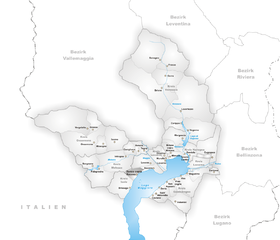
Gambarogno (Gambarogno)

 Hiking in Gambarogno
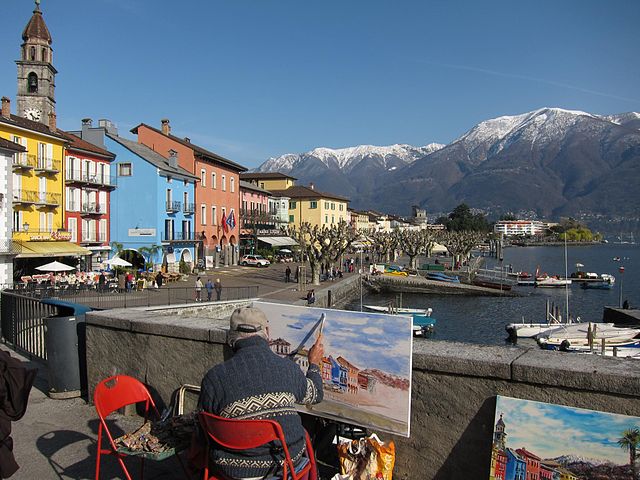
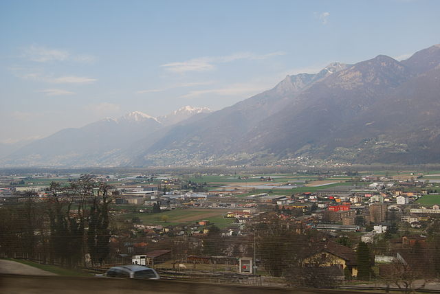
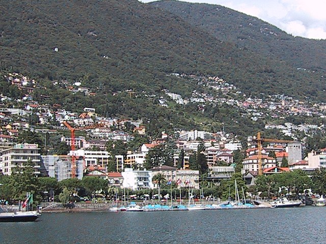
Gambarogno is a beautiful region in Switzerland, located on the Swiss side of Lake Maggiore, in the canton of Ticino. It offers a fantastic setting for hiking enthusiasts, with a variety of trails ranging from easy strolls along the lakeside to more challenging hikes that lead through stunning mountainous landscapes.
Hiking Trails
-
Lakeside Pathways: The area has several scenic lakeside trails that provide leisurely walks with beautiful views of Lake Maggiore and the surrounding mountains. These trails are generally flat and suitable for families and casual hikers.
-
Valle Verzasca: A bit further from Gambarogno, this valley is renowned for its breathtaking scenery and emerald-green river. There are numerous hiking routes here, varying in difficulty, and you can also see the impressive Ponte dei Salti bridge.
-
Monta Valeria: This hike offers breathtaking panoramic views of the lake and surrounding mountains. It’s a moderate hike that takes you through lush forests and meadows, making it a great option for those with some hiking experience.
-
Monte Gambarogno: For those looking for a more challenging hike, reaching the summit of Monte Gambarogno is a rewarding experience. The trail can be steep in sections, but the view from the top is well worth the effort, providing a stunning vista of Lake Maggiore and the Alps.
Considerations
-
Season: The best time to hike in Gambarogno is from late spring to early autumn when the weather is pleasant. However, always check local conditions, especially if hiking in late autumn or winter.
-
Preparation: Be sure to bring adequate footwear, water, snacks, and a map or GPS device. Some trails may not be marked, so planning is essential for exploring more remote areas.
-
Wildlife and Nature: Keep an eye out for local wildlife and enjoy the diverse flora and fauna along the trails. The area is known for its lush greenery and various bird species.
-
Local Culture: Don’t miss the chance to explore the charming villages in the region, like Ganterschwil and Vairano, which offer a glimpse into local culture and cuisine.
Gambarogno is an excellent destination for hikers of all levels, offering stunning natural beauty and a range of trails to explore. Remember to respect the environment and follow local guidelines while hiking. Enjoy your adventure!
- Страна:

- Почтовый код: 6571, 6573, 6574, 6575, 6576, 6577, 6578, 6579, 6594
- Телефонный код: 091
- Код автомобильного номера: TI
- Координаты: 46° 8' 2" N, 8° 50' 0" E


- GPS треки (wikiloc): [Ссылка]
- Высота над уровнем моря: 196 м m
- Площадь: 51.74 кв.км
- Население: 5137
- Веб сайт: http://www.gambarogno.ch
- Википедия английская: wiki(en)
- Википедия национальная: wiki(de)
- Хранилище Wikidata: Wikidata: Q70234
- Катеория в википедии: [Ссылка]
- код Freebase: [/m/0cc67tc]
- код GeoNames: Альт: [8260337]
- код VIAF: Альт: [237007025]
- ID отношения в OpenStreetMap: [1684677]
- код GND: Альт: [4591463-1]
- идентификатор местоположения ArchINFORM: [42784]
- идентификатор HDS: [8306]
- код швейцарского муниципалитета: [5398]
Граничит с регионами:
Maccagno con Pino e Veddasca
- коммуна Италии
Hiking in Maccagno con Pino e Veddasca
Maccagno con Pino e Veddasca is a charming municipality located in the province of Varese, Lombardy, Italy. Nestled near Lake Maggiore, it offers a diverse range of hiking opportunities, showcasing stunning views, natural beauty, and cultural heritage....
- Страна:

- Почтовый код: 21061
- Телефонный код: 0332
- Код автомобильного номера: VA
- Координаты: 46° 3' 0" N, 8° 44' 0" E
- GPS треки (wikiloc): [Ссылка]
- Высота над уровнем моря: 210 м m
- Площадь: 41.96 кв.км
- Население: 2585
- Веб сайт: [Ссылка]


Курилья-кон-Монтевьяско
- коммуна Италии
Hiking in Курилья-кон-Монтевьяско
Curiglia con Monteviasco, located in the Lombardy region of Italy, is a picturesque area that offers a variety of hiking opportunities amidst stunning natural scenery. The region is characterized by lush forests, scenic landscapes, and stunning views of Lake Lugano and the surrounding mountains. Here are some key points about hiking in this area:...
- Страна:
- Почтовый код: 21010
- Телефонный код: 0332
- Код автомобильного номера: VA
- Координаты: 46° 3' 0" N, 8° 48' 0" E
- GPS треки (wikiloc): [Ссылка]
- Высота над уровнем моря: 670 м m
- Площадь: 10.85 кв.км
- Население: 175
- Веб сайт: [Ссылка]
Аскона
Hiking in Аскона
Ascona, located on the shores of Lake Maggiore in the Ticino region of Switzerland, is a beautiful destination for hiking enthusiasts. The area offers a variety of trails that cater to different skill levels and preferences, ranging from leisurely lakeside walks to more challenging mountain hikes....
- Страна:
- Почтовый код: 6612
- Телефонный код: 91
- Код автомобильного номера: TI
- Координаты: 46° 9' 0" N, 8° 46' 0" E
- GPS треки (wikiloc): [Ссылка]
- Высота над уровнем моря: 199 м m
- Площадь: 4.95 кв.км
- Население: 5534
- Веб сайт: [Ссылка]


Alto Malcantone
Hiking in Alto Malcantone
Alto Malcantone is a beautiful region in the Canton of Ticino, Switzerland, known for its stunning landscapes, serene forests, and picturesque villages. The area offers a variety of hiking trails suitable for different skill levels, making it a great destination for both novice and experienced hikers. Here are some key points to consider if you’re planning a hike in Alto Malcantone:...
- Страна:
- Почтовый код: 6939
- Телефонный код: 91
- Код автомобильного номера: TI
- Координаты: 46° 2' 0" N, 8° 53' 0" E
- GPS треки (wikiloc): [Ссылка]
- Высота над уровнем моря: 810 м m
- Площадь: 22.1 кв.км
- Население: 1405
- Веб сайт: [Ссылка]

Ronco sopra Ascona
Hiking in Ronco sopra Ascona
Ronco sopra Ascona is a charming village located in the Italian-speaking region of Ticino, Switzerland. It's perched on a hillside overlooking Lake Maggiore, offering stunning views and a tranquil atmosphere that attracts hikers and nature lovers....
- Страна:
- Почтовый код: 6622
- Телефонный код: 091
- Код автомобильного номера: TI
- Координаты: 46° 8' 0" N, 8° 44' 0" E
- GPS треки (wikiloc): [Ссылка]
- Высота над уровнем моря: 353 м m
- Площадь: 5.0 кв.км
- Население: 608
- Веб сайт: [Ссылка]

Минузио
- община Швейцарии
Hiking in Минузио
Minusio, located in the Canton of Ticino in southern Switzerland, offers a range of beautiful hiking opportunities that allow you to explore the scenic beauty of the region. Here are some key points about hiking in Minusio:...
- Страна:
- Почтовый код: 6648
- Телефонный код: 091
- Код автомобильного номера: TI
- Координаты: 46° 11' 12" N, 8° 48' 51" E
- GPS треки (wikiloc): [Ссылка]
- Высота над уровнем моря: 600 м m
- Площадь: 5.85 кв.км
- Население: 7226
- Веб сайт: [Ссылка]

Бриссаго
- населённый пункт в Швейцарии
Hiking in Бриссаго
Brissago, located in the southern part of Switzerland in the canton of Ticino, is a beautiful destination for hiking enthusiasts. Nestled along the shores of Lake Maggiore, it features stunning landscapes, Mediterranean vegetation, and breathtaking views....
- Страна:
- Почтовый код: 6614
- Телефонный код: 091
- Код автомобильного номера: TI
- Координаты: 46° 7' 0" N, 8° 42' 0" E
- GPS треки (wikiloc): [Ссылка]
- Высота над уровнем моря: 197 м m
- Площадь: 17.8 кв.км
- Население: 1773
- Веб сайт: [Ссылка]
Cadenazzo
Hiking in Cadenazzo
Cadenazzo is a picturesque village located in the Italian-speaking canton of Ticino, Switzerland. It's known for its beautiful landscapes, charming architecture, and proximity to several hiking trails that cater to different skill levels....
- Страна:
- Почтовый код: 6593
- Телефонный код: 091
- Код автомобильного номера: TI
- Координаты: 46° 8' 48" N, 8° 57' 0" E
- GPS треки (wikiloc): [Ссылка]
- Высота над уровнем моря: 296 м m
- Площадь: 8.44 кв.км
- Население: 2932
- Веб сайт: [Ссылка]

Муральто
Hiking in Муральто
Muralto, located in the southern part of Switzerland near the picturesque town of Locarno, offers a range of beautiful hiking opportunities. The region is known for its stunning landscapes, including views of Lake Maggiore, lush forests, and mountainous terrain, making it a great destination for hikers of all levels....
- Страна:
- Почтовый код: 6600
- Телефонный код: 091
- Код автомобильного номера: TI
- Координаты: 46° 10' 0" N, 8° 48' 0" E
- GPS треки (wikiloc): [Ссылка]
- Высота над уровнем моря: 207 м m
- Площадь: 0.6 кв.км
- Население: 2713
- Веб сайт: [Ссылка]