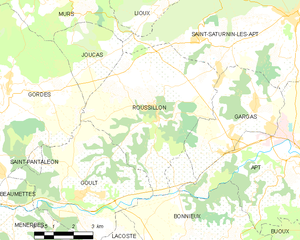
Гаргас (Gargas, Gargas)

 Hiking in Гаргас
Gargas, located in the Vaucluse department of the Provence-Alpes-Côte d'Azur region in southeastern France, is a charming area known for its picturesque landscapes, historical sites, and unique geological features. Hiking in and around Gargas offers a wonderful opportunity to explore the natural beauty of the region, including the iconic ochre cliffs that the area is famous for.
Popular Hiking Trails and Highlights:
-
Ochre Trails: The nearby village of Roussillon is famous for its ochre quarries. The Sentier des Ocres (Ochre Trail) allows hikers to walk through stunning geological formations and vibrant colored cliffs. The trail provides both educational information about the area's ochre production and breathtaking views.
-
Luberon Regional Park: Located not far from Gargas, this park offers numerous hiking trails through beautiful landscapes filled with vineyards, olive groves, and picturesque villages like Gordes and Bonnieux. The Luberon is excellent for both short walks and more challenging hikes that provide panoramic views of the Provence countryside.
-
Local Nature Walks: There are various shorter, less strenuous trails around Gargas that allow hikers to enjoy the natural beauty and tranquility of the landscape. These trails often meander through vineyards and fields, making them ideal for leisurely strolls.
-
Forest of Cedar: A less common area for hiking, but worth mentioning, is the Cedar forest nearby. Hikers can enjoy walking amongst these beautiful trees and observe different species of wildlife.
Tips for Hiking in Gargas:
-
Best Time to Hike: Spring (April to June) and fall (September to October) are the best times for hiking in Gargas. During these seasons, the weather is usually mild, and the views are vibrant with blossoming flora or autumn colors.
-
Trail Difficulty: Be sure to check the difficulty level of trails before heading out. Some may be suitable for families and beginners, while others may require more advanced hiking skills.
-
Hydration and Snacks: Always bring plenty of water and snacks, especially for longer hikes, as facilities may not be available on certain trails.
-
Local Guidance: Consider joining guided hikes if you're unfamiliar with the area. Local guides can provide valuable insights into the history and geology of the regions you explore.
-
Respect Nature: As with any hiking destination, be sure to follow Leave No Trace principles to help keep the area clean and preserve its beauty for future visitors.
Hiking in Gargas can be a rewarding experience, combining physical activity with the opportunity to immerse oneself in the enchanting landscapes of Provence. Enjoy your adventure!
- Страна:

- Почтовый код: 84400
- Координаты: 43° 54' 7" N, 5° 21' 31" E


- GPS треки (wikiloc): [Ссылка]
- Площадь: 14.9 кв.км
- Население: 2976
- Веб сайт: http://www.ville-gargas.fr
- Википедия русская: wiki(ru)
- Википедия английская: wiki(en)
- Википедия национальная: wiki(fr)
- Хранилище Wikidata: Wikidata: Q1044614
- Катеория в википедии: [Ссылка]
- код Freebase: [/m/025_v3p]
- код GeoNames: Альт: [6451546]
- номер SIREN: [218400471]
- код BNF: [15278027m]
- код VIAF: Альт: [151435406]
- код LCNAF: Альт: [n96012379]
- код тезауруса PACTOLS: [pcrt2hpnwRw6Yc]
- код муниципалитета INSEE: 84047
Граничит с регионами:


Сен-Сатюрнен-лез-Апт
- коммуна во Франции
Hiking in Сен-Сатюрнен-лез-Апт
Saint-Saturnin-lès-Apt, located in the Vaucluse department of the Provence region in France, is surrounded by stunning natural landscapes, making it a fantastic location for hiking enthusiasts. The area features picturesque trails that showcase the beautiful scenery of the Luberon Regional Nature Park, including rocky outcrops, vineyards, and charming villages....
- Страна:
- Почтовый код: 84490
- Координаты: 43° 56' 39" N, 5° 23' 2" E
- GPS треки (wikiloc): [Ссылка]
- Высота над уровнем моря: 411 м m
- Площадь: 75.79 кв.км
- Население: 2732
- Веб сайт: [Ссылка]


Апт
- коммуна во Франции
Hiking in Апт
Apt, located in the Vaucluse department of France, is an excellent destination for hiking enthusiasts. Nestled in the heart of the Luberon Regional Park, Apt offers a diverse range of landscapes, from lush hillsides and vineyards to rocky cliffs and scenic viewpoints. Here are some highlights of hiking in and around Apt:...
- Страна:
- Почтовый код: 84400
- Координаты: 43° 52' 34" N, 5° 23' 47" E
- GPS треки (wikiloc): [Ссылка]
- Высота над уровнем моря: 567 м m
- Площадь: 44.57 кв.км
- Население: 11846
- Веб сайт: [Ссылка]


Бонньё
- коммуна во Франции
Hiking in Бонньё
Bonnieux, a charming village located in the Vaucluse region of the Provence-Alpes-Côte d'Azur, offers beautiful hiking opportunities amid stunning landscapes, vineyards, and ancient ruins. The surrounding Luberon National Park is particularly rich in trails that cater to various skill levels, from easy walks to more challenging hikes....
- Страна:
- Почтовый код: 84480
- Координаты: 43° 49' 23" N, 5° 18' 25" E
- GPS треки (wikiloc): [Ссылка]
- Площадь: 51.12 кв.км
- Население: 1362
- Веб сайт: [Ссылка]

Руссийон
- коммуна во Франции
Hiking in Руссийон
Roussillon, located in the Vaucluse department of the Provence-Alpes-Côte d'Azur region in southeastern France, is renowned for its stunning landscapes, rich ochre deposits, and charming village atmosphere. Hiking in this area offers a unique blend of natural beauty and cultural heritage. Here are some key aspects to consider:...
- Страна:
- Почтовый код: 84220
- Координаты: 43° 54' 8" N, 5° 17' 34" E
- GPS треки (wikiloc): [Ссылка]
- Площадь: 29.77 кв.км
- Население: 1328
- Веб сайт: [Ссылка]