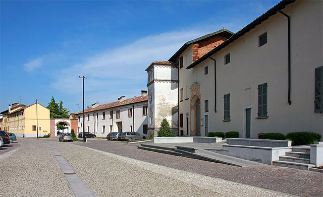
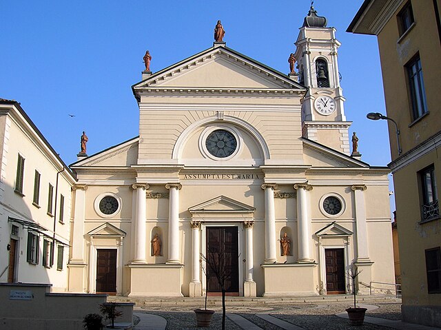
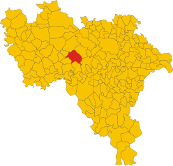
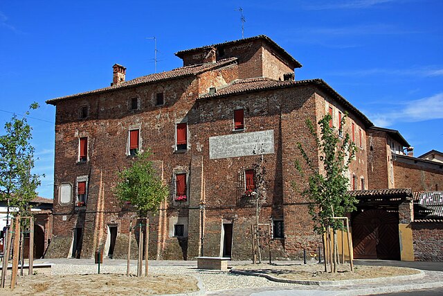
Гарласко (Garlasco, Garlasco)
.svg)
- коммуна Италии
 Hiking in Гарласко
Garlasco, a town in the Lombardy region of Italy, is not widely known as a hiking destination compared to other areas in the country, like the Dolomites or the Aosta Valley. However, it does have its own charm and scenic landscapes that can appeal to hikers looking for a more tranquil experience away from crowded tourist spots.
Hiking Opportunities in Garlasco:
-
Surrounding Nature: The area around Garlasco features gentle hills and countryside, which can provide lovely walking paths. The Po River, one of Italy's major rivers, is near the town and can offer pleasant routes alongside its banks.
-
Local Trails: While Garlasco itself may not have designated hiking trails, nearby municipalities may offer walking and biking paths that connect through the charming rural landscapes. Popular routes may include agricultural fields, orchards, and small woodlands.
-
Municipal Parks: Explore local parks and green spaces in and around Garlasco. These often have walking paths that provide a nice, easy-going hike while enjoying the local flora and fauna.
-
Nearby Natural Areas: Consider venturing to nearby natural reserves or parks, such as the Oasi di Sant'Alessio or the Ticino Park, which is a little farther away but offers well-maintained trails with stunning natural scenery, wildlife, and the chance to enjoy the tranquility of nature.
-
Local Culture and Nature: As you hike, you may also come across traditional Lombard architecture, charming villages, and agricultural landscapes, giving you a taste of local culture alongside your outdoor activities.
Tips for Hiking in Garlasco:
- Footwear: Make sure to wear comfortable and appropriate hiking shoes, especially if you venture onto uneven terrain.
- Maps and Guides: Local hiking maps might be available at tourist information centers; it's a good idea to pick one up to ensure you find the best routes.
- Stay Hydrated and Snack Ready: Carry water and some snacks, especially if you plan to hike longer distances.
- Respect Nature: Follow Leave No Trace principles to help preserve the natural beauty of the area.
Though Garlasco may not be the most famous hiking spot, it provides a peaceful retreat for those looking to enjoy nature, take leisurely walks, and experience the charm of rural Italy.
- Страна:

- Почтовый код: 27026
- Телефонный код: 0382
- Код автомобильного номера: PV
- Координаты: 45° 12' 0" N, 8° 55' 0" E


- GPS треки (wikiloc): [Ссылка]
- Высота над уровнем моря: 93 м m
- Площадь: 39.18 кв.км
- Население: 9805
- Веб сайт: http://www.comune.garlasco.pv.it
- Википедия русская: wiki(ru)
- Википедия английская: wiki(en)
- Википедия национальная: wiki(it)
- Хранилище Wikidata: Wikidata: Q40851
- Галерея изображений в википедии: [Ссылка]
- Катеория в википедии: [Ссылка]
- код Freebase: [/m/0gjj6b]
- код GeoNames: Альт: [6536557]
- код VIAF: Альт: [241232103]
- ID отношения в OpenStreetMap: [44397]
- идентификатор местоположения ArchINFORM: [45550]
- WOEID: [716018]
- UN/LOCODE: [ITGLC]
- код ISTAT: 018069
- кадастровый код Италии: D925
Граничит с регионами:

Борго-Сан-Сиро
- коммуна Италии
Hiking in Борго-Сан-Сиро
Borgo San Siro is a charming municipality located in the Province of Pavia in Lombardy, Italy. While it may not be as widely known as some of the larger hiking destinations in Italy, it offers a peaceful setting with natural beauty and a variety of potential hiking trails....
- Страна:
- Почтовый код: 27020
- Телефонный код: 0382
- Код автомобильного номера: PV
- Координаты: 45° 15' 0" N, 9° 2' 0" E
- GPS треки (wikiloc): [Ссылка]
- Высота над уровнем моря: 98 м m
- Площадь: 17.64 кв.км
- Население: 1002
- Веб сайт: [Ссылка]


Гропелло-Кайроли
- коммуна Италии
Hiking in Гропелло-Кайроли
Gropello Cairoli, a small municipality located in the Lombardy region of Italy, offers a serene escape for hiking enthusiasts. While it may not be as well-known as some larger hiking destinations in Italy, it provides a peaceful environment with scenic views, particularly along the nearby River Po....
- Страна:
- Почтовый код: 27027
- Телефонный код: 0382
- Код автомобильного номера: PV
- Координаты: 45° 11' 0" N, 9° 0' 0" E
- GPS треки (wikiloc): [Ссылка]
- Высота над уровнем моря: 89 м m
- Площадь: 26.22 кв.км
- Население: 4500
- Веб сайт: [Ссылка]


Тромелло
- коммуна Италии
Hiking in Тромелло
Tromello is a small town located in the Lombardy region of Italy, known more for its agricultural landscape and quaint charm than for extensive hiking trails. However, the surrounding area offers opportunities for outdoor activities and nature exploration....
- Страна:
- Почтовый код: 27020
- Телефонный код: 0382
- Код автомобильного номера: PV
- Координаты: 45° 13' 0" N, 8° 52' 0" E
- GPS треки (wikiloc): [Ссылка]
- Высота над уровнем моря: 97 м m
- Площадь: 35.5 кв.км
- Население: 3795
- Веб сайт: [Ссылка]


Церболо
- коммуна Италии
Hiking in Церболо
Zerbolò is a small municipality located in the Lombardy region of Italy, near the Po River. While it may not be a well-known hiking destination, its surrounding areas offer opportunities for outdoor activities, including hiking paths and scenic routes....
- Страна:
- Почтовый код: 27020
- Телефонный код: 0382
- Код автомобильного номера: PV
- Координаты: 45° 12' 0" N, 9° 1' 0" E
- GPS треки (wikiloc): [Ссылка]
- Высота над уровнем моря: 68 м m
- Площадь: 37.19 кв.км
- Население: 1807
- Веб сайт: [Ссылка]
Дорно
- коммуна Италии
Hiking in Дорно
Dorno is a lovely area located in the Scottish Borders, known for its scenic landscapes and diverse hiking opportunities. Here are some key points about hiking in Dorno:...
- Страна:
- Почтовый код: 27020
- Телефонный код: 0382
- Код автомобильного номера: PV
- Координаты: 45° 9' 0" N, 8° 57' 0" E
- GPS треки (wikiloc): [Ссылка]
- Высота над уровнем моря: 90 м m
- Площадь: 30.57 кв.км
- Население: 4671
- Веб сайт: [Ссылка]

Аккуаланьа
- коммуна Италии
Hiking in Аккуаланьа
Alagna Valsesia is a picturesque village located in the Aosta Valley region of northern Italy, nestled in the foothills of the Alps. It offers a variety of hiking opportunities for both beginners and experienced hikers. Here are some key points to consider when planning your hiking trips around Alagna:...
- Страна:
- Почтовый код: 27020
- Телефонный код: 0382
- Код автомобильного номера: PV
- Координаты: 45° 10' 0" N, 8° 53' 0" E
- GPS треки (wikiloc): [Ссылка]
- Высота над уровнем моря: 92 м m
- Площадь: 8.34 кв.км
- Население: 831
- Веб сайт: [Ссылка]