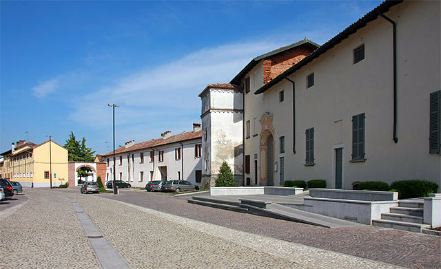
Церболо (Zerbolò, Zerbolò)
.svg)
- коммуна Италии
 Hiking in Церболо
Zerbolò is a small municipality located in the Lombardy region of Italy, near the Po River. While it may not be a well-known hiking destination, its surrounding areas offer opportunities for outdoor activities, including hiking paths and scenic routes.
Here are some hiking-related tips and information you can consider when planning a hike near Zerbolò:
-
Nature Reserves and Parks: The nearby Ticino Park (Parco del Ticino) is a beautiful area worth exploring. It features numerous trails along the river and through woodland, with opportunities for birdwatching and observing local flora and fauna.
-
Trail Difficulty: When selecting a hiking route, consider your fitness level and experience. The area has trails suitable for various levels, from easy walks to more challenging hikes.
-
Preparation: Always check weather conditions before heading out, and equip yourself with appropriate gear, including hiking boots, water, snacks, and a map or GPS device to navigate the trails.
-
Safety: Let someone know your hiking plans, especially if you will be going on less traveled paths. Mobile coverage can be limited in some areas.
-
Local Attractions: After your hike, you might enjoy exploring Zerbolò itself or nearby towns. Look for local restaurants or cafés to recharge after your outdoor adventures.
-
Conservation and Respect: Follow Leave No Trace principles. Respect wildlife and the natural environment by sticking to marked trails and disposing of waste properly.
Whether you're looking for a leisurely walk or a more intense hike, the vicinity of Zerbolò and the surrounding regions can provide a charming experience for outdoor enthusiasts. Be sure to research specific trails in the area for detailed information and maps.
- Страна:

- Почтовый код: 27020
- Телефонный код: 0382
- Код автомобильного номера: PV
- Координаты: 45° 12' 0" N, 9° 1' 0" E


- GPS треки (wikiloc): [Ссылка]
- Высота над уровнем моря: 68 м m
- Площадь: 37.19 кв.км
- Население: 1807
- Веб сайт: http://www.comune.zerbolo.pv.it
- Википедия русская: wiki(ru)
- Википедия английская: wiki(en)
- Википедия национальная: wiki(it)
- Хранилище Wikidata: Wikidata: Q40049
- Катеория в википедии: [Ссылка]
- код Freebase: [/m/0gjy7h]
- код GeoNames: Альт: [6540636]
- ID отношения в OpenStreetMap: [44399]
- UN/LOCODE: [ITZXM]
- код ISTAT: 018189
- кадастровый код Италии: M167
Граничит с регионами:

Борго-Сан-Сиро
- коммуна Италии
Hiking in Борго-Сан-Сиро
Borgo San Siro is a charming municipality located in the Province of Pavia in Lombardy, Italy. While it may not be as widely known as some of the larger hiking destinations in Italy, it offers a peaceful setting with natural beauty and a variety of potential hiking trails....
- Страна:
- Почтовый код: 27020
- Телефонный код: 0382
- Код автомобильного номера: PV
- Координаты: 45° 15' 0" N, 9° 2' 0" E
- GPS треки (wikiloc): [Ссылка]
- Высота над уровнем моря: 98 м m
- Площадь: 17.64 кв.км
- Население: 1002
- Веб сайт: [Ссылка]


Торре-д’Изола
- коммуна Италии
Hiking in Торре-д’Изола
Torre d'Isola, located in the Lombardy region of Italy, offers a variety of hiking opportunities that allow you to enjoy the natural beauty of the area. While the area is not as renowned for hiking as some of the more mountainous regions in Italy, it does present some scenic trails that can offer an enjoyable experience for outdoor enthusiasts....
- Страна:
- Почтовый код: 27020
- Телефонный код: 0382
- Код автомобильного номера: PV
- Координаты: 45° 13' 0" N, 9° 5' 0" E
- GPS треки (wikiloc): [Ссылка]
- Высота над уровнем моря: 84 м m
- Площадь: 16.44 кв.км
- Население: 2405
- Веб сайт: [Ссылка]
Вилланова-д'Арденги
- коммуна Италии
Hiking in Вилланова-д'Арденги
Villanova d'Ardenghi, located in the Lombardy region of Italy, offers a more tranquil and rural hiking experience compared to some of the more popular and mountainous areas of the country. While this small village may not have the high peaks or extensive trails found in places like the Dolomites, it provides an opportunity for lovely walks amid picturesque landscapes, charming farmland, and the serene atmosphere of the Italian countryside....
- Страна:
- Почтовый код: 27030
- Телефонный код: 0382
- Код автомобильного номера: PV
- Координаты: 45° 10' 0" N, 9° 2' 0" E
- GPS треки (wikiloc): [Ссылка]
- Высота над уровнем моря: 86 м m
- Площадь: 6.61 кв.км
- Население: 770
- Веб сайт: [Ссылка]


Гропелло-Кайроли
- коммуна Италии
Hiking in Гропелло-Кайроли
Gropello Cairoli, a small municipality located in the Lombardy region of Italy, offers a serene escape for hiking enthusiasts. While it may not be as well-known as some larger hiking destinations in Italy, it provides a peaceful environment with scenic views, particularly along the nearby River Po....
- Страна:
- Почтовый код: 27027
- Телефонный код: 0382
- Код автомобильного номера: PV
- Координаты: 45° 11' 0" N, 9° 0' 0" E
- GPS треки (wikiloc): [Ссылка]
- Высота над уровнем моря: 89 м m
- Площадь: 26.22 кв.км
- Население: 4500
- Веб сайт: [Ссылка]


Берегуардо
- коммуна Италии
Hiking in Берегуардо
Bereguardo is a charming town located in the Lombardy region of Italy, known for its picturesque landscapes and proximity to the Ticino River. While it may not be as widely recognized for hiking as some other areas, there are still opportunities for outdoor enthusiasts to explore the natural beauty surrounding this area....
- Страна:
- Почтовый код: 27021
- Телефонный код: 0382
- Код автомобильного номера: PV
- Координаты: 45° 15' 0" N, 9° 2' 0" E
- GPS треки (wikiloc): [Ссылка]
- Высота над уровнем моря: 98 м m
- Площадь: 17.86 кв.км
- Население: 2698
- Веб сайт: [Ссылка]


Гарласко
- коммуна Италии
Hiking in Гарласко
Garlasco, a town in the Lombardy region of Italy, is not widely known as a hiking destination compared to other areas in the country, like the Dolomites or the Aosta Valley. However, it does have its own charm and scenic landscapes that can appeal to hikers looking for a more tranquil experience away from crowded tourist spots....
- Страна:
- Почтовый код: 27026
- Телефонный код: 0382
- Код автомобильного номера: PV
- Координаты: 45° 12' 0" N, 8° 55' 0" E
- GPS треки (wikiloc): [Ссылка]
- Высота над уровнем моря: 93 м m
- Площадь: 39.18 кв.км
- Население: 9805
- Веб сайт: [Ссылка]

Карбонара-аль-Тичино
- коммуна Италии
Hiking in Карбонара-аль-Тичино
Carbonara al Ticino is a charming town located in the Lombardy region of Italy, and it offers a number of hiking opportunities that allow you to explore the scenic beauty of the surrounding area. The region is characterized by its picturesque landscapes, including rivers, forests, and hills, making it a great spot for outdoor enthusiasts....
- Страна:
- Почтовый код: 27020
- Телефонный код: 0382
- Код автомобильного номера: PV
- Координаты: 45° 8' 0" N, 9° 6' 0" E
- GPS треки (wikiloc): [Ссылка]
- Высота над уровнем моря: 83 м m
- Площадь: 14.78 кв.км
- Население: 1476
- Веб сайт: [Ссылка]