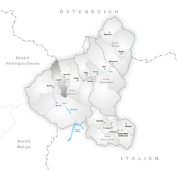
Гашурн (Gaschurn, Gaschurn)

 Hiking in Гашурн
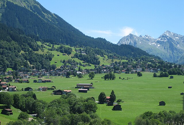
Gaschurn is a charming village located in the Montafon Valley in the Austrian Alps, known for its beautiful mountain scenery and a variety of outdoor activities, making it a fantastic destination for hiking enthusiasts.
Hiking Trails in Gaschurn
-
Montafon Panorama Trail: This trail offers stunning panoramic views of the surrounding mountains and valleys. It's well-marked and generally accessible, making it suitable for hikers of various skill levels. The trail also features several rest areas where you can enjoy the scenery.
-
Silvretta High Alpine Road: While not strictly a hiking trail, this scenic drive offers access to numerous hiking opportunities at higher elevations. You'll find various starting points for hikes leading into the Silvretta and Rätikon mountain ranges.
-
Zamangbahn Trail: Starting from the Zamangbahn cable car station, this trail provides easy access to higher elevations. It's a fantastic option for those wanting to experience beautiful alpine landscapes without a strenuous climb.
-
Vermuntstausee: This route takes you to a stunning reservoir surrounded by majestic peaks. The hike is relatively easy and perfect for families, offering picturesque views and opportunities for swimming in the summer.
-
Gargellen: Located nearby, Gargellen offers trails that vary in difficulty, with options for both casual walks and more challenging hikes. The area is known for its rich flora and fauna, making it a great spot for nature lovers.
Tips for Hiking in Gaschurn
- Check the Weather: Mountain weather can change rapidly, so always check the forecast before heading out and dress appropriately.
- Trail Maps: Obtain a local hiking map or use a hiking app to stay oriented on your adventure.
- Hiking Gear: Wear sturdy hiking boots and bring trekking poles if you need extra support on uneven terrain. A daypack with water, snacks, and a basic first-aid kit is highly recommended.
- Respect Nature: Stay on marked trails to protect the delicate alpine environment and follow Leave No Trace principles to minimize your impact.
Additional Activities
In addition to hiking, Gaschurn offers various outdoor activities like mountain biking, paragliding, and skiing in the winter months. The region is known for its warm hospitality, so take some time to enjoy local cuisine and culture after your hikes.
Whether you're looking for challenging mountain treks or leisurely walks through stunning landscapes, Gaschurn has something to offer for all hiking enthusiasts. Enjoy your adventure in the Alps!
- Страна:

- Почтовый код: 6793
- Телефонный код: 05558
- Код автомобильного номера: BZ
- Координаты: 46° 59' 13" N, 10° 1' 34" E


- GPS треки (wikiloc): [Ссылка]
- Высота над уровнем моря: 979 м m
- Площадь: 176.78 кв.км
- Население: 1464
- Веб сайт: http://www.gaschurn-partenen.at
- Википедия русская: wiki(ru)
- Википедия английская: wiki(en)
- Википедия национальная: wiki(de)
- Хранилище Wikidata: Wikidata: Q700997
- Катеория в википедии: [Ссылка]
- код Freebase: [/m/03gtppl]
- код GeoNames: Альт: [2778834]
- код VIAF: Альт: [239099415]
- код GND: Альт: [4259491-1]
- идентификатор местоположения ArchINFORM: [11076]
- код австрийского муниципалитета: [80110]
Граничит с регионами:


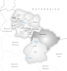
Зильберталь
Hiking in Зильберталь
Silbertal, located in the Montafon valley of Austria, is a fantastic destination for hiking enthusiasts. This picturesque region is surrounded by stunning Alpine scenery, making it ideal for outdoor activities. Here are some highlights and tips for hiking in Silbertal:...
- Страна:
- Почтовый код: 6782
- Телефонный код: 05556
- Код автомобильного номера: BZ
- Координаты: 47° 5' 41" N, 9° 58' 42" E
- GPS треки (wikiloc): [Ссылка]
- Высота над уровнем моря: 889 м m
- Площадь: 88.61 кв.км
- Население: 834
- Веб сайт: [Ссылка]


Гуарда
Hiking in Гуарда
Guarda, Switzerland, is a picturesque village located in the Lower Engadin region of the Swiss Alps. Renowned for its traditional Engadin architecture and stunning natural landscapes, Guarda is an excellent base for hiking enthusiasts. Here are some key highlights for hiking in this beautiful area:...
- Страна:

- Почтовый код: 7545
- Телефонный код: 081
- Координаты: 46° 46' 31" N, 10° 9' 9" E
- GPS треки (wikiloc): [Ссылка]
- Высота над уровнем моря: 1653 м m
- Площадь: 31.42 кв.км
- Веб сайт: [Ссылка]

Лавин
Hiking in Лавин
Lavin, a picturesque village in the Lower Engadine region of Switzerland, offers a stunning backdrop for hikers. Nestled in the Swiss Alps, it provides access to a variety of trails that cater to all skill levels. The region is known for its breathtaking landscapes, including lush valleys, scenic mountain views, and charming alpine architecture....
- Страна:
- Почтовый код: 7543
- Телефонный код: 081
- Код автомобильного номера: GR
- Координаты: 46° 46' 3" N, 10° 6' 38" E
- GPS треки (wikiloc): [Ссылка]
- Высота над уровнем моря: 2140 м m
- Площадь: 46.26 кв.км
- Веб сайт: [Ссылка]

Гальтюр
Hiking in Гальтюр
Galtür, located in the Paznaun Valley of Tyrol, Austria, is a stunning destination for hiking enthusiasts. Nestled in the Silvretta Alps, Galtür offers a variety of trails catering to different skill levels, making it an ideal spot for both beginners and experienced hikers. Here are some highlights of hiking in Galtür:...
- Страна:
- Почтовый код: 6563
- Телефонный код: 05443
- Код автомобильного номера: LA
- Координаты: 46° 58' 5" N, 10° 11' 13" E
- GPS треки (wikiloc): [Ссылка]
- Высота над уровнем моря: 1584 м m
- Площадь: 121.2 кв.км
- Население: 765
- Веб сайт: [Ссылка]
Клостерс-Зернойс
Hiking in Клостерс-Зернойс
Klosters, located in the Swiss Alps near the popular ski resort of Davos, is a beautiful destination for hiking enthusiasts. Here’s an overview of what you can expect while hiking in this wonderful area:...
- Страна:
- Почтовый код: 7250
- Телефонный код: 081
- Код автомобильного номера: GR
- Координаты: 46° 53' 0" N, 9° 53' 0" E
- GPS треки (wikiloc): [Ссылка]
- Высота над уровнем моря: 1342 м m
- Площадь: 193.10 кв.км
- Население: 4437
- Веб сайт: [Ссылка]


Санкт-Галленкирх
Hiking in Санкт-Галленкирх
Sankt Gallenkirch, located in the Montafon Valley of Austria, is an excellent destination for hiking enthusiasts. The region offers a diverse range of trails that cater to both beginners and experienced hikers, with stunning views of the surrounding mountains....
- Страна:
- Почтовый код: 6791
- Телефонный код: 05557
- Код автомобильного номера: BZ
- Координаты: 47° 1' 0" N, 9° 58' 0" E
- GPS треки (wikiloc): [Ссылка]
- Высота над уровнем моря: 878 м m
- Площадь: 127.83 кв.км
- Население: 2246
- Веб сайт: [Ссылка]