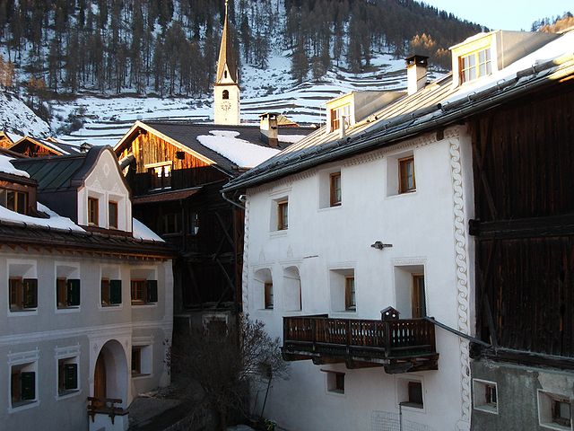
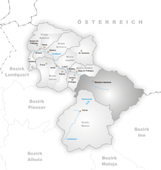
Лавин (Lavin, Lavin)

 Hiking in Лавин
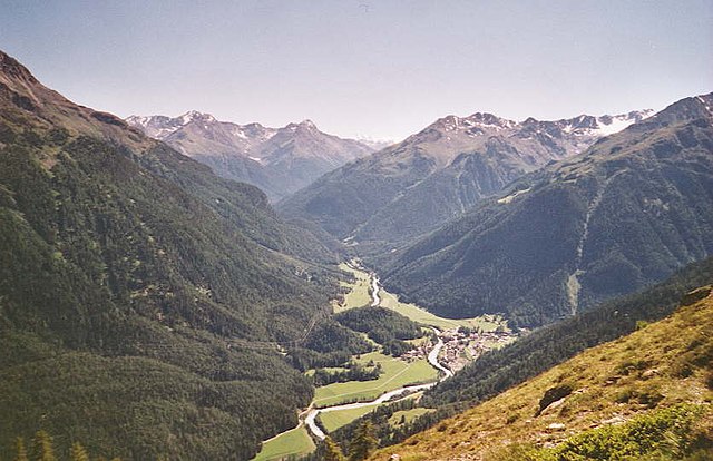
Lavin, a picturesque village in the Lower Engadine region of Switzerland, offers a stunning backdrop for hikers. Nestled in the Swiss Alps, it provides access to a variety of trails that cater to all skill levels. The region is known for its breathtaking landscapes, including lush valleys, scenic mountain views, and charming alpine architecture.
Popular Hiking Trails in Lavin
-
Lavin to Zernez: This moderate hike takes you through diverse alpine meadows and forests, providing spectacular views of the surrounding mountains. The trail is well-marked and will also give you a chance to observe local wildlife.
-
The Val S-charl Hike: A beautiful route starting from Lavin that leads to the Val S-charl National Park. This trail offers serene natural beauty and the opportunity to see unique flora and fauna, with the chance to spot ibex and chamois.
-
Piz Plavna Hike: For those looking for a challenge, hiking to Piz Plavna provides a rewarding experience with stunning panoramic views from the summit. The ascent can be steep, so it's recommended for experienced hikers.
Tips for Hiking in Lavin
-
Seasonal Considerations: The best time for hiking in Lavin is typically from late spring to early autumn when the trails are accessible and the weather is mild.
-
Proper Gear: Make sure to wear sturdy hiking boots, dress in layers, and pack enough water and snacks for your hike.
-
Local Guidance: Consider hiring a local guide or joining a hiking group if you're unfamiliar with the area. They can provide valuable insights on the terrain and ensure safety.
-
Respect Nature: Stay on marked trails to preserve the natural environment and adhere to local regulations regarding wildlife and flora.
Amenities
Lavin has several accommodation options ranging from cozy guesthouses to hotels, as well as local restaurants where you can enjoy traditional Swiss cuisine after a day on the trails.
Exploring the hiking paths around Lavin is a fantastic way to immerse yourself in the majestic natural beauty of the Swiss Alps while enjoying a range of outdoor activities.
- Страна:

- Почтовый код: 7543
- Телефонный код: 081
- Код автомобильного номера: GR
- Координаты: 46° 46' 3" N, 10° 6' 38" E


- GPS треки (wikiloc): [Ссылка]
- Высота над уровнем моря: 2140 м m
- Площадь: 46.26 кв.км
- Веб сайт: http://www.lavin.ch
- Википедия русская: wiki(ru)
- Википедия английская: wiki(en)
- Википедия национальная: wiki(de)
- Хранилище Wikidata: Wikidata: Q65557
- Катеория в википедии: [Ссылка]
- код Freebase: [/m/0bvvq3]
- код GeoNames: Альт: [7286291]
- идентификатор HDS: [1522]
- код швейцарского муниципалитета: [3743]
Граничит с регионами:

Ардец
Hiking in Ардец
Ardez is a picturesque village located in the Swiss Alps, specifically in the Lower Engadine region of Switzerland. Surrounded by stunning mountain landscapes, Ardez is an excellent destination for hiking enthusiasts. Here are some things to consider for hiking in and around Ardez:...
- Страна:
- Почтовый код: 7546
- Телефонный код: 081
- Код автомобильного номера: GR
- Координаты: 46° 46' 29" N, 10° 12' 3" E
- GPS треки (wikiloc): [Ссылка]
- Высота над уровнем моря: 1362 м m
- Площадь: 61.39 кв.км
- Веб сайт: [Ссылка]
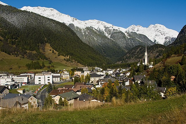

Цернец
Hiking in Цернец
Zernez is a beautiful village located in the Swiss National Park in the Engadin Valley, known for its stunning natural landscapes, diverse ecosystems, and a variety of hiking trails that cater to different skill levels. Here are some highlights and tips for hiking in Zernez:...
- Страна:
- Почтовый код: 7530
- Телефонный код: 081
- Код автомобильного номера: GR
- Координаты: 46° 41' 59" N, 10° 5' 59" E
- GPS треки (wikiloc): [Ссылка]
- Высота над уровнем моря: 2216 м m
- Площадь: 344.04 кв.км
- Население: 1532
- Веб сайт: [Ссылка]


Гуарда
Hiking in Гуарда
Guarda, Switzerland, is a picturesque village located in the Lower Engadin region of the Swiss Alps. Renowned for its traditional Engadin architecture and stunning natural landscapes, Guarda is an excellent base for hiking enthusiasts. Here are some key highlights for hiking in this beautiful area:...
- Страна:
- Почтовый код: 7545
- Телефонный код: 081
- Координаты: 46° 46' 31" N, 10° 9' 9" E
- GPS треки (wikiloc): [Ссылка]
- Высота над уровнем моря: 1653 м m
- Площадь: 31.42 кв.км
- Веб сайт: [Ссылка]

Суш
Hiking in Суш
Susch, a picturesque village located in the Lower Engadine region of Switzerland, offers a range of hiking opportunities that showcase its stunning alpine scenery and cultural heritage. Here are some things to know about hiking in Susch:...
- Страна:
- Почтовый код: 7542
- Телефонный код: 081
- Код автомобильного номера: GR
- Координаты: 46° 45' 3" N, 10° 1' 20" E
- GPS треки (wikiloc): [Ссылка]
- Высота над уровнем моря: 1856 м m
- Площадь: 93.93 кв.км
- Веб сайт: [Ссылка]
Клостерс-Зернойс
Hiking in Клостерс-Зернойс
Klosters, located in the Swiss Alps near the popular ski resort of Davos, is a beautiful destination for hiking enthusiasts. Here’s an overview of what you can expect while hiking in this wonderful area:...
- Страна:
- Почтовый код: 7250
- Телефонный код: 081
- Код автомобильного номера: GR
- Координаты: 46° 53' 0" N, 9° 53' 0" E
- GPS треки (wikiloc): [Ссылка]
- Высота над уровнем моря: 1342 м m
- Площадь: 193.10 кв.км
- Население: 4437
- Веб сайт: [Ссылка]