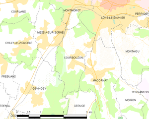
Geruge (Geruge)

- коммуна во Франции
 Hiking in Geruge
It seems there may be a typo in your query, as "Geruge" doesn't correspond to any well-known hiking destination that I'm aware of. If you intended to ask about "Gorge," "Gurage" (a region in Ethiopia), or a specific area with a similar name, please clarify, and I’d be happy to provide information.
If you were referring to a specific hiking area or trail, details about general safety tips, preparation, and types of trails could be beneficial. For Western regions, for example, I'd recommend checking out local maps, understanding trail markers, and ensuring you have enough supplies for your hike.
Please let me know how I can assist you further!
- Страна:

- Почтовый код: 39570
- Координаты: 46° 37' 37" N, 5° 31' 45" E


- GPS треки (wikiloc): [Ссылка]
- Площадь: 4.36 кв.км
- Население: 168
- Википедия английская: wiki(en)
- Википедия национальная: wiki(fr)
- Хранилище Wikidata: Wikidata: Q321902
- Катеория в википедии: [Ссылка]
- код Freebase: [/m/03npjgf]
- код GeoNames: Альт: [6433571]
- номер SIREN: [213902505]
- код BNF: [15258614h]
- код муниципалитета INSEE: 39250
Граничит с регионами:


Gevingey
- коммуна во Франции
Hiking in Gevingey
Gevingey is a charming village located in the Jura department of France, surrounded by beautiful natural landscapes, making it a great destination for hiking enthusiasts. The region is characterized by rolling hills, lush forests, and picturesque vineyards, offering a variety of trails for different skill levels....
- Страна:
- Почтовый код: 39570
- Координаты: 46° 38' 12" N, 5° 30' 22" E
- GPS треки (wikiloc): [Ссылка]
- Площадь: 5.9 кв.км
- Население: 455


Macornay
- коммуна во Франции
Hiking in Macornay
It seems there might be a typographical error or confusion regarding the location name "Macornay," as it doesn't appear to be a well-known hiking destination. If you meant to inquire about a specific region, park, or country (for example, "Macaronesia" or a particular area in France like "Macorny"), please clarify....
- Страна:
- Почтовый код: 39570
- Координаты: 46° 38' 41" N, 5° 32' 29" E
- GPS треки (wikiloc): [Ссылка]
- Площадь: 4.6 кв.км
- Население: 990
- Веб сайт: [Ссылка]

Courbouzon
- коммуна во Франции
Hiking in Courbouzon
Courbouzon is a picturesque village located in the Jura region of France, known for its stunning natural landscapes and outdoor activities, including hiking. Here are some key points to consider when hiking in and around Courbouzon:...
- Страна:
- Почтовый код: 39570
- Координаты: 46° 39' 4" N, 5° 31' 42" E
- GPS треки (wikiloc): [Ссылка]
- Площадь: 3.35 кв.км
- Население: 585


Bornay
- коммуна во Франции
Hiking in Bornay
Bornay is a picturesque area located in the Jura Mountains of France, known for its stunning landscapes, dense forests, and peaceful valleys. While it might not be as famous as some larger hiking destinations, it offers a wealth of natural beauty and opportunities for outdoor activities....
- Страна:
- Почтовый код: 39570
- Координаты: 46° 36' 52" N, 5° 33' 18" E
- GPS треки (wikiloc): [Ссылка]
- Площадь: 6.76 кв.км
- Население: 171


Saint-Laurent-la-Roche
- коммуна во Франции
Hiking in Saint-Laurent-la-Roche
Saint-Laurent-la-Roche is a charming commune located in the French Alps, known for its picturesque landscapes and natural beauty, making it a great destination for hiking enthusiasts. The area offers a variety of trails that cater to different skill levels, from easy walks suitable for families to more challenging hikes for experienced trekkers....
- Страна:
- Почтовый код: 39570
- Координаты: 46° 36' 1" N, 5° 30' 57" E
- GPS треки (wikiloc): [Ссылка]
- Площадь: 11.13 кв.км
- Население: 334