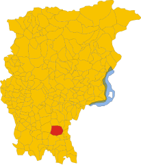
Гизальба (Ghisalba, Ghisalba)
.svg)
- коммуна Италии
 Hiking in Гизальба
Ghisalba is a small town located in the province of Bergamo in northern Italy. While it may not be widely recognized as a prominent hiking destination, its surrounding areas offer opportunities for nature walks and outdoor activities. Here’s what you can expect when hiking near Ghisalba:
Natural Landscape
- Scenic Views: The area is characterized by rolling hills and lush greenery, providing a picturesque backdrop for hikes.
- Proximity to the Seriana Valley: Just a short drive away, this valley offers more significant hiking opportunities with varied trails that range in difficulty.
Hiking Trails
While Ghisalba itself might not have extensive hiking trails, here are some nearby options to consider:
- Monte Gioco: A prominent hiking destination nearby, with trails leading up to the peak, where you're rewarded with stunning views of the surrounding mountains and valleys.
- Valle del Riso: This area features gentler trails perfect for a leisurely hike, allowing hikers to explore the natural beauty and local flora and fauna.
- Sentiero dei Sapori: This trail offers a combined experience of hiking and tasting local food, taking you through beautiful landscapes while showcasing local culinary delights.
Tips for Hiking in the Area
- Weather Check: Always check the weather conditions before heading out, as the area can experience rapid weather changes.
- Proper Gear: Wear appropriate hiking footwear and bring enough water, especially on longer treks.
- Trail Maps: Consider obtaining a map or using a hiking app to stay on track, since some trails may not be well marked.
- Local Guidance: Connect with local hiking groups or guides for the best trails and tips.
Nearby Attractions
If you're in Ghisalba, consider exploring nearby towns such as Bergamo, which boasts historical sites and charming streets, as well as further afield places like the Parco dei Colli di Bergamo, which has numerous hiking routes.
Conclusion
Ghisalba may not be a major hiking hub, but with its access to nearby trails and breathtaking landscapes, it can serve as a great base for discovering the beautiful natural environment of northern Italy. Happy hiking!
- Страна:

- Почтовый код: 24050
- Телефонный код: 0363
- Код автомобильного номера: BG
- Координаты: 45° 36' 0" N, 9° 45' 0" E


- GPS треки (wikiloc): [Ссылка]
- Высота над уровнем моря: 170 м m
- Площадь: 10.59 кв.км
- Население: 6170
- Веб сайт: http://www.comuneghisalba.it
- Википедия русская: wiki(ru)
- Википедия английская: wiki(en)
- Википедия национальная: wiki(it)
- Хранилище Wikidata: Wikidata: Q101139
- Галерея изображений в википедии: [Ссылка]
- Катеория в википедии: [Ссылка]
- код Freebase: [/m/0gjbjz]
- код GeoNames: Альт: [6540347]
- код VIAF: Альт: [147845979]
- ID отношения в OpenStreetMap: [45396]
- идентификатор местоположения ArchINFORM: [916]
- UN/LOCODE: [ITGSB]
- код ISTAT: 016113
- кадастровый код Италии: E006
Граничит с регионами:


Кальчинате
- коммуна Италии
Hiking in Кальчинате
Calcinate, located in the province of Bergamo in Italy, is not particularly known as a prime hiking destination, but it offers access to the scenic landscapes and trails in the surrounding regions of Lombardy. Here are some suggestions and information about hiking in and around Calcinate:...
- Страна:
- Почтовый код: 24050
- Телефонный код: 035
- Код автомобильного номера: BG
- Координаты: 45° 37' 16" N, 9° 48' 1" E
- GPS треки (wikiloc): [Ссылка]
- Высота над уровнем моря: 186 м m
- Площадь: 15.08 кв.км
- Население: 5985
- Веб сайт: [Ссылка]


Кавернаго
- коммуна Италии
Hiking in Кавернаго
Cavernago is a charming village located in the Lombardy region of Italy, close to Bergamo. While it may not be as widely recognized for hiking as some other areas in the region, it does offer opportunities for outdoor activities and exploration of the surrounding countryside....
- Страна:
- Почтовый код: 24050
- Телефонный код: 035
- Код автомобильного номера: BG
- Координаты: 45° 38' 0" N, 9° 46' 0" E
- GPS треки (wikiloc): [Ссылка]
- Высота над уровнем моря: 199 м m
- Площадь: 7.65 кв.км
- Население: 2587
- Веб сайт: [Ссылка]


Колоньо-аль-Серио
- коммуна Италии
Hiking in Колоньо-аль-Серио
Cologno al Serio is a small town located in the Lombardy region of Italy, near the Adda River and not far from the beautiful landscapes of the Italian Alps. While Cologno al Serio itself might not be a major hiking destination, there are several hiking opportunities in the surrounding areas....
- Страна:
- Почтовый код: 24055
- Телефонный код: 035
- Код автомобильного номера: BG
- Координаты: 45° 35' 0" N, 9° 42' 0" E
- GPS треки (wikiloc): [Ссылка]
- Высота над уровнем моря: 156 м m
- Площадь: 18.52 кв.км
- Население: 11180
- Веб сайт: [Ссылка]
Мартиненго
- коммуна Италии
Hiking in Мартиненго
Martinengo is a charming town located in the Lombardy region of Italy, known for its picturesque landscapes and historical architecture. While it is not a well-known hiking destination, there are several opportunities to explore the natural beauty of the surrounding area....
- Страна:
- Почтовый код: 24057
- Телефонный код: 0363
- Код автомобильного номера: BG
- Координаты: 45° 34' 20" N, 9° 46' 3" E
- GPS треки (wikiloc): [Ссылка]
- Высота над уровнем моря: 149 м m
- Площадь: 22.05 кв.км
- Население: 10560
- Веб сайт: [Ссылка]


Морнико-аль-Серио
- коммуна Италии
Hiking in Морнико-аль-Серио
Mornico al Serio is a quaint village located in the province of Bergamo in Lombardy, Italy. While it may not be a well-known hiking destination, it is surrounded by beautiful landscapes that offer opportunities for outdoor activities, including hiking....
- Страна:
- Почтовый код: 24050
- Телефонный код: 035
- Код автомобильного номера: BG
- Координаты: 45° 35' 33" N, 9° 48' 32" E
- GPS треки (wikiloc): [Ссылка]
- Высота над уровнем моря: 162 м m
- Площадь: 6.92 кв.км
- Население: 2942
- Веб сайт: [Ссылка]


Урньяно
- коммуна Италии
Hiking in Урньяно
Urgnano is a small town located in Lombardy, Italy, close to Bergamo. While Urgnano itself may not be a prominent hiking destination, it is surrounded by beautiful landscapes and trails that appeal to hiking enthusiasts....
- Страна:
- Почтовый код: 24059
- Телефонный код: 035
- Код автомобильного номера: BG
- Координаты: 45° 35' 50" N, 9° 41' 42" E
- GPS треки (wikiloc): [Ссылка]
- Высота над уровнем моря: 173 м m
- Площадь: 14.78 кв.км
- Население: 9908
- Веб сайт: [Ссылка]