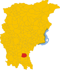
Колоньо-аль-Серио (Cologno al Serio, Cologno al Serio)
.svg)
- коммуна Италии
 Hiking in Колоньо-аль-Серио
Cologno al Serio is a small town located in the Lombardy region of Italy, near the Adda River and not far from the beautiful landscapes of the Italian Alps. While Cologno al Serio itself might not be a major hiking destination, there are several hiking opportunities in the surrounding areas.
Nearby Hiking Areas
-
Parco del Serio: This regional park, located to the east of Cologno al Serio, features scenic trails that run along the Serio River. The area is known for its natural beauty, including meadows, forests, and wetlands. Hiking here allows you to enjoy the local flora and fauna, and there are trails suitable for walkers of various skill levels.
-
Bergamo Alps: A short drive from Cologno al Serio will take you into the Bergamo Alps, where you'll find a range of trails that vary in difficulty. Popular areas include:
- Valle Brembana: Offers numerous hiking trails with stunning views, waterfalls, and rustic villages.
- Pizzo del Becco: A more challenging hike with rewarding panoramic views, suitable for experienced hikers.
-
Porta di Palazzo: Near Cologno al Serio, this area provides easier walkways and paths that can be great for families and casual walkers.
Hiking Tips for Cologno al Serio
- Season: Spring and early autumn are ideal for hiking in this region when temperatures are moderate, and landscapes are vibrant.
- Gear: Ensure you have proper footwear for hiking, weather-appropriate clothing, and a backpack with essentials (water, snacks, first-aid kit).
- Navigation: While trails may be marked, it is always advisable to carry a map or use a GPS app on your phone.
- Local Regulations: Respect the natural environment and follow local rules, especially in protected areas.
Conclusion
While Cologno al Serio may not have extensive hiking trails within the town, it serves as an excellent base for exploring the natural beauty of the surrounding regions. Whether you’re looking for gentle walks along the river or more strenuous hikes in the nearby Alps, there are plenty of options to enjoy the great outdoors!
- Страна:

- Почтовый код: 24055
- Телефонный код: 035
- Код автомобильного номера: BG
- Координаты: 45° 35' 0" N, 9° 42' 0" E


- GPS треки (wikiloc): [Ссылка]
- Высота над уровнем моря: 156 м m
- Площадь: 18.52 кв.км
- Население: 11180
- Веб сайт: http://www.comune.colognomonzese.mi.it
- Википедия русская: wiki(ru)
- Википедия английская: wiki(en)
- Википедия национальная: wiki(it)
- Хранилище Wikidata: Wikidata: Q100394
- Галерея изображений в википедии: [Ссылка]
- Катеория в википедии: [Ссылка]
- код Freebase: [/m/0gj9tj]
- код GeoNames: Альт: [6537150]
- код VIAF: Альт: [122423315]
- ID отношения в OpenStreetMap: [45321]
- UN/LOCODE: [ITCGS]
- код ISTAT: 016079
- кадастровый код Италии: C894
Граничит с регионами:


Бриньяно-Джера-д'Адда
- коммуна Италии
Hiking in Бриньяно-Джера-д'Адда
Brignano Gera d'Adda is located in the Lombardy region of Italy and offers a unique landscape for hiking enthusiasts. While the area may not be as globally renowned as some of Italy's larger national parks, it boasts picturesque scenery and natural beauty that can provide a pleasant hiking experience....
- Страна:
- Почтовый код: 24053
- Телефонный код: 0363
- Код автомобильного номера: BG
- Координаты: 45° 32' 0" N, 9° 38' 0" E
- GPS треки (wikiloc): [Ссылка]
- Высота над уровнем моря: 131 м m
- Площадь: 12.11 кв.км
- Население: 6009
- Веб сайт: [Ссылка]


Гизальба
- коммуна Италии
Hiking in Гизальба
Ghisalba is a small town located in the province of Bergamo in northern Italy. While it may not be widely recognized as a prominent hiking destination, its surrounding areas offer opportunities for nature walks and outdoor activities. Here’s what you can expect when hiking near Ghisalba:...
- Страна:
- Почтовый код: 24050
- Телефонный код: 0363
- Код автомобильного номера: BG
- Координаты: 45° 36' 0" N, 9° 45' 0" E
- GPS треки (wikiloc): [Ссылка]
- Высота над уровнем моря: 170 м m
- Площадь: 10.59 кв.км
- Население: 6170
- Веб сайт: [Ссылка]
Мартиненго
- коммуна Италии
Hiking in Мартиненго
Martinengo is a charming town located in the Lombardy region of Italy, known for its picturesque landscapes and historical architecture. While it is not a well-known hiking destination, there are several opportunities to explore the natural beauty of the surrounding area....
- Страна:
- Почтовый код: 24057
- Телефонный код: 0363
- Код автомобильного номера: BG
- Координаты: 45° 34' 20" N, 9° 46' 3" E
- GPS треки (wikiloc): [Ссылка]
- Высота над уровнем моря: 149 м m
- Площадь: 22.05 кв.км
- Население: 10560
- Веб сайт: [Ссылка]

Моренго
- коммуна Италии
Hiking in Моренго
It seems like you may be referring to a specific hiking area, but "Morengo" isn't widely recognized as a popular hiking destination in the general hiking community. It’s possible you meant "Morrison," which is known for its hiking trails near Red Rocks in Colorado, or perhaps a location in another region altogether....
- Страна:
- Почтовый код: 24050
- Телефонный код: 0363
- Код автомобильного номера: BG
- Координаты: 45° 32' 0" N, 9° 42' 0" E
- GPS треки (wikiloc): [Ссылка]
- Высота над уровнем моря: 126 м m
- Площадь: 9.57 кв.км
- Население: 2535
- Веб сайт: [Ссылка]


Пагаццано
- коммуна Италии
Hiking in Пагаццано
Pagazzano is a charming town located in the Lombardy region of Italy, not far from the more well-known city of Bergamo. While Pagazzano itself may not be a major hiking destination, its surrounding areas offer a variety of trails and natural beauty suitable for hiking enthusiasts....
- Страна:
- Почтовый код: 24040
- Телефонный код: 0363
- Код автомобильного номера: BG
- Координаты: 45° 32' 3" N, 9° 40' 16" E
- GPS треки (wikiloc): [Ссылка]
- Высота над уровнем моря: 126 м m
- Площадь: 5.24 кв.км
- Население: 2083
- Веб сайт: [Ссылка]


Спирано
- коммуна Италии
Hiking in Спирано
Spirano, a small town located in the province of Bergamo in Lombardy, Italy, offers a serene environment and picturesque landscapes suitable for hiking enthusiasts. While it may not be as renowned for hiking as some larger areas in the Italian Alps, Spirano and its surrounding regions provide a variety of trails that cater to different experience levels....
- Страна:
- Почтовый код: 24050
- Телефонный код: 035
- Код автомобильного номера: BG
- Координаты: 45° 34' 58" N, 9° 40' 9" E
- GPS треки (wikiloc): [Ссылка]
- Высота над уровнем моря: 154 м m
- Площадь: 9.61 кв.км
- Население: 5730
- Веб сайт: [Ссылка]


Урньяно
- коммуна Италии
Hiking in Урньяно
Urgnano is a small town located in Lombardy, Italy, close to Bergamo. While Urgnano itself may not be a prominent hiking destination, it is surrounded by beautiful landscapes and trails that appeal to hiking enthusiasts....
- Страна:
- Почтовый код: 24059
- Телефонный код: 035
- Код автомобильного номера: BG
- Координаты: 45° 35' 50" N, 9° 41' 42" E
- GPS треки (wikiloc): [Ссылка]
- Высота над уровнем моря: 173 м m
- Площадь: 14.78 кв.км
- Население: 9908
- Веб сайт: [Ссылка]