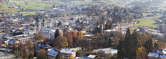
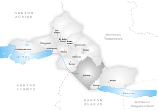
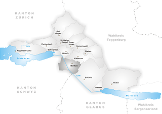
Glarus Nord (Glarus Nord)

 Hiking in Glarus Nord
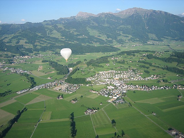
Glarus Nord, located in the Swiss canton of Glarus, is a stunning area for hiking, offering a diverse range of trails suitable for various skill levels. The region is characterized by its impressive mountains, lush valleys, and pristine nature, making it ideal for outdoor enthusiasts.
Highlights of Hiking in Glarus Nord:
-
Scenic Trails: The area boasts an extensive network of well-marked hiking trails that showcase the region's natural beauty. From leisurely walks to challenging mountain hikes, there's something for everyone.
-
Popular Hiking Routes:
- Klausen Pass: This scenic route leads you through breathtaking landscapes, featuring alpine meadows and stunning mountain views.
- Niesen-Glärnisch: A more challenging route offering rewarding panoramas of the surrounding peaks.
- Linthal: A valley with gentle paths, perfect for families and beginners, allowing hikers to enjoy the local flora and fauna.
-
Nature and Wildlife: As you hike, keep an eye out for Switzerland's diverse wildlife, including chamois, ibex, and a variety of bird species. The area is also rich in wildflowers, particularly in spring and early summer.
-
Historical Significance: Many trails pass through regions of historical importance, including old trade routes and sites that reveal the cultural heritage of the region.
-
Accessibility: Glarus Nord can be easily accessed by public transport from major Swiss cities, making it a convenient choice for day trips or longer hikes.
-
Seasonal Considerations: Hiking in Glarus Nord is best enjoyed from spring through autumn. However, some high-altitude trails may require proper gear and experience in winter conditions if you're planning to hike during the colder months.
-
Safety and Preparation: Always check trail conditions and weather forecasts before heading out. Be sure to pack plenty of water, snacks, and a first-aid kit, and consider using trekking poles for added support on uneven terrain.
Whether you're an experienced hiker or a beginner looking to explore the beauty of Switzerland, Glarus Nord offers a perfect backdrop for a memorable hiking experience.
- Страна:

- Почтовый код: 8752, 8753, 8757, 8758, 8865, 8866, 8867, 8868, 8874
- Телефонный код: 055
- Код автомобильного номера: GL
- Координаты: 47° 5' 57" N, 9° 3' 47" E


- GPS треки (wikiloc): [Ссылка]
- Высота над уровнем моря: 437 м m
- Площадь: 147 кв.км
- Население: 18247
- Веб сайт: http://www.glarus-nord.ch
- Википедия английская: wiki(en)
- Википедия национальная: wiki(de)
- Хранилище Wikidata: Wikidata: Q70635
- Катеория в википедии: [Ссылка]
- код Freebase: [/m/0g57ngs]
- код GeoNames: Альт: [8260335]
- ID отношения в OpenStreetMap: [1683140]
- место в MusicBrainz: [0531adb2-4dc3-4bf1-a9ea-4704d9f6caf4]
- идентификатор HDS: [50184]
- код швейцарского муниципалитета: [1630]
Граничит с регионами:

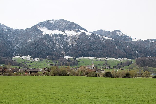
Гларус
Hiking in Гларус
Hiking in Glarus offers a stunning experience with a mix of picturesque landscapes, diverse trails, and a wealth of natural beauty. Located in the heart of Switzerland, Glarus is surrounded by impressive mountains, lush valleys, and clear lakes, making it a perfect destination for outdoor enthusiasts....
- Страна:
- Почтовый код: 8750
- Телефонный код: 055
- Код автомобильного номера: GL
- Координаты: 47° 1' 59" N, 9° 3' 59" E
- GPS треки (wikiloc): [Ссылка]
- Высота над уровнем моря: 474 м m
- Площадь: 103.6 кв.км
- Население: 12515
- Веб сайт: [Ссылка]

Шенис
Hiking in Шенис
Schänis is a charming municipality located in the canton of St. Gallen, Switzerland. It's a great area for hiking enthusiasts, offering a variety of trails that cater to different skill levels, along with stunning natural vistas....
- Страна:
- Почтовый код: 8718
- Телефонный код: 055
- Код автомобильного номера: SG
- Координаты: 47° 9' 32" N, 9° 2' 48" E
- GPS треки (wikiloc): [Ссылка]
- Высота над уровнем моря: 683 м m
- Площадь: 39.90 кв.км
- Население: 3812
- Веб сайт: [Ссылка]


Шюбельбах
- коммуна в Швейцарии
Hiking in Шюбельбах
Schübelbach is a charming location in the Canton of Schwyz in Switzerland, known for its picturesque landscapes and access to hiking trails that cater to a variety of skill levels. Here's some useful information about hiking in and around Schübelbach:...
- Страна:
- Почтовый код: 8862
- Телефонный код: 055
- Код автомобильного номера: SZ
- Координаты: 47° 9' 18" N, 8° 56' 0" E
- GPS треки (wikiloc): [Ссылка]
- Высота над уровнем моря: 433 м m
- Площадь: 29.0 кв.км
- Население: 9167
- Веб сайт: [Ссылка]


Амден
Hiking in Амден
Amden is a charming village located in the canton of St. Gallen in Switzerland, nestled in the foothills of the Alps. It offers stunning panoramic views of Lake Zurich and the surrounding mountains, making it a popular destination for hikers of all skill levels....
- Страна:
- Почтовый код: 8875
- Телефонный код: 055
- Код автомобильного номера: SG
- Координаты: 47° 9' 37" N, 9° 9' 59" E
- GPS треки (wikiloc): [Ссылка]
- Высота над уровнем моря: 903 м m
- Площадь: 43.48 кв.км
- Население: 1784
- Веб сайт: [Ссылка]

Райхенбург
- коммуна в Швейцарии
Hiking in Райхенбург
Reichenburg, located in the Canton of Schwyz in Switzerland, offers picturesque hiking opportunities with stunning views of the surrounding landscapes, including the nearby Lake Zurich and the impressive Swiss Alps. The area is known for its beautiful nature trails, varied terrain, and well-marked paths, making it a suitable destination for hikers of all skill levels....
- Страна:
- Почтовый код: 8864
- Телефонный код: 055
- Код автомобильного номера: SZ
- Координаты: 47° 9' 40" N, 8° 58' 24" E
- GPS треки (wikiloc): [Ссылка]
- Высота над уровнем моря: 560 м m
- Площадь: 11.6 кв.км
- Население: 3633
- Веб сайт: [Ссылка]

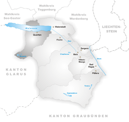
Квартен
Hiking in Квартен
Quarten is a beautiful hiking destination located in the Canton of St. Gallen in Switzerland, nestled near Lake Zurich. The region is known for its stunning scenery, with breathtaking views of the Swiss Alps, lush forests, and charming alpine meadows. Here are some highlights and tips for hiking in Quarten:...
- Страна:
- Почтовый код: 8883
- Телефонный код: 081
- Код автомобильного номера: SG
- Координаты: 47° 5' 4" N, 9° 13' 15" E
- GPS треки (wikiloc): [Ссылка]
- Высота над уровнем моря: 1420 м m
- Площадь: 61.90 кв.км
- Население: 2877
- Веб сайт: [Ссылка]


Иннерталь
- коммуна в Швейцарии
Hiking in Иннерталь
Innerthal is a picturesque valley located in the Swiss region of the Canton of Schwyz, known for its stunning landscapes, rich flora and fauna, and a variety of hiking trails that cater to different skill levels. Here are some details to consider when hiking in Innerthal:...
- Страна:
- Почтовый код: 8858
- Телефонный код: 055
- Код автомобильного номера: SZ
- Координаты: 47° 6' 18" N, 8° 55' 7" E
- GPS треки (wikiloc): [Ссылка]
- Высота над уровнем моря: 915 м m
- Площадь: 50.22 кв.км
- Население: 177
- Веб сайт: [Ссылка]
Бенкен
Hiking in Бенкен
Benken, located in the canton of St. Gallen, Switzerland, offers a variety of hiking opportunities that showcase the stunning landscapes and natural beauty of the region. The area is characterized by rolling hills, lush forests, and panoramic views of the Alps, making it a delightful destination for outdoor enthusiasts....
- Страна:
- Почтовый код: 8717
- Телефонный код: 055
- Код автомобильного номера: SG
- Координаты: 47° 11' 59" N, 9° 1' 0" E
- GPS треки (wikiloc): [Ссылка]
- Высота над уровнем моря: 420 м m
- Площадь: 16.48 кв.км
- Население: 3015
- Веб сайт: [Ссылка]
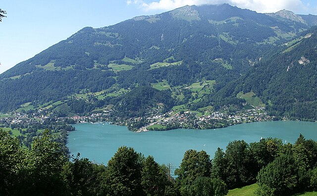

Везен
Hiking in Везен
Weesen, located in the canton of St. Gallen in Switzerland, is a picturesque village nestled along the shores of Lake Zurich and surrounded by the scenic Swiss Alps. It offers a wealth of hiking opportunities for both beginners and experienced hikers....
- Страна:
- Почтовый код: 8872
- Телефонный код: 055
- Код автомобильного номера: SG
- Координаты: 47° 7' 59" N, 9° 6' 0" E
- GPS треки (wikiloc): [Ссылка]
- Высота над уровнем моря: 423 м m
- Площадь: 5.39 кв.км
- Население: 1483
- Веб сайт: [Ссылка]