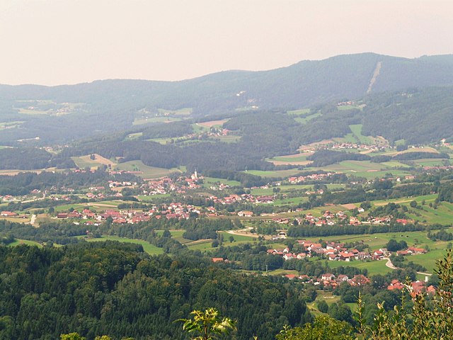
Граттерсдорф (Grattersdorf, Grattersdorf)

 Hiking in Граттерсдорф
Grattersdorf, a small village in Bavaria, Germany, is situated in a scenic area ideal for hiking enthusiasts. Here are some features to consider if you're planning a hike in this picturesque region:
-
Scenic Trails: The area around Grattersdorf offers various nature trails that take you through lush forests, rolling hills, and beautiful meadows. You can expect to enjoy stunning views of the Bavarian countryside.
-
Difficulty Levels: There are trails suitable for all skill levels, from easy walks perfect for families with children to more challenging routes for experienced hikers looking for a workout and a bit of adventure.
-
Local Flora and Fauna: While hiking, you may encounter diverse plant species, wildlife, and perhaps some beautiful local wildflowers, especially in the spring and summer months.
-
Guided Tours: If you prefer a guided experience, look for local hiking groups or instructors who can provide insights into the area’s history, geology, and ecology.
-
Cultural Attractions: In addition to the natural beauty, you can find charming Bavarian architecture in the village and surrounding areas, including traditional farms and churches.
-
Accessibility: Check trail maps and local resources for accessibility options, as some trails may be easier to navigate for families or individuals with mobility challenges.
-
Weather Considerations: Bavaria can have variable weather, so it's essential to check the forecast and dress in layers. Always be prepared with proper hiking gear, including sturdy footwear.
-
Safety Tips: Carry plenty of water, snacks, and a first-aid kit. Inform someone about your hiking plans, and always stay on marked paths to preserve the natural environment and ensure your safety.
Overall, hiking in Grattersdorf can be a delightful experience, combining nature, culture, and physical activity. Make sure to take some time to immerse yourself in the beautiful surroundings!
- Страна:

- Почтовый код: 94551; 94541
- Телефонный код: 09904
- Код автомобильного номера: DEG
- Координаты: 48° 48' 0" N, 13° 9' 0" E


- GPS треки (wikiloc): [Ссылка]
- Высота над уровнем моря: 476 м m
- Площадь: 25.98 кв.км
- Население: 1258
- Веб сайт: http://www.grattersdorf.de
- Википедия русская: wiki(ru)
- Википедия английская: wiki(en)
- Википедия национальная: wiki(de)
- Хранилище Wikidata: Wikidata: Q508611
- Катеория в википедии: [Ссылка]
- код Freebase: [/m/02q0_xq]
- код GeoNames: Альт: [2917951]
- код VIAF: Альт: [240516828]
- ID отношения в OpenStreetMap: [959817]
- код GND: Альт: [4368515-8]
- Bavarikon ID: [ODB_A00009179]
- идентификатор муниципалитетов в Германии: 09271123
Граничит с регионами:

Ауэрбах
- муниципалитет в Германии, Бавария
Hiking in Ауэрбах
Auerbach in Lower Bavaria is a picturesque area that offers a variety of hiking opportunities in the beautiful Bavarian countryside. Here are some highlights and tips for hiking in Auerbach and the surrounding region:...
- Страна:
- Почтовый код: 94530
- Телефонный код: 09901
- Код автомобильного номера: DEG
- Координаты: 48° 48' 0" N, 13° 6' 0" E
- GPS треки (wikiloc): [Ссылка]
- Высота над уровнем моря: 396 м m
- Площадь: 24.06 кв.км
- Население: 2088
- Веб сайт: [Ссылка]

Шёльнах
- коммуна в Баварии, Германия
Hiking in Шёльнах
Schöllnach is a beautiful region located in Bavaria, Germany, known for its lush landscapes and scenic hiking trails. Nestled in the heart of the Bavarian Forest, it offers a variety of hiking opportunities suitable for all levels, from beginners to experienced hikers....
- Страна:
- Почтовый код: 94508
- Телефонный код: 09903
- Код автомобильного номера: DEG
- Координаты: 48° 45' 0" N, 13° 10' 0" E
- GPS треки (wikiloc): [Ссылка]
- Высота над уровнем моря: 371 м m
- Площадь: 39.9 кв.км
- Население: 4772
- Веб сайт: [Ссылка]


Шёфвег
Hiking in Шёфвег
Schöfweg, located in the Bavarian Forest in Germany, offers beautiful hiking opportunities for outdoor enthusiasts. The region is known for its stunning natural landscapes, dense forests, and diverse wildlife, making it a great destination for hikers of all skill levels....
- Страна:
- Почтовый код: 94572
- Телефонный код: 09908
- Код автомобильного номера: FRG
- Координаты: 48° 50' 20" N, 13° 13' 43" E
- GPS треки (wikiloc): [Ссылка]
- Высота над уровнем моря: 772 м m
- Площадь: 19.02 кв.км
- Население: 1174
- Веб сайт: [Ссылка]
Лаллинг
Hiking in Лаллинг
Lalling, located in Bavaria, Germany, offers a variety of beautiful hiking opportunities, characterized by its stunning landscapes, lush forests, and picturesque surroundings. Here are some highlights for hiking in Lalling:...
- Страна:
- Почтовый код: 94551
- Телефонный код: 09904
- Код автомобильного номера: DEG
- Координаты: 48° 51' 0" N, 13° 8' 0" E
- GPS треки (wikiloc): [Ссылка]
- Высота над уровнем моря: 446 м m
- Площадь: 27.92 кв.км
- Население: 1541
- Веб сайт: [Ссылка]

Хенгерсберг
Hiking in Хенгерсберг
Hengersberg is located in the Bavarian Forest region of Germany, which offers a variety of hiking opportunities amid picturesque landscapes and diverse natural surroundings. Here are some highlights you might appreciate while hiking in Hengersberg:...
- Страна:
- Почтовый код: 94491
- Телефонный код: 09901
- Код автомобильного номера: DEG
- Координаты: 48° 47' 0" N, 13° 3' 0" E
- GPS треки (wikiloc): [Ссылка]
- Высота над уровнем моря: 311 м m
- Площадь: 45.81 кв.км
- Население: 7190
- Веб сайт: [Ссылка]
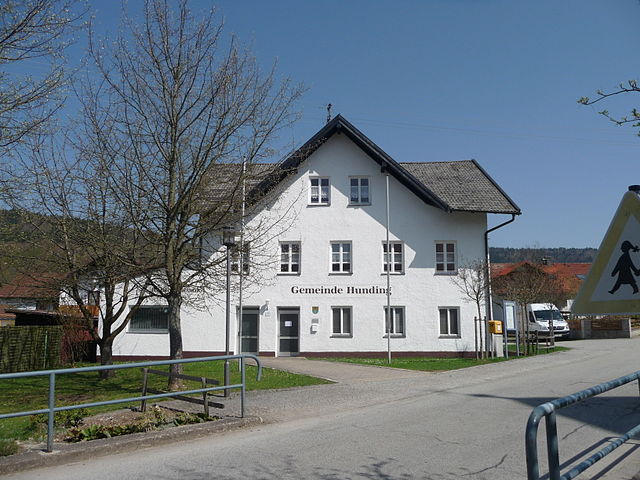
Хундинг
Hiking in Хундинг
It appears that "Hunding" may refer to a specific location that isn't widely recognized or perhaps has a different name more commonly used. However, if you meant to ask about hiking in a general area known for its outdoor activities, I can provide you with some tips and recommendations based on popular hiking destinations....
- Страна:
- Почтовый код: 94551
- Телефонный код: 09904
- Код автомобильного номера: DEG
- Координаты: 48° 51' 0" N, 13° 11' 0" E
- GPS треки (wikiloc): [Ссылка]
- Высота над уровнем моря: 468 м m
- Площадь: 14.67 кв.км
- Население: 1171
- Веб сайт: [Ссылка]