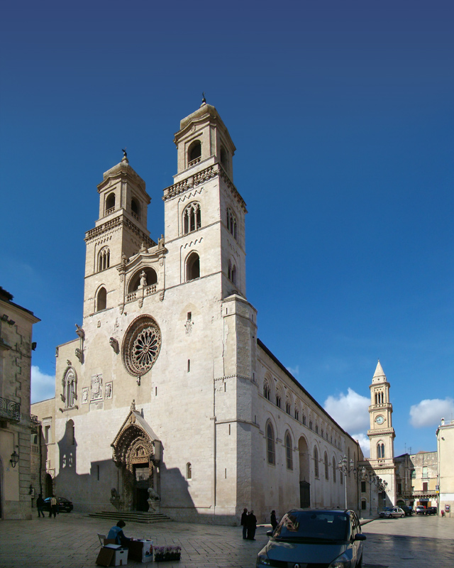
Гравина-ин-Пулья (Gravina in Puglia, Gravina in Puglia)

.svg)
- коммуна Италии
 Hiking in Гравина-ин-Пулья
Gravina in Puglia, located in the Apulia region of southern Italy, offers a unique hiking experience that combines natural beauty, historical significance, and cultural heritage. The town is known for its stunning ravines that have been shaped by the Gravina River, creating dramatic landscapes ideal for adventurous hikers.
Key Hiking Areas and Trails:
-
Gravina Gorge (Gravina di Puglia):
- This area features deep ravines and cliffs, providing breathtaking views and opportunities for exploring the local flora and fauna. The trails here can vary in difficulty, catering to both novice and experienced hikers.
- You can enjoy trails that lead down into the gorge, allowing you to experience the flora, ancient rock formations, and discover small grottoes and caves.
-
La Gravina Natural Park:
- The park encompasses diverse ecosystems and offers various trails that can be explored on foot. Hikers can encounter various wildlife species, as well as ancient civilizations' remnants, such as cave dwellings and churches carved into the rock.
-
Historical Trails:
- Some trails lead to the historical sites in the area, including churches, monasteries, and ruins that reflect the rich history of Gravina in Puglia. Exploring these sites adds an educational aspect to your hiking experience.
Tips for Hiking in Gravina in Puglia:
-
Best Time to Hike: The ideal months for hiking are spring (April to June) and fall (September to October) when the weather is mild. Summers can be very hot, while winters are cooler and may bring rain.
-
Appropriate Gear: Sturdy hiking boots with good grip are essential due to rocky and uneven terrain. Bring water, snacks, sun protection, and a guide or map of the trails.
-
Stay on Marked Trails: To preserve the natural environment, it's essential to follow marked paths and not venture too far off the trails.
-
Respect Local Customs: Be mindful of the area's cultural significance and local customs. Always take care of the environment by bagging trash and avoiding disturbing wildlife.
-
Consider Guided Tours: If you're unfamiliar with the area, consider joining a local hiking tour. Experienced guides can provide insights into the area's culture and geology.
Overall, hiking in Gravina in Puglia can be an exciting and enriching experience, combining physical activity with the exploration of stunning landscapes and historical sites. Enjoy your adventure!
- Страна:

- Почтовый код: 70024
- Телефонный код: 080
- Код автомобильного номера: BA
- Координаты: 40° 49' 14" N, 16° 25' 24" E


- GPS треки (wikiloc): [Ссылка]
- Высота над уровнем моря: 367 м m
- Площадь: 384.73 кв.км
- Население: 43816
- Веб сайт: http://www.comune.gravina.ba.it/
- Википедия русская: wiki(ru)
- Википедия английская: wiki(en)
- Википедия национальная: wiki(it)
- Хранилище Wikidata: Wikidata: Q51829
- Галерея изображений в википедии: [Ссылка]
- Катеория в википедии: [Ссылка]
- код Freebase: [/m/0f3lqb]
- код GeoNames: Альт: [6538943]
- код VIAF: Альт: [155999656]
- ID отношения в OpenStreetMap: [40706]
- код темы Quora: [Gravina-in-Puglia]
- UN/LOCODE: [ITGNG]
- код в энциклопедии «Британника онлайн»: [place/Gravina-in-Puglia]
- код в Большой каталанской энциклопедии: [0031014]
- код Цифрового атласа Римской империи: [30393]
- код NKC: [ge886575]
- код ISTAT: 072023
- кадастровый код Италии: E155
Граничит с регионами:


Матера
- коммуна Италии
Hiking in Матера
Hiking in Matera, Italy, offers a unique blend of ancient history, stunning landscapes, and diverse trails. Nestled in the Basilicata region, Matera is famous for its "Sassi" districts—cave dwellings that have been inhabited for thousands of years. Here are some key points you should consider when hiking in and around Matera:...
- Страна:
- Почтовый код: 75100
- Телефонный код: 0835
- Код автомобильного номера: MT
- Координаты: 40° 40' 0" N, 16° 36' 0" E
- GPS треки (wikiloc): [Ссылка]
- Высота над уровнем моря: 401 м m
- Площадь: 392.09 кв.км
- Население: 60351
- Веб сайт: [Ссылка]

Альтамура
- коммуна Италии
Hiking in Альтамура
Altamura, located in the Apulia region of Italy, is renowned for its rich history, stunning landscapes, and unique geological features. Hiking in this area can be a rewarding experience for nature lovers, history enthusiasts, and anyone looking to immerse themselves in the beautiful Italian countryside. Here are some key points to consider when planning a hiking trip in Altamura:...
- Страна:
- Почтовый код: 70022
- Телефонный код: 080
- Код автомобильного номера: BA
- Координаты: 40° 49' 0" N, 16° 33' 0" E
- GPS треки (wikiloc): [Ссылка]
- Высота над уровнем моря: 467 м m
- Площадь: 431.38 кв.км
- Население: 70514
- Веб сайт: [Ссылка]


Спинаццола
- коммуна Италии
Hiking in Спинаццола
Spinazzola is a charming town located in the province of Barletta-Andria-Trani in the Apulia region of Italy. The area is characterized by its picturesque landscapes, historical sites, and a variety of hiking opportunities that cater to different levels of experience. Here are some key highlights about hiking in Spinazzola:...
- Страна:
- Почтовый код: 76014
- Телефонный код: 0883
- Код автомобильного номера: BT
- Координаты: 40° 58' 0" N, 16° 5' 0" E
- GPS треки (wikiloc): [Ссылка]
- Высота над уровнем моря: 465 м m
- Площадь: 184.01 кв.км
- Население: 6515
- Веб сайт: [Ссылка]


Поджорсини
- коммуна Италии
Hiking in Поджорсини
Poggiorsini is a charming village located in the Apulia region of Italy, surrounded by beautiful landscapes and opportunities for hiking enthusiasts. The area is characterized by its unique karst formations, rolling hills, and picturesque trails that showcase the natural beauty of the region....
- Страна:
- Почтовый код: 70020
- Телефонный код: 080
- Код автомобильного номера: BA
- Координаты: 40° 55' 0" N, 16° 15' 0" E
- GPS треки (wikiloc): [Ссылка]
- Высота над уровнем моря: 461 м m
- Площадь: 43.44 кв.км
- Население: 1502
- Веб сайт: [Ссылка]


Руво-ди-Пулья
- коммуна Италии
Hiking in Руво-ди-Пулья
Ruvo di Puglia is a charming town located in the Apulia region of Italy, offering a blend of cultural heritage and stunning natural landscapes. While Ruvo di Puglia itself is not primarily known as a hiking destination, it is surrounded by beautiful countryside that provides opportunities for hiking and exploring the outdoors....
- Страна:
- Почтовый код: 70037
- Телефонный код: 080
- Код автомобильного номера: BA
- Координаты: 41° 7' 2" N, 16° 29' 1" E
- GPS треки (wikiloc): [Ссылка]
- Высота над уровнем моря: 240 м m
- Площадь: 223.83 кв.км
- Население: 25328
- Веб сайт: [Ссылка]
Гроттоле
- коммуна Италии
Hiking in Гроттоле
Grottole is a charming village located in the Basilicata region of Southern Italy, known for its beautiful landscapes and rich historical heritage. It's a great spot for hiking enthusiasts looking to explore the natural beauty and cultural sites of this lesser-known area. Here are some key points about hiking in and around Grottole:...
- Страна:
- Почтовый код: 75010
- Телефонный код: 0835
- Код автомобильного номера: MT
- Координаты: 40° 36' 12" N, 16° 22' 42" E
- GPS треки (wikiloc): [Ссылка]
- Высота над уровнем моря: 481 м m
- Площадь: 117.15 кв.км
- Население: 2116
- Веб сайт: [Ссылка]


Ирсина
- коммуна Италии
Hiking in Ирсина
Irsina is a charming town situated in the province of Matera, in the Basilicata region of Italy. It's known for its rich history, traditional architecture, and beautiful landscapes, making it an appealing location for hiking enthusiasts....
- Страна:
- Почтовый код: 75022
- Телефонный код: 0835
- Код автомобильного номера: MT
- Координаты: 40° 45' 0" N, 16° 14' 0" E
- GPS треки (wikiloc): [Ссылка]
- Высота над уровнем моря: 548 м m
- Площадь: 263.47 кв.км
- Население: 4909
- Веб сайт: [Ссылка]


Дженцано-ди-Лукания
- коммуна Италии
Hiking in Дженцано-ди-Лукания
Genzano di Lucania is a picturesque town located in the Basilicata region of Italy, known for its natural beauty and rich cultural heritage. Hiking around Genzano di Lucania offers a wonderful opportunity to explore the stunning landscapes, ancient trails, and the charming local culture....
- Страна:
- Почтовый код: 85013
- Телефонный код: 0971
- Код автомобильного номера: PZ
- Координаты: 40° 51' 0" N, 16° 2' 0" E
- GPS треки (wikiloc): [Ссылка]
- Высота над уровнем моря: 587 м m
- Площадь: 208.93 кв.км
- Население: 5688
- Веб сайт: [Ссылка]