Хайдмюле (Haidmühle, Haidmühle)

 Hiking in Хайдмюле
Haidmühle, a charming village in Bavaria, Germany, is an excellent destination for hiking enthusiasts. Nestled in the picturesque landscape of the Bavarian Forest, it offers a variety of hiking trails suitable for different skill levels. Here are some highlights and tips for hiking in Haidmühle:
Hiking Trails
-
The Haidmühle Round Tour: This circular route is perfect for beginners and provides stunning views of the surrounding countryside. It typically takes around 2-3 hours to complete.
-
Rottalweg: This trail runs along the Rott River and showcases the area's diverse flora and fauna. It's a leisurely walk that can be enjoyed throughout the year.
-
Dreisesselberg Trail: For those seeking a bit more adventure, the Dreisesselberg trail leads to a summit that offers panoramic views of the Bohemian Forest and the surrounding region. This hike may take around 4-5 hours.
-
Premium hiking trails: Nearby, you can find several premium trails, such as the "Bavarian Forest National Park" trails, which include well-marked routes and informative signage about the local wildlife and nature.
Nature and Scenery
-
Flora and Fauna: The region is rich in biodiversity, making it a great spot for nature lovers. Be on the lookout for various bird species and possibly even deer along the trails.
-
Scenic Views: Expect to encounter beautiful forests, rolling hills, and stunning vistas, especially atop the higher elevations like the Dreisesselberg.
Tips for Hiking in Haidmühle
-
Trail Maps: Make sure to grab a trail map at the local tourist information center or check online for the latest trail updates.
-
Weather Preparedness: The weather can change rapidly in the mountains, so it's best to check conditions before heading out and dress in layers.
-
Hydration and Snacks: Always carry enough water and some energy-boosting snacks to keep your stamina up.
-
Respect Nature: Follow Leave No Trace principles. Stay on marked trails, and pack out what you bring in.
Local Amenities
-
Accommodation: There are various options for lodging, from guesthouses to hotels, where you can rest after a day of hiking.
-
Local Cuisine: After a hike, enjoy hearty Bavarian dishes at local restaurants to replenish your energy.
Whether you're an experienced hiker or just looking to enjoy a peaceful stroll in nature, Haidmühle has something to offer everyone. Enjoy your hiking adventure in this beautiful part of Germany!
- Страна:

- Почтовый код: 94145
- Телефонный код: 08556
- Код автомобильного номера: FRG
- Координаты: 48° 49' 36" N, 13° 46' 31" E


- GPS треки (wikiloc): [Ссылка]
- Высота над уровнем моря: 831 м m
- Площадь: 21.03 кв.км
- Население: 1526
- Веб сайт: http://www.gde-haidmuehle.de
- Википедия русская: wiki(ru)
- Википедия английская: wiki(en)
- Википедия национальная: wiki(de)
- Хранилище Wikidata: Wikidata: Q505927
- Катеория в википедии: [Ссылка]
- код Freebase: [/m/02q36j5]
- код GeoNames: Альт: [2911983]
- ID отношения в OpenStreetMap: [958942]
- код GND: Альт: [4234080-9]
- код Historical Gazetteer: [HAIHLEJN68VT]
- Bavarikon ID: [ODB_A00001464]
- идентификатор муниципалитетов в Германии: 09272122
Граничит с регионами:

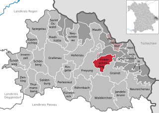
Хинтершмидинг
Hiking in Хинтершмидинг
Hinterschmiding is a beautiful area located in Bavaria, Germany, nestled near the border with Austria. It's an excellent destination for hiking enthusiasts, offering a variety of trails that cater to different skill levels and preferences. Here are some highlights of hiking in Hinterschmiding:...
- Страна:
- Почтовый код: 94146
- Телефонный код: 08551
- Код автомобильного номера: FRG
- Координаты: 48° 49' 23" N, 13° 36' 4" E
- GPS треки (wikiloc): [Ссылка]
- Высота над уровнем моря: 737 м m
- Площадь: 21.03 кв.км
- Население: 2107
- Веб сайт: [Ссылка]

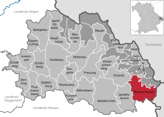
Нойрайхенау
Hiking in Нойрайхенау
Neureichenau is a beautiful area in Bavaria, Germany, located near the borders of the Czech Republic and Austria. It's characterized by its stunning landscapes, rolling hills, and diverse flora and fauna, making it an excellent destination for hiking enthusiasts....
- Страна:
- Почтовый код: 94089
- Телефонный код: 08583
- Код автомобильного номера: FRG
- Координаты: 48° 45' 0" N, 13° 45' 0" E
- GPS треки (wikiloc): [Ссылка]
- Высота над уровнем моря: 669 м m
- Площадь: 46.37 кв.км
- Население: 4182
- Веб сайт: [Ссылка]