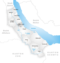
Херлиберг (Herrliberg, Herrliberg)

- коммуна в Швейцарии, в кантоне Цюрих
 Hiking in Херлиберг
Herrliberg is a picturesque municipality located on the shores of Lake Zurich in Switzerland, nestled amid the breathtaking landscapes of the Swiss Alps. Hiking in Herrliberg offers a wonderful combination of scenic beauty, tranquil lakeside paths, and stunning mountain views.
Hiking Trails
-
Lake Zurich Promenade: A popular and easy trail that stretches along the lakeshore, providing beautiful views of the water and the Alps. It's suitable for walkers of all ages and offers plenty of places to stop for a picnic.
-
Zurich Oberland Trails: More challenging hikes can be found in the nearby Zurich Oberland region. These trails lead you through lush forests, serene meadows, and up to vantage points that provide panoramic views of Lake Zurich and the surrounding mountains.
-
Hiking to Uetliberg: A hike to Uetliberg, which offers stunning views of Zurich, is another great option. You can start from Herrliberg, making it a longer but rewarding trek.
-
Regional Nature Park: Explore parts of the nearby regional nature park, where several trails wind through diverse ecosystems, offering opportunities to observe local flora and fauna.
Tips for Hiking in Herrliberg
- Timing: Spring and early autumn are perfect for hiking, with mild weather and vibrant landscapes. Summer can be warm but is great for longer daylight hours.
- Preparation: Always check the weather forecast before setting out, wear appropriate footwear, and bring plenty of water and snacks.
- Trail Maps: Familiarize yourself with trail maps and signage in the area, as they can help guide you through more complex routes.
- Respect Nature: Follow the "Leave No Trace" principles to help protect the natural beauty of the area.
Accessibility
Herrliberg is easily accessible by public transport from Zurich, making it a convenient getaway for hikers. The local transport system can help you reach various trailheads without the need for a car.
Overall, hiking in Herrliberg can provide a great escape into nature, offering both relaxing walks by the lakeside and challenging hikes in the surrounding hills.
- Страна:

- Почтовый код: 8704
- Телефонный код: 044; 043
- Код автомобильного номера: ZH
- Координаты: 47° 17' 50" N, 8° 37' 49" E


- GPS треки (wikiloc): [Ссылка]
- Высота над уровнем моря: 646 м m
- Площадь: 8.97 кв.км
- Население: 6290
- Веб сайт: http://www.herrliberg.ch
- Википедия русская: wiki(ru)
- Википедия английская: wiki(en)
- Википедия национальная: wiki(de)
- Хранилище Wikidata: Wikidata: Q69224
- Катеория в википедии: [Ссылка]
- код Freebase: [/m/01x2dq]
- код GeoNames: Альт: [7286074]
- код VIAF: Альт: [242733177]
- ID отношения в OpenStreetMap: [1682136]
- идентификатор местоположения ArchINFORM: [3936]
- место в MusicBrainz: [95135cbc-1e81-40d3-9708-7da79057b6d1]
- идентификатор HDS: [107]
- код швейцарского муниципалитета: [0152]
Граничит с регионами:


Маур
Hiking in Маур
Hiking in Maur, Switzerland, offers a picturesque escape into the Swiss countryside, characterized by lush landscapes, quaint villages, and stunning views of the surrounding Alps....
- Страна:
- Почтовый код: 8124
- Телефонный код: 044
- Код автомобильного номера: ZH
- Координаты: 47° 20' 30" N, 8° 40' 13" E
- GPS треки (wikiloc): [Ссылка]
- Высота над уровнем моря: 478 м m
- Площадь: 18.40 кв.км
- Население: 10148
- Веб сайт: [Ссылка]
Оберриден
Hiking in Оберриден
Oberrieden, a picturesque municipality in the canton of Zurich, Switzerland, offers a wonderful backdrop for hiking enthusiasts. The area is characterized by its scenic landscapes, which include rolling hills, lush forests, and stunning views of Lake Zurich and the Swiss Alps....
- Страна:
- Почтовый код: 8942
- Телефонный код: 043; 044
- Код автомобильного номера: ZH
- Координаты: 47° 16' 40" N, 8° 34' 41" E
- GPS треки (wikiloc): [Ссылка]
- Высота над уровнем моря: 460 м m
- Площадь: 2.76 кв.км
- Население: 5090
- Веб сайт: [Ссылка]
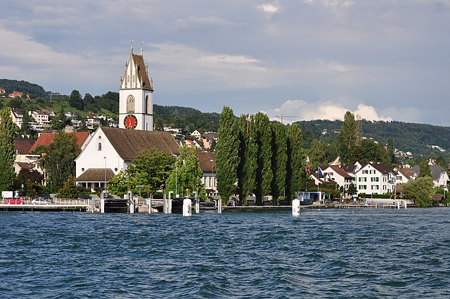

Майлен
- город в Швейцарии
Hiking in Майлен
Meilen, located on the shores of Lake Zurich in Switzerland, is a picturesque village that offers a range of hiking trails suitable for different skill levels. Here are some highlights and tips for hiking in the Meilen area:...
- Страна:
- Почтовый код: 8706
- Телефонный код: 01
- Код автомобильного номера: ZH
- Координаты: 47° 16' 13" N, 8° 38' 28" E
- GPS треки (wikiloc): [Ссылка]
- Высота над уровнем моря: 420 м m
- Площадь: 11.93 кв.км
- Население: 13999
- Веб сайт: [Ссылка]


Тальвиль
Hiking in Тальвиль
Thalwil, located in the canton of Zurich, Switzerland, is a beautiful area that offers a wonderful range of hiking opportunities. Nestled along the shores of Lake Zurich and surrounded by rolling hills and lush forests, Thalwil is an excellent starting point for both easy walks and more challenging hikes....
- Страна:
- Почтовый код: 8800
- Телефонный код: 044
- Код автомобильного номера: ZH
- Координаты: 47° 17' 43" N, 8° 33' 53" E
- GPS треки (wikiloc): [Ссылка]
- Высота над уровнем моря: 468 м m
- Площадь: 5.53 кв.км
- Население: 17784
- Веб сайт: [Ссылка]


Эрленбах
- коммуна в Швейцарии, в кантоне Цюрих
Hiking in Эрленбах
Erlenbach, located in the picturesque region of Switzerland, is a fantastic area for hiking enthusiasts. Nestled near Lake Zurich and surrounded by stunning landscapes, it offers a variety of trails that cater to different skill levels, from leisurely strolls to more challenging hikes. Here are some highlights of hiking in and around Erlenbach:...
- Страна:
- Почтовый код: 8703
- Телефонный код: 044
- Код автомобильного номера: ZH
- Координаты: 47° 18' 16" N, 8° 35' 32" E
- GPS треки (wikiloc): [Ссылка]
- Высота над уровнем моря: 412 м m
- Площадь: 2.97 кв.км
- Население: 5567
- Веб сайт: [Ссылка]


Кюснахт
- город в Швейцарии, в кантоне Цюрих
Hiking in Кюснахт
Küsnacht, located on the shores of Lake Zurich in Switzerland, offers a range of beautiful hiking opportunities, making it an attractive destination for both novice and experienced hikers. Here are some highlights of hiking in and around Küsnacht:...
- Страна:
- Почтовый код: 8700
- Телефонный код: 01
- Код автомобильного номера: ZH
- Координаты: 47° 19' 5" N, 8° 34' 57" E
- GPS треки (wikiloc): [Ссылка]
- Высота над уровнем моря: 427 м m
- Площадь: 12.35 кв.км
- Население: 14250
- Веб сайт: [Ссылка]