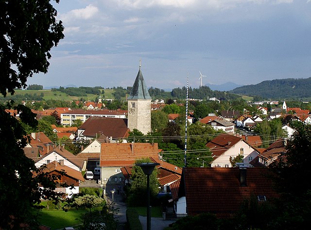
Хоэнпайссенберг (Hohenpeißenberg, Hohenpeißenberg)

 Hiking in Хоэнпайссенберг
Hohenpeißenberg is a popular hiking destination in Bavaria, Germany, known for its stunning panoramic views and scenic trails. Here’s an overview of hiking in this beautiful area:
Location and Access
Hohenpeißenberg is located in the Bavarian Alps, around 50 kilometers southwest of Munich. It's easily accessible by car and public transportation, making it a convenient choice for day trips or weekend hikes.
Trails
-
Peak Trail (Gipfelweg): The main trail leads you to the summit of Hohenpeißenberg, where you’ll find an observation tower and a church. The trail is well-marked and offers several resting points along the way.
-
Circular Routes: There are various circular hiking routes around the mountain, allowing hikers to explore the surrounding forests and fields while enjoying diverse landscapes.
-
Cultural Trails: Some trails incorporate local history and culture, passing by historical landmarks and offering insights into the area's heritage.
Difficulty Levels
The hiking trails in Hohenpeißenberg cater to various skill levels:
- Easy Trails: Suitable for families and beginners, these paths provide a gentle hike with beautiful views without strenuous climbs.
- Moderate Trails: These offer a bit more challenge, with some steeper sections and longer distances, making them suitable for those with some hiking experience.
- Challenging Trails: For experienced hikers, there are more demanding routes that require good fitness and proper hiking gear.
Best Time to Hike
The best time for hiking in Hohenpeißenberg is typically from late spring through early autumn (May to October), when the weather is mild, and the trails are accessible. Summer can be quite popular, so starting early in the day can help avoid crowds.
What to Bring
- Proper Footwear: Good hiking boots are essential for stability and comfort.
- Clothing: Dress in layers, as temperatures can vary significantly. Waterproof jackets are recommended, especially in spring and autumn.
- Water and Snacks: Carry enough water and some snacks to keep your energy up during your hike.
- Map or GPS Device: While trails are marked, having a map or GPS can help you navigate particularly in less familiar areas.
Safety Tips
- Always check the weather forecast before heading out.
- Inform someone about your hiking plans and expected return time.
- Stay on marked trails to protect the local flora and fauna.
- Carry a first-aid kit for minor injuries.
Hohenpeißenberg provides an excellent hiking experience with its natural beauty, cultural points of interest, and stunning views of the surrounding Alps and the distant Munich skyline. Enjoy your hike!
- Страна:

- Почтовый код: 82383
- Телефонный код: 08805
- Код автомобильного номера: WM
- Координаты: 47° 48' 0" N, 11° 0' 0" E


- GPS треки (wikiloc): [Ссылка]
- Высота над уровнем моря: 780 м m
- Площадь: 20.44 кв.км
- Население: 3231
- Веб сайт: https://www.hohenpeissenberg.de/
- Википедия русская: wiki(ru)
- Википедия английская: wiki(en)
- Википедия национальная: wiki(de)
- Хранилище Wikidata: Wikidata: Q533232
- Катеория в википедии: [Ссылка]
- код Freebase: [/m/02qjgg1]
- код GeoNames: Альт: [2901572]
- код VIAF: Альт: [163676810]
- ID отношения в OpenStreetMap: [936832]
- код GND: Альт: [4025563-3]
- идентификатор местоположения ArchINFORM: [13611]
- код LCNAF: Альт: [n81136812]
- место в MusicBrainz: [c9fc6b2e-c433-41dc-95b9-0e441eeb0edf]
- WOEID: [661275]
- код Historical Gazetteer: [object_300561]
- Bavarikon ID: [ODB_A00001400]
- идентификатор муниципалитетов в Германии: 09190130
Граничит с регионами:


Бёбинг
Hiking in Бёбинг
Böbing is a picturesque village located in Bavaria, Germany, and is surrounded by beautiful natural landscapes ideal for hiking enthusiasts. The region offers various trails that cater to different skill levels, from easy walks to challenging hikes....
- Страна:
- Почтовый код: 82389
- Телефонный код: 08867
- Код автомобильного номера: WM
- Координаты: 47° 45' 0" N, 10° 59' 0" E
- GPS треки (wikiloc): [Ссылка]
- Высота над уровнем моря: 750 м m
- Площадь: 40.32 кв.км
- Население: 1396
- Веб сайт: [Ссылка]

Пайтинг
Hiking in Пайтинг
Peiting, located in the Bavarian region of Germany, is surrounded by beautiful landscapes that are perfect for hiking enthusiasts. The town itself is situated near the rolling hills of the Ammergebirge Nature Park and is close to the foothills of the Alps, offering a variety of hiking trails suited for different skill levels....
- Страна:
- Почтовый код: 86971
- Телефонный код: 08861
- Код автомобильного номера: WM
- Координаты: 47° 48' 0" N, 10° 56' 0" E
- GPS треки (wikiloc): [Ссылка]
- Высота над уровнем моря: 718 м m
- Площадь: 75.14 кв.км
- Население: 10319
- Веб сайт: [Ссылка]
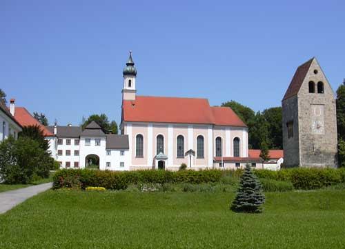

Вессобрунн
Hiking in Вессобрунн
Wessobrunn is a picturesque village located in Bavaria, Germany, surrounded by beautiful landscapes and offers various hiking opportunities that cater to different skill levels. Here’s an overview of what to expect when hiking in the area:...
- Страна:
- Почтовый код: 82405
- Телефонный код: 08809
- Код автомобильного номера: WM
- Координаты: 47° 53' 0" N, 11° 2' 0" E
- GPS треки (wikiloc): [Ссылка]
- Высота над уровнем моря: 702 м m
- Площадь: 51.11 кв.км
- Население: 1761
- Веб сайт: [Ссылка]