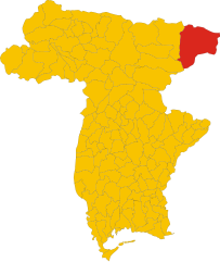
Хоэнтурн (Hohenthurn, Hohenthurn)
 Hiking in Хоэнтурн
Hohenthurn, a small village in Austria located near the border with Slovenia, is surrounded by beautiful natural landscapes that offer various hiking opportunities. The area is characterized by scenic views, lush forests, and the picturesque backdrop of the Julian Alps.
Hiking Trails:
-
Local Trails: There are numerous well-marked hiking trails starting from Hohenthurn that cater to different skill levels. These trails often lead through forests, meadows, and along rivers, with plenty of spots to take in the views.
-
Nassfeld Region: A short drive from Hohenthurn, the Nassfeld ski and hiking area offers a variety of trails, including easy walks and more challenging mountain hikes. In the summer, many ski lifts operate to take hikers up the mountain, making high-altitude hikes more accessible.
-
Faaker See: Just a few kilometers away, this stunning lake offers walking trails around it, providing beautiful views and opportunities for swimming, picnicking, and relaxing.
-
Biosphere Reserve Nockberge: If you venture a bit further, the Nockberge Biosphere Reserve offers fantastic hiking opportunities with stunning views, diverse flora and fauna, and well-maintained trails.
Tips for Hiking in Hohenthurn:
- Check Weather Conditions: Mountain weather can be unpredictable, so always check the forecast before heading out.
- Bring Sufficient Supplies: Ensure you have enough water, snacks, and possibly a packed lunch. A first aid kit is also recommended.
- Wear Appropriate Gear: Sturdy hiking boots, weather-appropriate clothing, and perhaps trekking poles for more challenging trails can enhance your hiking experience.
- Respect Nature: Follow local guidelines for conservation and display proper outdoor etiquette.
Additional Activities:
- Besides hiking, the area around Hohenthurn offers opportunities for biking, swimming, and other outdoor activities.
Exploring Hohenthurn and its surroundings can be a rejuvenating and enjoyable experience for hikers of all levels. Remember to take your time, appreciate the landscape, and stay safe!
- Страна:

- Почтовый код: 9613
- Телефонный код: 0 42 56
- Код автомобильного номера: VL
- Координаты: 46° 33' 24" N, 13° 39' 33" E


- GPS треки (wikiloc): [Ссылка]
- Высота над уровнем моря: 620 м m
- Площадь: 27.16 кв.км
- Население: 851
- Веб сайт: http://www.hohenthurn.gv.at
- Википедия русская: wiki(ru)
- Википедия английская: wiki(en)
- Википедия национальная: wiki(de)
- Хранилище Wikidata: Wikidata: Q660601
- Галерея изображений в википедии: [Ссылка]
- Катеория в википедии: [Ссылка]
- код Freebase: [/m/02qs33d]
- код GeoNames: Альт: [2775721]
- код VIAF: Альт: [235701081]
- код GND: Альт: [4998662-4]
- код австрийского муниципалитета: [20713]
Граничит с регионами:

Тарвизио
- коммуна Италии
Hiking in Тарвизио
Tarvisio, located in the northeastern part of Italy near the borders with Austria and Slovenia, is a beautiful destination for hiking enthusiasts. It is situated in the Julian Alps and offers a wide range of trails that cater to various skill levels, from easy strolls to challenging treks. Here are some highlights of hiking in Tarvisio:...
- Страна:

- Почтовый код: 33018
- Телефонный код: 0428
- Код автомобильного номера: UD
- Координаты: 46° 30' 0" N, 13° 34' 0" E
- GPS треки (wikiloc): [Ссылка]
- Высота над уровнем моря: 754 м m
- Площадь: 208.36 кв.км
- Население: 4224
- Веб сайт: [Ссылка]


Мальборгетто-Вальбруна
- коммуна Италии
Hiking in Мальборгетто-Вальбруна
Malborghetto Valbruna is a picturesque village located in the Valcanale region of northeastern Italy, close to the Austrian border. It is surrounded by stunning Alpine scenery and offers a variety of hiking opportunities for all skill levels. Here are some highlights and tips for hiking in this area:...
- Страна:
- Почтовый код: 33010
- Телефонный код: 0428
- Код автомобильного номера: UD
- Координаты: 46° 30' 24" N, 13° 26' 22" E
- GPS треки (wikiloc): [Ссылка]
- Высота над уровнем моря: 721 м m
- Площадь: 124.21 кв.км
- Население: 919
- Веб сайт: [Ссылка]