Хольцхайм (Holzheim, Holzheim)

 Hiking in Хольцхайм
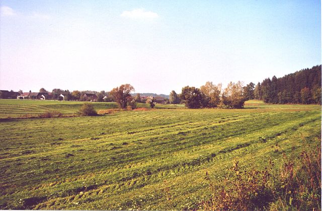
Holzheim, located in the Neu-Ulm district of Germany, offers beautiful landscapes and opportunities for outdoor activities, including hiking. While it may not be widely known as a hiking destination, the region is characterized by scenic trails that can be enjoyed by both beginners and experienced hikers.
Hiking Highlights in Holzheim and Surrounding Areas:
-
Natural Beauty: The area around Holzheim features picturesque countryside, including fields, forests, and gentle hills. This makes for a peaceful hiking environment with opportunities to observe local flora and fauna.
-
Trail Options: There may be several local walking paths and trails that connect Holzheim to nearby towns and nature reserves. It's advisable to visit local tourist information centers or check hiking apps for detailed maps and trail conditions.
-
Biodiversity: As you hike, keep an eye out for local wildlife and birds. The diverse habitats in the area can lead to interesting wildlife spotting opportunities.
-
Accessibility: Holzheim's location allows for easy access to larger hiking networks in the surrounding region, including routes that lead to the nearby Danube River, which is known for its scenic trails.
-
Community Events: Sometimes, local organizations or hiking clubs may offer group hikes or events, which can be a great way to meet fellow hiking enthusiasts and explore the area in a guided manner.
Tips for Hiking in Holzheim:
-
Prepare for Weather: Always check the weather forecast before heading out and dress accordingly. Layers work best for changing conditions.
-
Appropriate Footwear: Make sure to wear sturdy and comfortable hiking shoes to protect your feet during your trek.
-
Stay Hydrated: Carry enough water and snacks, especially if you plan to hike for an extended period.
-
Respect Nature: As always, follow the "Leave No Trace" principles. Stay on marked trails and avoid disturbing wildlife.
-
Local Regulations: Familiarize yourself with any local regulations regarding hiking and outdoor activities, especially if you are near protected areas.
If you're interested in exploring the hiking options around Holzheim, consider reaching out to local hiking groups or outdoor enthusiasts for additional insights and trail recommendations!
- Страна:

- Почтовый код: 89291
- Телефонный код: 07302
- Код автомобильного номера: ILL; NU
- Координаты: 48° 23' 0" N, 10° 6' 0" E


- GPS треки (wikiloc): [Ссылка]
- Высота над уровнем моря: 475 м m
- Площадь: 7.60 кв.км
- Население: 1455
- Веб сайт: http://www.holzheim-nu.de
- Википедия русская: wiki(ru)
- Википедия английская: wiki(en)
- Википедия национальная: wiki(de)
- Хранилище Wikidata: Wikidata: Q528548
- Катеория в википедии: [Ссылка]
- код Freebase: [/m/02rfpqw]
- код GeoNames: Альт: [6557186]
- ID отношения в OpenStreetMap: [941090]
- код GND: Альт: [7600265-2]
- код Historical Gazetteer: [HOLEI1JN58BJ]
- Bavarikon ID: [ODB_A00000689]
- идентификатор муниципалитетов в Германии: 09775126
Граничит с регионами:


Ной-Ульм
- город в Германии
Hiking in Ной-Ульм
Neu-Ulm, located in Bavaria, Germany, sits along the banks of the Danube River and offers a variety of hiking opportunities in the surrounding areas. While the city itself is more urban, the nearby countryside and natural landscapes provide excellent options for outdoor exploration. Here are a few highlights related to hiking in and around Neu-Ulm:...
- Страна:
- Почтовый код: 89231
- Телефонный код: 0731; 07308; 07307
- Код автомобильного номера: NU
- Координаты: 48° 23' 0" N, 10° 0' 0" E
- GPS треки (wikiloc): [Ссылка]
- Высота над уровнем моря: 474 м m
- Площадь: 80.50 кв.км
- Население: 57727
- Веб сайт: [Ссылка]

Пфаффенхофен-ан-дер-Рот
Hiking in Пфаффенхофен-ан-дер-Рот
Pfaffenhofen an der Roth, located in Bavaria, Germany, is surrounded by beautiful landscapes that make it an excellent spot for hiking enthusiasts. The region features a mix of forested pathways, rolling hills, and picturesque rural settings, ideal for hikers of all levels....
- Страна:
- Почтовый код: 89284
- Телефонный код: 07302
- Код автомобильного номера: ILL; NU
- Координаты: 48° 21' 16" N, 10° 9' 43" E
- GPS треки (wikiloc): [Ссылка]
- Высота над уровнем моря: 489 м m
- Площадь: 42.66 кв.км
- Население: 5897
- Веб сайт: [Ссылка]