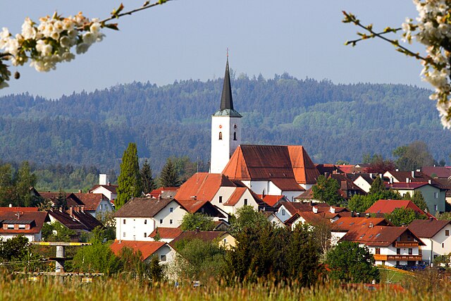
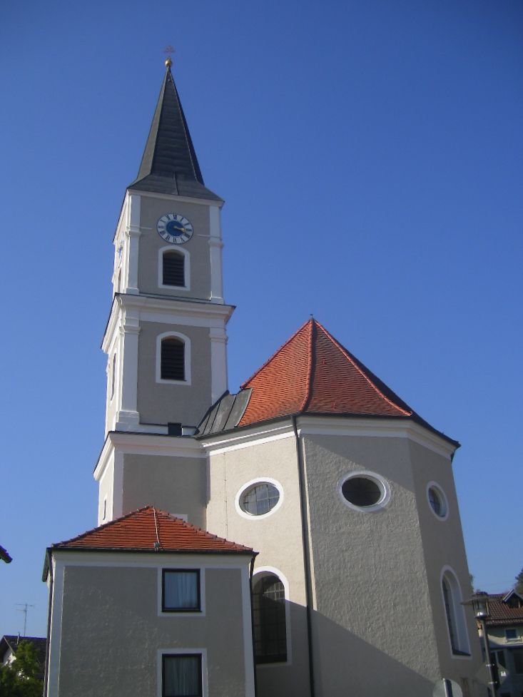
Иггенсбах (Iggensbach, Iggensbach)

 Hiking in Иггенсбах
Iggensbach is a beautiful village located in Bavaria, Germany, known for its picturesque landscapes and outdoor recreational opportunities, including hiking. Here's a brief overview of what you can expect when hiking in and around Iggensbach:
Scenic Landscapes
The scenic beauty around Iggensbach features lush forests, rolling hills, and charming farmland. The region offers a mix of flat terrain and hilly landscapes, making it suitable for hikers of all levels.
Trails
- Local Trails: There are numerous marked hiking trails in and around Iggensbach, ranging from easy walks to more challenging hikes. The trails often provide stunning views of the landscape, allowing hikers to immerse themselves in nature.
- Long-Distance Trails: Iggensbach is also located near some longer hiking routes, such as the Bavarian Forest National Park trails, which offer more extensive exploration opportunities for experienced hikers.
Flora and Fauna
As you hike, you'll likely encounter a variety of plant species and wildlife typical to the Bavarian region. Keep an eye out for local birds, deer, and other wildlife that inhabit the area.
Facilities
Iggensbach and nearby towns usually have facilities like rest areas, small cafes, or local inns where you can refresh and enjoy traditional Bavarian food and drinks after a hike.
Hiking Season
The best time for hiking in this region is generally from late spring to early autumn when the weather is milder, and the trails are more accessible. However, winter hiking is also popular in the nearby areas for those equipped with appropriate gear.
Safety Tips
- Always check the weather before heading out and dress in layers.
- Carry enough water and snacks, especially if you plan on a longer hike.
- Familiarize yourself with the trail maps, and consider using a GPS or hiking app.
Conclusion
Hiking in Iggensbach offers an excellent opportunity to enjoy the natural beauty of Bavaria. Whether you are an experienced hiker or a casual walker, you’ll find suitable trails to explore and appreciate the tranquility of this charming region.
- Страна:

- Почтовый код: 94547
- Телефонный код: 09903
- Код автомобильного номера: DEG
- Координаты: 48° 44' 0" N, 13° 8' 0" E


- GPS треки (wikiloc): [Ссылка]
- Высота над уровнем моря: 382 м m
- Площадь: 19.08 кв.км
- Население: 2014
- Веб сайт: http://www.iggensbach.de
- Википедия русская: wiki(ru)
- Википедия английская: wiki(en)
- Википедия национальная: wiki(de)
- Хранилище Wikidata: Wikidata: Q425952
- Катеория в википедии: [Ссылка]
- код Freebase: [/m/02q0_yd]
- код GeoNames: Альт: [2896679]
- код VIAF: Альт: [130291910]
- ID отношения в OpenStreetMap: [959821]
- код GND: Альт: [4253098-2]
- код LCNAF: Альт: [n88155686]
- Bavarikon ID: [ODB_A00001442]
- идентификатор муниципалитетов в Германии: 09271127
Граничит с регионами:

Ауссернцелль
Hiking in Ауссернцелль
Außernzell is a picturesque area located in Bavaria, Germany, known for its beautiful landscapes, rolling hills, and lush greenery. Hiking in this region can be quite rewarding for both beginners and experienced hikers. Here are some highlights and tips for hiking in Außernzell:...
- Страна:
- Почтовый код: 94532
- Телефонный код: 08544; 09903
- Код автомобильного номера: DEG
- Координаты: 48° 43' 0" N, 13° 12' 0" E
- GPS треки (wikiloc): [Ссылка]
- Высота над уровнем моря: 372 м m
- Площадь: 24.11 кв.км
- Население: 1377
- Веб сайт: [Ссылка]

Эгинг-ам-Зе
Hiking in Эгинг-ам-Зе
Eging am See, located in Bavaria, Germany, is a charming destination for outdoor enthusiasts, particularly those interested in hiking. The area is known for its scenic landscapes, including the beautiful Egginger See (Eging Lake), lush forests, and rolling hills. Here are some highlights and tips for hiking in Eging am See:...
- Страна:
- Почтовый код: 94535
- Телефонный код: 08544
- Код автомобильного номера: PA
- Координаты: 48° 43' 0" N, 13° 16' 0" E
- GPS треки (wikiloc): [Ссылка]
- Высота над уровнем моря: 399 м m
- Площадь: 23.66 кв.км
- Население: 3208
- Веб сайт: [Ссылка]

Шёльнах
- коммуна в Баварии, Германия
Hiking in Шёльнах
Schöllnach is a beautiful region located in Bavaria, Germany, known for its lush landscapes and scenic hiking trails. Nestled in the heart of the Bavarian Forest, it offers a variety of hiking opportunities suitable for all levels, from beginners to experienced hikers....
- Страна:
- Почтовый код: 94508
- Телефонный код: 09903
- Код автомобильного номера: DEG
- Координаты: 48° 45' 0" N, 13° 10' 0" E
- GPS треки (wikiloc): [Ссылка]
- Высота над уровнем моря: 371 м m
- Площадь: 39.9 кв.км
- Население: 4772
- Веб сайт: [Ссылка]
Винцер
Hiking in Винцер
Winzer, a charming area in Germany, offers a variety of hiking opportunities, especially for nature lovers and those who enjoy scenic landscapes. While it's not as widely known as some other hiking destinations in Germany, it has its own unique appeal, often characterized by vineyards, rolling hills, and picturesque views of the surrounding countryside....
- Страна:
- Почтовый код: 94577
- Телефонный код: 09901
- Код автомобильного номера: DEG
- Координаты: 48° 43' 0" N, 13° 4' 0" E
- GPS треки (wikiloc): [Ссылка]
- Высота над уровнем моря: 311 м m
- Площадь: 27.61 кв.км
- Население: 3812
- Веб сайт: [Ссылка]

Хенгерсберг
Hiking in Хенгерсберг
Hengersberg is located in the Bavarian Forest region of Germany, which offers a variety of hiking opportunities amid picturesque landscapes and diverse natural surroundings. Here are some highlights you might appreciate while hiking in Hengersberg:...
- Страна:
- Почтовый код: 94491
- Телефонный код: 09901
- Код автомобильного номера: DEG
- Координаты: 48° 47' 0" N, 13° 3' 0" E
- GPS треки (wikiloc): [Ссылка]
- Высота над уровнем моря: 311 м m
- Площадь: 45.81 кв.км
- Население: 7190
- Веб сайт: [Ссылка]


Хофкирхен
Hiking in Хофкирхен
Hofkirchen, located in the Bavarian region of Germany, is a charming area surrounded by picturesque landscapes that make it a great destination for hiking enthusiasts. While it might not be as famous as some other Bavarian hiking spots, it offers a range of scenic trails suitable for different experience levels....
- Страна:
- Почтовый код: 94544
- Телефонный код: 08545
- Код автомобильного номера: PA
- Координаты: 48° 41' 0" N, 13° 7' 0" E
- GPS треки (wikiloc): [Ссылка]
- Высота над уровнем моря: 309 м m
- Площадь: 32.7 кв.км
- Население: 3122
- Веб сайт: [Ссылка]