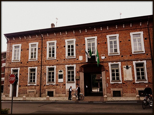
Инверуно (Inveruno, Inveruno)
.svg)
- коммуна Италии
 Hiking in Инверуно
Inveruno, a small town located in the Lombardy region of Italy, may not be the first destination that comes to mind for hiking, but it does offer some charming routes and nearby areas that can be explored on foot. While the town itself is more suburban and agricultural, here are some tips for hiking around Inveruno and in the surrounding areas:
Local Parks and Trails:
-
Parco della Rocchetta: This nearby park offers paths for walking and enjoying the natural surroundings, perfect for a leisurely hike. It features beautiful scenery and is a great spot for families.
-
Navigli and Canals: Inveruno is close to the Navigli district, which has scenic paths along the canals. Hiking or walking along these waterways can be a unique experience, where you can enjoy picturesque views and local architecture.
Nearby Areas for Hiking:
-
Parco del Ticino: A short drive from Inveruno, this regional park encompasses a large area along the Ticino River. It has a variety of trails suitable for different skill levels and beautiful natural scenery including forests, meadows, and riverside paths.
-
Montevecchia and Curone Valley Regional Park: Located a bit further out, this park has well-marked trails offering both easy and challenging hikes, with stunning views of the Lombard countryside and opportunities for wildlife watching.
Tips for Hiking in the Area:
- Prepare for the Weather: Check the weather forecast before heading out, as conditions can change quickly. Dress in layers and wear sturdy footwear.
- Stay Hydrated and Nourished: Bring enough water and snacks to keep your energy up during the hike.
- Respect Nature: Stay on marked paths, avoid littering, and respect local wildlife and flora.
Local Culture:
While hiking, take some time to appreciate the local culture and cuisine. After your hike, consider visiting local eateries to enjoy traditional Lombard dishes.
Conclusion:
While Inveruno may not be a hiking hotspot, it offers access to some lovely trails and parks that can be enjoyed with a short drive. Whether you're looking for a gentle stroll or a more vigorous hike, there are options nearby that provide a taste of the natural beauty of the Lombardy region. Enjoy your outdoor adventures!
- Страна:

- Почтовый код: 20010
- Телефонный код: 02
- Код автомобильного номера: MI
- Координаты: 45° 31' 0" N, 8° 51' 0" E


- GPS треки (wikiloc): [Ссылка]
- Высота над уровнем моря: 161 м m
- Площадь: 12.14 кв.км
- Население: 8608
- Веб сайт: http://www.comuneinveruno.it
- Википедия русская: wiki(ru)
- Википедия английская: wiki(en)
- Википедия национальная: wiki(it)
- Хранилище Wikidata: Wikidata: Q42575
- Катеория в википедии: [Ссылка]
- код Freebase: [/m/0gj640]
- код GeoNames: Альт: [6536511]
- код VIAF: Альт: [167774084]
- ID отношения в OpenStreetMap: [45191]
- UN/LOCODE: [ITIVO]
- код ISTAT: 015113
- кадастровый код Италии: E313
- LombardiaBeniCulturali toponym ID: 8000257
Граничит с регионами:


Оссона
- коммуна Италии
Hiking in Оссона
Hiking in Ossona, a town in the Lombardy region of Italy, can be a delightful experience, as it offers a charming mix of nature and cultural sights. While Ossona itself is not a prominent hiking destination, it is located near larger natural areas and parks that provide great opportunities for outdoor activities....
- Страна:
- Почтовый код: 20010
- Телефонный код: 02
- Код автомобильного номера: MI
- Координаты: 45° 30' 0" N, 8° 54' 0" E
- GPS треки (wikiloc): [Ссылка]
- Высота над уровнем моря: 156 м m
- Площадь: 5.98 кв.км
- Население: 4288
- Веб сайт: [Ссылка]

Бусто-Гарольфо
- коммуна Италии
Hiking in Бусто-Гарольфо
Busto Garolfo is a small town located in the Lombardy region of Italy, just northwest of Milan. While it may not be as widely known for hiking as larger national parks or mountainous areas, there are still several opportunities for outdoor activities in and around the region. Here are some key points about hiking in Busto Garolfo:...
- Страна:
- Почтовый код: 20020
- Телефонный код: 0331
- Код автомобильного номера: MI
- Координаты: 45° 32' 52" N, 8° 53' 12" E
- GPS треки (wikiloc): [Ссылка]
- Высота над уровнем моря: 180 м m
- Площадь: 12.99 кв.км
- Население: 13850
- Веб сайт: [Ссылка]
Бускате
- коммуна Италии
Hiking in Бускате
Buscate, located in the Lombardy region of Italy, offers a charming setting for hiking enthusiasts. While it may not be as renowned for hiking as some other areas in Italy, it is surrounded by beautiful landscapes that are perfect for outdoor activities....
- Страна:
- Почтовый код: 20010
- Телефонный код: 0331
- Код автомобильного номера: MI
- Координаты: 45° 33' 0" N, 8° 49' 0" E
- GPS треки (wikiloc): [Ссылка]
- Высота над уровнем моря: 176 м m
- Площадь: 7.83 кв.км
- Население: 4760
- Веб сайт: [Ссылка]
Казореццо
- коммуна Италии
Hiking in Казореццо
Casorezzo is a small town located in the Lombardy region of Italy, not far from larger cities like Milan. While it may not be a widely recognized hiking destination, there are still opportunities for walking and enjoying the outdoors in the surrounding areas....
- Страна:
- Почтовый код: 20010
- Телефонный код: 02
- Код автомобильного номера: MI
- Координаты: 45° 31' 0" N, 8° 54' 0" E
- GPS треки (wikiloc): [Ссылка]
- Высота над уровнем моря: 166 м m
- Площадь: 6.6 кв.км
- Население: 5467
- Веб сайт: [Ссылка]
Арконате
- коммуна Италии
Hiking in Арконате
Arconate is a town located in the Lombardy region of Italy, near the larger metropolitan areas of Milan and Novara. While Arconate itself is not traditionally recognized as a major hiking destination, its proximity to various natural areas and parks makes it a great base for those looking to explore the beautiful landscapes of Lombardy....
- Страна:
- Почтовый код: 20020
- Телефонный код: 0331
- Код автомобильного номера: MI
- Координаты: 45° 32' 0" N, 8° 51' 0" E
- GPS треки (wikiloc): [Ссылка]
- Высота над уровнем моря: 180 м m
- Площадь: 8.42 кв.км
- Население: 6700
- Веб сайт: [Ссылка]


Кугджоно
- коммуна Италии
Hiking in Кугджоно
Cuggiono is a charming municipality located in the Lombardy region of Italy, nestled in the province of Milan. While it's not as well-known for hiking as some other regions in Italy, it offers some lovely trails and natural areas that can be enjoyed by outdoor enthusiasts....
- Страна:
- Почтовый код: 20012
- Телефонный код: 02
- Код автомобильного номера: MI
- Координаты: 45° 30' 0" N, 8° 49' 0" E
- GPS треки (wikiloc): [Ссылка]
- Высота над уровнем моря: 157 м m
- Площадь: 14.93 кв.км
- Население: 8266
- Веб сайт: [Ссылка]


Мезеро
- коммуна Италии
Hiking in Мезеро
Mesero is a small town located in the Lombardy region of Italy, near the larger town of Magenta. While it may not be as widely known for hiking as some other regions in Italy, there are still beautiful trails and natural areas in and around Mesero that can offer a pleasant hiking experience....
- Страна:
- Почтовый код: 20010
- Телефонный код: 02
- Код автомобильного номера: MI
- Координаты: 45° 30' 0" N, 8° 51' 0" E
- GPS треки (wikiloc): [Ссылка]
- Высота над уровнем моря: 154 м m
- Площадь: 5.64 кв.км
- Население: 4159
- Веб сайт: [Ссылка]