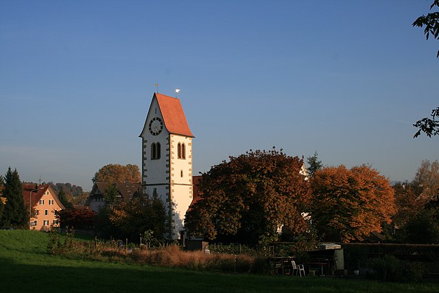
Каппель-на-Альбисе (Kappel am Albis, Kappel am Albis)

 Hiking in Каппель-на-Альбисе
Kappel am Albis is a beautiful area in Switzerland that's great for hiking enthusiasts. Located near Zurich, it offers a mix of scenic landscapes, including rolling hills, forests, and panoramic views of the surrounding areas, including Lake Zurich and the Alps.
Popular Hiking Routes:
-
Albis Pass Trail: This trail provides a variety of routes with different difficulty levels. It offers stunning views of the Zurich region and is well-marked, making it suitable for both experienced hikers and beginners.
-
Zugertäli Nature Trail: A relatively easy hike that takes you through lush forests and along charming streams. It's especially beautiful in spring and autumn when the foliage is vibrant.
-
Uetliberg Trail: Although slightly further afield, this trail is worth mentioning for its proximity to Kappel am Albis. It connects to the Uetliberg mountain, providing breathtaking views of Zurich and the surrounding mountains.
-
Felsenegg Trail: Another option for more experienced hikers, this trail leads you along cliff sides with dramatic views and can be more challenging due to its elevation changes.
Tips for Hiking in Kappel am Albis:
- Weather Considerations: Be sure to check the weather before heading out, as conditions can change quickly in the mountains.
- Proper Gear: Wear appropriate footwear and bring enough water and snacks. Trekking poles can be useful for certain trails.
- Local Regulations: Respect local guidelines and trail markers to preserve the natural environment.
- Wildlife: Keep an eye out for local wildlife, including various bird species and deer. Observing from a distance is best.
Transport and Accessibility:
Kappel am Albis is accessible via public transport from Zurich. Trains and buses connect the area, making it easy to reach various trailheads. The region is also well-connected with local hiking networks and mapped trails.
Conclusion:
Overall, Kappel am Albis offers a range of hiking opportunities for everyone, from family-friendly walks to challenging hikes. The combination of natural beauty and accessible routes makes it a fantastic destination for both locals and visitors looking to enjoy the Swiss outdoors.
- Страна:

- Почтовый код: 8926
- Телефонный код: 01
- Код автомобильного номера: ZH
- Координаты: 47° 13' 31" N, 8° 30' 40" E


- GPS треки (wikiloc): [Ссылка]
- Высота над уровнем моря: 572 м m
- Площадь: 7.87 кв.км
- Население: 1124
- Веб сайт: http://www.kappel-am-albis.ch
- Википедия русская: wiki(ru)
- Википедия английская: wiki(en)
- Википедия национальная: wiki(de)
- Хранилище Wikidata: Wikidata: Q64589
- Катеория в википедии: [Ссылка]
- код Freebase: [/m/081g0m]
- код GeoNames: Альт: [7286180]
- код VIAF: Альт: [142329797]
- ID отношения в OpenStreetMap: [1682151]
- код LCNAF: Альт: [nr90015457]
- идентификатор HDS: [6]
- код швейцарского муниципалитета: [0006]
Граничит с регионами:

Бар
- город и коммуна в Швейцарии, в кантоне Цуг
Hiking in Бар
Baar, located in the canton of Zug in Switzerland, offers a variety of hiking opportunities that allow you to enjoy the stunning natural landscapes of the region. The area is characterized by rolling hills, lush forests, and beautiful views of the surrounding mountains and Lake Zug....
- Страна:
- Почтовый код: 6340
- Телефонный код: 041
- Код автомобильного номера: ZG
- Координаты: 47° 11' 44" N, 8° 31' 35" E
- GPS треки (wikiloc): [Ссылка]
- Высота над уровнем моря: 443 м m
- Площадь: 24.83 кв.км
- Население: 24322
- Веб сайт: [Ссылка]


Хаузен-на-Альбисе
Hiking in Хаузен-на-Альбисе
Hausen am Albis is a picturesque village located in the Canton of Zurich, Switzerland. It is surrounded by beautiful landscapes, making it an ideal destination for hiking enthusiasts. Here’s a guide to hiking in this charming area:...
- Страна:
- Почтовый код: 8915
- Телефонный код: 044; 043
- Код автомобильного номера: ZH
- Координаты: 47° 14' 41" N, 8° 32' 4" E
- GPS треки (wikiloc): [Ссылка]
- Высота над уровнем моря: 611 м m
- Площадь: 13.64 кв.км
- Население: 3646
- Веб сайт: [Ссылка]


Метменштеттен
Hiking in Метменштеттен
Mettmenstetten is a charming village located in the Zurich Oberland region of Switzerland, offering a variety of hiking opportunities in a picturesque setting. The area is known for its beautiful landscapes, rolling hills, and well-marked trails that cater to hikers of all levels....
- Страна:
- Почтовый код: 8932
- Телефонный код: 044
- Код автомобильного номера: ZH
- Координаты: 47° 14' 41" N, 8° 27' 52" E
- GPS треки (wikiloc): [Ссылка]
- Высота над уровнем моря: 468 м m
- Площадь: 13.11 кв.км
- Население: 4865
- Веб сайт: [Ссылка]

Кнонау
Hiking in Кнонау
Knonau is a picturesque town located in the Canton of Zurich, Switzerland, known for its beautiful landscapes and rich natural surroundings, making it an excellent destination for hiking enthusiasts. Here are some key points to consider when hiking in and around Knonau:...
- Страна:
- Почтовый код: 8934
- Телефонный код: 044
- Код автомобильного номера: ZH
- Координаты: 47° 13' 28" N, 8° 27' 45" E
- GPS треки (wikiloc): [Ссылка]
- Высота над уровнем моря: 430 м m
- Площадь: 6.48 кв.км
- Население: 2301
- Веб сайт: [Ссылка]


Рифферсвиль
Hiking in Рифферсвиль
Rifferswil is a charming village located in the Canton of Zurich, Switzerland, surrounded by beautiful landscapes that make it a great destination for hiking enthusiasts. Here are some highlights and tips for hiking in the Rifferswil area:...
- Страна:
- Почтовый код: 8911
- Телефонный код: 01
- Код автомобильного номера: ZH
- Координаты: 47° 13' 59" N, 8° 28' 0" E
- GPS треки (wikiloc): [Ссылка]
- Высота над уровнем моря: 585 м m
- Площадь: 6.50 кв.км
- Население: 1096
- Веб сайт: [Ссылка]

Штайнхаузен
Hiking in Штайнхаузен
Steinhausen is a charming municipality located in the canton of Zug, Switzerland. Although it may not be as widely known for hiking as some of the larger mountainous regions, there are still opportunities in and around the area for enjoyable outdoor activities....
- Страна:
- Почтовый код: 6312
- Телефонный код: 041
- Код автомобильного номера: ZG
- Координаты: 47° 11' 49" N, 8° 29' 10" E
- GPS треки (wikiloc): [Ссылка]
- Высота над уровнем моря: 427 м m
- Площадь: 5.10 кв.км
- Население: 9875
- Веб сайт: [Ссылка]