Кнонау (Knonau, Knonau)

 Hiking in Кнонау
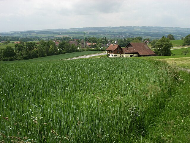
Knonau is a picturesque town located in the Canton of Zurich, Switzerland, known for its beautiful landscapes and rich natural surroundings, making it an excellent destination for hiking enthusiasts. Here are some key points to consider when hiking in and around Knonau:
Trails and Routes
-
Diverse Terrain: The area around Knonau offers a variety of trails that cater to different skill levels, from gentle walks suitable for beginners to more challenging routes for experienced hikers.
-
Scenic Views: Many of the trails provide stunning views of the Zurich Oberland and the surrounding valleys, including the impressive backdrop of the Alps on clear days.
-
Local Trails: Look for well-marked trails that connect Knonau to nearby towns and natural attractions. The trails may take you through lush forests, past rolling hills, and alongside charming farms.
-
Limmat Trail: This picturesque trail follows the River Limmat and can be accessed from Knonau, offering a lovely walking experience along the riverbank.
Nature Spots
-
Nature Reserves: The areas around Knonau may have nature reserves and protected landscapes that provide a great opportunity to observe local wildlife and enjoy the flora.
-
Picnic Areas: There are several spots along the hiking trails that are perfect for taking breaks, having a picnic, and enjoying the serene environment.
Seasonal Considerations
- Spring and Summer: Ideal for hiking with blooming wildflowers and pleasant temperatures.
- Autumn: The trails offer breathtaking views with vibrant fall foliage.
- Winter: Some trails may be accessible for winter hiking or snowshoeing, but always check local conditions and safety.
Preparation Tips
-
Proper Gear: Make sure to wear sturdy, comfortable footwear and bring plenty of water, snacks, and a map or GPS device.
-
Local Regulations: Be aware of any local regulations regarding trail use, and always stick to marked paths to protect the environment.
-
Safety First: Inform someone about your hiking plans, especially if you're exploring less traveled paths.
-
Weather Check: Always check the weather forecast before heading out, as conditions can change rapidly in the mountains.
Hiking in Knonau can be a rewarding experience, allowing you to connect with nature while enjoying the scenic beauty of Switzerland. Whether you're looking for a peaceful day hike or a more challenging adventure, there's something for everyone in this lovely region. Enjoy your hike!
- Страна:

- Почтовый код: 8934
- Телефонный код: 044
- Код автомобильного номера: ZH
- Координаты: 47° 13' 28" N, 8° 27' 45" E


- GPS треки (wikiloc): [Ссылка]
- Высота над уровнем моря: 430 м m
- Площадь: 6.48 кв.км
- Население: 2301
- Веб сайт: http://www.knonau.ch
- Википедия русская: wiki(ru)
- Википедия английская: wiki(en)
- Википедия национальная: wiki(de)
- Хранилище Wikidata: Wikidata: Q66328
- Катеория в википедии: [Ссылка]
- код Freebase: [/m/0gn_m8]
- код GeoNames: Альт: [7286211]
- код VIAF: Альт: [128273299]
- ID отношения в OpenStreetMap: [1682155]
- идентификатор HDS: [7]
- код швейцарского муниципалитета: [0007]
- код GAMEO: [Knonau (Kanton Zürich, Switzerland)]
Граничит с регионами:


Каппель-на-Альбисе
Hiking in Каппель-на-Альбисе
Kappel am Albis is a beautiful area in Switzerland that's great for hiking enthusiasts. Located near Zurich, it offers a mix of scenic landscapes, including rolling hills, forests, and panoramic views of the surrounding areas, including Lake Zurich and the Alps....
- Страна:
- Почтовый код: 8926
- Телефонный код: 01
- Код автомобильного номера: ZH
- Координаты: 47° 13' 31" N, 8° 30' 40" E
- GPS треки (wikiloc): [Ссылка]
- Высота над уровнем моря: 572 м m
- Площадь: 7.87 кв.км
- Население: 1124
- Веб сайт: [Ссылка]

Машванден
Hiking in Машванден
Maschwanden is a picturesque village located near Zug in Switzerland, surrounded by beautiful natural landscapes that are ideal for hiking. The area offers several trails suitable for various skill levels, making it a great destination for both novice and experienced hikers....
- Страна:
- Почтовый код: 8933
- Телефонный код: 044
- Код автомобильного номера: ZH
- Координаты: 47° 14' 5" N, 8° 25' 45" E
- GPS треки (wikiloc): [Ссылка]
- Высота над уровнем моря: 407 м m
- Площадь: 4.67 кв.км
- Население: 641
- Веб сайт: [Ссылка]


Метменштеттен
Hiking in Метменштеттен
Mettmenstetten is a charming village located in the Zurich Oberland region of Switzerland, offering a variety of hiking opportunities in a picturesque setting. The area is known for its beautiful landscapes, rolling hills, and well-marked trails that cater to hikers of all levels....
- Страна:
- Почтовый код: 8932
- Телефонный код: 044
- Код автомобильного номера: ZH
- Координаты: 47° 14' 41" N, 8° 27' 52" E
- GPS треки (wikiloc): [Ссылка]
- Высота над уровнем моря: 468 м m
- Площадь: 13.11 кв.км
- Население: 4865
- Веб сайт: [Ссылка]

Штайнхаузен
Hiking in Штайнхаузен
Steinhausen is a charming municipality located in the canton of Zug, Switzerland. Although it may not be as widely known for hiking as some of the larger mountainous regions, there are still opportunities in and around the area for enjoyable outdoor activities....
- Страна:
- Почтовый код: 6312
- Телефонный код: 041
- Код автомобильного номера: ZG
- Координаты: 47° 11' 49" N, 8° 29' 10" E
- GPS треки (wikiloc): [Ссылка]
- Высота над уровнем моря: 427 м m
- Площадь: 5.10 кв.км
- Население: 9875
- Веб сайт: [Ссылка]

Хам
- община в Швейцарии, Цуг
Hiking in Хам
Hiking in Cham, Switzerland, offers a beautiful blend of scenic views, diverse trails, and rich cultural experiences. Located in the Zug region, Cham lies along the shores of Lake Zug and is surrounded by stunning countryside and mountains. Here are some highlights and tips for hiking in this area:...
- Страна:
- Почтовый код: 6330
- Телефонный код: 041
- Код автомобильного номера: ZG
- Координаты: 47° 10' 49" N, 8° 27' 34" E
- GPS треки (wikiloc): [Ссылка]
- Высота над уровнем моря: 420 м m
- Площадь: 19.82 кв.км
- Население: 16690
- Веб сайт: [Ссылка]