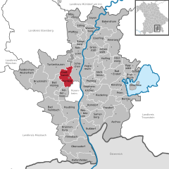
Кольбермор (Kolbermoor, Kolbermoor)

- город в Германии
 Hiking in Кольбермор
Kolbermoor, located in Bavaria, Germany, is a charming town near the banks of the River Mangfall and nestled at the foothills of the Alps. While Kolbermoor itself may not have extensive hiking trails directly within its borders, it serves as an excellent starting point for various hiking opportunities in the surrounding regions.
Nearby Hiking Trails and Areas:
-
Mangfalltal Nature Park: Just a short distance from Kolbermoor, this nature park features an array of hiking trails that follow the Mangfall River. The trails vary in difficulty and offer beautiful views of the river and the surrounding landscape.
-
Wendelstein Mountain: A bit further afield, Wendelstein offers more challenging hikes with stunning panoramic views of the Alps. You can take hiking paths or a cable car up to enjoy easier access to hiking trails at higher altitudes.
-
Tegernsee and Schliersee Lakes: These picturesque lakes are about a 30-minute drive from Kolbermoor. Numerous hiking paths surround the lakes, ranging from easy walks to advanced hikes that can lead you into the surrounding mountains.
-
Alpenvorland: The foothills of the Alps are known for their scenic trails that provide an excellent mix of open fields, woodlands, and mountain views.
Tips for Hiking in the Region:
-
Map and Navigation: Always carry a detailed map or use a GPS device to stay oriented on your hikes, as trails can sometimes be less marked.
-
Weather Check: The weather in the Alps can change rapidly, so it’s essential to check the forecast before heading out and to be prepared for various conditions.
-
Gear Up: Ensure you wear proper hiking boots and bring enough water, snacks, a first-aid kit, and sun protection.
-
Respect Nature: Follow Leave No Trace principles to keep the trails clean and enjoy the natural beauty responsibly.
Local Hiking Groups:
Joining local hiking groups or checking with visitor centers in Kolbermoor can provide you with additional information and guided hikes, allowing you to discover the best spots in the region.
Overall, Kolbermoor serves as a fantastic gateway to the natural beauty of Bavaria, offering a range of hiking experiences from leisurely strolls to more demanding excursions in the stunning alpine landscapes. Enjoy your time exploring the trails!
- Страна:

- Почтовый код: 83059
- Телефонный код: 08061; 08031
- Код автомобильного номера: RO
- Координаты: 47° 51' 0" N, 12° 4' 0" E


- GPS треки (wikiloc): [Ссылка]
- Высота над уровнем моря: 461 м m
- Площадь: 19.87 кв.км
- Население: 18371
- Веб сайт: https://www.kolbermoor.de/
- Википедия русская: wiki(ru)
- Википедия английская: wiki(en)
- Википедия национальная: wiki(de)
- Хранилище Wikidata: Wikidata: Q253445
- Катеория в википедии: [Ссылка]
- код Freebase: [/m/0dm_kx]
- код GeoNames: Альт: [2886446]
- код VIAF: Альт: [139590668]
- ID отношения в OpenStreetMap: [2168247]
- код GND: Альт: [4031735-3]
- идентификатор местоположения ArchINFORM: [15551]
- код LCNAF: Альт: [n83052529]
- место в MusicBrainz: [61980079-8b24-4062-bee2-55e9b9f5daf6]
- WOEID: [15002679]
- код TGN: [1039914]
- Bavarikon ID: [ODB_A00001317]
- идентификатор муниципалитетов в Германии: 09187150
- код региона Германии: 091870150150
Граничит с регионами:

Гроскаролиненфельд
Hiking in Гроскаролиненфельд
Großkarolinenfeld, located in Bavaria, Germany, is a charming village that offers access to beautiful hiking trails and stunning landscapes. The area is characterized by gentle rolling hills, lush forests, and scenic views of the Alps in the distance. Here are some key points about hiking in and around Großkarolinenfeld:...
- Страна:
- Почтовый код: 83109
- Телефонный код: 08031
- Код автомобильного номера: RO
- Координаты: 47° 53' 28" N, 12° 4' 52" E
- GPS треки (wikiloc): [Ссылка]
- Высота над уровнем моря: 467 м m
- Площадь: 29.73 кв.км
- Население: 5207
- Веб сайт: [Ссылка]


Раублинг
- община в Баварии
Hiking in Раублинг
Raubling is a picturesque municipality located in Bavaria, Germany, near the foothills of the Alps. It's an excellent destination for outdoor enthusiasts and hikers, offering a range of trails suitable for different skill levels. Here’s what you need to know about hiking in Raubling:...
- Страна:
- Почтовый код: 83064
- Телефонный код: 08035
- Код автомобильного номера: RO
- Координаты: 47° 47' 17" N, 12° 6' 17" E
- GPS треки (wikiloc): [Ссылка]
- Высота над уровнем моря: 460 м m
- Площадь: 44.20 кв.км
- Население: 8894
- Веб сайт: [Ссылка]