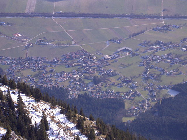
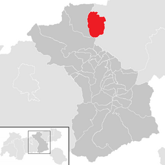
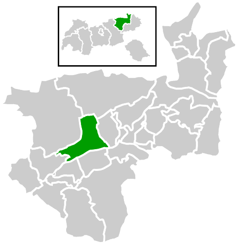
Крамзах (Kramsach, Kramsach)

 Hiking in Крамзах
Kramsach, located in the beautiful Tyrol region of Austria, is a fantastic destination for hiking enthusiasts. Nestled in the scenic Inn Valley, this charming village offers a variety of trails suitable for all levels of hikers, from beginners to advanced trekkers.
Popular Hiking Trails in Kramsach:
-
Kräuterküche Trail: This trail is excellent for those who enjoy nature and herbs. It combines hiking with a learning experience about local plants and herbs, making it ideal for families.
-
Land’s End Trail: This moderate trail leads you through lush forests and stunning viewpoints overlooking the Inn Valley. It's perfect for hikers looking for a mix of relaxation and striking scenery.
-
Römerstraße (Roman Road): An historical trail that traces parts of ancient Roman routes, it’s a fascinating way to explore the region's history while enjoying an invigorating hike.
-
Buchackeralm: A popular trail that takes you to a traditional alpine hut where you can enjoy local Tyrolean cuisine. The hike offers breathtaking views of the surrounding mountains.
-
Mountain Tours: For more experienced hikers, Kramsach serves as a gateway to higher peaks in the Zillertal Alps. Popular summits like the Gratlspitze or surrounding ridges provide challenging routes with rewarding vistas.
Practical Tips:
-
Best Time to Hike: The best hiking season in Kramsach typically runs from late spring to early autumn (May to October). During this time, trails are accessible, the weather is mild, and wildflowers abound.
-
Equipment: Good hiking shoes, weather-appropriate clothing, and plenty of water are essential. Always check trail conditions before heading out, as weather can change rapidly in the mountains.
-
Maps and Guides: Utilize local tourist information for maps and guides of the trails, or consider hiring a local guide if you're unfamiliar with the area.
-
Ethics and Safety: Adhere to Leave No Trace principles. Stay on marked paths to protect the local ecosystem and always prioritize safety by letting someone know your plans.
Kramsach's enchanting landscapes, diverse hiking trails, and rich cultural heritage make it a must-visit destination for anyone looking to explore the great outdoors in Austria.
- Страна:

- Почтовый код: 6233
- Телефонный код: 05337
- Код автомобильного номера: KU
- Координаты: 47° 26' 41" N, 11° 52' 53" E


- GPS треки (wikiloc): [Ссылка]
- Высота над уровнем моря: 520 м m
- Площадь: 26.9 кв.км
- Население: 4891
- Веб сайт: http://www.kramsach.at/
- Википедия русская: wiki(ru)
- Википедия английская: wiki(en)
- Википедия национальная: wiki(de)
- Хранилище Wikidata: Wikidata: Q261045
- Катеория в википедии: [Ссылка]
- код Freebase: [/m/02vx67l]
- код GeoNames: Альт: [2773605]
- код VIAF: Альт: [248958588]
- код GND: Альт: [4032760-7]
- идентификатор местоположения ArchINFORM: [10326]
- код австрийского муниципалитета: [70512]
Граничит с регионами:


Брикслегг
- Политическая община в Австрии
Hiking in Брикслегг
Brixlegg, located in the Tyrol region of Austria, is a beautiful destination for hiking enthusiasts. Surrounded by the stunning alpine landscape of the Zillertal and Alpbachtal valleys, Brixlegg offers a variety of trails suitable for all levels of hikers, from leisurely walks to challenging mountain hikes....
- Страна:
- Почтовый код: 6230
- Телефонный код: 05337
- Код автомобильного номера: KU
- Координаты: 47° 25' 45" N, 11° 52' 39" E
- GPS треки (wikiloc): [Ссылка]
- Высота над уровнем моря: 534 м m
- Площадь: 9.1 кв.км
- Население: 2970
- Веб сайт: [Ссылка]


Бранденберг
Hiking in Бранденберг
The Brandenburg region of Germany offers a variety of hiking opportunities, featuring beautiful landscapes, diverse ecosystems, and historical sites. Here are some key points to consider when hiking in Brandenburg:...
- Страна:
- Почтовый код: 6234
- Телефонный код: 05331
- Код автомобильного номера: KU
- Координаты: 47° 30' 29" N, 11° 53' 27" E
- GPS треки (wikiloc): [Ссылка]
- Высота над уровнем моря: 919 м m
- Площадь: 130.18 кв.км
- Население: 1523
- Веб сайт: [Ссылка]


Раттенберг
Hiking in Раттенберг
Rattenberg, a picturesque town located in Austria's Tyrol region, is not only known for its beautiful glass-making tradition and medieval architecture but also for its access to some excellent hiking opportunities in the surrounding area. Here are some highlights for hiking enthusiasts:...
- Страна:
- Почтовый код: 6240
- Телефонный код: 05337
- Код автомобильного номера: KU
- Координаты: 47° 26' 20" N, 11° 53' 36" E
- GPS треки (wikiloc): [Ссылка]
- Высота над уровнем моря: 521 м m
- Площадь: 0.11 кв.км
- Население: 411
- Веб сайт: [Ссылка]


Радфельд
Hiking in Радфельд
Radfeld, located in the Tyrol region of Austria, is a beautiful destination for hiking enthusiasts. Nestled in the scenic Inn Valley and surrounded by the majestic Alps, Radfeld offers diverse trails catering to all skill levels, from leisurely strolls to more challenging hikes....
- Страна:
- Почтовый код: 6241
- Телефонный код: 05337
- Код автомобильного номера: KU
- Координаты: 47° 26' 46" N, 11° 54' 41" E
- GPS треки (wikiloc): [Ссылка]
- Высота над уровнем моря: 512 м m
- Площадь: 14.32 кв.км
- Население: 2495
- Веб сайт: [Ссылка]


Райт
- община в Австрии, Тироль, Куфштайн
Hiking in Райт
Reith im Alpbachtal, located in the Tyrol region of Austria, is a picturesque destination for hikers, offering stunning alpine scenery and a variety of trails for all skill levels. The area is known for its charming villages, lush meadows, and dramatic mountain vistas....
- Страна:
- Почтовый код: 6235
- Телефонный код: 05337
- Код автомобильного номера: KU
- Координаты: 47° 25' 0" N, 11° 52' 42" E
- GPS треки (wikiloc): [Ссылка]
- Высота над уровнем моря: 637 м m
- Площадь: 27.41 кв.км
- Население: 2722
- Веб сайт: [Ссылка]

Мюнстер
- община в Австрии, Тироль, Куфштайн
Hiking in Мюнстер
Münster in Tyrol is a charming village located in the Austrian Alps, within a stunning natural landscape that offers a variety of hiking opportunities. Here are some key points to consider when hiking in Münster:...
- Страна:
- Почтовый код: 6232
- Телефонный код: 05337
- Код автомобильного номера: KU
- Координаты: 47° 25' 16" N, 11° 50' 2" E
- GPS треки (wikiloc): [Ссылка]
- Высота над уровнем моря: 534 м m
- Площадь: 27.82 кв.км
- Население: 3317
- Веб сайт: [Ссылка]

Штайнберг-ам-Рофан
Hiking in Штайнберг-ам-Рофан
Steinberg am Rofan is a picturesque village in the Tyrol region of Austria, surrounded by the stunning Rofan mountain range. It’s an excellent destination for hikers of all skill levels, offering a variety of trails and breathtaking landscapes....
- Страна:
- Почтовый код: 6215
- Телефонный код: 05248
- Код автомобильного номера: SZ
- Координаты: 47° 30' 55" N, 11° 47' 46" E
- GPS треки (wikiloc): [Ссылка]
- Высота над уровнем моря: 1010 м m
- Площадь: 68.6 кв.км
- Население: 286
- Веб сайт: [Ссылка]

Брайтенбах-ам-Инн
- Политическая община в Австрии
Hiking in Брайтенбах-ам-Инн
Breitenbach am Inn is a charming village located in Tyrol, Austria, surrounded by stunning alpine scenery, making it an ideal destination for hiking enthusiasts. The area offers a variety of hiking trails suitable for different skill levels, from family-friendly walks to more challenging mountain hikes....
- Страна:
- Почтовый код: 6252
- Телефонный код: 05338
- Код автомобильного номера: KU
- Координаты: 47° 28' 44" N, 11° 58' 24" E
- GPS треки (wikiloc): [Ссылка]
- Высота над уровнем моря: 510 м m
- Площадь: 37.99 кв.км
- Население: 3475
- Веб сайт: [Ссылка]