
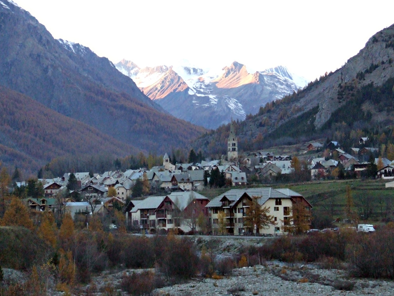
Ла-Грав (La Grave, La Grave)
- коммуна во Франции
 Hiking in Ла-Грав
La Grave is a stunning area located in the French Alps, known for its breathtaking mountain scenery and varied hiking opportunities. Here are some key points to consider if you're planning a hiking trip in La Grave:
Hiking Trails
- Variety of Trails: La Grave offers a range of trails suitable for different experience levels, from leisurely walks to challenging mountain hikes. Some popular routes include the hike to the Glacier de la Meije and the ascent to the Col des Ruines.
- Scenic Views: Many trails provide stunning panoramic views of the surrounding peaks, including the famous La Meije mountain, which is a highlight for many hikers.
- Wildlife and Flora: The area is rich in biodiversity, and you may encounter various alpine flowers, as well as wildlife such as chamois and ibex.
Seasonality
- Summer Hiking: The best time to hike in La Grave is from early June to mid-September, when the trails are typically snow-free and accessible.
- Winter Sports: While not hiking, the winter season attracts skiers and mountaineers to the region, particularly for off-piste skiing.
Preparation
- Weather Conditions: Always check the weather before heading out, as conditions can change rapidly in the mountains.
- Gear: Make sure to wear appropriate hiking boots and gear, and carry essentials such as water, snacks, and a first-aid kit. Depending on your chosen route, trekking poles and crampons might be necessary.
- Map and Navigation: Familiarize yourself with the hiking maps and trail markers, as some areas may be less well-marked.
Eco-conscious Hiking
- Leave No Trace: Be mindful of your impact on the environment. Stick to marked trails, pack out what you bring in, and respect wildlife and plant life.
Local Information
- Guided Tours: If you're unfamiliar with the region or prefer a guided experience, consider hiring a local guide who can enhance your hiking experience with their knowledge of the area.
- Accommodation: La Grave has a range of accommodation options, from camping sites to cozy mountain lodges.
Hiking in La Grave not only offers an exhilarating experience in nature but also provides a sense of adventure with its dramatic landscapes. Always prioritize safety and preparation to ensure an enjoyable outing in this alpine paradise.
- Страна:

- Почтовый код: 05320
- Координаты: 45° 2' 46" N, 6° 18' 21" E


- GPS треки (wikiloc): [Ссылка]
- Площадь: 126.91 кв.км
- Население: 487
- Веб сайт: https://mairie-lagrave-lameije.jimdo.com/
- Википедия русская: wiki(ru)
- Википедия английская: wiki(en)
- Википедия национальная: wiki(fr)
- Хранилище Wikidata: Wikidata: Q624323
- Катеория в википедии: [Ссылка]
- код Freebase: [/m/0bd60s]
- код Freebase: [/m/0bd60s]
- код GeoNames: Альт: [6618135]
- код GeoNames: Альт: [6618135]
- номер SIREN: [210500633]
- номер SIREN: [210500633]
- код VIAF: Альт: [261265429]
- код VIAF: Альт: [261265429]
- код тезауруса PACTOLS: [pcrtvtM1Q7jLne]
- код тезауруса PACTOLS: [pcrtvtM1Q7jLne]
- код темы Quora: [La-Grave-1]
- код темы Quora: [La-Grave-1]
- код муниципалитета INSEE: 05063
- код муниципалитета INSEE: 05063
Граничит с регионами:
Ле-Монетье-ле-Бен
- коммуна во Франции
Hiking in Ле-Монетье-ле-Бен
Le Monêtier-les-Bains, located in the Hautes-Alpes region of France, is a stunning destination for hiking enthusiasts. Nestled in the Serre Chevalier Valley, this alpine village offers a variety of trails that cater to all levels of hikers, from beginners to experienced adventurers. Here are some highlights and tips for hiking in Le Monêtier-les-Bains:...
- Страна:
- Почтовый код: 05220
- Координаты: 44° 58' 34" N, 6° 30' 31" E
- GPS треки (wikiloc): [Ссылка]
- Площадь: 97.87 кв.км
- Население: 1024
- Веб сайт: [Ссылка]

Виллар-д’Арен
- коммуна во Франции
Hiking in Виллар-д’Арен
Villar-d'Arêne is a charming village located in the Écrins National Park in the French Alps, known for its stunning natural beauty and a variety of hiking opportunities. Here are some key aspects of hiking in this area:...
- Страна:
- Почтовый код: 05480
- Координаты: 45° 2' 34" N, 6° 20' 13" E
- GPS треки (wikiloc): [Ссылка]
- Площадь: 77.51 кв.км
- Население: 330
- Веб сайт: [Ссылка]

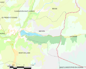
Мизоэн
- коммуна во Франции
Hiking in Мизоэн
Mizoën is a charming village located in the Écrins National Park in the French Alps. This picturesque region is known for its stunning landscapes, pristine wilderness, and variety of hiking trails suitable for all levels of experience. Here’s some information to help you plan your hiking adventure in Mizoën:...
- Страна:
- Почтовый код: 38142
- Координаты: 45° 3' 0" N, 6° 8' 33" E
- GPS треки (wikiloc): [Ссылка]
- Площадь: 14.6 кв.км
- Население: 195
- Веб сайт: [Ссылка]


Бесс
- коммуна во Франции
Hiking in Бесс
Besse, located in the Isère department of the Auvergne-Rhône-Alpes region in southeastern France, is a fantastic destination for hiking enthusiasts. Nestled in the spectacular landscapes of the French Alps, Besse offers a range of hiking trails that cater to various levels of experience, from beginner to expert....
- Страна:
- Почтовый код: 38142
- Координаты: 45° 4' 18" N, 6° 10' 12" E
- GPS треки (wikiloc): [Ссылка]
- Площадь: 25.46 кв.км
- Население: 133
- Веб сайт: [Ссылка]


Saint-Jean-d'Arves
- коммуна во Франции
Hiking in Saint-Jean-d'Arves
Saint-Jean-d'Arves is a picturesque village located in the French Alps, specifically in the Savoie region. This area is renowned for its stunning mountain landscapes, diverse wildlife, and a wide array of hiking opportunities. Here’s what you can expect when hiking in Saint-Jean-d'Arves:...
- Страна:
- Почтовый код: 73530
- Координаты: 45° 12' 26" N, 6° 16' 23" E
- GPS треки (wikiloc): [Ссылка]
- Площадь: 75.6 кв.км
- Население: 265
- Веб сайт: [Ссылка]

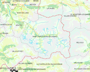
Сен-Кристоф-ан-Уазан
- коммуна во Франции
Hiking in Сен-Кристоф-ан-Уазан
Saint-Christophe-en-Oisans is a charming village located in the French Alps, nestled within the Oisans valley. It serves as a gateway to some stunning hiking opportunities in the surrounding terrain, known for its breathtaking scenery, diverse ecosystems, and the proximity to the Écrins National Park....
- Страна:
- Почтовый код: 38520
- Координаты: 44° 57' 26" N, 6° 10' 37" E
- GPS треки (wikiloc): [Ссылка]
- Площадь: 123.5 кв.км
- Население: 105
- Веб сайт: [Ссылка]


Valloire
- коммуна во Франции
Hiking in Valloire
Valloire is a charming mountain village located in the Savoie region of the French Alps. It's known for its stunning landscapes, rich heritage, and excellent opportunities for hiking and outdoor activities. Here are some highlights of hiking in Valloire:...
- Страна:
- Почтовый код: 73450
- Координаты: 45° 9' 55" N, 6° 25' 42" E
- GPS треки (wikiloc): [Ссылка]
- Площадь: 137.48 кв.км
- Население: 1135
- Веб сайт: [Ссылка]