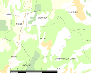
La Prétière (La Prétière)

- коммуна во Франции
 Hiking in La Prétière
La Prétière is a beautiful area for outdoor enthusiasts and hikers. Located in the Vienne region of France, it offers a mix of scenic landscapes, lush green forests, and a variety of trails suitable for different skill levels. Here’s what you can expect when hiking in La Prétière:
Trails and Routes
-
Trail Diversity: There are several marked trails ranging from easy walks to more challenging hikes. This makes it accessible for families, beginners, and experienced hikers alike.
-
Nature Walks: The area is rich in biodiversity, with opportunities to see local flora and fauna. Expect to encounter different wildlife including birds, deer, and an array of plant species.
-
Historical Sites: Some hiking routes may take you past historical landmarks or ruins, adding a cultural element to your outdoor adventure.
Preparation
- Maps: It's advisable to carry a detailed map or use a hiking app for navigation. Local visitor centers often provide maps and information about the trails.
- Gear: Wear appropriate footwear and clothing, and pack essentials such as water, snacks, a first-aid kit, and a rain jacket, depending on the weather.
Best Time to Visit
- Season: Spring and fall are ideal for hiking in La Prétière, with mild temperatures and beautiful scenery. Summer can be warm, while winter might present challenges due to snow.
Leave No Trace
- As always, respect nature by following the Leave No Trace principles: stay on marked trails, take your trash with you, and avoid disturbing wildlife.
Local Regulations
- Check for any specific regulations or permits required for hiking in specific areas, as well as hours of operation for trails.
Whether you are looking for a peaceful nature walk or an invigorating hike through picturesque landscapes, La Prétière offers a wonderful experience for all hiking enthusiasts. Always be sure to check local conditions and trail statuses before setting out. Enjoy your hike!
- Страна:

- Почтовый код: 25250
- Координаты: 47° 26' 41" N, 6° 36' 34" E


- GPS треки (wikiloc): [Ссылка]
- Площадь: 2.71 кв.км
- Население: 160
- Википедия английская: wiki(en)
- Википедия национальная: wiki(fr)
- Хранилище Wikidata: Wikidata: Q200803
- Катеория в википедии: [Ссылка]
- код Freebase: [/m/03mhc5_]
- код Freebase: [/m/03mhc5_]
- код GeoNames: Альт: [6455727]
- код GeoNames: Альт: [6455727]
- номер SIREN: [212504708]
- номер SIREN: [212504708]
- код муниципалитета INSEE: 25470
- код муниципалитета INSEE: 25470
Граничит с регионами:


Blussangeaux
- коммуна во Франции
Hiking in Blussangeaux
Blussangeaux is a relatively lesser-known hiking destination, so it might not have as much detailed information available compared to more popular hiking areas. However, if you find yourself in or around this region, you can expect beautiful landscapes, diverse flora and fauna, and a chance to enjoy the great outdoors. Here are some general tips and considerations for hiking in Blussangeaux:...
- Страна:
- Почтовый код: 25250
- Координаты: 47° 25' 47" N, 6° 36' 50" E
- GPS треки (wikiloc): [Ссылка]
- Площадь: 2.12 кв.км
- Население: 84

Beutal
- коммуна во Франции
Hiking in Beutal
Beutal is a small village located in the Swiss Alps, known for its stunning natural landscapes, diverse wildlife, and numerous hiking trails. While it may not be as famous as some larger destinations in Switzerland, it offers a tranquil hiking experience for those looking to escape the crowds....
- Страна:
- Почтовый код: 25250
- Координаты: 47° 28' 17" N, 6° 38' 18" E
- GPS треки (wikiloc): [Ссылка]
- Площадь: 5.78 кв.км
- Население: 291
- Веб сайт: [Ссылка]


Blussans
- коммуна во Франции
Hiking in Blussans
Blussans is a picturesque village located in the Jura region of France, known for its beautiful landscapes and outdoor activities, including hiking. Here are some key aspects of hiking in Blussans:...
- Страна:
- Почтовый код: 25250
- Координаты: 47° 25' 39" N, 6° 36' 26" E
- GPS треки (wikiloc): [Ссылка]
- Площадь: 8.04 кв.км
- Население: 196

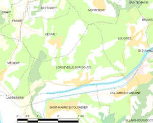
Longevelle-sur-Doubs
- коммуна во Франции
Hiking in Longevelle-sur-Doubs
Longevelle-sur-Doubs is a charming commune located in the Doubs department of eastern France, bordered by beautiful natural scenery. It is an excellent base for hiking enthusiasts due to its proximity to the Doubs River and the surrounding landscapes that offer a variety of trails suitable for different skill levels....
- Страна:
- Почтовый код: 25260
- Координаты: 47° 27' 9" N, 6° 39' 5" E
- GPS треки (wikiloc): [Ссылка]
- Площадь: 8.31 кв.км
- Население: 697
- Веб сайт: [Ссылка]


Médière
- коммуна во Франции
Hiking in Médière
Médière, located in the beautiful region of the French Alps, is known for its stunning landscapes and a variety of hiking trails suitable for different skill levels. Here are some key points you might find helpful when considering a hiking trip in Médière:...
- Страна:
- Почтовый код: 25250
- Координаты: 47° 27' 24" N, 6° 35' 55" E
- GPS треки (wikiloc): [Ссылка]
- Площадь: 5.73 кв.км
- Население: 302

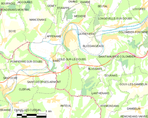
л'Иль-сюр-ле-Ду
- коммуна во Франции
Hiking in л'Иль-сюр-ле-Ду
L'Isle-sur-le-Doubs, located in the Doubs department of France, offers a delightful hiking experience amidst beautiful natural scenery. Sitting along the Doubs River, this area features diverse landscapes, including forests, hills, and riversides, making it perfect for outdoor enthusiasts....
- Страна:
- Почтовый код: 25250
- Координаты: 47° 26' 52" N, 6° 35' 10" E
- GPS треки (wikiloc): [Ссылка]
- Площадь: 10.67 кв.км
- Население: 3078
- Веб сайт: [Ссылка]