Цернец (Zernez, Zernez)

 Hiking in Цернец
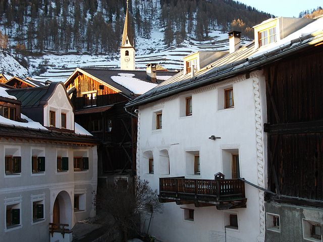
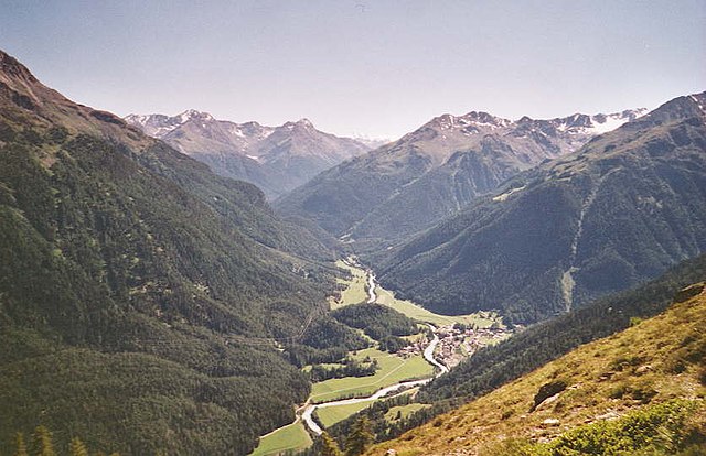
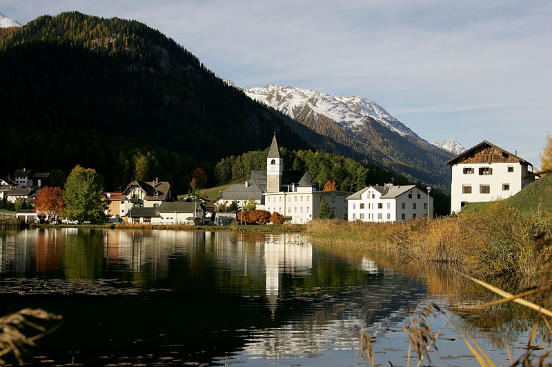
Zernez is a beautiful village located in the Swiss National Park in the Engadin Valley, known for its stunning natural landscapes, diverse ecosystems, and a variety of hiking trails that cater to different skill levels. Here are some highlights and tips for hiking in Zernez:
Hiking Trails
-
National Park Walking Trails:
- The Swiss National Park offers a network of well-marked trails, ranging from easy walks to more challenging hikes. The park is known for its pristine nature, and you can often see wildlife such as deer, ibex, and marmots.
-
Val Muestair:
- This area features scenic trails that take you through lush valleys and offer breathtaking views of the surrounding mountains. The Val Muestair Loop is a recommended route for its stunning panoramas.
-
Trail to the Zernez Observatory:
- A moderate hike that leads to the observatory, providing educational insights about the local wildlife and ecology. The views from the top are spectacular.
-
The Fuorn Pass Trail:
- A more challenging hike that offers incredible views and a chance to experience the unique alpine flora. This trail connects several points of interest within the park.
-
Lai da Palpuogna:
- A picturesque lake that can be reached via a beautiful hiking trail from Zernez. It’s a great spot for a picnic or simply enjoying the natural beauty of the area.
Tips for Hiking in Zernez
-
Weather Preparedness: Always check the weather before heading out as conditions can change rapidly in the mountains. Dress in layers and bring rain gear, even if the forecast looks good.
-
Park Regulations: Familiarize yourself with the Swiss National Park regulations. Littering, disturbing wildlife, and leaving marked trails are prohibited to preserve the area’s natural beauty.
-
Water and Snacks: Carry sufficient water and snacks, as options for purchasing these may be limited on the trails.
-
Hiking Gear: Wear appropriate hiking boots with good traction, and consider trekking poles for stability, especially on steeper trails.
-
Maps and Guides: While trails are marked, having a detailed map or GPS device can be helpful for navigation.
-
Respect Nature: Leave no trace. Carry out whatever you carry in, and ensure that you respect the delicate ecosystems present in the park.
Wildlife Viewing
Zernez and the surrounding national park are prime areas for wildlife enthusiasts. Keep your distance from animals, take pictures from afar, and be mindful of their habitats.
Accessibility
The village of Zernez itself is accessible by public transport and car, making it a convenient base for hiking excursions in the region. There are also local accommodations and dining options available.
Hiking in Zernez offers a unique opportunity to immerse yourself in some of Switzerland's most breathtaking natural beauty, making it a must-visit destination for outdoor enthusiasts.
- Страна:

- Почтовый код: 7530
- Телефонный код: 081
- Код автомобильного номера: GR
- Координаты: 46° 41' 59" N, 10° 5' 59" E


- GPS треки (wikiloc): [Ссылка]
- Высота над уровнем моря: 2216 м m
- Площадь: 344.04 кв.км
- Население: 1532
- Веб сайт: http://www.zernez.ch
- Википедия русская: wiki(ru)
- Википедия английская: wiki(en)
- Википедия национальная: wiki(de)
- Хранилище Wikidata: Wikidata: Q64609
- Катеория в википедии: [Ссылка]
- код Freebase: [/m/04cqpm]
- код GeoNames: Альт: [7287632]
- код VIAF: Альт: [248261106]
- ID отношения в OpenStreetMap: [4447274]
- идентификатор местоположения ArchINFORM: [43408]
- код TGN: [1064543]
- идентификатор HDS: [1525]
- код швейцарского муниципалитета: [3746]
- код Цифрового атласа Римской империи: [18007]
- код Pleiades: [187631]
- LIR: [3030]
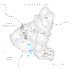
Граничит с регионами:


Вальдидентро
- коммуна Италии
Hiking in Вальдидентро
Valdidentro is a beautiful valley located in the Lombardy region of northern Italy, within the larger Valtellina area. It's an excellent spot for hiking enthusiasts, offering a variety of trails that cater to different experience levels, stunning scenery, and opportunities to explore the rich natural and cultural heritage of the region....
- Страна:

- Почтовый код: 23038
- Телефонный код: 0342
- Код автомобильного номера: SO
- Координаты: 46° 29' 0" N, 10° 18' 0" E
- GPS треки (wikiloc): [Ссылка]
- Высота над уровнем моря: 1345 м m
- Площадь: 226.73 кв.км
- Население: 4131
- Веб сайт: [Ссылка]


Ливиньо
- коммуна Италии
Hiking in Ливиньо
Livigno, located in the Italian Alps near the Swiss border, is a fantastic destination for hiking enthusiasts. This charming alpine resort is surrounded by stunning scenery, with lush valleys, high peaks, and pristine landscapes....
- Страна:
- Почтовый код: 23030
- Телефонный код: 0342
- Код автомобильного номера: SO
- Координаты: 46° 32' 0" N, 10° 8' 0" E
- GPS треки (wikiloc): [Ссылка]
- Высота над уровнем моря: 1816 м m
- Площадь: 227.3 кв.км
- Население: 6550
- Веб сайт: [Ссылка]

Ардец
Hiking in Ардец
Ardez is a picturesque village located in the Swiss Alps, specifically in the Lower Engadine region of Switzerland. Surrounded by stunning mountain landscapes, Ardez is an excellent destination for hiking enthusiasts. Here are some things to consider for hiking in and around Ardez:...
- Страна:
- Почтовый код: 7546
- Телефонный код: 081
- Код автомобильного номера: GR
- Координаты: 46° 46' 29" N, 10° 12' 3" E
- GPS треки (wikiloc): [Ссылка]
- Высота над уровнем моря: 1362 м m
- Площадь: 61.39 кв.км
- Веб сайт: [Ссылка]


Шчанф
Hiking in Шчанф
S-chanf, a picturesque village located in the Engadin Valley of Switzerland, offers a variety of hiking opportunities for outdoor enthusiasts of all skill levels. Here are some aspects to consider when hiking in this beautiful area:...
- Страна:
- Почтовый код: 7525
- Телефонный код: 081
- Код автомобильного номера: GR
- Координаты: 46° 36' 59" N, 9° 59' 0" E
- GPS треки (wikiloc): [Ссылка]
- Высота над уровнем моря: 1878 м m
- Площадь: 138.03 кв.км
- Население: 685
- Веб сайт: [Ссылка]

Лавин
Hiking in Лавин
Lavin, a picturesque village in the Lower Engadine region of Switzerland, offers a stunning backdrop for hikers. Nestled in the Swiss Alps, it provides access to a variety of trails that cater to all skill levels. The region is known for its breathtaking landscapes, including lush valleys, scenic mountain views, and charming alpine architecture....
- Страна:
- Почтовый код: 7543
- Телефонный код: 081
- Код автомобильного номера: GR
- Координаты: 46° 46' 3" N, 10° 6' 38" E
- GPS треки (wikiloc): [Ссылка]
- Высота над уровнем моря: 2140 м m
- Площадь: 46.26 кв.км
- Веб сайт: [Ссылка]

Суш
Hiking in Суш
Susch, a picturesque village located in the Lower Engadine region of Switzerland, offers a range of hiking opportunities that showcase its stunning alpine scenery and cultural heritage. Here are some things to know about hiking in Susch:...
- Страна:
- Почтовый код: 7542
- Телефонный код: 081
- Код автомобильного номера: GR
- Координаты: 46° 45' 3" N, 10° 1' 20" E
- GPS треки (wikiloc): [Ссылка]
- Высота над уровнем моря: 1856 м m
- Площадь: 93.93 кв.км
- Веб сайт: [Ссылка]

Давос
- швейцарская коммуна
Hiking in Давос
Davos, located in the Swiss Alps, is renowned for its stunning landscapes and extensive hiking trails, making it a popular destination for outdoor enthusiasts. Here are some key points to consider when hiking in Davos:...
- Страна:
- Почтовый код: 7272 Davos Clavadel; 7294 Davos Wiesen; 7278; 7277; 7276; 7270 Davos Platz; 7260 Davos Dorf; 7265 Davos Wolfgang
- Телефонный код: 081
- Код автомобильного номера: GR
- Координаты: 46° 48' 17" N, 9° 50' 14" E
- GPS треки (wikiloc): [Ссылка]
- Высота над уровнем моря: 1563 м m
- Площадь: 284 кв.км
- Население: 10937
- Веб сайт: [Ссылка]

Тарасп
Hiking in Тарасп
Tarasp is a beautiful village in the Lower Engadine region of Switzerland, renowned for its stunning landscapes and rich cultural heritage. It’s an excellent destination for hiking enthusiasts, offering trails that cater to various skill levels, from easy walks to challenging hikes....
- Страна:
- Почтовый код: 7553
- Телефонный код: 081
- Код автомобильного номера: GR
- Координаты: 46° 46' 40" N, 10° 15' 37" E
- GPS треки (wikiloc): [Ссылка]
- Высота над уровнем моря: 2658 м m
- Площадь: 46.99 кв.км
- Веб сайт: [Ссылка]