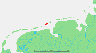
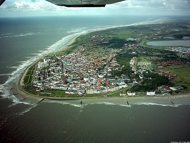
Лер (Leer, Landkreis Leer)


 Hiking in Лер
Leer is a district located in the Lower Saxony region of Germany, and it offers a variety of opportunities for hiking enthusiasts. The landscape is characterized by flat terrain, picturesque wetlands, canals, and rivers, making it a unique area for outdoor activities.
Hiking Trails
-
Nature Reserves and Wetlands: The Ems- and the Leda rivers run through the district, offering scenic views and opportunities to hike along their banks. The area's wetlands are home to a variety of bird species, making it a great spot for both hiking and bird-watching.
-
Historical Trails: There are several circular hiking trails that connect historic sites and towns within the district. For instance, you might explore the quaint town of Leer itself, with its charming buildings and rich maritime history.
-
Cultural Paths: Leer has routes that highlight its cultural and historical significance. You can find signs and markers that provide information about the history and ecology of the area as you hike.
-
Long-Distance Trails: The district is also a part of broader hiking networks in Lower Saxony, including the Baltic Sea Trail and the Emsland Route, which offer longer distances for more seasoned hikers.
Tips for Hiking in Leer
-
Best Time to Hike: Spring (April to June) and early autumn (September to October) are the most pleasant times for hiking, with mild weather and fewer crowds.
-
Gear: Given the wetland areas, waterproof hiking boots are recommended. Additionally, bringing layers for changing weather conditions is advisable.
-
Navigation: While many trails are marked, it's wise to have a map or a hiking app on your phone for guidance.
-
Local Wildlife: Be mindful of the local fauna, as the wetlands are home to various birds and other wildlife. Observing them from a distance is usually best.
-
Stay Hydrated: Always bring enough water, especially if you are planning to hike for several hours.
Local Amenities
Leer has various amenities that make hiking more enjoyable, such as cafes and restaurants perfect for a post-hike meal. Additionally, there are local shops where you can pick up any hiking supplies you may need.
In summary, hiking in Leer (district) offers a blend of nature, history, and culture, making it a rewarding experience for hikers of all levels. Whether you prefer an easy stroll along the rivers or a more challenging day hike through natural reserves, you’ll find a variety of trails to explore in this charming part of Germany.
- Страна:

- Код автомобильного номера: LER
- Координаты: 53° 15' 0" N, 7° 30' 0" E


- GPS треки (wikiloc): [Ссылка]
- Высота над уровнем моря: 1 м m
- Площадь: 1086.00 кв.км
- Население: 168253
- Веб сайт: http://www.landkreis-leer.de/
- Википедия русская: wiki(ru)
- Википедия английская: wiki(en)
- Википедия национальная: wiki(de)
- Хранилище Wikidata: Wikidata: Q5934
- Галерея изображений в википедии: [Ссылка]
- Катеория в википедии: [Ссылка]
- Карты в википедии: [Ссылка]
- код Freebase: [/m/012qzn]
- код GeoNames: Альт: [3221094]
- код VIAF: Альт: [134098575]
- ID отношения в OpenStreetMap: [62567]
- код GND: Альт: [4035003-4]
- идентификатор местоположения ArchINFORM: [11973]
- код LCNAF: Альт: [no2009097785]
- код TGN: [7076841]
- код NUTS: [DE94C]
- код района Германии: 03457
Включает регионы:

Hesel
Hiking in Hesel
Hesel, located in the Samtgemeinde of Hesel in Lower Saxony, Germany, offers a variety of opportunities for hiking enthusiasts. The region is characterized by its picturesque landscapes, which include wooded areas, farmland, and small rivers. Here are some highlights about hiking in Hesel:...
- Страна:
- Координаты: 53° 18' 0" N, 7° 36' 0" E
- GPS треки (wikiloc): [Ссылка]
- Население: 10809


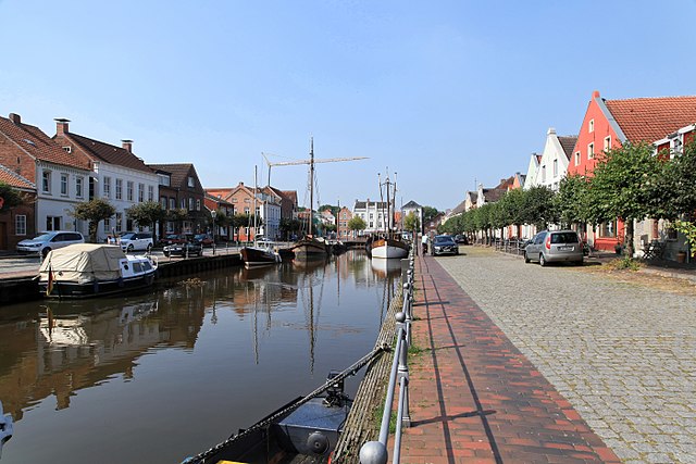
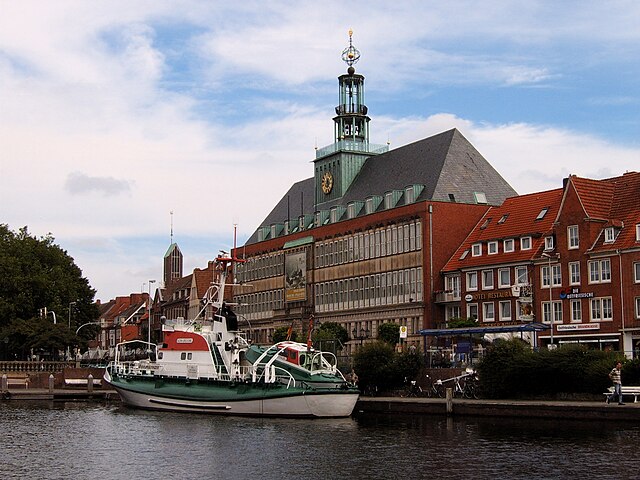
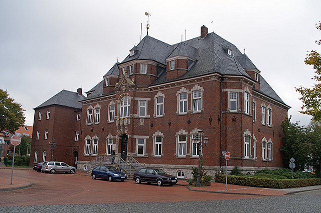
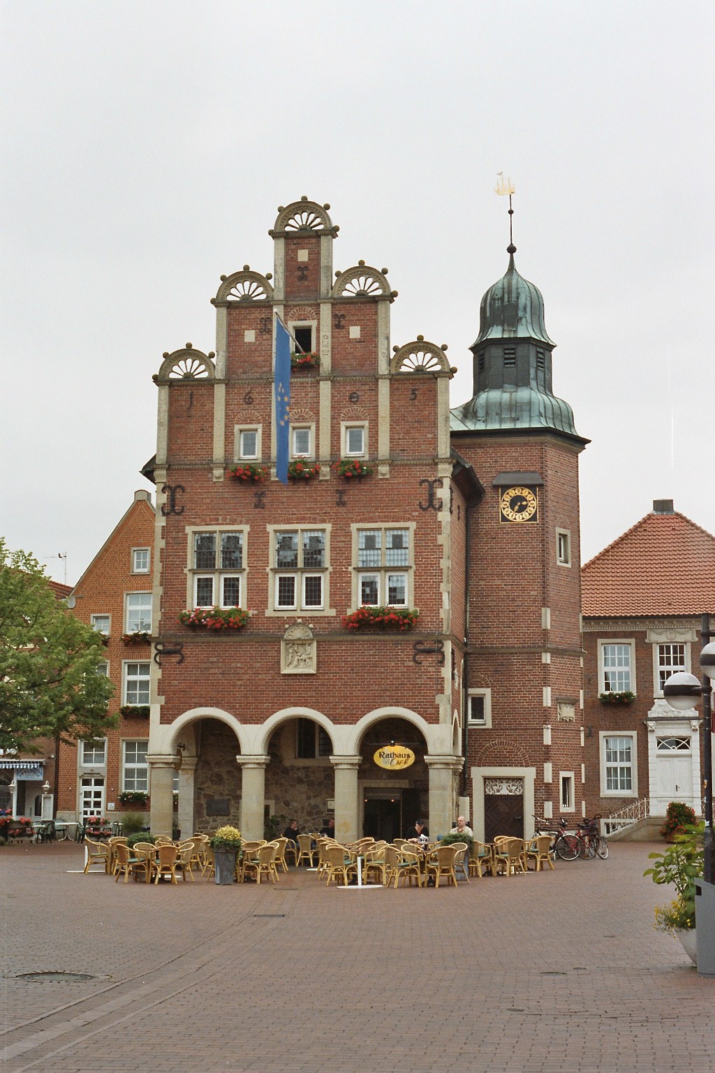
Лер
- город в Нижней Саксонии
Hiking in Лер
Leer is a town located in the Lower Saxony region of Germany. While it may not be as widely known for hiking as some other areas in the country, it offers beautiful landscapes and paths suitable for outdoor activities. Here are some points to consider if you're looking to hike in and around Leer:...
- Страна:
- Почтовый код: 26789
- Телефонный код: 0491
- Код автомобильного номера: LER
- Координаты: 53° 13' 51" N, 7° 27' 10" E
- GPS треки (wikiloc): [Ссылка]
- Высота над уровнем моря: 7 м m
- Площадь: 70.30 кв.км
- Население: 34407
- Веб сайт: [Ссылка]
Insel Lütje Hörn
Hiking in Insel Lütje Hörn
Insel Lütje Hörn is a small island located in the North Sea, part of the East Frisian Islands in Germany. It's a quaint and relatively untouched destination that's perfect for those looking to escape the hustle and bustle of more crowded hiking spots. Here’s a brief overview of what you might expect when hiking on or around Insel Lütje Hörn....
- Страна:
- Координаты: 53° 35' 0" N, 6° 52' 0" E
- GPS треки (wikiloc): [Ссылка]
- Площадь: 0.31 кв.км
- Население: 0

Боркум
Hiking in Боркум
Borkum, the largest of the East Frisian Islands in Germany, is a fantastic destination for hiking enthusiasts. Known for its stunning natural landscapes, Borkum offers a variety of trails that showcase its unique coastal environment, diverse flora and fauna, and charming seaside villages....
- Страна:
- Почтовый код: 26757
- Телефонный код: 04922
- Код автомобильного номера: LER
- Координаты: 53° 35' 17" N, 6° 40' 11" E
- GPS треки (wikiloc): [Ссылка]
- Высота над уровнем моря: 6 м m
- Площадь: 30.6 кв.км
- Население: 5189
- Веб сайт: [Ссылка]

Венер
Hiking in Венер
Weener, a small town located in the Lower Saxony region of Germany, is not widely known as a hiking hotspot, but it offers some pleasant walking and hiking opportunities, especially for those who appreciate tranquil landscapes and the charm of the countryside....
- Страна:
- Почтовый код: 26826
- Телефонный код: 04961; 04953; 04951; 04903
- Код автомобильного номера: LER
- Координаты: 53° 10' 9" N, 7° 21' 23" E
- GPS треки (wikiloc): [Ссылка]
- Высота над уровнем моря: 5 м m
- Площадь: 81.24 кв.км
- Население: 15541
- Веб сайт: [Ссылка]


Бунде
Hiking in Бунде
Bunde, located in the Lower Saxony region of Germany, offers a charming yet less populous setting for hiking enthusiasts. While it may not be as widely recognized as some of Germany's larger natural reserves or national parks, there are still plenty of opportunities for exploration in and around the area....
- Страна:
- Почтовый код: 26831
- Телефонный код: 04953
- Код автомобильного номера: LER
- Координаты: 53° 11' 2" N, 7° 16' 19" E
- GPS треки (wikiloc): [Ссылка]
- Высота над уровнем моря: 2 м m
- Площадь: 121.00 кв.км
- Население: 7656
- Веб сайт: [Ссылка]
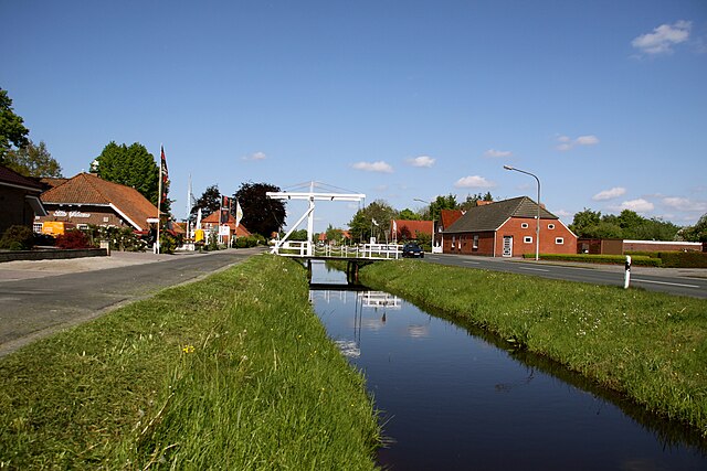
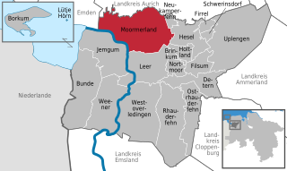
Мормерланд
Hiking in Мормерланд
Moormerland, located in the Lower Saxony region of Germany, is a beautiful area known for its natural landscapes, including moors, forests, and lakes. It offers a variety of hiking opportunities that cater to both beginners and experienced hikers. Here are some key points about hiking in Moormerland:...
- Страна:
- Почтовый код: 26802
- Телефонный код: 04954; 04945; 04924
- Код автомобильного номера: LER
- Координаты: 53° 19' 11" N, 7° 25' 22" E
- GPS треки (wikiloc): [Ссылка]
- Высота над уровнем моря: 1 м m
- Площадь: 122 кв.км
- Население: 23474
- Веб сайт: [Ссылка]


Йемгум
Hiking in Йемгум
Jemgum, located in Lower Saxony, Germany, is not typically known as a hiking hotspot like some of the larger national parks or mountain areas, but it does offer charming landscapes and opportunities for walking and exploring nature. The region features picturesque farmland, quiet rural paths, and scenic views, making it suitable for leisurely hikes....
- Страна:
- Почтовый код: 26844
- Телефонный код: 04958; 04902
- Код автомобильного номера: LER
- Координаты: 53° 15' 57" N, 7° 23' 6" E
- GPS треки (wikiloc): [Ссылка]
- Высота над уровнем моря: 0 м m
- Площадь: 78.48 кв.км
- Население: 3583
- Веб сайт: [Ссылка]

Остраудерфен
Hiking in Остраудерфен
Ostrhauderfehn is a charming area located in Lower Saxony, Germany, known for its unique landscape formed by canals, moors, and lush greenery. While it is not a major hiking destination, it does offer a variety of scenic walking and hiking trails that can be enjoyable for outdoor enthusiasts....
- Страна:
- Почтовый код: 26842
- Телефонный код: 04952
- Код автомобильного номера: LER
- Координаты: 53° 7' 0" N, 7° 37' 0" E
- GPS треки (wikiloc): [Ссылка]
- Высота над уровнем моря: 3 м m
- Площадь: 51.00 кв.км
- Население: 11198
- Веб сайт: [Ссылка]

Вестоферлединген
Hiking in Вестоферлединген
Westoverledingen is a municipality in the district of Leer, Lower Saxony, Germany. While it may not be as famous for hiking as some of Germany’s national parks or mountainous regions, there are still opportunities for pleasant outdoor activities in and around this area....
- Страна:
- Почтовый код: 26810
- Телефонный код: 04961; 04955; 0491
- Код автомобильного номера: LER
- Координаты: 53° 9' 0" N, 7° 28' 0" E
- GPS треки (wikiloc): [Ссылка]
- Высота над уровнем моря: 7 м m
- Площадь: 111.9 кв.км
- Население: 20912
- Веб сайт: [Ссылка]


Раудерфен
Hiking in Раудерфен
Rhauderfehn, a charming town in Lower Saxony, Germany, is known for its scenic beauty and tranquil landscapes, making it a great destination for hiking enthusiasts. The region features a mix of natural sites, waterways, and well-maintained trails that showcase the beauty of the surrounding countryside....
- Страна:
- Почтовый код: 26817
- Телефонный код: 04967; 04955; 04952
- Код автомобильного номера: LER
- Координаты: 53° 10' 0" N, 7° 33' 0" E
- GPS треки (wikiloc): [Ссылка]
- Высота над уровнем моря: 4 м m
- Площадь: 102.92 кв.км
- Население: 17850
- Веб сайт: [Ссылка]

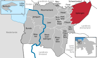
Упленген
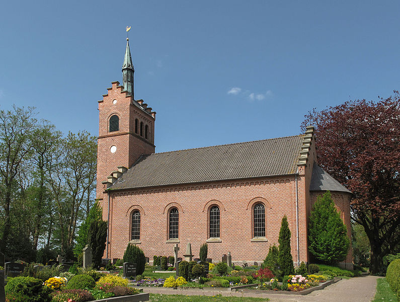
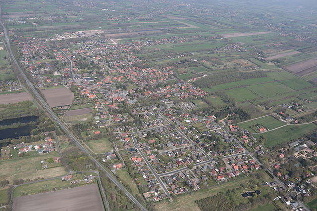
Hiking in Упленген
Uplengen is a small municipality located in Lower Saxony, Germany. While it may not be as widely known for hiking as some other regions, it does offer some picturesque landscapes and trails suitable for outdoor enthusiasts. Here are a few highlights regarding hiking in Uplengen:...
- Страна:
- Почтовый код: 26670
- Телефонный код: 04957; 04956; 04489
- Код автомобильного номера: LER
- Координаты: 53° 16' 0" N, 7° 45' 0" E
- GPS треки (wikiloc): [Ссылка]
- Высота над уровнем моря: 6 м m
- Площадь: 149 кв.км
- Население: 11805
- Веб сайт: [Ссылка]

Jümme
Hiking in Jümme
Jümme, located in Lower Saxony, Germany, is a pleasant region for hiking enthusiasts, offering a variety of landscapes and trails. The area is characterized by flat terrain, lush forests, picturesque fields, and charming small villages. Here are some highlights for hiking in Jümme:...
- Страна:
- Координаты: 53° 14' 0" N, 7° 38' 0" E
- GPS треки (wikiloc): [Ссылка]
- Население: 6628
- Веб сайт: [Ссылка]
Граничит с регионами:

Эмден
- город в Восточной Фризии в Германии
Hiking in Эмден
Emden, located in the northern part of Germany in the state of Lower Saxony, is not predominantly known for mountainous hiking trails but offers some charming walking and hiking opportunities. Here are some aspects to consider for hiking in and around Emden:...
- Страна:
- Почтовый код: 26725; 26723; 26721
- Телефонный код: 04924; 04927; 04921
- Код автомобильного номера: EMD
- Координаты: 53° 22' 1" N, 7° 12' 22" E
- GPS треки (wikiloc): [Ссылка]
- Высота над уровнем моря: 1 м m
- Площадь: 112.34 кв.км
- Население: 50486
- Веб сайт: [Ссылка]

Аурих
Hiking in Аурих
Aurich, located in the East Frisian region of Lower Saxony, Germany, is not as mountainous as other hiking destinations but offers a unique and picturesque setting for those who enjoy walking and exploring nature. Here are some aspects to consider when hiking in the Aurich district:...
- Страна:
- Код автомобильного номера: AUR; NOR
- Координаты: 53° 30' 0" N, 7° 19' 48" E
- GPS треки (wikiloc): [Ссылка]
- Высота над уровнем моря: 2 м m
- Площадь: 1287.00 кв.км
- Население: 190066
- Веб сайт: [Ссылка]

Виттмунд
Hiking in Виттмунд
Wittmund is a district in Lower Saxony, Germany, known for its picturesque landscapes, charming villages, and proximity to the North Sea. While it isn't famous for extensive hiking trails like some other regions in Germany, there are still plenty of opportunities for outdoor enthusiasts to explore the natural beauty of this area....
- Страна:
- Код автомобильного номера: WTM
- Координаты: 53° 34' 48" N, 7° 45' 0" E
- GPS треки (wikiloc): [Ссылка]
- Высота над уровнем моря: 1 м m
- Площадь: 656.65 кв.км
- Население: 56881
- Веб сайт: [Ссылка]


Фрисландия
- район в Германии
Hiking in Фрисландия
Friesland, a province in the northern Netherlands, offers a unique and beautiful landscape for hiking enthusiasts. Known for its picturesque lake districts, lush meadows, and iconic windmills, Friesland combines natural beauty with cultural heritage....
- Страна:
- Код автомобильного номера: FRI
- Координаты: 53° 30' 0" N, 8° 0' 0" E
- GPS треки (wikiloc): [Ссылка]
- Площадь: 608.00 кв.км
- Население: 97900
- Веб сайт: [Ссылка]

Эмсланд
Hiking in Эмсланд
Emsland, located in Lower Saxony, Germany, is a fantastic region for hiking enthusiasts. Known for its wide-open landscapes and rich natural beauty, Emsland offers a variety of trails that cater to hikers of all levels....
- Страна:
- Столица: Меппен
- Код автомобильного номера: EL
- Координаты: 52° 40' 12" N, 7° 15' 0" E
- GPS треки (wikiloc): [Ссылка]
- Высота над уровнем моря: 25 м m
- Площадь: 2882.07 кв.км
- Население: 321391
- Веб сайт: [Ссылка]


Клоппенбург
Hiking in Клоппенбург
Cloppenburg district, located in Lower Saxony, Germany, offers a variety of picturesque landscapes and natural beauty, making it a great destination for hiking enthusiasts. Here are some highlights and tips for hiking in the region:...
- Страна:
- Столица: Клоппенбург
- Код автомобильного номера: CLP
- Координаты: 52° 49' 48" N, 8° 0' 0" E
- GPS треки (wikiloc): [Ссылка]
- Высота над уровнем моря: 27 м m
- Площадь: 1418.00 кв.км
- Население: 165930
- Веб сайт: [Ссылка]

Аммерланд
Hiking in Аммерланд
Ammerland, located in Lower Saxony, Germany, is a scenic region known for its beautiful landscapes, lush greenery, and peaceful lakes. While it may not be as mountainous as other regions in Germany, it offers a variety of trails that are perfect for hiking enthusiasts of all levels. Here are some key aspects to consider when hiking in Ammerland:...
- Страна:
- Код автомобильного номера: WST
- Координаты: 53° 15' 0" N, 7° 55' 12" E
- GPS треки (wikiloc): [Ссылка]
- Высота над уровнем моря: 7 м m
- Площадь: 728.00 кв.км
- Население: 122698
- Веб сайт: [Ссылка]