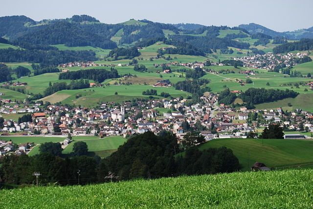
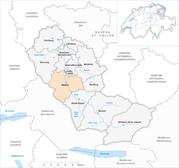
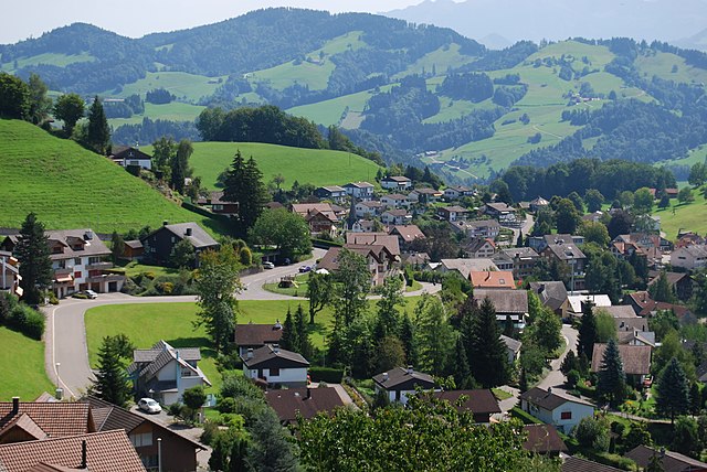
Лихтенштейг (Lichtensteig, Lichtensteig)

 Hiking in Лихтенштейг
Lichtensteig, a charming municipality in the canton of St. Gallen, Switzerland, offers a variety of hiking opportunities that cater to different skill levels and preferences. The area is characterized by its rolling hills, lush forests, and picturesque landscapes, making it an excellent destination for outdoor enthusiasts.
Hiking Trails
-
Lichtensteig to the Zofingergrat: This hike features a moderate trail that offers beautiful views of the surrounding region. It's approximately 10 km and can take around 3-4 hours to complete, depending on your pace. You’ll enjoy the scenic hills and valleys along the way.
-
Ruggen Mountain Trail: A popular route offering a more challenging hike that rewards you with panoramic views from the summit. This trail is often around 12-15 km and takes about 4-5 hours.
-
Alpstein Area: A short drive from Lichtensteig, the Alpstein region is renowned for its stunning alpine scenery and offers a variety of trails, from easy walks to more strenuous climbs.
Tips for Hiking in Lichtensteig
- Weather: Always check the weather conditions before setting out. The weather in the region can change rapidly.
- Gear: Wear sturdy hiking boots and bring appropriate clothing, as well as sufficient water and snacks.
- Maps and Navigation: While some trails are well-marked, it's a good idea to carry a map or a GPS device to ensure you stay on route.
- Local Flora and Fauna: Take a moment to enjoy the local wildlife and plant life. The area is rich in biodiversity.
- Respect Nature: Stick to marked trails and carry out all litter to preserve the area's natural beauty.
Additional Activities
In addition to hiking, Lichtensteig offers options for cycling, nature walks, and exploring local cultural attractions, including charming architecture and historical sites.
Whether you're looking for a leisurely stroll or a rigorous hike, Lichtensteig provides a wonderful setting to connect with nature and enjoy the breathtaking Swiss landscape.
- Страна:

- Почтовый код: 9620
- Телефонный код: 071
- Код автомобильного номера: SG
- Координаты: 47° 18' 59" N, 9° 4' 59" E


- GPS треки (wikiloc): [Ссылка]
- Высота над уровнем моря: 709 м m
- Площадь: 2.82 кв.км
- Население: 1871
- Веб сайт: http://www.lichtensteig.ch
- Википедия русская: wiki(ru)
- Википедия английская: wiki(en)
- Википедия национальная: wiki(de)
- Хранилище Wikidata: Wikidata: Q69274
- Катеория в википедии: [Ссылка]
- код Freebase: [/m/0gprfk]
- код GeoNames: Альт: [7286345]
- код VIAF: Альт: [152429215]
- ID отношения в OpenStreetMap: [1683902]
- код GND: Альт: [4392453-0]
- идентификатор местоположения ArchINFORM: [14123]
- код LCNAF: Альт: [n79040475]
- место в MusicBrainz: [11c8ad64-210b-4129-b60a-4734a2f88404]
- идентификатор HDS: [1384]
- код швейцарского муниципалитета: [3374]
Граничит с регионами:
Бючвиль
Hiking in Бючвиль
Bütschwil is a picturesque village located in the Canton of St. Gallen, Switzerland. It offers a range of hiking opportunities amidst stunning landscapes, rolling hills, and lush greenery. Here are some highlights for hiking in Bütschwil:...
- Страна:
- Почтовый код: 9606
- Телефонный код: 071
- Код автомобильного номера: SG
- Координаты: 47° 20' 59" N, 9° 4' 0" E
- GPS треки (wikiloc): [Ссылка]
- Высота над уровнем моря: 610 м m
- Площадь: 13.79 кв.км
- Веб сайт: [Ссылка]

Ваттвиль
Hiking in Ваттвиль
Wattwil, located in the Canton of St. Gallen in Switzerland, is a charming town surrounded by stunning landscapes, making it an excellent base for hiking enthusiasts. The region offers a variety of trails that cater to different skill levels, from easy walks to more challenging hikes....
- Страна:
- Почтовый код: 9630
- Телефонный код: 071
- Код автомобильного номера: SG
- Координаты: 47° 17' 58" N, 9° 5' 8" E
- GPS треки (wikiloc): [Ссылка]
- Высота над уровнем моря: 610 м m
- Площадь: 51.25 кв.км
- Население: 8713
- Веб сайт: [Ссылка]

Оберхельфеншвиль
Hiking in Оберхельфеншвиль
Oberhelfenschwil is a charming village located in the canton of St. Gallen, Switzerland. It is an ideal spot for hiking enthusiasts due to its picturesque landscapes, varied terrain, and well-marked trails. Here’s an overview of what you can expect when hiking in and around Oberhelfenschwil:...
- Страна:
- Почтовый код: 9621
- Телефонный код: 071
- Код автомобильного номера: SG
- Координаты: 47° 20' 43" N, 9° 6' 42" E
- GPS треки (wikiloc): [Ссылка]
- Высота над уровнем моря: 792 м m
- Площадь: 12.68 кв.км
- Население: 1267
- Веб сайт: [Ссылка]