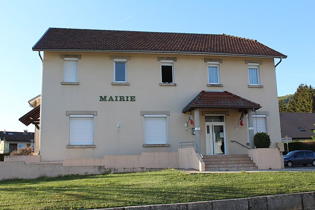
Лоньё (Lompnieu, Lompnieu)
- коммуна во Франции
 Hiking in Лоньё
Lompnieu is a charming village located in the Auvergne-Rhône-Alpes region of France, nestled in the beautiful Jura mountains. This area offers stunning landscapes, lush forests, and a variety of trails that cater to hikers of all levels. Here are some key points about hiking in Lompnieu:
Scenic Trails
-
Diverse Terrain: The trails around Lompnieu vary from gentle walks suitable for families to more challenging routes for experienced hikers. The terrain includes wooded areas, rocky paths, and expansive views of the surrounding valleys.
-
Circular Routes: Many trails are circular, allowing hikers to explore different landscapes without retracing their steps. Look for well-marked paths that guide you through picturesque villages and natural parks.
Points of Interest
-
Natural Landmarks: Hiking in this region often includes opportunities to see local flora and fauna, waterfalls, and striking rock formations. The Jura mountains are known for their unique geology, which can be fascinating to explore.
-
Cultural Stops: Along the way, you might encounter charming local architecture, historic sites, and small cafés or restaurants where you can taste local specialties.
Preparations
-
Gear: Make sure to wear comfortable hiking shoes and dress in layers, as the weather can change quickly in the mountains. Bringing a map or a GPS device is advisable to navigate the trails.
-
Safety: Always inform someone of your hiking plans, especially if you are venturing alone or on less trafficked trails. Carry essentials like water, snacks, a first-aid kit, and a fully charged mobile phone.
-
Seasonal Considerations: The best times for hiking in Lompnieu are typically from late spring to early autumn when the weather is milder and the trails are more accessible. Snow may cover some trails in winter, which would require proper gear if you choose to explore during that time.
Local Resources
- Tourist Information: Visit the local tourist office for maps, trail conditions, and recommendations for the best hikes based on your skill level.
- Guided Tours: If you’re unfamiliar with the area, consider joining a guided hiking tour to learn more about the region's geology, flora and fauna, and history.
Overall, hiking in Lompnieu offers a delightful experience for those looking to connect with nature and explore the beauty of the Jura mountains. Enjoy your hike!
- Страна:

- Почтовый код: 01260
- Координаты: 45° 57' 42" N, 5° 39' 39" E


- GPS треки (wikiloc): [Ссылка]
- Площадь: 11.35 кв.км
- Население: 113
- Веб сайт: http://www.lompnieu.fr
- Википедия русская: wiki(ru)
- Википедия английская: wiki(en)
- Википедия национальная: wiki(fr)
- Хранилище Wikidata: Wikidata: Q271289
- Катеория в википедии: [Ссылка]
- Карты в википедии: [Ссылка]
- код Freebase: [/m/081672]
- код Freebase: [/m/081672]
- код GeoNames: Альт: [6424573]
- код GeoNames: Альт: [6424573]
- номер SIREN: [210102216]
- номер SIREN: [210102216]
- код VIAF: Альт: [246283278]
- код VIAF: Альт: [246283278]
- код муниципалитета INSEE: 01221
- код муниципалитета INSEE: 01221
Граничит с регионами:

Шампань-ан-Вальроме
- коммуна во Франции
Hiking in Шампань-ан-Вальроме
Champagne-en-Valromey is a charming commune located in the Ain department in the Auvergne-Rhône-Alpes region of France. This area is known for its splendid natural landscapes, making it a great destination for hiking enthusiasts....
- Страна:
- Почтовый код: 01260
- Координаты: 45° 54' 16" N, 5° 40' 39" E
- GPS треки (wikiloc): [Ссылка]
- Площадь: 18.16 кв.км
- Население: 819
- Веб сайт: [Ссылка]
Haut-Valromey
Hiking in Haut-Valromey
Haut-Valromey is a beautiful region located in the French Alps, known for its stunning landscapes and outdoor activities, particularly hiking. Here are some key points to consider if you plan to hike in Haut-Valromey:...
- Страна:
- Почтовый код: 01260
- Координаты: 45° 59' 51" N, 5° 41' 42" E
- GPS треки (wikiloc): [Ссылка]
- Площадь: 107.85 кв.км
- Веб сайт: [Ссылка]

Кормаранш-ан-Бюже
- коммуна во Франции
Hiking in Кормаранш-ан-Бюже
Cormaranche-en-Bugey is a charming village located in the Bugey region of the Auvergne-Rhône-Alpes in France. It's known for its beautiful landscapes, lush greenery, and a variety of outdoor activities, making it a great destination for hiking enthusiasts....
- Страна:
- Почтовый код: 01110
- Координаты: 45° 57' 11" N, 5° 36' 40" E
- GPS треки (wikiloc): [Ссылка]
- Площадь: 18.92 кв.км
- Население: 803
- Веб сайт: [Ссылка]

Отвиль-Лоннес
- коммуна во Франции
Hiking in Отвиль-Лоннес
Hauteville-Lompnes, located in the Ain department of the Auvergne-Rhône-Alpes region in France, is a stunning destination for hiking enthusiasts. Nestled in the foothills of the Alps, it offers a variety of trails ranging from easy walks to more challenging hikes, making it suitable for hikers of all experience levels....
- Страна:
- Почтовый код: 01110
- Координаты: 45° 58' 44" N, 5° 35' 58" E
- GPS треки (wikiloc): [Ссылка]
- Площадь: 50.34 кв.км
- Население: 3739
- Веб сайт: [Ссылка]

Сютриё
- коммуна во Франции
Hiking in Сютриё
Sutrieu, located in the Ain department of the Auvergne-Rhône-Alpes region in France, is known for its beautiful natural landscapes and hiking opportunities. The area is characterized by rolling hills, forests, and panoramic views, making it a great destination for outdoor enthusiasts....
- Страна:
- Почтовый код: 01260
- Координаты: 45° 57' 5" N, 5° 39' 32" E
- GPS треки (wikiloc): [Ссылка]
- Площадь: 19.05 кв.км
- Население: 211

Рюфьё
- коммуна во Франции
Hiking in Рюфьё
Ruffieu is a charming village located in the Ain department of the Auvergne-Rhône-Alpes region in France. It’s nestled in the picturesque landscapes of the Jura mountains, offering a variety of hiking opportunities that cater to different levels of experience....
- Страна:
- Почтовый код: 01260
- Координаты: 45° 59' 39" N, 5° 39' 48" E
- GPS треки (wikiloc): [Ссылка]
- Площадь: 14.03 кв.км
- Население: 182
- Веб сайт: [Ссылка]

Сонжьё
- коммуна во Франции
Hiking in Сонжьё
It seems there might be a typo in your query as there is no widely recognized hiking destination by the name of "Songieu." However, if you meant "Sonjieu," "Songyue," or a similar location, I can still provide general information about hiking in various regions or help with hiking tips and trails in any well-known national parks or hiking areas....
- Страна:
- Почтовый код: 01260
- Координаты: 45° 58' 24" N, 5° 42' 8" E
- GPS треки (wikiloc): [Ссылка]
- Площадь: 20.58 кв.км
- Население: 128