Луфтенберг-на-Дунае (Luftenberg an der Donau, Luftenberg an der Donau)
 Hiking in Луфтенберг-на-Дунае
Luftenberg an der Donau is a picturesque village located in Austria, along the beautiful Danube River. The area offers a variety of hiking opportunities, showcasing stunning landscapes, historical sites, and well-marked trails suited for various skill levels.
Hiking Trails:
-
Danube River Path (Donauradweg): This famous trail runs alongside the Danube River and is part of a larger network extending through several countries. It offers a mix of comfortable walking paths and more challenging segments, allowing hikers to enjoy views of the river, lush landscapes, and charming villages.
-
Local Nature Trails: There are several local trails that take you through the scenic countryside surrounding Luftenberg. These paths often lead through vineyards, forests, and meadows, providing hikers with a taste of the region's natural beauty.
-
Hills and Forests: The hills around Luftenberg offer various hiking options. Trails can take you up into the wooded areas, where you can enjoy quiet walks and perhaps spot local wildlife.
-
Cultural Hikes: Some trails may include stops at historical sites or scenic viewpoints, allowing hikers to blend nature appreciation with cultural exploration. Don’t miss nearby landmarks such as the parish church or ruins of historical buildings.
Tips for Hiking in Luftenberg:
- Maps and Signage: Make sure to have a good map or GPS device, as trails may not always be well-marked. Local tourism offices can provide useful trail maps.
- Weather Preparedness: The weather in Austria can change quickly, so check forecasts and be prepared with appropriate gear.
- Stay Hydrated and Fueled: Always bring enough water and snacks, especially on longer hikes, as options may be limited in more remote areas.
- Respect Nature: Follow Leave No Trace principles, staying on paths to protect the natural environment.
Local Amenities:
After a day of hiking, you can explore local restaurants or cafes in Luftenberg, where you can enjoy traditional Austrian cuisine, often featuring local ingredients.
Overall, hiking in Luftenberg an der Donau offers a lovely blend of nature, culture, and tranquil beauty, making it a wonderful choice for outdoor enthusiasts.
- Страна:

- Почтовый код: 4225
- Телефонный код: 07237
- Код автомобильного номера: PE
- Координаты: 48° 16' 32" N, 14° 25' 45" E


- GPS треки (wikiloc): [Ссылка]
- Высота над уровнем моря: 295 м m
- Площадь: 16.86 кв.км
- Население: 4057
- Веб сайт: http://www.luftenberg.at/
- Википедия русская: wiki(ru)
- Википедия английская: wiki(en)
- Википедия национальная: wiki(de)
- Хранилище Wikidata: Wikidata: Q677951
- Катеория в википедии: [Ссылка]
- код Freebase: [/m/03gv7d8]
- код GeoNames: Альт: [2772213]
- код VIAF: Альт: [150994925]
- код GND: Альт: [4485224-1]
- код LCNAF: Альт: [no00088645]
- код австрийского муниципалитета: [41110]
Граничит с регионами:

Санкт-Георген-на-Гузене
Hiking in Санкт-Георген-на-Гузене
Sankt Georgen an der Gusen is a picturesque town located in Austria, known for its historical significance and beautiful landscapes. While it may not be as popular as some other hiking destinations in the region, it offers a variety of trails and outdoor activities for hiking enthusiasts....
- Страна:
- Телефонный код: 07237
- Код автомобильного номера: PE
- Координаты: 48° 16' 18" N, 14° 26' 54" E
- GPS треки (wikiloc): [Ссылка]
- Высота над уровнем моря: 262 м m
- Площадь: 7.12 кв.км
- Население: 4119
- Веб сайт: [Ссылка]

Энс
- город в Федеральной земле Верхняя Австрия
Hiking in Энс
Enns, a town in Austria, is situated in the stunning region of Upper Austria and is known for its rich history and beautiful landscapes. While it may not be as prominent as some larger tourist destinations, it offers a fantastic opportunity for hiking and enjoying nature in a more tranquil setting. Here are some aspects to consider if you're interested in hiking around Enns:...
- Страна:
- Почтовый код: 4470
- Телефонный код: 07223
- Код автомобильного номера: LL
- Координаты: 48° 13' 0" N, 14° 28' 30" E
- GPS треки (wikiloc): [Ссылка]
- Высота над уровнем моря: 281 м m
- Площадь: 33.27 кв.км
- Население: 11523
- Веб сайт: [Ссылка]

Линц
- административный центр федеральной земли Верхняя Австрия
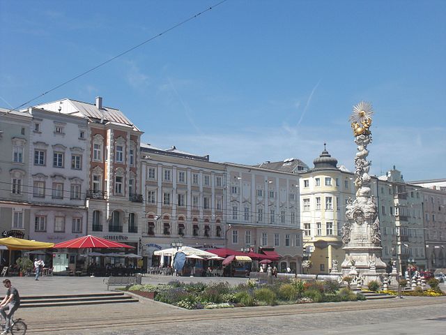
Hiking in Линц
Linz, the third-largest city in Austria, offers a variety of beautiful hiking opportunities in and around the area. Here are some highlights for hiking in and around Linz:...
- Страна:
- Почтовый код: 4030–4039; 4020–4029; 4040–4049; 4010
- Телефонный код: 0732
- Код автомобильного номера: L
- Координаты: 48° 18' 0" N, 14° 17' 0" E
- GPS треки (wikiloc): [Ссылка]
- Высота над уровнем моря: 261 м m
- Площадь: 95.99 кв.км
- Население: 204846
- Веб сайт: [Ссылка]

Энгервицдорф
Hiking in Энгервицдорф
Engerwitzdorf, located in Austria, offers a variety of scenic hiking opportunities for both casual walkers and more experienced hikers. The region is characterized by its picturesque landscapes, lush forests, and rolling hills, making it an ideal destination for nature lovers....
- Страна:
- Почтовый код: 4209
- Телефонный код: 0 72 35
- Код автомобильного номера: UU
- Координаты: 48° 20' 23" N, 14° 25' 32" E
- GPS треки (wikiloc): [Ссылка]
- Высота над уровнем моря: 333 м m
- Площадь: 41.09 кв.км
- Население: 8790
- Веб сайт: [Ссылка]

Лангенштайн
Hiking in Лангенштайн
Langenstein, a picturesque village in Austria, offers numerous opportunities for hiking enthusiasts. Nestled in the scenic landscapes of Styria, it provides access to lush forests, rolling hills, and stunning mountain views. Here’s a general overview of hiking in the area:...
- Страна:
- Телефонный код: 07237
- Код автомобильного номера: PE
- Координаты: 48° 15' 31" N, 14° 27' 51" E
- GPS треки (wikiloc): [Ссылка]
- Высота над уровнем моря: 245 м m
- Площадь: 12.36 кв.км
- Население: 2534
- Веб сайт: [Ссылка]

Астен
Hiking in Астен
Asten, located in Upper Austria, is surrounded by beautiful landscapes that are ideal for hiking. The region features rolling hills, lush forests, and picturesque views of the nearby mountains, making it a great destination for outdoor enthusiasts....
- Страна:
- Почтовый код: 4481
- Телефонный код: 07224
- Код автомобильного номера: LL
- Координаты: 48° 13' 0" N, 14° 25' 0" E
- GPS треки (wikiloc): [Ссылка]
- Высота над уровнем моря: 255 м m
- Площадь: 8.48 кв.км
- Население: 6613
- Веб сайт: [Ссылка]