
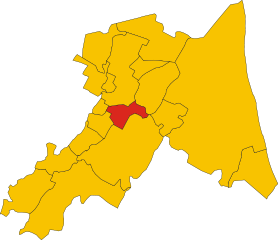
Луго (Lugo, Lugo)
.svg)
- коммуна в Италии
 Hiking in Луго
Lugo, located in the Emilia-Romagna region of Italy, is known for its rich history and beautiful landscapes. While it's not a prominent hiking destination compared to some other areas in Emilia-Romagna, there are still some enjoyable hiking opportunities in and around Lugo.
Key Features of Hiking in Lugo:
-
Countryside Trails: The area around Lugo has picturesque rural landscapes. You can find several small trails that meander through fields, orchards, and vineyards, showcasing the authentic Italian countryside.
-
Natural Parks Nearby: While Lugo itself might not have large hiking trails, it is close to several natural parks and reserves. For instance, the Parco del Delta del Po is about an hour's drive away and offers various hiking opportunities along with a chance to see diverse wildlife in the delta area.
-
Historical Walks: Lugo has a rich history, and walking through its streets can feel like a hike through time. You can explore historic sites such as the Rocca Estense and the city's lovely gardens and piazzas.
-
Local Festivals and Events: Depending on the time of year, you might coincide your visit with local events or festivals that could involve outdoor activities, small guided hikes, or excursions to nearby attractions.
-
Flat Terrain: The region is predominantly flat, which makes hiking accessible to people of all skill levels. The lack of steep ascents means you can enjoy leisurely walks with scenic views.
Recommended Hiking Tips:
-
Find Local Guides: If you're unfamiliar with the area, consider hiring a local guide or joining a hiking group to explore the best trails and hidden gems.
-
Check Weather Conditions: Emilia-Romagna experiences varied weather, so plan your hikes accordingly. Spring and early autumn are usually the best times for hiking.
-
Get Local Maps: Before starting your hike, get a detailed map of the area. Local tourist offices can provide useful resources.
-
Stay Hydrated and Prepared: Always carry water, snacks, and sunscreen, even for short hikes.
In summary, while Lugo may not be the most renowned hiking destination, its beautiful surroundings and close proximity to natural parks provide ample opportunity for outdoor enthusiasts to enjoy the scenery and the local culture.
- Страна:

- Почтовый код: 48022
- Телефонный код: 0545
- Код автомобильного номера: RA
- Координаты: 44° 25' 0" N, 11° 55' 0" E


- GPS треки (wikiloc): [Ссылка]
- Высота над уровнем моря: 15 м m
- Площадь: 117.06 кв.км
- Население: 32317
- Веб сайт: http://www.comune.lugo.ra.it
- Википедия русская: wiki(ru)
- Википедия английская: wiki(en)
- Википедия национальная: wiki(it)
- Хранилище Wikidata: Wikidata: Q52983
- Катеория в википедии: [Ссылка]
- код Freebase: [/m/0g9b1v]
- код GeoNames: Альт: [6540435]
- код VIAF: Альт: [154661404]
- ID отношения в OpenStreetMap: [43140]
- код GND: Альт: [4365722-9]
- место в MusicBrainz: [7b4cd8de-0b38-43fd-859c-32231e38385a]
- UN/LOCODE: [ITZMO]
- код ISTAT: 039012
- кадастровый код Италии: E730
Граничит с регионами:
Альфонсине
- коммуна Италии
Hiking in Альфонсине
Alfonsine is a small town located in the Emilia-Romagna region of Italy, known more for its agricultural landscape than for traditional hiking trails. However, that doesn't mean there aren't beautiful opportunities for outdoor activities in the surrounding areas....
- Страна:
- Почтовый код: 48011
- Телефонный код: 0544
- Код автомобильного номера: RA
- Координаты: 44° 30' 22" N, 12° 2' 28" E
- GPS треки (wikiloc): [Ссылка]
- Высота над уровнем моря: 6 м m
- Площадь: 106.79 кв.км
- Население: 11953
- Веб сайт: [Ссылка]


Баньякавалло
- коммуна Италии
Hiking in Баньякавалло
Bagnacavallo is a charming town in the Emilia-Romagna region of Italy, known for its historical architecture, rich culture, and proximity to the beautiful countryside. While Bagnacavallo itself isn't primarily known for hiking, there are some lovely trails and outdoor activities in the surrounding areas that can provide a great hiking experience....
- Страна:
- Почтовый код: 48012
- Телефонный код: 0545
- Код автомобильного номера: RA
- Координаты: 44° 25' 1" N, 11° 58' 34" E
- GPS треки (wikiloc): [Ссылка]
- Высота над уровнем моря: 12 м m
- Площадь: 79.58 кв.км
- Население: 16780
- Веб сайт: [Ссылка]
Баньяра-ди-Романья
- коммуна Италии
Hiking in Баньяра-ди-Романья
Bagnara di Romagna, located in the Emilia-Romagna region of Italy, is a small town that offers a variety of hiking opportunities for outdoor enthusiasts. While it's not as well-known for hiking as some other areas in Italy, its proximity to the Apennine Mountains provides access to beautiful trails and stunning landscapes....
- Страна:
- Почтовый код: 48010
- Телефонный код: 0545
- Код автомобильного номера: RA
- Координаты: 44° 23' 0" N, 11° 50' 0" E
- GPS треки (wikiloc): [Ссылка]
- Высота над уровнем моря: 22 м m
- Площадь: 9.96 кв.км
- Население: 2439
- Веб сайт: [Ссылка]
Конселиче
- коммуна Италии
Hiking in Конселиче
Conselice, located in the Emilia-Romagna region of Italy, is not widely known as a hiking destination compared to more mountainous areas of the country. However, it does offer some interesting opportunities for those looking to explore the outdoors in a serene, rural setting....
- Страна:
- Почтовый код: 48017
- Телефонный код: 0545
- Код автомобильного номера: RA
- Координаты: 44° 31' 0" N, 11° 50' 0" E
- GPS треки (wikiloc): [Ссылка]
- Высота над уровнем моря: 9 м m
- Площадь: 60.20 кв.км
- Население: 9779
- Веб сайт: [Ссылка]

Котиньола
- коммуна Италии
Hiking in Котиньола
Cotignola is a small town in the region of Emilia-Romagna in Italy, located near the larger city of Ravenna. While it may not be a traditional hiking destination like the Dolomites or the Apennines, the area around Cotignola offers a network of trails and beautiful landscapes that can be appealing for outdoor enthusiasts....
- Страна:
- Почтовый код: 48010
- Телефонный код: 0545
- Код автомобильного номера: RA
- Координаты: 44° 23' 0" N, 11° 56' 0" E
- GPS треки (wikiloc): [Ссылка]
- Высота над уровнем моря: 19 м m
- Площадь: 35.14 кв.км
- Население: 7479
- Веб сайт: [Ссылка]


Фузиньяно
- коммуна Италии
Hiking in Фузиньяно
Fusignano is a charming municipality located in the Emilia-Romagna region of Italy. While it may not be as widely known as other hiking destinations in the region, it offers a variety of trails and scenic landscapes that are ideal for nature lovers and outdoor enthusiasts....
- Страна:
- Почтовый код: 48010
- Телефонный код: 0545
- Код автомобильного номера: RA
- Координаты: 44° 28' 0" N, 11° 57' 0" E
- GPS треки (wikiloc): [Ссылка]
- Высота над уровнем моря: 9 м m
- Площадь: 24.55 кв.км
- Население: 8164
- Веб сайт: [Ссылка]
Масса-Ломбарда
- коммуна Италии
Hiking in Масса-Ломбарда
Massa Lombarda, located in the Emilia-Romagna region of Italy, is not predominantly known as a hiking destination compared to other areas in Italy. However, the surrounding countryside offers some scenic walks and opportunities for exploration....
- Страна:
- Почтовый код: 48024
- Телефонный код: 0545
- Код автомобильного номера: RA
- Координаты: 44° 27' 0" N, 11° 49' 0" E
- GPS треки (wikiloc): [Ссылка]
- Высота над уровнем моря: 13 м m
- Площадь: 37.25 кв.км
- Население: 10646
- Веб сайт: [Ссылка]


Сант'Агата-суль-Сантерно
- коммуна Италии
Hiking in Сант'Агата-суль-Сантерно
Sant'Agata sul Santerno is a quaint village located in the Emilia-Romagna region of Italy, surrounded by beautiful landscapes that are perfect for hiking enthusiasts. While the area itself may not be as famous as other hiking destinations in Italy, it offers a variety of scenic trails that cater to different skill levels....
- Страна:
- Почтовый код: 48020
- Телефонный код: 0545
- Код автомобильного номера: RA
- Координаты: 44° 26' 0" N, 11° 52' 0" E
- GPS треки (wikiloc): [Ссылка]
- Высота над уровнем моря: 14 м m
- Площадь: 9.37 кв.км
- Население: 2918
- Веб сайт: [Ссылка]
Мордано
- коммуна Италии
Hiking in Мордано
Mordano, located in the Emilia-Romagna region of Italy, is not typically known as a major hiking destination compared to more mountainous areas of Italy, but it does offer some pleasant trails and beautiful landscapes for outdoor enthusiasts....
- Страна:
- Почтовый код: 40027
- Телефонный код: 0542
- Код автомобильного номера: BO
- Координаты: 44° 24' 0" N, 11° 49' 0" E
- GPS треки (wikiloc): [Ссылка]
- Высота над уровнем моря: 21 м m
- Площадь: 21.45 кв.км
- Население: 4692
- Веб сайт: [Ссылка]