
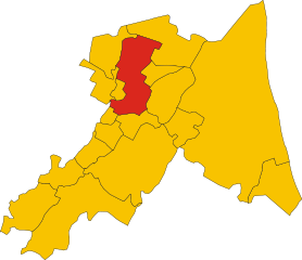
Масса-Ломбарда (Massa Lombarda, Massa Lombarda)
.svg)
- коммуна Италии
 Hiking in Масса-Ломбарда
Massa Lombarda, located in the Emilia-Romagna region of Italy, is not predominantly known as a hiking destination compared to other areas in Italy. However, the surrounding countryside offers some scenic walks and opportunities for exploration.
Hiking Opportunities in Massa Lombarda and Surrounding Areas
-
Countryside Trails: The flat, fertile landscape around Massa Lombarda is characterized by agricultural fields, vineyards, and small woods. You can enjoy leisurely walks or bike rides through these rural paths, making it a great area for a relaxing outing.
-
Bologna Hills: A short distance away lies the Bologna region, which includes the Bolognese hills. This area features more varied terrain and provides a range of hiking options, including paths that lead to panoramic views, ancient ruins, and charming villages.
-
The Po Delta: To the east, the Po Delta National Park offers unique landscapes and rich biodiversity. You can hike or explore with guided tours, experiencing wetlands, woodlands, and a variety of wildlife, particularly birds.
-
Cultural and Historical Trails: While not traditional hiking paths, walking in local towns and cities like Faenza or Imola, not far from Massa Lombarda, can provide a different type of hiking experience combined with cultural exploration. You can visit historical sites, museums, and local eateries along the way.
Tips for Hiking in the Area
-
Choose the Right Time: Spring and early autumn are ideal for hiking in this region, as temperatures are mild and the landscape is particularly beautiful.
-
Footwear and Gear: Even on flat terrain, comfortable footwear is essential. If you venture into the hills or the delta, consider more rugged hiking shoes and appropriate gear.
-
Stay Hydrated: Carry enough water, especially during warmer months, as rural areas may lack readily available facilities.
-
Check Local Maps: Always have a local map or GPS app on hand, as trails may not always be well-marked, particularly in less populated areas.
-
Respect Nature: Follow local guidelines regarding nature conservation and be sure to leave no trace.
While Massa Lombarda may not be a well-known hiking hotspot, it offers nearby opportunities for those looking to enjoy the outdoors in a picturesque Italian setting. If you're looking for more strenuous hikes, consider traveling to nearby regions with more rugged terrains.
- Страна:

- Почтовый код: 48024
- Телефонный код: 0545
- Код автомобильного номера: RA
- Координаты: 44° 27' 0" N, 11° 49' 0" E


- GPS треки (wikiloc): [Ссылка]
- Высота над уровнем моря: 13 м m
- Площадь: 37.25 кв.км
- Население: 10646
- Веб сайт: http://www.comune.massalombarda.ra.it/
- Википедия русская: wiki(ru)
- Википедия английская: wiki(en)
- Википедия национальная: wiki(it)
- Хранилище Wikidata: Wikidata: Q52984
- Катеория в википедии: [Ссылка]
- код Freebase: [/m/0gkjpr]
- код GeoNames: Альт: [6536753]
- код VIAF: Альт: [159434579]
- ID отношения в OpenStreetMap: [43155]
- код GND: Альт: [4518522-0]
- место в MusicBrainz: [f386109c-d47d-4fd2-bf5f-547af1a01a5a]
- UN/LOCODE: [ITMSL]
- код ISTAT: 039013
- кадастровый код Италии: F029
Граничит с регионами:


Имола
- город и коммуна в Италии
Hiking in Имола
Hiking in Imola can be a delightful experience, especially for those who appreciate the beautiful landscapes and rich history of the Emilia-Romagna region in Italy. While Imola is primarily known for its motorsport scene, including the famous Autodromo Enzo e Dino Ferrari, the surrounding areas offer various hiking opportunities....
- Страна:
- Почтовый код: 40026
- Телефонный код: 0542
- Код автомобильного номера: BO
- Координаты: 44° 21' 12" N, 11° 42' 52" E
- GPS треки (wikiloc): [Ссылка]
- Высота над уровнем моря: 47 м m
- Площадь: 205.02 кв.км
- Население: 69951
- Веб сайт: [Ссылка]
Конселиче
- коммуна Италии
Hiking in Конселиче
Conselice, located in the Emilia-Romagna region of Italy, is not widely known as a hiking destination compared to more mountainous areas of the country. However, it does offer some interesting opportunities for those looking to explore the outdoors in a serene, rural setting....
- Страна:
- Почтовый код: 48017
- Телефонный код: 0545
- Код автомобильного номера: RA
- Координаты: 44° 31' 0" N, 11° 50' 0" E
- GPS треки (wikiloc): [Ссылка]
- Высота над уровнем моря: 9 м m
- Площадь: 60.20 кв.км
- Население: 9779
- Веб сайт: [Ссылка]

Луго
- коммуна в Италии
Hiking in Луго
Lugo, located in the Emilia-Romagna region of Italy, is known for its rich history and beautiful landscapes. While it's not a prominent hiking destination compared to some other areas in Emilia-Romagna, there are still some enjoyable hiking opportunities in and around Lugo....
- Страна:
- Почтовый код: 48022
- Телефонный код: 0545
- Код автомобильного номера: RA
- Координаты: 44° 25' 0" N, 11° 55' 0" E
- GPS треки (wikiloc): [Ссылка]
- Высота над уровнем моря: 15 м m
- Площадь: 117.06 кв.км
- Население: 32317
- Веб сайт: [Ссылка]


Сант'Агата-суль-Сантерно
- коммуна Италии
Hiking in Сант'Агата-суль-Сантерно
Sant'Agata sul Santerno is a quaint village located in the Emilia-Romagna region of Italy, surrounded by beautiful landscapes that are perfect for hiking enthusiasts. While the area itself may not be as famous as other hiking destinations in Italy, it offers a variety of scenic trails that cater to different skill levels....
- Страна:
- Почтовый код: 48020
- Телефонный код: 0545
- Код автомобильного номера: RA
- Координаты: 44° 26' 0" N, 11° 52' 0" E
- GPS треки (wikiloc): [Ссылка]
- Высота над уровнем моря: 14 м m
- Площадь: 9.37 кв.км
- Население: 2918
- Веб сайт: [Ссылка]
Мордано
- коммуна Италии
Hiking in Мордано
Mordano, located in the Emilia-Romagna region of Italy, is not typically known as a major hiking destination compared to more mountainous areas of Italy, but it does offer some pleasant trails and beautiful landscapes for outdoor enthusiasts....
- Страна:
- Почтовый код: 40027
- Телефонный код: 0542
- Код автомобильного номера: BO
- Координаты: 44° 24' 0" N, 11° 49' 0" E
- GPS треки (wikiloc): [Ссылка]
- Высота над уровнем моря: 21 м m
- Площадь: 21.45 кв.км
- Население: 4692
- Веб сайт: [Ссылка]