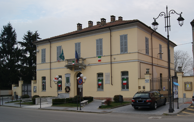
Лунгавилла (Lungavilla, Lungavilla)
.svg)
- коммуна Италии
 Hiking in Лунгавилла
Lungavilla is a charming village located in the province of Pavia in Lombardy, Italy. It’s surrounded by beautiful landscapes, including rolling hills, vineyards, and the serene countryside, which makes it a delightful spot for hiking enthusiasts. Here are some highlights and tips for hiking in and around Lungavilla:
Hiking Trails
-
Local Trails: There are several well-marked trails around Lungavilla that vary in difficulty. These trails often offer varying terrains, such as gentle slopes and more challenging paths, allowing hikers of all levels to enjoy the scenic beauty.
-
Vineyard Walks: Given the area’s reputation for wine production, some routes take hikers through picturesque vineyards, providing a unique opportunity to enjoy local wine culture while taking in the views.
-
Nature Reserves: The nearby regional parks and nature reserves, like the Parco Regionale della Valle del Ticino, offer extensive hiking options. These parks have diverse flora and fauna, scenic river views, and picnic areas.
What to Bring
- Appropriate Footwear: Sturdy hiking boots are essential for comfort and to prevent injuries on uneven terrain.
- Water and Snacks: Always carry sufficient water and high-energy snacks to keep your energy levels up during the hike.
- Map or GPS Device: While many trails are marked, having a map or GPS device can help keep you on track.
- Sun Protection: Hats, sunglasses, and sunscreen are important, especially during warmer months.
Best Times to Hike
- Spring and Fall: The weather is usually mild and pleasant, with blooming flowers in spring and beautiful autumn colors.
- Avoiding the Heat: Summer can be hot, so it’s wise to hike early in the morning or later in the afternoon.
Additional Tips
- Local Guides: Consider hiring a local guide for a more enriching experience. They can provide insights into the area’s history, culture, and natural features.
- Respect Nature: Follow the Leave No Trace principles, keeping the environment clean and respecting wildlife.
Hiking in Lungavilla offers a great way to immerse yourself in the natural beauty of the Lombardy region, making for a memorable outdoor experience.
- Страна:

- Почтовый код: 27053
- Телефонный код: 0383
- Код автомобильного номера: PV
- Координаты: 45° 2' 0" N, 9° 5' 0" E


- GPS треки (wikiloc): [Ссылка]
- Высота над уровнем моря: 74 м m
- Площадь: 6.82 кв.км
- Население: 2433
- Веб сайт: http://www.comune.lungavilla.pv.it
- Википедия русская: wiki(ru)
- Википедия английская: wiki(en)
- Википедия национальная: wiki(it)
- Хранилище Wikidata: Wikidata: Q40940
- Катеория в википедии: [Ссылка]
- код Freebase: [/m/0gjjmz]
- код GeoNames: Альт: [6540359]
- ID отношения в OpenStreetMap: [44022]
- UN/LOCODE: [ITLGL]
- код ISTAT: 018084
- кадастровый код Италии: B387
Граничит с регионами:

Пиццале
- коммуна Италии
Hiking in Пиццале
Pizzale is a small village located in the Province of Pavia, Lombardy, Italy, and it serves as a gateway to scenic hiking trails in the surrounding regions, including the Val d'Ossola and the nearby hills of the Oltrepò Pavese. Here’s what you need to know about hiking in the area:...
- Страна:
- Почтовый код: 27050
- Телефонный код: 0383
- Код автомобильного номера: PV
- Координаты: 45° 2' 19" N, 9° 3' 0" E
- GPS треки (wikiloc): [Ссылка]
- Высота над уровнем моря: 728 м m
- Площадь: 7.09 кв.км
- Население: 722
- Веб сайт: [Ссылка]


Кастеллетто-ди-Брандуццо
- коммуна Италии
Hiking in Кастеллетто-ди-Брандуццо
Castelletto di Branduzzo is a small town located in the Lombardy region of Italy, nestled within the beautiful landscapes of the Oltrepò Pavese area. While it may not be as widely known as some larger hiking destinations, it offers a charming escape for hikers looking to enjoy the natural beauty of Northern Italy....
- Страна:
- Почтовый код: 27040
- Телефонный код: 0383
- Код автомобильного номера: PV
- Координаты: 45° 4' 0" N, 9° 6' 0" E
- GPS треки (wikiloc): [Ссылка]
- Высота над уровнем моря: 70 м m
- Площадь: 11.77 кв.км
- Население: 1082
- Веб сайт: [Ссылка]
Верретто
- коммуна Италии
Hiking in Верретто
It seems there might be a bit of confusion. As of my last knowledge update in October 2023, there's no well-known hiking destination called "Verretto." It's possible that it may refer to a lesser-known area, a new trail, or a local nickname....
- Страна:
- Почтовый код: 27053
- Телефонный код: 0383
- Код автомобильного номера: PV
- Координаты: 45° 3' 0" N, 9° 8' 0" E
- GPS треки (wikiloc): [Ссылка]
- Высота над уровнем моря: 74 м m
- Площадь: 2.71 кв.км
- Население: 384
- Веб сайт: [Ссылка]


Вогера
- коммуна Италии
Hiking in Вогера
Voghera, located in the Lombardy region of Italy, is surrounded by picturesque landscapes that offer various hiking opportunities. While Voghera itself is a small city, its proximity to the Oltrepò Pavese hills and other natural areas makes it a great starting point for outdoor enthusiasts....
- Страна:
- Почтовый код: 27058
- Телефонный код: 0383
- Код автомобильного номера: PV
- Координаты: 44° 59' 33" N, 9° 0' 33" E
- GPS треки (wikiloc): [Ссылка]
- Высота над уровнем моря: 96 м m
- Площадь: 63.44 кв.км
- Население: 39354
- Веб сайт: [Ссылка]


Кастеджо
- коммуна Италии
Hiking in Кастеджо
Casteggio, located in the Lombardy region of Italy, is a picturesque town surrounded by the rolling hills of the Oltrepò Pavese wine region. It offers a variety of hiking opportunities that cater to different skill levels and preferences. Here are some highlights and tips for hiking in and around Casteggio:...
- Страна:
- Почтовый код: 27045
- Телефонный код: 0383
- Код автомобильного номера: PV
- Координаты: 45° 1' 0" N, 9° 8' 0" E
- GPS треки (wikiloc): [Ссылка]
- Высота над уровнем моря: 90 м m
- Площадь: 17.66 кв.км
- Население: 6712
- Веб сайт: [Ссылка]


Монтебелло-делла-Батталья
- коммуна Италии
Hiking in Монтебелло-делла-Батталья
Montebello della Battaglia, located in the province of Pavia in Lombardy, Italy, is known for its historical significance and beautiful landscapes, making it a great destination for hiking enthusiasts. Here are some highlights to consider when hiking in this area:...
- Страна:
- Почтовый код: 27054
- Телефонный код: 0383
- Код автомобильного номера: PV
- Координаты: 45° 0' 0" N, 9° 6' 9" E
- GPS треки (wikiloc): [Ссылка]
- Высота над уровнем моря: 110 м m
- Площадь: 15.74 кв.км
- Население: 1596
- Веб сайт: [Ссылка]