
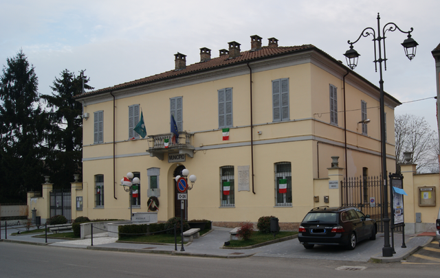
Вогера (Voghera, Voghera)
.svg)
- коммуна Италии
 Hiking in Вогера
Voghera, located in the Lombardy region of Italy, is surrounded by picturesque landscapes that offer various hiking opportunities. While Voghera itself is a small city, its proximity to the Oltrepò Pavese hills and other natural areas makes it a great starting point for outdoor enthusiasts.
Hiking Trails and Areas
-
Oltrepò Pavese: This region is known for its rolling hills, vineyards, and charming villages. There are several hiking trails that wind through the countryside, providing stunning views of the landscape. The trails vary in difficulty, making it suitable for both beginners and experienced hikers.
-
Monte Canto: This is a well-known hiking destination near Voghera. The trail to the summit of Monte Canto offers rewarding views, and the area is rich in flora and fauna. It’s a great spot for a day hike, with paths that vary in difficulty.
-
Parco Naturale Regionale del Monte Veleto: Located a bit further from Voghera, this natural park features numerous trails that showcase the diverse ecosystems of the area. The park is home to many species of plants and animals, making it a wonderful place for nature lovers.
Considerations
-
Seasonal Weather: The best time to hike in and around Voghera is typically in the spring and early autumn when the weather is mild. Summers can be hot, while winters can bring snow to higher elevations.
-
Gear and Preparation: Always wear appropriate hiking footwear, and carry enough water, snacks, and a basic first aid kit. It's also useful to have a map or a GPS device, as well as knowledge of the trails you plan to take.
-
Local Regulations: Be mindful of local regulations and guidelines regarding outdoor activities, as some areas may have restrictions to protect wildlife.
Conclusion
Hiking around Voghera offers a fantastic opportunity to explore natural beauty and experience the serene Italian countryside. Whether you're looking for a casual walk or a more challenging hike, you’ll find a range of options suitable for all skill levels. Be sure to do some research and prepare adequately to enjoy your hiking adventure safely!
- Страна:

- Почтовый код: 27058
- Телефонный код: 0383
- Код автомобильного номера: PV
- Координаты: 44° 59' 33" N, 9° 0' 33" E


- GPS треки (wikiloc): [Ссылка]
- Высота над уровнем моря: 96 м m
- Площадь: 63.44 кв.км
- Население: 39354
- Веб сайт: http://www.comune.voghera.pv.it
- Википедия русская: wiki(ru)
- Википедия английская: wiki(en)
- Википедия национальная: wiki(it)
- Хранилище Wikidata: Wikidata: Q39981
- Галерея изображений в википедии: [Ссылка]
- Катеория в википедии: [Ссылка]
- код Freebase: [/m/05zynj]
- код GeoNames: Альт: [6540635]
- код BNF: [145225852]
- код VIAF: Альт: [168214470]
- ID отношения в OpenStreetMap: [43902]
- код GND: Альт: [4282411-4]
- идентификатор местоположения ArchINFORM: [16400]
- код LCNAF: Альт: [n88056220]
- код тезауруса PACTOLS: [pcrtLjNpaTISJN]
- место в MusicBrainz: [901ea555-00b2-443c-aafc-a7a8b2664fe2]
- код темы Quora: [Voghera]
- UN/LOCODE: [ITVGH]
- код в энциклопедии «Британника онлайн»: [place/Voghera]
- код в Большой каталанской энциклопедии: [0071517]
- код Цифрового атласа Римской империи: [26549]
- код ISTAT: 018182
- кадастровый код Италии: M109
Граничит с регионами:

Понтекуроне
- коммуна в регионе Пьемонт, Италия
Hiking in Понтекуроне
Pontecurone is a charming municipality in the province of Alessandria in the Piedmont region of northern Italy. While it's not primarily known as a hiking destination, it offers a rural landscape that can be enjoyed by outdoor enthusiasts....
- Страна:
- Почтовый код: 15055
- Телефонный код: 0131
- Код автомобильного номера: AL
- Координаты: 44° 57' 40" N, 8° 56' 6" E
- GPS треки (wikiloc): [Ссылка]
- Высота над уровнем моря: 104 м m
- Площадь: 29.7 кв.км
- Население: 3603
- Веб сайт: [Ссылка]

Пиццале
- коммуна Италии
Hiking in Пиццале
Pizzale is a small village located in the Province of Pavia, Lombardy, Italy, and it serves as a gateway to scenic hiking trails in the surrounding regions, including the Val d'Ossola and the nearby hills of the Oltrepò Pavese. Here’s what you need to know about hiking in the area:...
- Страна:
- Почтовый код: 27050
- Телефонный код: 0383
- Код автомобильного номера: PV
- Координаты: 45° 2' 19" N, 9° 3' 0" E
- GPS треки (wikiloc): [Ссылка]
- Высота над уровнем моря: 728 м m
- Площадь: 7.09 кв.км
- Население: 722
- Веб сайт: [Ссылка]
Кодевилла
- коммуна Италии
Hiking in Кодевилла
Codevilla is a small municipality located in the Lombardy region of Italy, near the city of Pavia. While it may not be as well-known for hiking as larger national parks or famous hiking destinations, there are still opportunities for outdoor enthusiasts to explore the natural beauty of the area....
- Страна:
- Почтовый код: 27050
- Телефонный код: 0383
- Код автомобильного номера: PV
- Координаты: 44° 58' 0" N, 9° 3' 0" E
- GPS треки (wikiloc): [Ссылка]
- Высота над уровнем моря: 146 м m
- Площадь: 12.96 кв.км
- Население: 994
- Веб сайт: [Ссылка]


Сильвано-Пьетра
- коммуна Италии
Hiking in Сильвано-Пьетра
Silvano Pietra is a picturesque town located in the province of Pavia, Lombardy, Italy. While it may not be as famous as some of the more popular hiking destinations, it offers a variety of outdoor activities and hiking opportunities set against the stunning backdrop of the Lombardy landscape....
- Страна:
- Почтовый код: 27050
- Телефонный код: 0383
- Код автомобильного номера: PV
- Координаты: 45° 2' 0" N, 8° 57' 0" E
- GPS треки (wikiloc): [Ссылка]
- Высота над уровнем моря: 83 м m
- Площадь: 14 кв.км
- Население: 668
- Веб сайт: [Ссылка]
Корана
- коммуна Италии
Hiking in Корана
It seems that "Corana" may refer to a specific area or might be a typographical error. If you meant "Corona," California, I can certainly provide information about hiking opportunities in that region. Alternatively, if you meant another location or if "Corana" refers to a specific hiking destination, please clarify, and I'll do my best to assist you!...
- Страна:
- Почтовый код: 27050
- Телефонный код: 0383
- Код автомобильного номера: PV
- Координаты: 45° 4' 0" N, 8° 58' 0" E
- GPS треки (wikiloc): [Ссылка]
- Высота над уровнем моря: 71 м m
- Площадь: 12.87 кв.км
- Население: 804
- Веб сайт: [Ссылка]
Червезина
- коммуна Италии
Hiking in Червезина
Cervesina, located in the Lombardy region of northern Italy, offers a unique hiking experience characterized by its picturesque landscapes, rolling hills, and rich natural diversity. While it's not as widely known as some of the more popular hiking destinations in Italy, such as the Dolomites or Cinque Terre, Cervesina provides a more tranquil setting that can be ideal for those looking to escape the crowds....
- Страна:
- Почтовый код: 27050
- Телефонный код: 0383
- Код автомобильного номера: PV
- Координаты: 45° 3' 43" N, 9° 1' 1" E
- GPS треки (wikiloc): [Ссылка]
- Высота над уровнем моря: 72 м m
- Площадь: 12.41 кв.км
- Население: 1242
- Веб сайт: [Ссылка]
Панкарана
- коммуна Италии
Hiking in Панкарана
Pancarana is not a widely recognized hiking destination, but if you're referring to a specific region or area that may be less known in hiking circles, I can provide some general tips and suggestions for hiking in lesser-known locations....
- Страна:
- Почтовый код: 27050
- Телефонный код: 0383
- Код автомобильного номера: PV
- Координаты: 45° 4' 31" N, 9° 3' 6" E
- GPS треки (wikiloc): [Ссылка]
- Высота над уровнем моря: 68 м m
- Площадь: 6.1 кв.км
- Население: 318
- Веб сайт: [Ссылка]


Реторбидо
- коммуна Италии
Hiking in Реторбидо
Retorbido is a small town located in the Lombardy region of Italy, known for its picturesque landscapes and proximity to charming natural settings. While it may not have the extensive trail systems of larger national parks, there are opportunities for hiking and enjoying the natural beauty of the surrounding area....
- Страна:
- Почтовый код: 27050
- Телефонный код: 0383
- Код автомобильного номера: PV
- Координаты: 44° 57' 0" N, 9° 2' 0" E
- GPS треки (wikiloc): [Ссылка]
- Высота над уровнем моря: 169 м m
- Площадь: 11.67 кв.км
- Население: 1546
- Веб сайт: [Ссылка]


Риванаццано
- коммуна Италии
Hiking in Риванаццано
Rivanazzano Terme, located in the Lombardy region of Italy, is known for its thermal springs and picturesque landscapes, making it a charming destination for hiking enthusiasts. The area offers a variety of trails that cater to different skill levels and interests....
- Страна:
- Почтовый код: 27055
- Телефонный код: 0383
- Код автомобильного номера: PV
- Координаты: 44° 55' 45" N, 9° 0' 49" E
- GPS треки (wikiloc): [Ссылка]
- Высота над уровнем моря: 153 м m
- Площадь: 28.91 кв.км
- Население: 5326
- Веб сайт: [Ссылка]


Монтебелло-делла-Батталья
- коммуна Италии
Hiking in Монтебелло-делла-Батталья
Montebello della Battaglia, located in the province of Pavia in Lombardy, Italy, is known for its historical significance and beautiful landscapes, making it a great destination for hiking enthusiasts. Here are some highlights to consider when hiking in this area:...
- Страна:
- Почтовый код: 27054
- Телефонный код: 0383
- Код автомобильного номера: PV
- Координаты: 45° 0' 0" N, 9° 6' 9" E
- GPS треки (wikiloc): [Ссылка]
- Высота над уровнем моря: 110 м m
- Площадь: 15.74 кв.км
- Население: 1596
- Веб сайт: [Ссылка]


Казеи-Джерола
- коммуна Италии
Hiking in Казеи-Джерола
Casei Gerola is a small municipality located in the Lombardy region of Italy, specifically in the province of Pavia. The area is known for its picturesque landscapes and is surrounded by mountainous terrain, making it an excellent destination for hiking enthusiasts....
- Страна:
- Почтовый код: 27050
- Телефонный код: 0383
- Код автомобильного номера: PV
- Координаты: 45° 2' 13" N, 8° 54' 27" E
- GPS треки (wikiloc): [Ссылка]
- Высота над уровнем моря: 81 м m
- Площадь: 24.81 кв.км
- Население: 2485
- Веб сайт: [Ссылка]
Лунгавилла
- коммуна Италии
Hiking in Лунгавилла
Lungavilla is a charming village located in the province of Pavia in Lombardy, Italy. It’s surrounded by beautiful landscapes, including rolling hills, vineyards, and the serene countryside, which makes it a delightful spot for hiking enthusiasts. Here are some highlights and tips for hiking in and around Lungavilla:...
- Страна:
- Почтовый код: 27053
- Телефонный код: 0383
- Код автомобильного номера: PV
- Координаты: 45° 2' 0" N, 9° 5' 0" E
- GPS треки (wikiloc): [Ссылка]
- Высота над уровнем моря: 74 м m
- Площадь: 6.82 кв.км
- Население: 2433
- Веб сайт: [Ссылка]