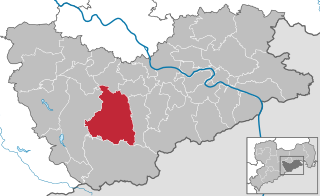
Мюглицталь (Müglitztal, Müglitztal)

 Hiking in Мюглицталь
Müglitztal, located in the Saxon Switzerland region of Germany, is a stunning destination for hiking enthusiasts. This valley is carved out by the river Müglitz and set against a backdrop of striking sandstone formations, lush forests, and picturesque villages. Here are some key aspects to consider if you're planning a hiking trip to Müglitztal:
Trail Options
-
Müglitztal-Rundwanderweg: This circular trail is a great way to experience the beauty of the valley. It offers a mix of forest paths, riverside trails, and stunning viewpoints. The trail is suitable for various skill levels.
-
Rural Trails: Explore the picturesque villages such as Glashütte, known for its watchmaking, and nearby areas that offer rural trails, leading through scenic meadows and charming farms.
-
Sandstone Cliffs: For those looking for more excitement, there are routes that take you closer to the impressive sandstone cliffs that the region is famous for, providing breathtaking views if you reach the tops.
Things to See
-
Natural Beauty: The Müglitztal area is known for its dense forests, diverse flora and fauna, and the flowing river, making it perfect for nature lovers.
-
Cultural Sites: You may encounter historical sites such as old watchmaker workshops or traditional Saxon architecture in the villages.
-
Wildlife: Keep an eye out for local wildlife, including various bird species, deer, and other forest creatures.
Best Time to Visit
The best time to hike in Müglitztal is during spring (April to June) or fall (September to October), when the weather is mild, and the scenery is often at its most beautiful with blooming flowers or fall foliage.
Tips for Hiking in Müglitztal
-
Weather Preparation: Always check the weather forecast as conditions can change quickly. Dress in layers and prepare for potential rain.
-
Stay Hydrated: Carry enough water and snacks, especially if you plan to hike longer trails.
-
Footwear: Good hiking boots with ankle support are essential due to varied terrain.
-
Navigation: While many trails are well-marked, carrying a map or GPS is wise, especially for less well-trodden paths.
-
Respect Nature: Follow the Leave No Trace principles to preserve the natural beauty of the area.
Whether you seek a leisurely stroll along the river or a more challenging trek up into the hills, Müglitztal offers diverse hiking experiences that cater to all levels of hikers. Enjoy your time exploring this captivating region!
- Страна:

- Почтовый код: 01809
- Телефонный код: 035206; 035027
- Код автомобильного номера: PIR
- Координаты: 50° 55' 0" N, 13° 49' 0" E


- GPS треки (wikiloc): [Ссылка]
- Высота над уровнем моря: 396 м m
- Площадь: 21.00 кв.км
- Население: 1916
- Веб сайт: http://www.gemeinde-mueglitztal.de
- Википедия русская: wiki(ru)
- Википедия английская: wiki(en)
- Википедия национальная: wiki(de)
- Хранилище Wikidata: Wikidata: Q8205
- Катеория в википедии: [Ссылка]
- код Freebase: [/m/02vytg8]
- код Freebase: [/m/02vytg8]
- код GeoNames: Альт: [6548697]
- код GeoNames: Альт: [6548697]
- код VIAF: Альт: [309635542]
- код VIAF: Альт: [309635542]
- ID отношения в OpenStreetMap: [455486]
- ID отношения в OpenStreetMap: [455486]
- код GND: Альт: [4482163-3]
- код GND: Альт: [4482163-3]
- идентификатор местоположения ArchINFORM: [44066]
- идентификатор местоположения ArchINFORM: [44066]
- код Historical Gazetteer: [MUGTALJO60VV]
- код Historical Gazetteer: [MUGTALJO60VV]
- идентификатор муниципалитетов в Германии: 14628250
- идентификатор муниципалитетов в Германии: 14628250
Включает регионы:
Burkhardswalde
Hiking in Burkhardswalde
Burkhardswalde, located in the Müglitztal region of Saxony, Germany, offers a variety of hiking opportunities that showcase its beautiful natural landscapes, charming villages, and rich cultural heritage. Here are some details to consider if you're planning to hike in this area:...
- Страна:
- Почтовый код: 01809
- Телефонный код: 035027
- Координаты: 50° 55' 16" N, 13° 51' 28" E
- GPS треки (wikiloc): [Ссылка]
- Высота над уровнем моря: 298 м m

Веезенштейн
Hiking in Веезенштейн
Weesenstein is a charming town located in the Saxon Switzerland region of Germany. It offers a variety of hiking opportunities that showcase its beautiful natural landscapes, rich history, and unique rock formations. Here are some key points about hiking in and around Weesenstein:...
- Страна:
- Почтовый код: 01809
- Телефонный код: 035027
- Координаты: 50° 55' 59" N, 13° 51' 41" E
- GPS треки (wikiloc): [Ссылка]
- Высота над уровнем моря: 166 м m
Crotta
Hiking in Crotta
Hiking in Crotta, located in the Müglitztal region of Germany, offers a beautiful experience for outdoor enthusiasts. The Müglitztal is known for its picturesque landscapes, dense forests, and scenic river views. Here are some highlights and tips for hiking in this area:...
- Страна:
- Почтовый код: 01809
- Телефонный код: 035027
- Координаты: 50° 55' 50" N, 13° 50' 0" E
- GPS треки (wikiloc): [Ссылка]
- Высота над уровнем моря: 270 м m
Falkenhain
Hiking in Falkenhain
Falkenhain, located in the Müglitztal valley of Saxony, Germany, is a beautiful destination for hiking enthusiasts. The area is characterized by its picturesque landscapes, lush forests, and the peaceful Müglitz River. Here are some key aspects to consider when hiking in Falkenhain:...
- Страна:
- Почтовый код: 01809
- Телефонный код: 035027
- Координаты: 50° 56' 20" N, 13° 50' 50" E
- GPS треки (wikiloc): [Ссылка]
- Высота над уровнем моря: 223 м m
Mühlbach
Hiking in Mühlbach
Mühlbach, located in the picturesque Müglitztal region of Germany, is a delightful destination for hikers, offering beautiful landscapes, lush forests, and a variety of trails for different skill levels. Here are some key points to consider for hiking in this area:...
- Страна:
- Почтовый код: 01809
- Телефонный код: 035027
- Координаты: 50° 54' 50" N, 13° 48' 55" E
- GPS треки (wikiloc): [Ссылка]
- Высота над уровнем моря: 208 м m

Максен
- село в Саксонии
Hiking in Максен
Maxen is a charming village located in the Saxon Switzerland region of Germany, known for its stunning natural landscapes and a variety of hiking trails suitable for all levels of experience. Here are some key points about hiking in and around Maxen:...
- Страна:
- Почтовый код: 01809
- Телефонный код: 035206
- Координаты: 50° 55' 25" N, 13° 48' 10" E
- GPS треки (wikiloc): [Ссылка]
- Высота над уровнем моря: 363 м m
Schmorsdorf
Hiking in Schmorsdorf
Schmorsdorf, a small village located in the eastern part of Germany, offers a variety of hiking opportunities, particularly for those looking to explore the natural beauty of the surrounding region. Here are some key points about hiking in and around Schmorsdorf:...
- Страна:
- Координаты: 50° 55' 52" N, 13° 49' 14" E
- GPS треки (wikiloc): [Ссылка]
Граничит с регионами:


Бареталь
Hiking in Бареталь
Bahretal is a picturesque municipality in Saxony, Germany, known for its charming landscapes and opportunities for hiking and outdoor activities. While it may not be as widely recognized as some major hiking destinations, it offers a variety of trails and scenic routes that cater to both casual walkers and more experienced hikers....
- Страна:
- Почтовый код: 01819
- Телефонный код: 035025; 035023
- Код автомобильного номера: PIR
- Координаты: 50° 53' 15" N, 13° 54' 0" E
- GPS треки (wikiloc): [Ссылка]
- Высота над уровнем моря: 299 м m
- Площадь: 36.47 кв.км
- Население: 2193
- Веб сайт: [Ссылка]


Дона
- город в Саксонии, Германия
Hiking in Дона
Hiking in Dohna, a small town in Saxony, Germany, offers a scenic experience with beautiful landscapes and trails. Here are some key points to consider when hiking in this area:...
- Страна:
- Почтовый код: 01809
- Телефонный код: 03529
- Код автомобильного номера: PIR
- Координаты: 50° 57' 17" N, 13° 51' 27" E
- GPS треки (wikiloc): [Ссылка]
- Высота над уровнем моря: 164 м m
- Площадь: 28.58 кв.км
- Население: 6270
- Веб сайт: [Ссылка]

Гласхютте
- город в Саксонии (Германия)
Hiking in Гласхютте
Glashütte, located in the Saxon Switzerland region of Germany, offers a wonderful experience for hiking enthusiasts. Renowned for its striking sandstone cliffs, dense forests, and beautiful valleys, the area is part of the Saxon Switzerland National Park, which boasts numerous trails with varying degrees of difficulty, making it accessible for both beginners and experienced hikers....
- Страна:
- Почтовый код: 01768
- Телефонный код: 035053
- Код автомобильного номера: PIR
- Координаты: 50° 51' 0" N, 13° 47' 0" E
- GPS треки (wikiloc): [Ссылка]
- Высота над уровнем моря: 340 м m
- Площадь: 95.57 кв.км
- Население: 6691
- Веб сайт: [Ссылка]