
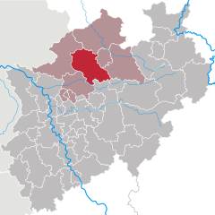
Мюнстер (Münster, Münster)
.svg)

- город в Германии, Северный Рейн-Вестфалия
 Hiking in Мюнстер
Hiking in Münster offers a delightful experience, combining beautiful landscapes, historical sites, and lush green parks. The area is characterized by its flat terrain, making it accessible for hikers of all skill levels. Here are some highlights for hiking in and around Münster:
Trails and Routes
-
Aasee Loop: This scenic trail around Aasee, a picturesque lake near the city center, is perfect for a leisurely hike. The route is about 6 km and offers beautiful views, picnic spots, and opportunities for birdwatching.
-
Promenade: A unique urban hiking experience, the Promenade is a 4 km circular route that encircles the city center. It's perfect for combining sightseeing with a walk, featuring gardens, parks, and historical monuments.
-
Green Belt (Grüne Hügel): This trail is a bit longer (around 10 km) and takes you through green belts and parks that surround the city. It's a great way to experience the local flora and fauna.
-
Werse Trail: This route follows the Werse river and provides a pleasant escape into nature. It's ideal for those who enjoy riverside walks and exploring rural landscapes.
Nature Reserves
- Münsterland Nature Park: Just outside Münster, this region is perfect for longer hikes. The park features rolling hills, forests, small lakes, and farmland, providing a more rugged hiking experience away from the urban environment.
Tips for Hiking in Münster
- Best Time to Hike: Spring and early autumn are particularly beautiful, with mild weather and blooming flowers or colorful foliage.
- Trail Markings: Most trails around Münster are well-marked, but it's still a good idea to carry a map or a GPS device.
- Facilities: Many trails have rest spots, cafes, or parks where you can take a break and enjoy a meal or snack.
Local Attractions
- Don’t miss the opportunity to explore Münster's city center, where you can find historical buildings like the Prinzipalmarkt and the St. Paulus Cathedral after your hike.
- Check out the botanical garden, which features a wide variety of plants and is a peaceful place to unwind.
Overall, Münster offers diverse hiking opportunities that cater to both nature lovers and those interested in history and culture. Enjoy your hiking adventure!
- Страна:

- Почтовый код: 48143–48167
- Телефонный код: 2536; 2534; 2533; 2506; 2501; 251
- Код автомобильного номера: MS
- Координаты: 51° 57' 45" N, 7° 37' 32" E


- GPS треки (wikiloc): [Ссылка]
- Высота над уровнем моря: 60 м m
- Площадь: 303.28 кв.км
- Население: 311846
- Веб сайт: https://www.muenster.de/
- Википедия русская: wiki(ru)
- Википедия английская: wiki(en)
- Википедия национальная: wiki(de)
- Хранилище Wikidata: Wikidata: Q2742
- Катеория в википедии: [Ссылка]
- Карты в википедии: [Ссылка]
- код Freebase: [/m/0149mq]
- код GeoNames: Альт: [6553087]
- код BNF: [121627337]
- код VIAF: Альт: [132447077]
- ID отношения в OpenStreetMap: [62591]
- код GND: Альт: [4040608-8]
- идентификатор местоположения ArchINFORM: [410]
- код LCNAF: Альт: [n82040141]
- место в MusicBrainz: [38693e55-f5d3-4dc5-99af-debd2a8c1c87]
- код темы Quora: [Münster-Germany]
- код SUDOC: [030154189]
- код в энциклопедии «Британника онлайн»: [place/Munster-Germany]
- код в Encyclopædia Universalis: [munster]
- код Historical Gazetteer: [MUNTERJO31TX]
- EMLO location ID: [3ab21f9d-6321-47a2-8da3-b3b23c7fb3ab]
- код места в Facebook: [112144845468135]
- код в Большой российской энциклопедии онлайн: [2242175]
- код ISNI: Альт: [0000 0001 2254 1172]
- код NLI: [000991660]
- код NUTS: [DEA33]
- Nomisma ID: [muenster]
- код статьи Klexikon: [Münster_in_Westfalen]
- учётная запись Facebook: Альт: [stadt.muenster]
- идентификатор муниципалитетов в Германии: 05515000
- код района Германии: 05515
Граничит с регионами:
Варендорф
- район в Германии
Hiking in Варендорф
Warendorf, located in the North Rhine-Westphalia region of Germany, is known for its picturesque landscapes, charming villages, and lush countryside, making it a delightful destination for hiking enthusiasts....
- Страна:
- Код автомобильного номера: WAF
- Координаты: 51° 55' 12" N, 7° 55' 12" E
- GPS треки (wikiloc): [Ссылка]
- Высота над уровнем моря: 65 м m
- Веб сайт: [Ссылка]


Штейнфурт
Hiking in Штейнфурт
Hiking in the Steinfurt district, located in North Rhine-Westphalia, Germany, offers a variety of scenic trails and natural landscapes that are ideal for outdoor enthusiasts. The region is characterized by its rolling hills, woodlands, and charming villages, making it a great place for hiking and exploring nature....
- Страна:
- Код автомобильного номера: ST
- Координаты: 52° 10' 12" N, 7° 40' 12" E
- GPS треки (wikiloc): [Ссылка]
- Высота над уровнем моря: 42 м m
- Площадь: 1795.76 кв.км
- Веб сайт: [Ссылка]

Косфельд
- район Германии
Hiking in Косфельд
Coesfeld district, located in the North Rhine-Westphalia region of Germany, is not as widely known for hiking as other parts of the country, but it offers several scenic trails and outdoor opportunities that can appeal to nature lovers and hikers. Here are some highlights:...
- Страна:
- Код автомобильного номера: COE
- Координаты: 51° 52' 0" N, 7° 23' 0" E
- GPS треки (wikiloc): [Ссылка]
- Высота над уровнем моря: 64 м m
- Веб сайт: [Ссылка]