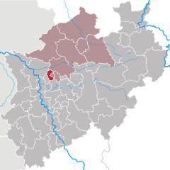
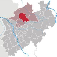
Мюнстер (Münster Government Region, Regierungsbezirk Münster)

- административный округ Северного Рейна-Вестфалии
 Hiking in Мюнстер
Münster, a city in North Rhine-Westphalia, Germany, is surrounded by beautiful landscapes that offer a variety of hiking opportunities. The region is characterized by its flat terrain, charming countryside, and network of well-marked trails, making it an excellent destination for both casual walkers and seasoned hikers. Here are some highlights and tips for hiking in and around Münster:
Scenic Trails
-
Münsterland Cycle Route: While primarily a cycling route, the Münsterland Cycle Route features paths that are also great for walking. It takes you through picturesque landscapes, including fields, meadows, and historic estates.
-
Werse River Trail: This trail follows the Werse River, offering lovely views and the chance to spot wildlife. The path is relatively easy and can be enjoyed as a long day hike.
-
Aasee Loop: The area around Aasee, a scenic lake in Münster, offers several walking paths. The loop around the lake is particularly popular, providing beautiful water views and plenty of spots to rest.
-
Hiking in the Baumberge: A short drive from Münster, the Baumberge hills offer more elevation and a variety of hiking options. The hills and nature reserves provide trails that can vary in difficulty, making it a great spot for an adventurous outing.
Nature Reserves
- Havixbeck and the surrounding nature reserves: Just outside Münster, the Havixbeck region is home to several trails through well-preserved nature areas, rich in flora and fauna. The area is suitable for leisurely hikes as well as more challenging terrains.
Practical Tips
-
Trail Markings: Trails are generally well-marked, but it’s advisable to have a map or a hiking app handy, especially when venturing into less familiar areas.
-
Weather Considerations: The weather in the Münster region can change quickly, so check the forecast and dress in layers. Good hiking boots are essential, especially if you plan to hike in wetter conditions.
-
Local Amenities: Many hiking trails are accessible from Munster’s city center, where you can find a variety of cafes and restaurants to refuel after your hike.
-
Duration: Consider the length and difficulty of the hike when planning your day, and be sure to pack plenty of water and snacks.
-
Hiking with Dogs: Many trails are dog-friendly, but be sure to keep your pet on a leash, especially in nature reserves.
Münster offers a delightful blend of urban exploration and countryside hiking, making it a fantastic location for all levels of hikers. Enjoy your adventures!
- Страна:

- Столица: Мюнстер
- Координаты: 52° 0' 0" N, 7° 30' 0" E


- GPS треки (wikiloc): [Ссылка]
- Высота над уровнем моря: 76 м m
- Площадь: 6917.49 кв.км
- Веб сайт: http://www.bezreg-muenster.nrw.de/
- Википедия русская: wiki(ru)
- Википедия английская: wiki(en)
- Википедия национальная: wiki(de)
- Хранилище Wikidata: Wikidata: Q7920
- Катеория в википедии: [Ссылка]
- код Freebase: [/m/019v5f]
- код GeoNames: Альт: [2867539]
- код VIAF: Альт: [136053383]
- ID отношения в OpenStreetMap: [63594]
- код GND: Альт: [4040613-1]
- код TGN: [7133375]
- код NUTS: [DEA3]
- код GNS: -1829324
Включает регионы:
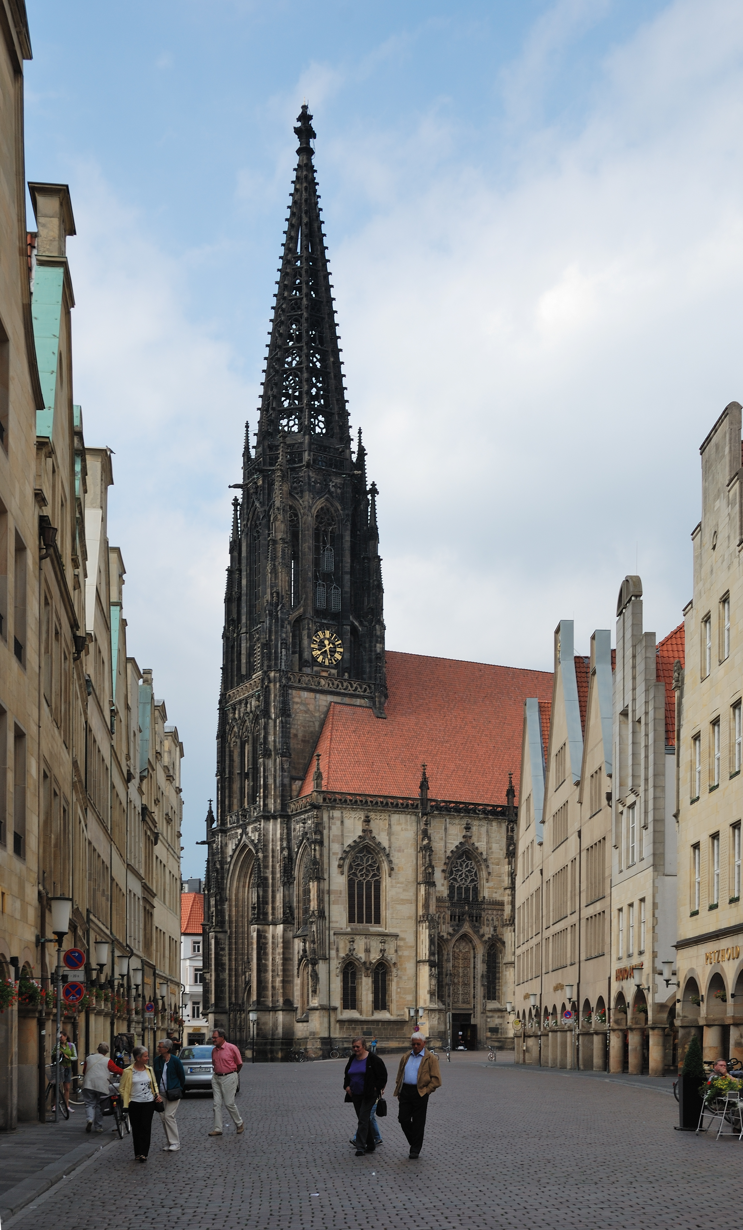

Мюнстер
- город в Германии, Северный Рейн-Вестфалия
Hiking in Мюнстер
Hiking in Münster offers a delightful experience, combining beautiful landscapes, historical sites, and lush green parks. The area is characterized by its flat terrain, making it accessible for hikers of all skill levels. Here are some highlights for hiking in and around Münster:...
- Страна:
- Почтовый код: 48143–48167
- Телефонный код: 2536; 2534; 2533; 2506; 2501; 251
- Код автомобильного номера: MS
- Координаты: 51° 57' 45" N, 7° 37' 32" E
- GPS треки (wikiloc): [Ссылка]
- Высота над уровнем моря: 60 м m
- Площадь: 303.28 кв.км
- Население: 311846
- Веб сайт: [Ссылка]
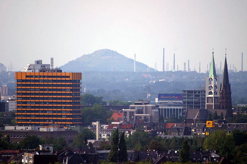

Гельзенкирхен
- город в Германии
Hiking in Гельзенкирхен
Gelsenkirchen, located in North Rhine-Westphalia, Germany, is primarily known as an industrial city, but it also offers some opportunities for hiking and enjoying nature. Here are a few highlights for hiking in the area:...
- Страна:
- Почтовый код: 45801–45899; 4660; 4650
- Телефонный код: 0209
- Код автомобильного номера: GE
- Координаты: 51° 31' 0" N, 7° 6' 0" E
- GPS треки (wikiloc): [Ссылка]
- Высота над уровнем моря: 48 м m
- Площадь: 104.94 кв.км
- Население: 262528
- Веб сайт: [Ссылка]
Варендорф
- район в Германии
Hiking in Варендорф
Warendorf, located in the North Rhine-Westphalia region of Germany, is known for its picturesque landscapes, charming villages, and lush countryside, making it a delightful destination for hiking enthusiasts....
- Страна:
- Код автомобильного номера: WAF
- Координаты: 51° 55' 12" N, 7° 55' 12" E
- GPS треки (wikiloc): [Ссылка]
- Высота над уровнем моря: 65 м m
- Веб сайт: [Ссылка]

Ботроп
- город в Северном Рейне - Вестфалии, Германия
Hiking in Ботроп
Bottrop, a city in North Rhine-Westphalia, Germany, is not primarily known for extensive hiking trails compared to more renowned natural areas. However, there are still some opportunities for hiking and enjoying the outdoors in and around Bottrop....
- Страна:
- Почтовый код: 46236
- Телефонный код: 02045; 02041
- Код автомобильного номера: BOT
- Координаты: 51° 31' 29" N, 6° 55' 22" E
- GPS треки (wikiloc): [Ссылка]
- Высота над уровнем моря: 55 м m
- Площадь: 100.61 кв.км
- Население: 117409
- Веб сайт: [Ссылка]


Штейнфурт
Hiking in Штейнфурт
Hiking in the Steinfurt district, located in North Rhine-Westphalia, Germany, offers a variety of scenic trails and natural landscapes that are ideal for outdoor enthusiasts. The region is characterized by its rolling hills, woodlands, and charming villages, making it a great place for hiking and exploring nature....
- Страна:
- Код автомобильного номера: ST
- Координаты: 52° 10' 12" N, 7° 40' 12" E
- GPS треки (wikiloc): [Ссылка]
- Высота над уровнем моря: 42 м m
- Площадь: 1795.76 кв.км
- Веб сайт: [Ссылка]
Боркен
Hiking in Боркен
Borken is a district located in North Rhine-Westphalia, Germany, and it offers a variety of hiking opportunities for outdoor enthusiasts. The region is characterized by its diverse landscapes, which include forests, meadows, rivers, and a mix of natural and agricultural areas....
- Страна:
- Код автомобильного номера: BOR
- Координаты: 51° 55' 0" N, 6° 55' 0" E
- GPS треки (wikiloc): [Ссылка]
- Высота над уровнем моря: 65 м m
- Площадь: 1420.98 кв.км
- Веб сайт: [Ссылка]

Косфельд
- район Германии
Hiking in Косфельд
Coesfeld district, located in the North Rhine-Westphalia region of Germany, is not as widely known for hiking as other parts of the country, but it offers several scenic trails and outdoor opportunities that can appeal to nature lovers and hikers. Here are some highlights:...
- Страна:
- Код автомобильного номера: COE
- Координаты: 51° 52' 0" N, 7° 23' 0" E
- GPS треки (wikiloc): [Ссылка]
- Высота над уровнем моря: 64 м m
- Веб сайт: [Ссылка]


Реклингхаузен
Hiking in Реклингхаузен
Recklinghausen, located in the state of North Rhine-Westphalia in Germany, offers a variety of hiking opportunities, primarily in the form of trails that showcase the region's natural beauty and cultural heritage. Here are some aspects to consider when planning a hike in and around Recklinghausen:...
- Страна:
- Код автомобильного номера: RE
- Координаты: 51° 40' 12" N, 7° 10' 12" E
- GPS треки (wikiloc): [Ссылка]
- Высота над уровнем моря: 52 м m
- Веб сайт: [Ссылка]