Марксен (Marxen, Marxen)

 Hiking in Марксен
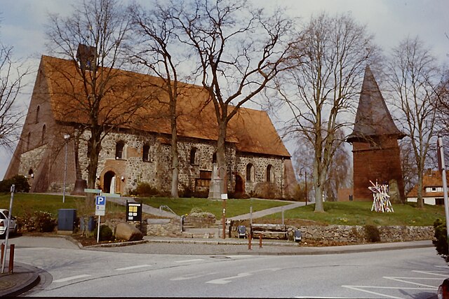
Marxen, located in Lower Saxony, Germany, is a charming village surrounded by scenic landscapes, making it a great destination for hiking enthusiasts. The area is characterized by its rolling hills, dense forests, and picturesque fields, offering a variety of trails catering to different skill levels.
Hiking Trails:
-
Nature Paths: There are numerous well-marked trails that wind through the beautiful countryside. These paths often include views of farms, meadows, and woodlands, allowing hikers to experience the tranquility of rural Germany.
-
Forest Trails: The surrounding areas have expansive forests, where you can enjoy shaded hikes. A popular choice is to explore the Lüneburg Heath National Park nearby, which showcases a unique landscape known for its heathlands, and is especially stunning during the late summer bloom.
-
Cultural Trails: Some trails might also lead you to historical sites, charming villages, and cultural landmarks that reflect the region's heritage.
Tips for Hiking in Marxen:
- Trail Maps: It's advisable to have a map or a hiking app to navigate the trails easily. Maps can often be obtained from local tourist information centers.
- Weather Preparedness: Weather can change rapidly, so check the forecast and dress in layers. Good hiking shoes and a rain jacket are recommended.
- Respect Nature: Follow the Leave No Trace principles to ensure that the natural beauty of the area is preserved for future hikers.
- Local Regulations: Pay attention to any local regulations regarding hiking, especially in protected areas.
Accessibility:
Marxen is reasonably accessible by car and train from larger cities in Lower Saxony, and the surrounding areas provide ample parking options for hikers.
Whether you're looking for a leisurely stroll or a challenging trek, hiking in Marxen offers an opportunity to connect with nature and enjoy the serene countryside of northern Germany.
- Страна:

- Почтовый код: 21439
- Телефонный код: 04185
- Код автомобильного номера: WL
- Координаты: 53° 19' 0" N, 10° 1' 0" E


- GPS треки (wikiloc): [Ссылка]
- Высота над уровнем моря: 43 м m
- Площадь: 13.42 кв.км
- Население: 1507
- Веб сайт: http://www.hanstedt.de/
- Википедия русская: wiki(ru)
- Википедия английская: wiki(en)
- Википедия национальная: wiki(de)
- Хранилище Wikidata: Wikidata: Q633102
- Катеория в википедии: [Ссылка]
- код Freebase: [/m/02rydyf]
- код Freebase: [/m/02rydyf]
- код GeoNames: Альт: [2873087]
- код GeoNames: Альт: [2873087]
- код VIAF: Альт: [135546804]
- код VIAF: Альт: [135546804]
- ID отношения в OpenStreetMap: [307326]
- ID отношения в OpenStreetMap: [307326]
- код GND: Альт: [2097429-2]
- код GND: Альт: [2097429-2]
- код Historical Gazetteer: [MARXEN_W2091]
- код Historical Gazetteer: [MARXEN_W2091]
- идентификатор муниципалитетов в Германии: 03353024
- идентификатор муниципалитетов в Германии: 03353024
Граничит с регионами:

Зеветаль
Hiking in Зеветаль
Seevetal, located in Lower Saxony, Germany, is not only a charming area with beautiful landscapes but also offers some wonderful hiking opportunities. The region is characterized by its lush forests, picturesque rivers, and scenic countryside. Here are some highlights and tips for hiking in Seevetal:...
- Страна:
- Почтовый код: 21217–21220
- Телефонный код: 040; 04185; 04105
- Код автомобильного номера: WL
- Координаты: 53° 23' 0" N, 10° 2' 0" E
- GPS треки (wikiloc): [Ссылка]
- Высота над уровнем моря: 14 м m
- Площадь: 105.10 кв.км
- Население: 41234
- Веб сайт: [Ссылка]