Меггенхофен (Meggenhofen, Meggenhofen)
 Hiking in Меггенхофен
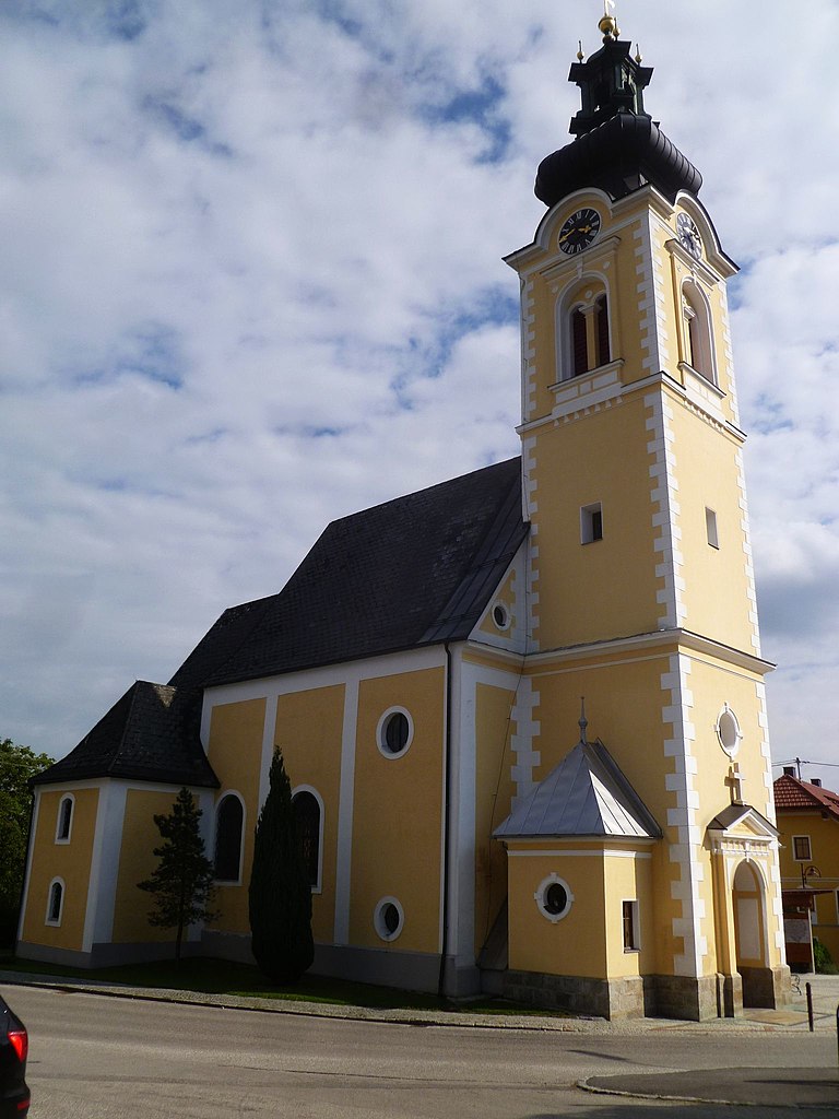
Meggenhofen, a small community in Upper Austria, offers scenic landscapes and a variety of hiking opportunities for outdoor enthusiasts. Here are some highlights for hiking in the area:
Trails and Terrain:
- Scenic Views: Meggenhofen is surrounded by beautiful countryside, rolling hills, and lush forests, providing hikers with picturesque views.
- Trail Variety: The region offers a mix of easy and moderate trails suitable for families, casual walkers, and more experienced hikers. Some paths may lead through vineyards or along local streams.
- Nature Accessibility: Many trails are well-maintained, making them accessible for different skill levels. Maps and trail markers are typically available.
Points of Interest:
- Local Flora and Fauna: Hikers can enjoy the local biodiversity, including various plant species and wildlife. Birdwatching can also be an exciting activity along some trails.
- Cultural Landmarks: Depending on your route, you might pass historical sites, chapels, or traditional Austro-Hungarian architecture that can add an educational element to your hike.
Hiking Tips:
- Weather: Check the weather forecast before heading out, as conditions can change quickly.
- Preparation: Wear appropriate footwear and bring enough water, snacks, and a map or GPS device.
- Respect Nature: Stay on designated trails, and make sure to leave no trace to preserve the beauty of the area.
Nearby Attractions:
If you have time, consider exploring nearby towns or natural parks, as Upper Austria has a rich cultural heritage and stunning landscapes worth discovering.
Overall, hiking in Meggenhofen is an excellent way to experience the charm of rural Austria and enjoy its natural beauty. Happy hiking!
- Страна:

- Почтовый код: 4714
- Телефонный код: 07247
- Код автомобильного номера: GR
- Координаты: 48° 10' 53" N, 13° 47' 47" E


- GPS треки (wikiloc): [Ссылка]
- Высота над уровнем моря: 390 м m
- Площадь: 18.2 кв.км
- Население: 1514
- Веб сайт: http://www.meggenhofen.at/
- Википедия русская: wiki(ru)
- Википедия английская: wiki(en)
- Википедия национальная: wiki(de)
- Хранилище Wikidata: Wikidata: Q680578
- Катеория в википедии: [Ссылка]
- код Freebase: [/m/03gv55_]
- код GeoNames: Альт: [7873146]
- код VIAF: Альт: [233893770]
- код GND: Альт: [4699493-2]
- код австрийского муниципалитета: [40814]
Граничит с регионами:

Айстерсхайм
Hiking in Айстерсхайм
Aistersheim, located in Austria, may not be as widely recognized for its hiking trails compared to more prominent destinations in the region, but it offers picturesque landscapes and opportunities for outdoor activities....
- Страна:
- Почтовый код: 4676
- Телефонный код: 07734
- Код автомобильного номера: GR
- Координаты: 48° 11' 12" N, 13° 44' 31" E
- GPS треки (wikiloc): [Ссылка]
- Высота над уровнем моря: 437 м m
- Площадь: 11.12 кв.км
- Население: 892
- Веб сайт: [Ссылка]

Бахманнинг
- коммуна в Австрии
Hiking in Бахманнинг
Bachmanning is a small town located in Austria, surrounded by beautiful landscapes typical of the region. Hiking in and around Bachmanning offers a variety of trails that cater to different skill levels, making it a great destination for both novice and experienced hikers....
- Страна:
- Почтовый код: 4672
- Телефонный код: 0 77 35
- Код автомобильного номера: WL
- Координаты: 48° 7' 49" N, 13° 47' 45" E
- GPS треки (wikiloc): [Ссылка]
- Высота над уровнем моря: 435 м m
- Площадь: 7 кв.км
- Население: 704
- Веб сайт: [Ссылка]

Гаспольтсхофен
Hiking in Гаспольтсхофен
Gaspoltshofen is a small town located in Austria, specifically in the state of Upper Austria. It's well-known for its picturesque landscapes and serene natural beauty, making it a charming destination for hiking enthusiasts. Here are a few key points to consider when hiking in and around Gaspoltshofen:...
- Страна:
- Телефонный код: 07735
- Код автомобильного номера: GR
- Координаты: 48° 8' 40" N, 13° 44' 11" E
- GPS треки (wikiloc): [Ссылка]
- Высота над уровнем моря: 455 м m
- Площадь: 40.6 кв.км
- Население: 3566
- Веб сайт: [Ссылка]

Кематен-на-Инбахе
Hiking in Кематен-на-Инбахе
Kematen am Innbach is a picturesque village located in the Upper Austria region, offering a lovely setting for hiking enthusiasts. The area is characterized by rolling hills, lush forests, and scenic views of the surrounding countryside, making it ideal for outdoor activities....
- Страна:
- Почтовый код: 4633
- Телефонный код: 07247
- Код автомобильного номера: GR
- Координаты: 48° 10' 39" N, 13° 51' 45" E
- GPS треки (wikiloc): [Ссылка]
- Высота над уровнем моря: 350 м m
- Площадь: 12.7 кв.км
- Население: 1413
- Веб сайт: [Ссылка]

Санкт-Георген-Грискирхен
Hiking in Санкт-Георген-Грискирхен
Sankt Georgen bei Grieskirchen, located in the beautiful Upper Austria region, is a charming destination for hikers. The surrounding area boasts a variety of trails that cater to different skill levels, making it a great spot for both beginners and experienced hikers....
- Страна:
- Почтовый код: 4710
- Телефонный код: 07248
- Код автомобильного номера: GR
- Координаты: 48° 12' 45" N, 13° 46' 47" E
- GPS треки (wikiloc): [Ссылка]
- Высота над уровнем моря: 396 м m
- Площадь: 11.41 кв.км
- Население: 1336
- Веб сайт: [Ссылка]

Галльспах
Hiking in Галльспах
Gallspach is a charming town located in the Upper Austria region of Austria, surrounded by picturesque landscapes that are perfect for hiking enthusiasts. The area offers a variety of trails that cater to different skill levels, from easy walks to more challenging hikes....
- Страна:
- Почтовый код: 4713
- Телефонный код: 07248
- Код автомобильного номера: GR
- Координаты: 48° 12' 33" N, 13° 48' 40" E
- GPS треки (wikiloc): [Ссылка]
- Высота над уровнем моря: 365 м m
- Площадь: 6.18 кв.км
- Население: 2772
- Веб сайт: [Ссылка]

Оффенхаузен
Hiking in Оффенхаузен
Offenhausen is a small town in Austria, located in the picturesque region of Upper Austria. This area is known for its stunning landscapes, hills, and natural beauty, making it a great spot for hiking enthusiasts. Here are some highlights and tips for hiking in and around Offenhausen:...
- Страна:
- Почтовый код: 4625
- Телефонный код: 07247
- Код автомобильного номера: WL
- Координаты: 48° 9' 27" N, 13° 50' 17" E
- GPS треки (wikiloc): [Ссылка]
- Высота над уровнем моря: 386 м m
- Площадь: 15 кв.км
- Население: 1638
- Веб сайт: [Ссылка]