Montécheroux (Montécheroux)

- коммуна во Франции
 Hiking in Montécheroux
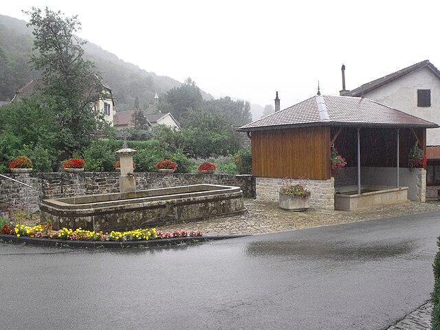
Montécheroux is a charming commune located in the Doubs department in the Bourgogne-Franche-Comté region of eastern France. Nestled in a picturesque landscape that features rolling hills and dense forests, it offers a variety of hiking opportunities for both beginners and experienced hikers.
Hiking Trails:
-
Local Trails: Montécheroux and its surrounding areas have several marked trails that cater to different skill levels. You can find loops and paths that offer scenic views of the countryside, forests, and rivers.
-
Sentier de Grande Randonnée (GR) Paths: While Montécheroux is not on the main GR trails, you can easily access them from nearby areas. These long-distance hiking paths can lead you through stunning landscapes across the region.
-
Nature Walks: The region is rich in flora and fauna. You can enjoy shorter nature walks that allow for birdwatching and observing the local wildlife, especially in the quieter mornings.
Points of Interest:
- Scenic Views: Many trails provide breathtaking views of the Doubs region, including valleys and forests.
- Historic Sites: The area is home to historical landmarks. Incorporate cultural exploration with your hikes by visiting nearby villages and their local attractions.
- Lakes and Rivers: The proximity to bodies of water adds to the charm of hiking in this area. Some trails may lead you close to lakes or rivers, perfect for a picnic break.
Preparation Tips:
- Maps and Guides: Carry a detailed map or hiking app, as not all trails may be well-marked.
- Local Weather: Check the weather conditions before heading out, as mountain weather can change rapidly.
- Gear: Proper footwear is essential for hiking on varied terrains. Consider bringing trekking poles for added stability.
- Hydration and Snacks: Always carry enough water and snacks, especially for longer hikes.
Safety:
- Inform someone about your hiking plans and expected return time.
- Be aware of your surroundings, and keep an eye out for trail markers.
- If you're hiking during off-peak times, consider going with a friend for safety.
Overall, hiking in Montécheroux can be a delightful experience, combining the beauty of nature with the region's cultural heritage. Enjoy your adventure!
- Страна:

- Почтовый код: 25190
- Координаты: 47° 21' 0" N, 6° 48' 22" E


- GPS треки (wikiloc): [Ссылка]
- Площадь: 13.13 кв.км
- Население: 581
- Википедия английская: wiki(en)
- Википедия национальная: wiki(fr)
- Хранилище Wikidata: Wikidata: Q907285
- Катеория в википедии: [Ссылка]
- код Freebase: [/m/03mhbkc]
- код Freebase: [/m/03mhbkc]
- код GeoNames: Альт: [2992737]
- код GeoNames: Альт: [2992737]
- номер SIREN: [212503932]
- номер SIREN: [212503932]
- код муниципалитета INSEE: 25393
- код муниципалитета INSEE: 25393
Граничит с регионами:


Noirefontaine
- коммуна во Франции
Hiking in Noirefontaine
Noirefontaine is an area in the French region of Auvergne-Rhône-Alpes, known for its scenic beauty and great opportunities for hiking. This region boasts a mix of lush forests, rolling hills, and picturesque landscapes, making it an ideal destination for outdoor enthusiasts....
- Страна:
- Почтовый код: 25190
- Координаты: 47° 20' 56" N, 6° 45' 43" E
- GPS треки (wikiloc): [Ссылка]
- Площадь: 3.35 кв.км
- Население: 396


Chamesol
- коммуна во Франции
Hiking in Chamesol
Chamesol is a charming destination for hiking enthusiasts, located in the stunning Vosges mountains of France. This region is renowned for its beautiful landscapes, extensive forested areas, and variety of wildlife, making it an excellent spot for outdoor activities....
- Страна:
- Почтовый код: 25190
- Координаты: 47° 20' 51" N, 6° 49' 54" E
- GPS треки (wikiloc): [Ссылка]
- Площадь: 10.21 кв.км
- Население: 373
- Веб сайт: [Ссылка]


Pont-de-Roide-Vermondans
- коммуна во Франции
Hiking in Pont-de-Roide-Vermondans
Pont-de-Roide-Vermondans is a picturesque area located in the Doubs department in the Bourgogne-Franche-Comté region of France. It's known for its natural beauty and landscapes, making it a great destination for hiking enthusiasts. Here are some details to consider when hiking in this area:...
- Страна:
- Почтовый код: 25150
- Координаты: 47° 23' 5" N, 6° 46' 12" E
- GPS треки (wikiloc): [Ссылка]
- Площадь: 13.58 кв.км
- Население: 4215
- Веб сайт: [Ссылка]


Сент-Ипполит
- коммуна во Франции
Hiking in Сент-Ипполит
Saint-Hippolyte is a picturesque village located in the Doubs department in the Bourgogne-Franche-Comté region of France. The area is well-known for its stunning landscapes, rich nature, and cultural heritage, making it an excellent location for hiking enthusiasts. Here are some highlights regarding hiking in and around Saint-Hippolyte:...
- Страна:
- Почтовый код: 25190
- Координаты: 47° 19' 6" N, 6° 48' 44" E
- GPS треки (wikiloc): [Ссылка]
- Площадь: 11.01 кв.км
- Население: 907
- Веб сайт: [Ссылка]


Pierrefontaine-lès-Blamont
- коммуна во Франции
Hiking in Pierrefontaine-lès-Blamont
Pierrefontaine-lès-Blamont, located in the Doubs department of France, offers a picturesque setting for hiking enthusiasts. The area is characterized by its rolling hills, lush forests, and scenic landscapes, making it an ideal destination for nature lovers....
- Страна:
- Почтовый код: 25310
- Координаты: 47° 22' 32" N, 6° 50' 21" E
- GPS треки (wikiloc): [Ссылка]
- Площадь: 8.96 кв.км
- Население: 445

Liebvillers
- коммуна во Франции
Hiking in Liebvillers
Liebvillers is a small village located in the Vosges department of northeastern France. Although it may not be as widely known as other hiking destinations, it offers a peaceful setting and beautiful natural landscapes that can appeal to hikers looking for a quieter experience....
- Страна:
- Почтовый код: 25190
- Координаты: 47° 20' 9" N, 6° 47' 2" E
- GPS треки (wikiloc): [Ссылка]
- Площадь: 3.03 кв.км
- Население: 168