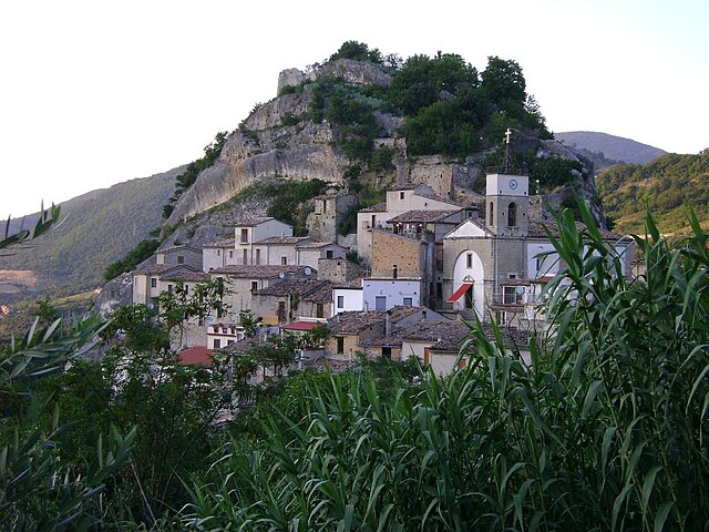
Монтеферранте (Monteferrante, Monteferrante)
.svg)
- коммуна Италии
 Hiking in Монтеферранте
Monteferrante, located in the Abruzzo region of Italy, offers beautiful hiking opportunities surrounded by stunning scenery and rich natural biodiversity. Here are some highlights to consider for your hiking trip in Monteferrante:
Trails and Routes
-
Nature Trails: The area features various marked trails that vary in difficulty and length. Popular routes often lead through forests, along ridges, and offer panoramic views of the surrounding mountains and valleys.
-
Scenic Views: The higher you climb, the more breathtaking the views become. Look out for wide vistas of the Apennines, lush greenery, and charming rural landscapes.
-
Flora and Fauna: The region is home to diverse plant and animal species. As you hike, you might encounter native wildflowers, oak and beech forests, and a range of wildlife, including birds and mammals unique to the area.
Best Hiking Tips
- Season: Consider the best time to hike. Spring and early fall offer mild temperatures and beautiful landscapes, while summer can be warm.
- Gear: Wear proper hiking boots and clothing suitable for the terrain and weather conditions. Don't forget trekking poles for added support on steep ascents or descents.
- Hydration and Snacks: Carry enough water and energy-boosting snacks, especially on longer hikes.
- Maps and Navigation: Download offline maps or have a physical map. Some trails may not have clear signage.
Local Advice
- Guided Tours: If you're unfamiliar with the area, consider joining a guided tour. Local guides can enhance your experience with knowledge about the ecosystem and history.
- Cultural Sites: Besides hiking, look for nearby cultural or historical sites to explore, such as ancient villages or churches that add context to the natural beauty.
Safety
Always inform someone about your hiking plans, stay on marked trails, and be conscious of changing weather conditions. It’s advisable to check the local weather forecast before heading out.
Enjoy your hiking adventure in Monteferrante! It promises a great experience for both seasoned hikers and newcomers alike.
- Страна:

- Почтовый код: 66040
- Телефонный код: 0872
- Код автомобильного номера: CH
- Координаты: 41° 57' 0" N, 14° 23' 0" E


- GPS треки (wikiloc): [Ссылка]
- Высота над уровнем моря: 850 м m
- Площадь: 15.29 кв.км
- Население: 123
- Веб сайт: http://www.comune.monteferrante.ch.it
- Википедия русская: wiki(ru)
- Википедия английская: wiki(en)
- Википедия национальная: wiki(it)
- Хранилище Wikidata: Wikidata: Q3563
- Катеория в википедии: [Ссылка]
- код Freebase: [/m/0fg30v]
- код GeoNames: Альт: [6537484]
- ID отношения в OpenStreetMap: [41633]
- код TGN: [7053615]
- код ISTAT: 069052
- кадастровый код Италии: F498
Граничит с регионами:

Пьетраферраццана
- коммуна Италии
Hiking in Пьетраферраццана
Pietraferrazzana is a charming village in the province of Chieti, situated in the Abruzzo region of Italy. It's nestled within the scenic landscapes of the Apennines, making it a wonderful destination for hikers and nature lovers. Here are some highlights and tips for hiking in the area:...
- Страна:
- Почтовый код: 66040
- Телефонный код: 0872
- Код автомобильного номера: CH
- Координаты: 41° 58' 0" N, 14° 22' 0" E
- GPS треки (wikiloc): [Ссылка]
- Высота над уровнем моря: 357 м m
- Площадь: 4.37 кв.км
- Население: 133
- Веб сайт: [Ссылка]


Ройо-дель-Сангро
- коммуна Италии
Hiking in Ройо-дель-Сангро
Roio del Sangro is a charming town located in the Abruzzo region of Italy, surrounded by beautiful natural landscapes, making it a great destination for hiking enthusiasts. The area is characterized by its varied terrain, including mountains, forests, and rivers, offering a wide range of hiking trails suitable for different skill levels....
- Страна:
- Почтовый код: 66040
- Телефонный код: 0872
- Код автомобильного номера: CH
- Координаты: 41° 55' 0" N, 14° 22' 0" E
- GPS треки (wikiloc): [Ссылка]
- Высота над уровнем моря: 840 м m
- Площадь: 11.81 кв.км
- Население: 101
- Веб сайт: [Ссылка]

Кастильоне-Мессер-Марино
- коммуна Италии
Hiking in Кастильоне-Мессер-Марино
Castiglione Messer Marino is a charming village in the Abruzzo region of Italy, known for its beautiful landscapes, rich history, and traditional architecture. The area is surrounded by the stunning scenery of the Abruzzo National Park and offers a variety of hiking opportunities for both novice and experienced hikers....
- Страна:
- Почтовый код: 66033
- Телефонный код: 0873
- Код автомобильного номера: CH
- Координаты: 41° 52' 0" N, 14° 27' 0" E
- GPS треки (wikiloc): [Ссылка]
- Высота над уровнем моря: 1081 м m
- Площадь: 47.99 кв.км
- Население: 1712
- Веб сайт: [Ссылка]
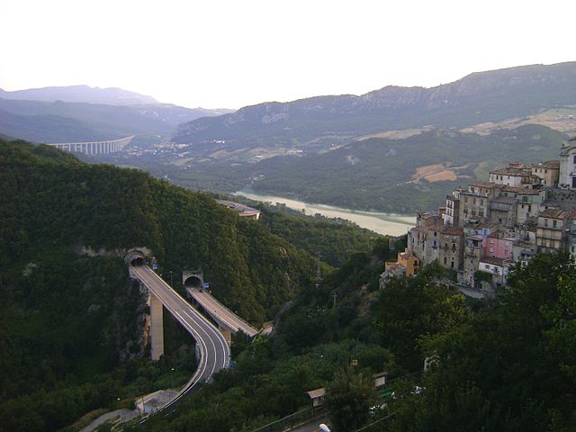

Колледимеццо
- коммуна Италии
Hiking in Колледимеццо
Colledimezzo is a picturesque village in the Abruzzo region of Italy, situated in the province of Chieti. This area is characterized by its stunning landscapes, rolling hills, and a mix of natural beauty and rich cultural heritage, making it an ideal destination for hiking enthusiasts....
- Страна:
- Почтовый код: 66040
- Телефонный код: 0872
- Код автомобильного номера: CH
- Координаты: 41° 59' 0" N, 14° 23' 0" E
- GPS треки (wikiloc): [Ссылка]
- Высота над уровнем моря: 425 м m
- Площадь: 11.05 кв.км
- Население: 482
- Веб сайт: [Ссылка]


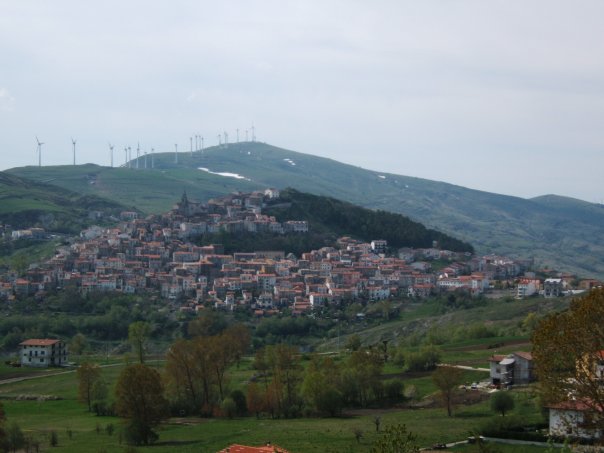
Монтаццоли
- коммуна Италии
Hiking in Монтаццоли
Montazzoli is a charming village located in the Abruzzo region of Italy, known for its stunning landscapes and rich natural beauty. The surrounding area offers a variety of hiking opportunities for both beginners and experienced hikers....
- Страна:
- Почтовый код: 66030
- Телефонный код: 0872
- Код автомобильного номера: CH
- Координаты: 41° 57' 0" N, 14° 26' 0" E
- GPS треки (wikiloc): [Ссылка]
- Высота над уровнем моря: 850 м m
- Площадь: 39.46 кв.км
- Население: 930
- Веб сайт: [Ссылка]

Вилла-Санта-Мария
- коммуна Италии
Hiking in Вилла-Санта-Мария
Villa Santa Maria is a beautiful destination located in the heart of Italy, surrounded by stunning landscapes that make it an excellent spot for hiking and outdoor activities. The area is characterized by rolling hills, lush forests, and breathtaking views of the surrounding mountains....
- Страна:
- Почтовый код: 66047
- Телефонный код: 0872
- Код автомобильного номера: CH
- Координаты: 41° 57' 5" N, 14° 21' 5" E
- GPS треки (wikiloc): [Ссылка]
- Высота над уровнем моря: 390 м m
- Площадь: 16.23 кв.км
- Население: 1338
- Веб сайт: [Ссылка]