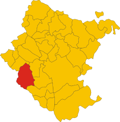
Монтеварки (Montevarchi, Montevarchi)
.svg)
- коммуна Италии
 Hiking in Монтеварки
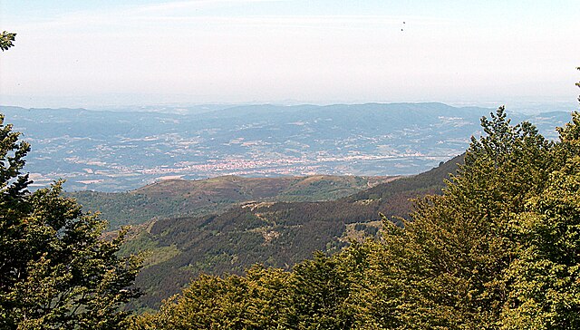
Montevarchi, located in the Tuscany region of Italy, is a charming town surrounded by picturesque landscapes, making it an excellent area for hiking enthusiasts. The region is known for its rolling hills, vineyards, and the nearby Chianti area, offering various trails for different skill levels.
Hiking Trails
-
Chianti Trail:
- This famous trail winds through the Chianti wine region. Hikers can enjoy scenic views of vineyards and olive groves while tasting some of the best wines in Italy.
-
Valdarno Valley Hiking:
- Montevarchi is situated in the Valdarno Valley, where several trails offer different lengths and difficulties. The valley itself is rich in history and culture, with opportunities to explore ancient villages and local flora and fauna.
-
Pratomagno Ridge:
- The Pratomagno massif is not far from Montevarchi and provides hiking trails with stunning panoramic views. The trails vary in difficulty, catering to both beginners and experienced hikers.
-
Nature Reserves:
- The nearby nature reserves, such as the Riserva Naturale di Ponte Buriano e Molezzano, offer trails where hikers can observe diverse wildlife and get close to nature.
General Tips for Hiking in Montevarchi
- Best Time to Hike: Although hiking can be enjoyed year-round, spring (April to June) and early autumn (September to October) are ideal, as temperatures are generally mild and the scenery is beautiful.
- Preparation: Make sure to wear appropriate hiking shoes and bring plenty of water, snacks, and a map or GPS device. It's also a good idea to check the weather forecast before heading out.
- Guided Tours: If you're unfamiliar with the area, consider joining guided hiking tours, which are often available and can provide insights into the region's ecology and history.
- Respect Nature: While enjoying the trails, remember to stick to marked paths and dispose of waste properly to protect the beautiful environment.
Whether you're looking for a leisurely walk or a challenging trek, Montevarchi and its surroundings offer a variety of options to satisfy your hiking desires!
- Страна:

- Почтовый код: 52025
- Телефонный код: 055
- Код автомобильного номера: AR
- Координаты: 43° 31' 24" N, 11° 34' 4" E


- GPS треки (wikiloc): [Ссылка]
- Высота над уровнем моря: 144 м m
- Площадь: 56.67 кв.км
- Население: 24440
- Веб сайт: http://www.comune.montevarchi.ar.it/
- Википедия русская: wiki(ru)
- Википедия английская: wiki(en)
- Википедия национальная: wiki(it)
- Хранилище Wikidata: Wikidata: Q52089
- Галерея изображений в википедии: [Ссылка]
- Катеория в википедии: [Ссылка]
- код Freebase: [/m/0cxkv5]
- код GeoNames: Альт: [6541098]
- код VIAF: Альт: [155967327]
- ID отношения в OpenStreetMap: [42469]
- идентификатор местоположения ArchINFORM: [43161]
- место в MusicBrainz: [7479f9ea-4917-4aaa-95c1-8333301af787]
- код темы Quora: [Montevarchi]
- UN/LOCODE: [ITMVH]
- код в Большой каталанской энциклопедии: [0043814]
- код места в Facebook: [112966102050978]
- dmoz: Альт: [Regional/Europe/Italy/Tuscany/Localities/Montevarchi/]
- код ISTAT: 051026
- кадастровый код Италии: F656
Граничит с регионами:

Бучине
- коммуна Италии
Hiking in Бучине
Bucine, located in the heart of Tuscany, Italy, offers a beautiful setting for hiking with its rolling hills, vineyards, olive groves, and charming villages. The area is known for its picturesque landscapes and mild climate, making it a great destination for outdoor enthusiasts. Here are some highlights for hiking in Bucine:...
- Страна:
- Почтовый код: 52021
- Телефонный код: 055
- Код автомобильного номера: AR
- Координаты: 43° 28' 39" N, 11° 36' 57" E
- GPS треки (wikiloc): [Ссылка]
- Высота над уровнем моря: 207 м m
- Площадь: 131.47 кв.км
- Население: 10087
- Веб сайт: [Ссылка]


Каврилья
- коммуна Италии
Hiking in Каврилья
Cavriglia is a scenic town located in the province of Arezzo, Tuscany, Italy. Nestled in the foothills of the Chianti region, it offers beautiful landscapes, rolling hills, and a rich history, making it a great destination for hiking enthusiasts. Here are some key points about hiking in and around Cavriglia:...
- Страна:
- Почтовый код: 52022
- Телефонный код: 055
- Код автомобильного номера: AR
- Координаты: 43° 31' 13" N, 11° 29' 13" E
- GPS треки (wikiloc): [Ссылка]
- Высота над уровнем моря: 308 м m
- Площадь: 60.87 кв.км
- Население: 9543
- Веб сайт: [Ссылка]

Сан-Джованни-Вальдарно
- коммуна Италии
Hiking in Сан-Джованни-Вальдарно
San Giovanni Valdarno, located in Tuscany, Italy, is a charming town that serves as a great base for hiking enthusiasts. The surrounding landscapes are characterized by rolling hills, vineyards, olive groves, and scenic views of the Arno Valley, making it an excellent destination for outdoor activities....
- Страна:
- Почтовый код: 52027
- Телефонный код: 055
- Код автомобильного номера: AR
- Координаты: 43° 33' 52" N, 11° 31' 58" E
- GPS треки (wikiloc): [Ссылка]
- Высота над уровнем моря: 134 м m
- Площадь: 21.45 кв.км
- Население: 16812
- Веб сайт: [Ссылка]


Террануова-Браччолини
- коммуна Италии
Hiking in Террануова-Браччолини
Terranuova Bracciolini, located in the Tuscany region of Italy, offers a beautiful and diverse landscape for hiking enthusiasts. Nestled inside the Valdarno valley and surrounded by hills, it provides a range of trails ideal for various skill levels, from gentle walks to more challenging hikes....
- Страна:
- Почтовый код: 52028
- Телефонный код: 055
- Код автомобильного номера: AR
- Координаты: 43° 33' 11" N, 11° 35' 22" E
- GPS треки (wikiloc): [Ссылка]
- Высота над уровнем моря: 156 м m
- Площадь: 85.88 кв.км
- Население: 12292
- Веб сайт: [Ссылка]


Гайоле-ин-Кьянти
- коммуна Италии
Hiking in Гайоле-ин-Кьянти
Gaiole in Chianti is a charming village located in the heart of the Chianti region of Tuscany, Italy. This area is renowned for its stunning landscapes, vineyards, olive groves, and rolling hills, making it a fantastic destination for hiking enthusiasts. Here are some highlights and tips for hiking in Gaiole in Chianti:...
- Страна:
- Почтовый код: 53013
- Телефонный код: 0577
- Код автомобильного номера: SI
- Координаты: 43° 28' 0" N, 11° 26' 0" E
- GPS треки (wikiloc): [Ссылка]
- Высота над уровнем моря: 360 м m
- Площадь: 128.89 кв.км
- Население: 2758
- Веб сайт: [Ссылка]