
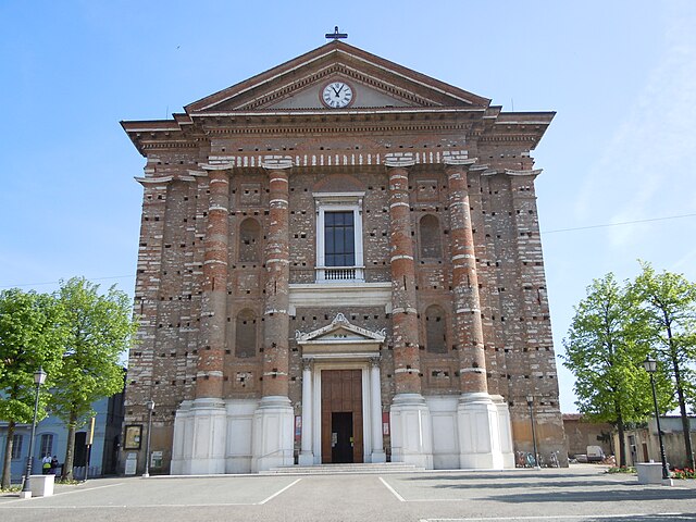
Монтикьяри (Montichiari, Montichiari)
.svg)
- коммуна Италии
 Hiking in Монтикьяри
Montichiari, located in the province of Brescia in Northern Italy, is not typically known as a major hiking destination compared to other regions in the Italian Alps or the Dolomites. However, it is surrounded by scenic countryside, rolling hills, and offers some opportunities for outdoor activities including hiking.
Here are a few options and tips for hiking in and around Montichiari:
-
Local Trails: Look for local walking trails that wind through the countryside. Many trails can take you through vineyards and farms, offering beautiful views of the landscape.
-
Parco del Mincio: A short drive from Montichiari, this park features flat walking and biking trails along the Mincio River, with opportunities to explore nature, wildlife, and picturesque villages.
-
Lakes: The nearby Lake Garda, about 30 minutes from Montichiari, offers numerous hiking trails along its shores and into the surrounding hills. The area provides a variety of trails ranging from easy walks to more challenging hikes.
-
Equipment: Always wear appropriate hiking shoes, carry water, snacks, and a map or GPS device to guide you on the trails.
-
Weather: Check the weather forecast before heading out, as conditions can change quickly, particularly in mountainous areas.
-
Local Guidance: Consider reaching out to local hiking clubs or tourism offices for guided hikes or more information about trails suited to your skill level.
-
Cultural Sites: While hiking, you may also stumble upon historical sites, such as churches and old ruins, adding a cultural aspect to your outdoor adventures.
While the hiking options might be more limited compared to other regions, the charm of Montichiari's countryside and its proximity to Lake Garda can make for a pleasant hiking experience.
- Страна:

- Почтовый код: 25018
- Телефонный код: 030
- Код автомобильного номера: BS
- Координаты: 45° 24' 58" N, 10° 23' 30" E


- GPS треки (wikiloc): [Ссылка]
- Высота над уровнем моря: 108 м m
- Площадь: 81.192 кв.км
- Население: 25714
- Веб сайт: http://www.comune.montichiari.bs.it
- Википедия русская: wiki(ru)
- Википедия английская: wiki(en)
- Википедия национальная: wiki(it)
- Хранилище Wikidata: Wikidata: Q105256
- Катеория в википедии: [Ссылка]
- код Freebase: [/m/044wdf]
- код GeoNames: Альт: [6537174]
- код VIAF: Альт: [133649068]
- ID отношения в OpenStreetMap: [44861]
- место в MusicBrainz: [3747ef8c-fa7e-469f-aed5-1b0687b64a0a]
- код темы Quora: [Montichiari]
- UN/LOCODE: [ITMCH]
- код в Большой каталанской энциклопедии: [0043880]
- код ISTAT: 017113
- кадастровый код Италии: F471
Граничит с регионами:

Кальчинато
- коммуна Италии
Hiking in Кальчинато
Calcinato is a charming town located in the Lombardy region of northern Italy, not far from the city of Brescia. While it may not be as well-known for hiking as some other areas in Italy, it offers opportunities for outdoor activities and exploration in the surrounding region....
- Страна:
- Почтовый код: 25011
- Телефонный код: 030
- Код автомобильного номера: BS
- Координаты: 45° 27' 29" N, 10° 24' 53" E
- GPS треки (wikiloc): [Ссылка]
- Высота над уровнем моря: 171 м m
- Площадь: 33.3 кв.км
- Население: 12894
- Веб сайт: [Ссылка]

Кальвизано
- коммуна Италии
Hiking in Кальвизано
Calvisano is a charming town located in the Lombardy region of northern Italy, known for its picturesque landscapes and proximity to various natural reserves. Hiking opportunities around Calvisano are typically characterized by beautiful scenery, lush countryside, and serene rural settings....
- Страна:
- Почтовый код: 25012
- Телефонный код: 030
- Код автомобильного номера: BS
- Координаты: 45° 20' 56" N, 10° 20' 45" E
- GPS треки (wikiloc): [Ссылка]
- Высота над уровнем моря: 67 м m
- Площадь: 44.83 кв.км
- Население: 8543
- Веб сайт: [Ссылка]

Карпенедоло
- коммуна Италии
Hiking in Карпенедоло
Carpenedolo, located in the Lombardy region of Italy, is a charming town that offers access to scenic hiking opportunities, primarily within the surrounding countryside and nearby natural areas. While Carpenedolo itself may not be widely recognized for extensive hiking trails, it serves as a great starting point for exploring the natural beauty of Lombardy....
- Страна:
- Почтовый код: 25013
- Телефонный код: 030
- Код автомобильного номера: BS
- Координаты: 45° 21' 55" N, 10° 25' 56" E
- GPS треки (wikiloc): [Ссылка]
- Высота над уровнем моря: 78 м m
- Площадь: 29.84 кв.км
- Население: 12957
- Веб сайт: [Ссылка]
Кастенедоло
- коммуна Италии
Hiking in Кастенедоло
Castenedolo is a municipality located in the province of Brescia in northern Italy. While it may not be as well-known for hiking as larger national parks or mountain ranges in Italy, it is nestled in a beautiful region that offers various outdoor activities, including hiking....
- Страна:
- Почтовый код: 25014
- Телефонный код: 030
- Код автомобильного номера: BS
- Координаты: 45° 28' 13" N, 10° 17' 48" E
- GPS треки (wikiloc): [Ссылка]
- Высота над уровнем моря: 150 м m
- Площадь: 26.2 кв.км
- Население: 11482
- Веб сайт: [Ссылка]

Геди
- коммуна Италии
Hiking in Геди
Ghedi, located in the Lombardy region of northern Italy, is primarily known for its agricultural landscape rather than extensive hiking trails. However, the surrounding areas, such as the nearby hills and nature reserves, offer opportunities for outdoor activities including hiking....
- Страна:
- Почтовый код: 25016
- Телефонный код: 030
- Код автомобильного номера: BS
- Координаты: 45° 24' 7" N, 10° 16' 49" E
- GPS треки (wikiloc): [Ссылка]
- Высота над уровнем моря: 85 м m
- Площадь: 60 кв.км
- Население: 18828
- Веб сайт: [Ссылка]


Кастильоне-делле-Стивьере
- коммуна Италии
Hiking in Кастильоне-делле-Стивьере
Castiglione delle Stiviere is a charming town located in the Lombardy region of northern Italy, known for its rich history, beautiful landscapes, and proximity to various natural attractions. While it may not be as famous for hiking as other areas in Italy, there are several opportunities for outdoor activities and exploration in the surrounding region....
- Страна:
- Почтовый код: 46043
- Телефонный код: 0376
- Код автомобильного номера: MN
- Координаты: 45° 24' 0" N, 10° 30' 0" E
- GPS треки (wikiloc): [Ссылка]
- Высота над уровнем моря: 111 м m
- Площадь: 42.02 кв.км
- Население: 23570
- Веб сайт: [Ссылка]