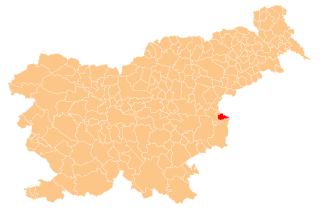
Брежице (Brežice Municipality, Občina Brežice)

 Hiking in Брежице
Hiking in the Municipality of Brežice, located in Slovenia near the border with Croatia, offers a blend of scenic landscapes, cultural landmarks, and natural beauty. The region is characterized by rolling hills, rivers, and vineyards that provide a picturesque backdrop for outdoor activities.
Popular Hiking Trails
-
Sava River Trails: The banks of the Sava River offer various paths where hikers can enjoy peaceful walks along the river, taking in the flora and fauna of the area.
-
Plesivec Hill: A popular spot for hikers, Plesivec Hill provides trails with varying difficulty levels and rewards you with panoramic views of the surrounding landscape.
-
Nature Park Šmarješke Toplice: Located nearby, this area has well-maintained trails through diverse habitats, including woodlands and meadows. It's perfect for both hiking and birdwatching.
-
Vineyards Trails: The region is known for its wine production, and several trails weave through vineyards, allowing hikers to enjoy local wines and stunning views of the countryside.
Tips for Hiking in Brežice
-
Best Time to Hike: The ideal time for hiking is during late spring (May to June) and early autumn (September to October) when the weather is mild and the scenery is at its best.
-
Local Maps and Guides: It’s advisable to pick up local maps or guides available at tourist information centers to better navigate the trails.
-
Safety: Always let someone know your planned route and estimated return time, carry plenty of water, and wear appropriate hiking footwear.
-
Respect Nature: Follow the Leave No Trace principles, stay on marked trails, and respect local wildlife and plants.
Brežice not only provides great hiking opportunities but also cultural experiences, such as visiting the Brežice Castle, which is close to several trails, making it ideal for combining your hike with exploration of local history.
- Страна:

- Почтовый код: 8250
- Код автомобильного номера: KK
- Координаты: 45° 54' 0" N, 15° 35' 0" E


- GPS треки (wikiloc): [Ссылка]
- Площадь: 268.1 кв.км
- Википедия английская: wiki(en)
- Википедия национальная: wiki(sl)
- Хранилище Wikidata: Wikidata: Q906879
- Катеория в википедии: [Ссылка]
- код GeoNames: Альт: [3203411]
- код VIAF: Альт: [159586085]
- код LCNAF: Альт: [n92019737]
- место в MusicBrainz: [46f30e2e-28e1-4415-8f1f-ca980a27b16c]
- код ISNI: Альт: [0000 0004 0397 7888]
- ISO 3166-2: SI-009
- FIPS 10-4: SI08
- код CONOR: 286718051
Граничит с регионами:


Козье
Hiking in Козье
Kozje is a picturesque area located in Slovenia, known for its beautiful landscapes and accessible hiking trails. Here are some highlights and tips for hiking in Kozje:...
- Страна:
- Почтовый код: 3260
- Код автомобильного номера: CE
- Координаты: 46° 4' 20" N, 15° 33' 25" E
- GPS треки (wikiloc): [Ссылка]
- Высота над уровнем моря: 276 м m
- Площадь: 89.7 кв.км
- Веб сайт: [Ссылка]

Бистрица-об-Сотли
Hiking in Бистрица-об-Сотли
The Municipality of Bistrica ob Sotli, located in Slovenia, is known for its beautiful natural landscapes, making it an appealing destination for hikers who enjoy exploring rural and scenic terrains. Here are some highlights and tips for hiking in this area:...
- Страна:
- Почтовый код: 3256
- Код автомобильного номера: CE
- Координаты: 46° 3' 36" N, 15° 38' 50" E
- GPS треки (wikiloc): [Ссылка]
- Высота над уровнем моря: 230 м m
- Площадь: 31.1 кв.км
- Веб сайт: [Ссылка]


Кршко
- муниципалиет в Словении
- Страна:
- Почтовый код: 8270
- Код автомобильного номера: KK
- Координаты: 45° 57' 0" N, 15° 29' 0" E
- GPS треки (wikiloc): [Ссылка]
- Высота над уровнем моря: 163 м m
- Площадь: 344.9 кв.км