
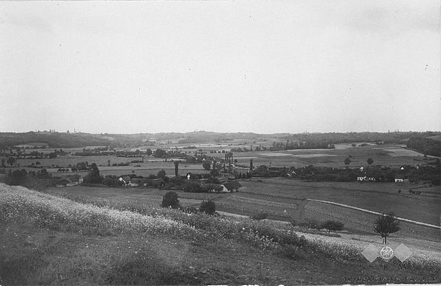
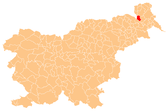
Словения (Slovenia, Slovenija)


- страна в Европе
 Hiking in Словения
Slovenia is a fantastic destination for hiking, offering a diverse range of trails that cater to all levels of experience. Here are some key highlights:
1.
The Julian Alps are arguably the crown jewel of Slovenia’s hiking scene. Trails vary from easy walks to challenging alpine routes. Notable hikes include:
- Triglav National Park: Home to Mount Triglav, Slovenia's highest peak. The hike to the summit is a classic, requiring a good level of fitness and some climbing experience.
- Vintgar Gorge: A scenic, easy walk that follows a wooden boardwalk along the gorge and showcases beautiful waterfalls and emerald waters.
2.
Both lakes offer stunning vistas and various hiking opportunities.
- Walk around Lake Bled: An easier hike with spectacular views of both the lake and Bled Castle.
- Savica Waterfall: A short hike leads to this picturesque waterfall near Lake Bohinj.
3.
While primarily known for its cave system and castle, there are several hiking trails nearby that explore the karst landscape and provide unique views.
4.
Famous for its turquoise river, the Soča Valley offers beautiful hikes, including trails that follow the river and lead to scenic viewpoints or through historical sites, like the World War I battleground trails.
5.
The region has unique landscapes and offers hiking trails through distinctive karst formations, caves, and quaint villages.
6.
Many hikes can lead you to historical sites, traditional villages, or opportunities to taste local cuisine, enhancing your experience beyond just the scenery.
Tips for Hiking in Slovenia:
- Maps & Guides: Utilize local hiking maps or apps for navigational support.
- Weather: Be aware of rapidly changing weather conditions, especially in the mountains.
- Trail Markings: Most trails are well marked with the familiar GZZ (green, white, and red) markings.
- Safety: Always inform someone about your hiking plans, especially for remote or alpine trails.
- Respect Nature: Stay on marked trails and follow Leave No Trace principles.
Whether you're looking for a leisurely stroll or a strenuous multi-day trek, Slovenia has something to offer for everyone!
- Страна:

- Код автомобильного номера: SLO
- Координаты: 46° 0' 0" N, 15° 0' 0" E


- GPS треки (wikiloc): [Ссылка]
- Площадь: 20273 кв.км
- Население: 2066880
- Веб сайт: http://www.gov.si/
- Википедия русская: wiki(ru)
- Википедия английская: wiki(en)
- Википедия национальная: wiki(sl)
- Хранилище Wikidata: Wikidata: Q215
- Галерея изображений в википедии: [Ссылка]
- Катеория в википедии: [Ссылка]
- Карты в википедии: [Ссылка]
- код Freebase: [/m/06t8v]
- код GeoNames: Альт: [3190538]
- код VIAF: Альт: [141826349]
- ID отношения в OpenStreetMap: [218657]
- код GND: Альт: [4055302-4]
- идентификатор местоположения ArchINFORM: [2298]
- код LCNAF: Альт: [n81035365]
- код тезауруса PACTOLS: [pcrtQaSzfXMOcR]
- место в MusicBrainz: [5b0b6225-584c-3942-b69d-5efceb9989af]
- код темы Quora: [Slovenia]
- код TGN: [7006670]
- код в энциклопедии «Британника онлайн»: [place/Slovenia]
- код в Большой каталанской энциклопедии: [0024758]
- код в Encyclopædia Universalis: [slovenie]
- идентификатор HDS: [32209]
- код в Большой российской энциклопедии онлайн: [3837662]
- код ISNI: Альт: [0000 0001 2110 9038]
- код NKC: [ge130856]
- dmoz: Альт: [Regional/Europe/Slovenia/]
- код NLI: [000984326]
- код NUTS: [SI]
- код YSO: [107594]
- Giant Bomb ID: [3035-2883]
- код статьи Klexikon: [Slowenien]
- код BabelNet: [00067230n]
- код онлайн-версии Энциклопедии Брокгауз: [slowenien]
- сабреддит: [Slovenia]
- код NDL: [00577333]
- STW Thesaurus for Economics ID: [18226-5]
- LoC and MARC vocabularies ID: [countries/xv]
- код Statoids: [usi]
- код MeSH: Альт: [D017524]
- код темы Guardian: [world/slovenia]
- код Тезауруса ЮНЕСКО: [concept8622]
- идентификатор темы Le Monde diplomatique: [pays/slovenie]
- идентификатор таблицы данных Invasive Species Compendium: [108559]
- код темы NYT: [destination/slovenia]
- ASC Leiden Thesaurus ID: [369184459]
- код BBC Things: [f5ab04b1-0b88-4b7c-ad9c-1d29d4b3b936]
- CIVICUS Monitor country entry: [slovenia]
- код US National Archives: 10045308
- FIPS 10-4: SI
- GACS ID: 193
- код CONOR: 288961123
- ISO 3166-1 alpha-3: SVN
- ISO 3166-1 цифровой: 705
- ISO 3166-1 alpha-2: SI
- идентификатор ITU/ISO/IEC: 2.16.705
- WIPO ST.3: SI
- код страны МОК: SLO
- ITU letter code: SVN
- код INSEE для стран и зарубежных территорий: 99145
- UIC алфавитный код страны: SLO
- код страны UIC: 79
Включает регионы:
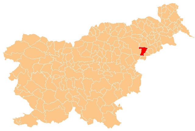
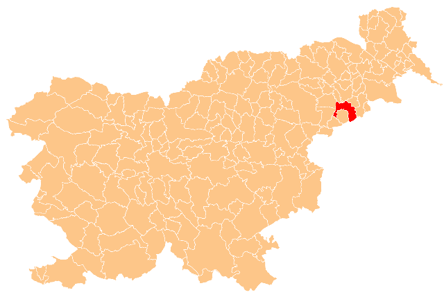
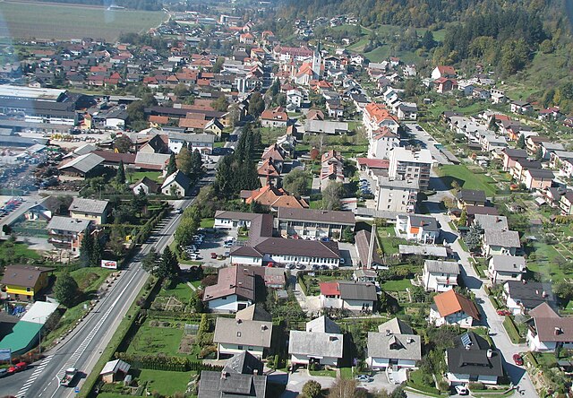
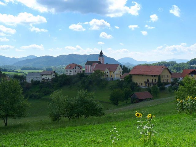
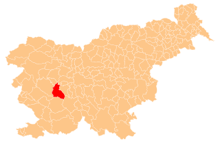
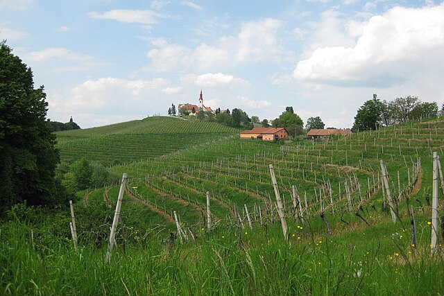
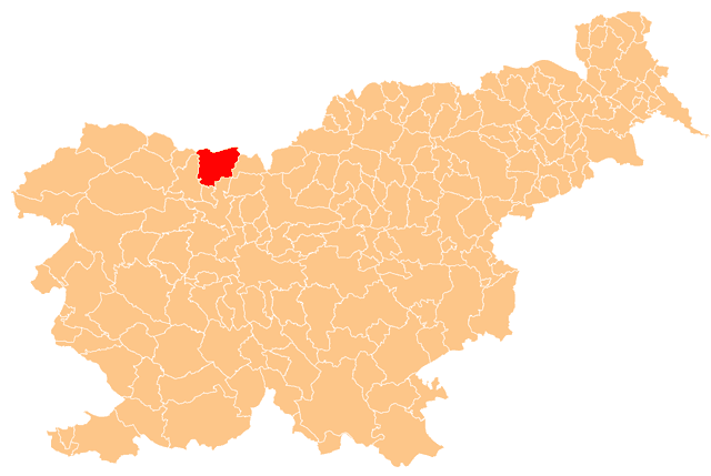
Випава
Hiking in Випава
The Municipality of Vipava, located in Slovenia, is known for its stunning natural landscapes, rolling hills, and picturesque valleys, making it a fantastic destination for hiking enthusiasts. Here are some highlights of hiking in this area:...
- Страна:
- Координаты: 45° 49' 25" N, 13° 59' 4" E
- GPS треки (wikiloc): [Ссылка]
- Высота над уровнем моря: 697 м m
- Площадь: 107.4 кв.км


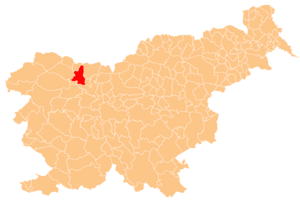
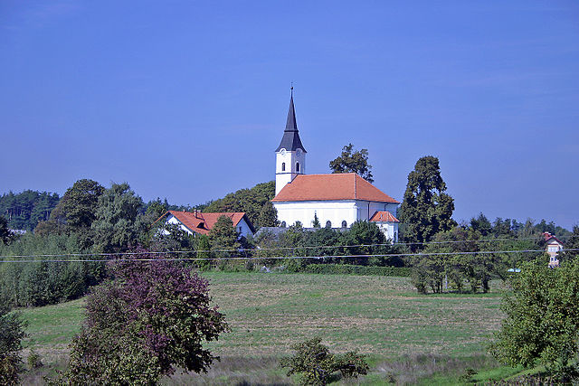
Подлехник
Hiking in Подлехник
Podlehnik is a picturesque village located in southeastern Slovenia, near the Drava River and bordering the region of Styria. While it may not be as famous as some of Slovenia's more popular hiking destinations, it offers a variety of trails and natural scenery that can be appealing to outdoor enthusiasts....
- Страна:
- Почтовый код: 2286
- Код автомобильного номера: MB
- Координаты: 46° 18' 58" N, 15° 52' 0" E
- GPS треки (wikiloc): [Ссылка]
- Высота над уровнем моря: 242 м m
- Площадь: 46.0 кв.км
- Веб сайт: [Ссылка]

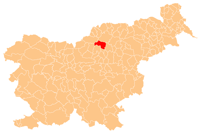
Майшперк
Hiking in Майшперк
The Municipality of Majšperk, located in Slovenia, offers some beautiful hiking opportunities amid its picturesque landscapes. Nestled in the northeastern part of the country, Majšperk features diverse terrain, including hills, forests, and rivers, which provides a variety of trails for hikers of different experience levels....
- Страна:
- Почтовый код: 2322
- Код автомобильного номера: MB
- Координаты: 46° 21' 6" N, 15° 44' 1" E
- GPS треки (wikiloc): [Ссылка]
- Площадь: 72.8 кв.км
- Веб сайт: [Ссылка]

Videm Municipality
Hiking in Videm Municipality
The Municipality of Videm, located in Slovenia, offers some beautiful hiking opportunities, thanks to its picturesque landscapes and diverse terrain. Here are some key points about hiking in this area:...
- Страна:
- Почтовый код: 2284
- Код автомобильного номера: MB
- Координаты: 46° 21' 51" N, 15° 52' 53" E
- GPS треки (wikiloc): [Ссылка]
- Высота над уровнем моря: 217 м m
- Площадь: 80.2 кв.км
- Веб сайт: [Ссылка]


Дорнава
Hiking in Дорнава
The Municipality of Dornava, located in Slovenia, offers a unique combination of natural beauty and cultural insights for hiking enthusiasts. While the area may not be as widely known for hiking as some other Slovenian regions, it boasts several trails that traverse picturesque landscapes, including lush forests, rolling hills, and quaint villages....
- Страна:
- Почтовый код: 2252
- Код автомобильного номера: MB
- Координаты: 46° 26' 44" N, 15° 59' 26" E
- GPS треки (wikiloc): [Ссылка]
- Высота над уровнем моря: 249 м m
- Площадь: 28.4 кв.км
- Веб сайт: [Ссылка]


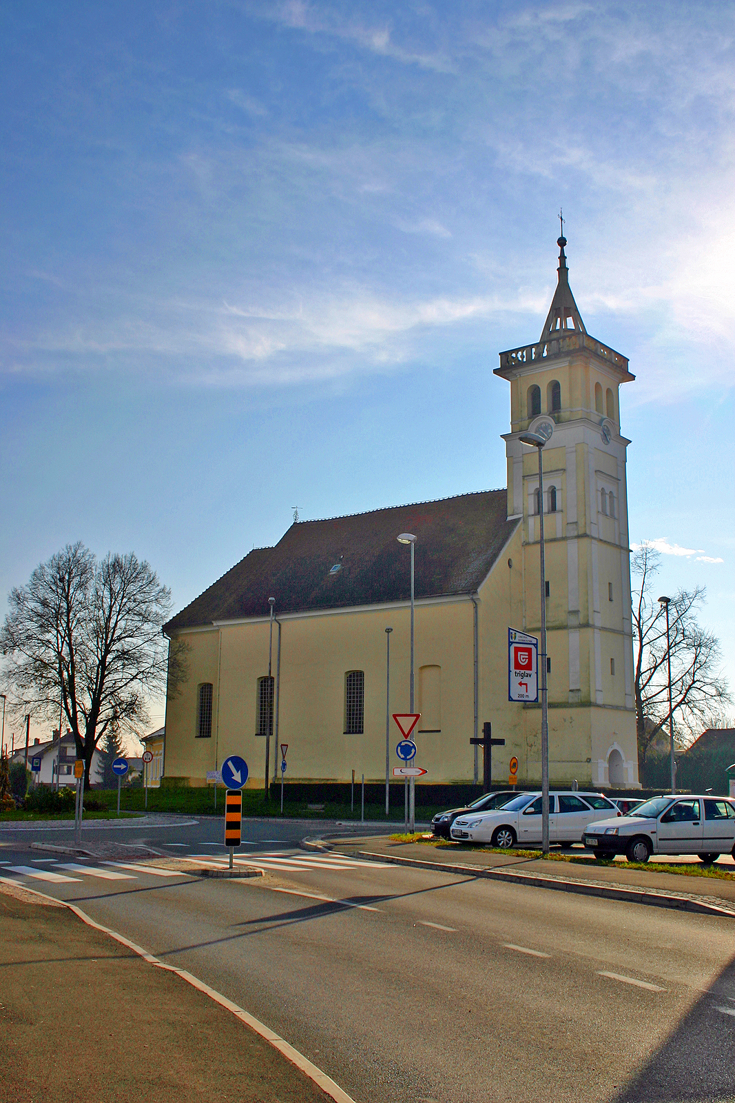
Юршинци
Hiking in Юршинци
Juršinci is a picturesque village located in Slovenia, known for its charming landscapes and hiking opportunities. The area around Juršinci offers various trails that cater to different skill levels, making it a great destination for both novice and experienced hikers....
- Страна:
- Почтовый код: 2256
- Код автомобильного номера: MB
- Координаты: 46° 29' 15" N, 15° 58' 35" E
- GPS треки (wikiloc): [Ссылка]
- Высота над уровнем моря: 261 м m
- Площадь: 36.3 кв.км
- Веб сайт: [Ссылка]


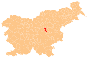
Miklavž na Dravskem Polju Municipality
Hiking in Miklavž na Dravskem Polju Municipality
The Municipality of Miklavž na Dravskem Polju, located in Slovenia, offers a variety of hiking opportunities, blending scenic landscapes with cultural experiences. Here are some key highlights for hiking in this area:...
- Страна:
- Почтовый код: 2204
- Код автомобильного номера: MB
- Координаты: 46° 29' 11" N, 15° 42' 34" E
- GPS треки (wikiloc): [Ссылка]
- Площадь: 12.5 кв.км
- Веб сайт: [Ссылка]


Хорьюл
Hiking in Хорьюл
The Municipality of Horjul, located in Slovenia, features picturesque landscapes and a variety of hiking opportunities suitable for different skill levels. Here are some key highlights regarding hiking in the area:...
- Страна:
- Почтовый код: 1354
- Код автомобильного номера: LJ
- Координаты: 46° 1' 29" N, 14° 17' 5" E
- GPS треки (wikiloc): [Ссылка]
- Высота над уровнем моря: 446 м m
- Площадь: 32.5 кв.км
- Веб сайт: [Ссылка]


Доброва-Полхов Градец
Hiking in Доброва-Полхов Градец
The Municipality of Dobrova–Polhov Gradec, located near Ljubljana in Slovenia, offers beautiful landscapes and diverse hiking opportunities. Here are some key highlights about hiking in this area:...
- Страна:
- Почтовый код: 1355, 1356
- Код автомобильного номера: LJ
- Координаты: 46° 3' 0" N, 14° 18' 0" E
- GPS треки (wikiloc): [Ссылка]
- Площадь: 117.5 кв.км
- Веб сайт: [Ссылка]


Горенья-вас-Поляне
Hiking in Горенья-вас-Поляне
The Municipality of Gorenja Vas–Poljane, located in Slovenia, is known for its beautiful natural landscapes and hiking opportunities. This region is characterized by rolling hills, forests, and scenic views that make it an attractive destination for nature enthusiasts and hikers....
- Страна:
- Почтовый код: 4224
- Код автомобильного номера: KR
- Координаты: 46° 5' 0" N, 14° 3' 0" E
- GPS треки (wikiloc): [Ссылка]
- Площадь: 153.3 кв.км
- Веб сайт: [Ссылка]

Радле-об-Драви
Hiking in Радле-об-Драви
The Municipality of Radlje ob Dravi, located in Slovenia, offers a variety of beautiful hiking opportunities set against a backdrop of stunning natural landscapes. This region is characterized by picturesque valleys, rolling hills, and the Drava River, making it an excellent destination for outdoor enthusiasts....
- Страна:
- Почтовый код: 2360
- Код автомобильного номера: SG
- Координаты: 46° 36' 26" N, 15° 15' 3" E
- GPS треки (wikiloc): [Ссылка]
- Высота над уровнем моря: 345 м m
- Площадь: 93.9 кв.км
- Веб сайт: [Ссылка]


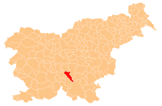
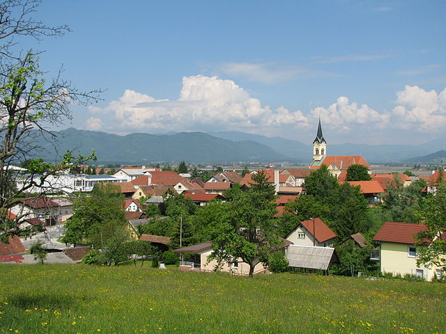
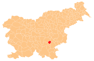
Иванчна Горица
- община в Словении
Hiking in Иванчна Горица
Ivančna Gorica is a picturesque town located in Slovenia, surrounded by beautiful natural landscapes ideal for hiking. The region offers various trails that cater to different skill levels, making it suitable for both beginners and experienced hikers. Here's what you need to know about hiking in Ivančna Gorica:...
- Страна:
- Почтовый код: 1295
- Код автомобильного номера: LJ
- Координаты: 45° 54' 44" N, 14° 48' 26" E
- GPS треки (wikiloc): [Ссылка]
- Высота над уровнем моря: 311 м m
- Площадь: 227 кв.км
- Веб сайт: [Ссылка]
Содражица
Hiking in Содражица
The Municipality of Sodražica, located in Slovenia, offers various hiking opportunities set against a backdrop of beautiful natural scenery, including hills, forests, and rivers. Here are some key highlights for hiking in this region:...
- Страна:
- Почтовый код: 1317
- Код автомобильного номера: NM
- Координаты: 45° 45' 23" N, 14° 37' 20" E
- GPS треки (wikiloc): [Ссылка]
- Высота над уровнем моря: 689 м m
- Площадь: 49.5 кв.км
- Веб сайт: [Ссылка]


Вержей
Hiking in Вержей
The Municipality of Veržej, located in northeastern Slovenia, offers several opportunities for hiking enthusiasts to explore its beautiful landscapes and natural features. The area is characterized by its diverse terrain, with rolling hills, forests, and scenic rivers, making it an excellent destination for hiking and outdoor activities....
- Страна:
- Почтовый код: 9241
- Код автомобильного номера: MS
- Координаты: 46° 34' 54" N, 16° 9' 44" E
- GPS треки (wikiloc): [Ссылка]
- Площадь: 12 кв.км
- Веб сайт: [Ссылка]


Марковцы
Hiking in Марковцы
Markovci is a small village located in Slovenia, and it serves as a gateway to exploring the beautiful countryside and natural landscapes in the area. While Markovci itself may not be as widely known for hiking as some of the larger national parks, it offers access to charming local trails that are suitable for various skill levels....
- Страна:
- Почтовый код: 2281
- Код автомобильного номера: MB
- Координаты: 46° 23' 31" N, 15° 57' 2" E
- GPS треки (wikiloc): [Ссылка]
- Высота над уровнем моря: 217 м m
- Площадь: 29.8 кв.км
- Веб сайт: [Ссылка]


Хоче-Сливница
- община Словении
Hiking in Хоче-Сливница
The Municipality of Hoče-Slivnica, located in Slovenia, offers a variety of hiking opportunities amidst scenic landscapes. The region is characterized by rolling hills, lush forests, and beautiful rural scenery, making it a great destination for both casual hikers and more experienced trekkers....
- Страна:
- Почтовый код: 2311
- Код автомобильного номера: MB
- Координаты: 46° 29' 0" N, 15° 40' 0" E
- GPS треки (wikiloc): [Ссылка]
- Площадь: 53.7 кв.км
- Веб сайт: [Ссылка]


Sveti Jurij v Slovenskih Goricah Municipality
Hiking in Sveti Jurij v Slovenskih Goricah Municipality
The Municipality of Sveti Jurij v Slovenskih Goricah, located in Slovenia, offers a variety of hiking opportunities set against beautiful natural landscapes. Here are some highlights and features you may want to consider:...
- Страна:
- Почтовый код: 2223
- Код автомобильного номера: MB
- Координаты: 46° 36' 3" N, 15° 47' 3" E
- GPS треки (wikiloc): [Ссылка]
- Высота над уровнем моря: 240 м m
- Площадь: 34 кв.км
- Веб сайт: [Ссылка]

Добье
Hiking in Добье
The Municipality of Dobje, located in Slovenia, offers a beautiful setting for hiking enthusiasts, with picturesque landscapes that include rolling hills, lush forests, and scenic viewpoints. Here are some highlights about hiking in this area:...
- Страна:
- Почтовый код: 3224
- Код автомобильного номера: CE
- Координаты: 46° 8' 13" N, 15° 23' 40" E
- GPS треки (wikiloc): [Ссылка]
- Высота над уровнем моря: 600 м m
- Площадь: 17.5 кв.км
- Веб сайт: [Ссылка]

Добреполье
Hiking in Добреполье
The Municipality of Dobrepolje, located in Slovenia, offers various opportunities for outdoor enthusiasts and hikers. This picturesque area is characterized by its beautiful landscapes, rolling hills, and rich natural diversity, making it a great destination for hiking....
- Страна:
- Почтовый код: 1312
- Код автомобильного номера: LJ
- Координаты: 45° 51' 0" N, 14° 42' 0" E
- GPS треки (wikiloc): [Ссылка]
- Площадь: 94.9 кв.км
- Веб сайт: [Ссылка]


Рибница-на-Похорью
Hiking in Рибница-на-Похорью
Ribnica na Pohorju is a picturesque village located in Slovenia’s Pohorje mountain range, known for its stunning natural beauty, lush forests, and diverse hiking trails. Hiking in this area offers a wonderful opportunity to experience the serene landscapes, rich biodiversity, and the charm of the surrounding environment. Here are some highlights and tips for hiking in Ribnica na Pohorju:...
- Страна:
- Почтовый код: 2364
- Код автомобильного номера: SG
- Координаты: 46° 31' 31" N, 15° 15' 39" E
- GPS треки (wikiloc): [Ссылка]
- Высота над уровнем моря: 932 м m
- Площадь: 59.3 кв.км
- Веб сайт: [Ссылка]


Козье
Hiking in Козье
Kozje is a picturesque area located in Slovenia, known for its beautiful landscapes and accessible hiking trails. Here are some highlights and tips for hiking in Kozje:...
- Страна:
- Почтовый код: 3260
- Код автомобильного номера: CE
- Координаты: 46° 4' 20" N, 15° 33' 25" E
- GPS треки (wikiloc): [Ссылка]
- Высота над уровнем моря: 276 м m
- Площадь: 89.7 кв.км
- Веб сайт: [Ссылка]


Моравче
- община Словении
Hiking in Моравче
Moravče is a charming municipality in Slovenia, known for its picturesque landscapes and outdoor opportunities, making it an excellent destination for hiking enthusiasts. The region is characterized by rolling hills, lush forests, and the beautiful natural scenery typical of Slovenian countryside....
- Страна:
- Почтовый код: 1251
- Код автомобильного номера: LJ
- Координаты: 46° 8' 1" N, 14° 45' 18" E
- GPS треки (wikiloc): [Ссылка]
- Высота над уровнем моря: 374 м m
- Площадь: 61.4 кв.км
- Веб сайт: [Ссылка]

Преболд
Hiking in Преболд
The Municipality of Prebold is located in Slovenia and offers a variety of hiking opportunities, thanks to its beautiful natural landscapes and diverse terrain. The region is characterized by its rolling hills, lush forests, and scenic views of the surrounding areas. Here are some key aspects to consider when hiking in Prebold:...
- Страна:
- Почтовый код: 3312
- Код автомобильного номера: CE
- Координаты: 46° 13' 2" N, 15° 5' 34" E
- GPS треки (wikiloc): [Ссылка]
- Высота над уровнем моря: 374 м m
- Площадь: 41.0 кв.км
- Население: 4514
- Веб сайт: [Ссылка]

Подвелка
Hiking in Подвелка
Podvelka is a picturesque village located in Slovenia, surrounded by stunning natural landscapes that are perfect for hiking enthusiasts. Nestled in the Pohorje region, the area offers a variety of trails, suitable for different skill levels, from easy walks to more challenging hikes....
- Страна:
- Почтовый код: 2363
- Код автомобильного номера: SG
- Координаты: 46° 35' 0" N, 15° 20' 0" E
- GPS треки (wikiloc): [Ссылка]
- Площадь: 103.9 кв.км
- Веб сайт: [Ссылка]

Мирна Печ
Hiking in Мирна Печ
Mirna Peč is a picturesque municipality located in Slovenia, known for its stunning natural landscapes and rich cultural heritage. Hiking in this area offers a range of trails that cater to different skill levels, allowing hikers to enjoy the beauty of the Slovenian countryside....
- Страна:
- Почтовый код: 8216
- Код автомобильного номера: NM
- Координаты: 45° 51' 12" N, 15° 5' 4" E
- GPS треки (wikiloc): [Ссылка]
- Высота над уровнем моря: 231 м m
- Площадь: 48 кв.км
- Веб сайт: [Ссылка]


Шентджернедж
Hiking in Шентджернедж
Šentjernej is a picturesque municipality located in Slovenia, nestled in the rolling hills of the Dolenjska region. The area is known for its beautiful landscapes, rich cultural heritage, and a variety of outdoor activities, including hiking....
- Страна:
- Почтовый код: 8275
- Код автомобильного номера: NM
- Координаты: 45° 49' 25" N, 15° 20' 1" E
- GPS треки (wikiloc): [Ссылка]
- Высота над уровнем моря: 227 м m
- Площадь: 96 кв.км
- Веб сайт: [Ссылка]


Sveta Trojica v Slovenskih Goricah Municipality
Hiking in Sveta Trojica v Slovenskih Goricah Municipality
Sveta Trojica v Slovenskih Goricah is a charming village located in northeastern Slovenia, surrounded by the picturesque landscape of the Slovenske Gorice hills. Hiking in this area offers a mix of scenic views, natural beauty, and cultural experiences, making it a great destination for outdoor enthusiasts....
- Страна:
- Почтовый код: 2235
- Код автомобильного номера: MB
- Координаты: 46° 34' 8" N, 15° 53' 21" E
- GPS треки (wikiloc): [Ссылка]
- Высота над уровнем моря: 266 м m
- Площадь: 26 кв.км
- Веб сайт: [Ссылка]


Старше
Hiking in Старше
Starše is a charming area located in Slovenia, near the city of Maribor. While it may not be as widely recognized as some of Slovenia's more famous hiking destinations, it offers beautiful landscapes, lush greenery, and trails suitable for various levels of hikers....
- Страна:
- Почтовый код: 2205
- Код автомобильного номера: MB
- Координаты: 46° 27' 19" N, 15° 45' 19" E
- GPS треки (wikiloc): [Ссылка]
- Высота над уровнем моря: 245 м m
- Площадь: 34 кв.км
- Веб сайт: [Ссылка]

Sveti Tomaž Municipality
Hiking in Sveti Tomaž Municipality
The Municipality of Sveti Tomaž is a beautiful and lesser-known hiking destination located in Slovenia. Nestled in the eastern part of the country, it offers a serene experience for nature lovers and outdoor enthusiasts. Here are some highlights and tips for hiking in this region:...
- Страна:
- Почтовый код: 2258
- Код автомобильного номера: MB
- Координаты: 46° 29' 0" N, 16° 4' 46" E
- GPS треки (wikiloc): [Ссылка]
- Высота над уровнем моря: 295 м m
- Площадь: 38.09 кв.км
- Веб сайт: [Ссылка]
Доленьске-Топлице
- община Словении
Hiking in Доленьске-Топлице
Dolenjske Toplice is a picturesque municipality in Slovenia, known for its beautiful landscapes, thermal springs, and rich cultural heritage. The region offers a range of hiking opportunities suitable for various skill levels. Here are some highlights about hiking in Dolenjske Toplice:...
- Страна:
- Почтовый код: 8350
- Код автомобильного номера: NM
- Координаты: 45° 42' 54" N, 15° 2' 59" E
- GPS треки (wikiloc): [Ссылка]
- Высота над уровнем моря: 433 м m
- Площадь: 110.2 кв.км
- Веб сайт: [Ссылка]

Град
Hiking in Град
The Municipality of Grad, located in Slovenia, offers a variety of hiking opportunities for outdoor enthusiasts. The region is characterized by its beautiful landscapes, including lush forests, rolling hills, and scenic vistas. Here are some key features of hiking in this area:...
- Страна:
- Почтовый код: 9264
- Код автомобильного номера: MS
- Координаты: 46° 47' 13" N, 16° 5' 54" E
- GPS треки (wikiloc): [Ссылка]
- Высота над уровнем моря: 337 м m
- Площадь: 37.4 кв.км
- Веб сайт: [Ссылка]

Gorje Municipality
Hiking in Gorje Municipality
The Municipality of Gorje, located in Slovenia, is a beautiful area known for its stunning natural landscapes and hiking opportunities. Nestled near the famous Lake Bled and the Triglav National Park, Gorje offers various trails that cater to different skill levels and interests....
- Страна:
- Почтовый код: 4247
- Код автомобильного номера: KR
- Координаты: 46° 23' 29" N, 13° 58' 21" E
- GPS треки (wikiloc): [Ссылка]
- Высота над уровнем моря: 597 м m
- Площадь: 116.0 кв.км
- Веб сайт: [Ссылка]


Мокроног-Требелно
- община Словении
Hiking in Мокроног-Требелно
The Municipality of Mokronog-Trebelno, located in Slovenia, offers a variety of hiking opportunities that showcase the region's natural beauty, cultural heritage, and diverse landscapes. Here are some highlights and tips for hiking in this area:...
- Страна:
- Почтовый код: 8230, 8231
- Код автомобильного номера: NM
- Координаты: 45° 56' 0" N, 15° 8' 0" E
- GPS треки (wikiloc): [Ссылка]
- Высота над уровнем моря: 255 м m
- Площадь: 71.0 кв.км
- Веб сайт: [Ссылка]
Log–Dragomer Municipality
Hiking in Log–Dragomer Municipality
The Municipality of Log-Dragomer, located in Slovenia, offers a variety of hiking opportunities that showcase the region's natural beauty and diverse landscapes. Here are some highlights for hikers in the area:...
- Страна:
- Код автомобильного номера: LJ
- Координаты: 46° 0' 41" N, 14° 22' 30" E
- GPS треки (wikiloc): [Ссылка]
- Высота над уровнем моря: 308 м m
- Площадь: 11.0 кв.км
- Веб сайт: [Ссылка]


Рогатец
Hiking in Рогатец
The Municipality of Rogatec, located in Slovenia, offers a charming environment for hiking enthusiasts. Nestled at the border with Croatia, this area is characterized by its picturesque landscapes, rolling hills, and rich cultural heritage....
- Страна:
- Почтовый код: 3252
- Код автомобильного номера: CE
- Координаты: 46° 14' 31" N, 15° 44' 27" E
- GPS треки (wikiloc): [Ссылка]
- Высота над уровнем моря: 382 м m
- Площадь: 39.6 кв.км
- Веб сайт: [Ссылка]


Брасловче
Hiking in Брасловче
The Municipality of Braslovče, located in Slovenia, offers various hiking opportunities amidst picturesque landscapes, charming villages, and lush nature. Here are some key points about hiking in this area:...
- Страна:
- Почтовый код: 3314
- Код автомобильного номера: CE
- Координаты: 46° 16' 40" N, 15° 2' 13" E
- GPS треки (wikiloc): [Ссылка]
- Высота над уровнем моря: 303 м m
- Площадь: 54.9 кв.км

Slovenska Bistrica Municipality
Hiking in Slovenska Bistrica Municipality
Občina Slovenska Bistrica, located in Slovenia, offers a variety of hiking opportunities for outdoor enthusiasts. The region is characterized by beautiful landscapes, including rolling hills, lush forests, and scenic views of the surrounding mountains....
- Страна:
- Координаты: 46° 24' 0" N, 15° 34' 0" E
- GPS треки (wikiloc): [Ссылка]
- Площадь: 260.1 кв.км

Севница
Hiking in Севница
Sevnica, located in Slovenia, is a beautiful area known for its scenic landscapes and great hiking opportunities. The municipality is nestled in the Savinja River valley and surrounded by the scenic hills of the Slovenian countryside, making it an excellent destination for hiking enthusiasts. Here are some highlights for hikers in Sevnica:...
- Страна:
- Координаты: 46° 0' 33" N, 15° 18' 15" E
- GPS треки (wikiloc): [Ссылка]
- Площадь: 272.17 кв.км

Ankaran Municipality
Hiking in Ankaran Municipality
The Municipality of Ankaran, located in Slovenia along the Adriatic Coast, offers some scenic hiking opportunities that cater to various skill levels while showcasing beautiful landscapes and cultural points of interest. Here are a few highlights:...
- Страна:
- Почтовый код: 6280
- Координаты: 45° 34' 44" N, 13° 44' 10" E
- GPS треки (wikiloc): [Ссылка]
- Площадь: 8.0 кв.км


Izola Municipality
Hiking in Izola Municipality
Občina Izola, located on the Adriatic coast in Slovenia, offers a variety of beautiful hiking opportunities. This picturesque region combines stunning coastal views, lush vegetation, and charming towns, making it an excellent destination for outdoor enthusiasts....
- Страна:
- Почтовый код: 6310
- Код автомобильного номера: KP
- Координаты: 45° 30' 40" N, 13° 39' 24" E
- GPS треки (wikiloc): [Ссылка]
- Высота над уровнем моря: 257 м m
- Площадь: 28.6 кв.км


Kostanjevica na Krki Municipality
Hiking in Kostanjevica na Krki Municipality
Kostanjevica na Krki, located in Slovenia, is an idyllic spot for hiking enthusiasts. This picturesque municipality is situated along the Krka River, surrounded by beautiful landscapes, rolling hills, and dense forests. Here are some highlights of hiking in this area:...
- Страна:
- Почтовый код: 8311
- Код автомобильного номера: KK
- Координаты: 45° 51' 0" N, 15° 25' 0" E
- GPS треки (wikiloc): [Ссылка]
- Высота над уровнем моря: 155 м m
- Площадь: 58.3 кв.км
- Веб сайт: [Ссылка]


Церквеняк
Hiking in Церквеняк
The Municipality of Cerkvenjak is located in northeastern Slovenia and is known for its picturesque landscapes, vineyards, and rolling hills. Hiking in this region can be a delightful experience for nature lovers and outdoor enthusiasts. Here are some key points about hiking in Cerkvenjak:...
- Страна:
- Код автомобильного номера: MB
- Координаты: 46° 33' 41" N, 15° 56' 31" E
- GPS треки (wikiloc): [Ссылка]
- Высота над уровнем моря: 300 м m
- Площадь: 23.0 кв.км

Тишина
Hiking in Тишина
Občina Tišina is a municipality located in Slovenia, featured with beautiful landscapes that provide opportunities for hiking and outdoor activities. While the area itself is not as widely known for hiking compared to other regions in Slovenia, it does offer scenic views and a chance to explore the nature typical of this part of the country....
- Страна:
- Почтовый код: 9251
- Код автомобильного номера: MS
- Координаты: 46° 39' 38" N, 16° 4' 51" E
- GPS треки (wikiloc): [Ссылка]
- Высота над уровнем моря: 196 м m
- Площадь: 38.8 кв.км
- Веб сайт: [Ссылка]


Церкница
Hiking in Церкница
The Municipality of Cerknica, located in Slovenia, offers some beautiful hiking opportunities, mainly due to its diverse landscapes, natural features, and rich biodiversity. Here are some highlights:...
- Страна:
- Код автомобильного номера: LJ
- Координаты: 45° 48' 0" N, 14° 22' 0" E
- GPS треки (wikiloc): [Ссылка]
- Площадь: 241.0 кв.км


Solčava Municipality
Hiking in Solčava Municipality
Občina Solčava, located in Slovenia's Julian Alps, is a stunning hiking destination known for its breathtaking landscapes, diverse trails, and rich cultural heritage. The area is characterized by rolling hills, steep mountain ranges, and picturesque valleys, making it a perfect spot for both novice and experienced hikers....
- Страна:
- Координаты: 46° 24' 22" N, 14° 39' 33" E
- GPS треки (wikiloc): [Ссылка]
- Высота над уровнем моря: 1408 м m
- Площадь: 102.8 кв.км

Церкно
Hiking in Церкно
The Municipality of Cerkno, located in Slovenia, is a fantastic area for hiking, offering a diverse landscape that includes mountains, forests, and picturesque valleys. Here are some key points about hiking in Cerkno:...
- Страна:
- Код автомобильного номера: GO
- Координаты: 46° 7' 30" N, 13° 58' 23" E
- GPS треки (wikiloc): [Ссылка]
- Высота над уровнем моря: 619 м m
- Площадь: 131.6 кв.км

Ленарт
- община Словении
Hiking in Ленарт
The Municipality of Lenart is located in Slovenia, specifically in the northeastern part of the country. It offers beautiful natural landscapes, including rolling hills, forests, and charming rural scenery, making it a delightful area for hiking enthusiasts. Here are some highlights to consider when hiking in this region:...
- Страна:
- Координаты: 46° 34' 27" N, 15° 49' 56" E
- GPS треки (wikiloc): [Ссылка]
- Высота над уровнем моря: 289 м m
- Площадь: 62.0 кв.км

Dobrovnik Municipality
Hiking in Dobrovnik Municipality
Hiking in the Municipality of Dobrovnik, located in Slovenia, offers a blend of natural beauty, rich history, and a variety of trails suitable for all levels of hikers. Here are some highlights you can expect when hiking in this area:...
- Страна:
- Почтовый код: 9223
- Код автомобильного номера: MS
- Координаты: 46° 39' 2" N, 16° 21' 7" E
- GPS треки (wikiloc): [Ссылка]
- Высота над уровнем моря: 172 м m
- Площадь: 31.1 кв.км
- Веб сайт: [Ссылка]

Ходош
Hiking in Ходош
The Municipality of Hodoš is a small area in Slovenia that offers picturesque landscapes suitable for hiking enthusiasts. While it may not be as widely known as some larger hiking destinations in Slovenia, it provides some unique opportunities for outdoor activities....
- Страна:
- Почтовый код: 9205
- Код автомобильного номера: MS
- Координаты: 46° 49' 24" N, 16° 20' 3" E
- GPS треки (wikiloc): [Ссылка]
- Высота над уровнем моря: 209 м m
- Площадь: 18.1 кв.км
- Веб сайт: [Ссылка]


Municipality of Cirkulane
Hiking in Municipality of Cirkulane
The Municipality of Cirkulane is located in northeastern Slovenia and offers a variety of natural landscapes, making it a lovely destination for hiking enthusiasts. Here are some key points to consider when hiking in this area:...
- Страна:
- Координаты: 46° 21' 0" N, 16° 0' 0" E
- GPS треки (wikiloc): [Ссылка]
- Площадь: 32.07 кв.км

Бистрица-об-Сотли
Hiking in Бистрица-об-Сотли
The Municipality of Bistrica ob Sotli, located in Slovenia, is known for its beautiful natural landscapes, making it an appealing destination for hikers who enjoy exploring rural and scenic terrains. Here are some highlights and tips for hiking in this area:...
- Страна:
- Почтовый код: 3256
- Код автомобильного номера: CE
- Координаты: 46° 3' 36" N, 15° 38' 50" E
- GPS треки (wikiloc): [Ссылка]
- Высота над уровнем моря: 230 м m
- Площадь: 31.1 кв.км
- Веб сайт: [Ссылка]


Боровница
Hiking in Боровница
The Municipality of Borovnica, located in Slovenia, offers beautiful hiking opportunities that cater to various levels of experience and fitness. The landscape is characterized by lush greenery, rolling hills, and picturesque views, making it an attractive destination for nature lovers and outdoor enthusiasts....
- Страна:
- Почтовый код: 1360
- Код автомобильного номера: LJ
- Координаты: 45° 54' 52" N, 14° 22' 46" E
- GPS треки (wikiloc): [Ссылка]
- Высота над уровнем моря: 428 м m
- Площадь: 42.3 кв.км


Канкова
Hiking in Канкова
Hiking in the Municipality of Cankova, located in Slovenia, offers a unique experience for outdoor enthusiasts. The region is characterized by its picturesque landscapes, including rolling hills, lush forests, and charming villages. Here are some key points about hiking in this area:...
- Страна:
- Почтовый код: 9261
- Код автомобильного номера: MS
- Координаты: 46° 43' 0" N, 16° 1' 0" E
- GPS треки (wikiloc): [Ссылка]
- Высота над уровнем моря: 215 м m
- Площадь: 30.6 кв.км

Домжале
- община Словении
Hiking in Домжале
The Municipality of Domžale, located near Ljubljana in Slovenia, offers a variety of hiking opportunities that cater to different skill levels and preferences. With its beautiful natural landscapes, ranging from rolling hills to wooded areas, Domžale is a great destination for both casual walkers and seasoned hikers....
- Страна:
- Координаты: 46° 8' 0" N, 14° 36' 0" E
- GPS треки (wikiloc): [Ссылка]
- Площадь: 72.3 кв.км
- Веб сайт: [Ссылка]

Гросупле
Hiking in Гросупле
The Municipality of Grosuplje, located in Slovenia, offers a variety of hiking opportunities set against a beautiful landscape characterized by rolling hills, forests, and picturesque valleys. Here are some highlights and key points to consider for hiking in this area:...
- Страна:
- Почтовый код: 1290
- Код автомобильного номера: LJ
- Координаты: 45° 56' 11" N, 14° 39' 55" E
- GPS треки (wikiloc): [Ссылка]
- Высота над уровнем моря: 326 м m
- Площадь: 133.8 кв.км


Храстник
Hiking in Храстник
The Municipality of Hrastnik, located in Slovenia, offers a variety of opportunities for hiking enthusiasts. Nestled in the picturesque central part of the country, it features diverse landscapes, including lush forests, hills, and mountain ranges....
- Страна:
- Почтовый код: 1430
- Код автомобильного номера: CE
- Координаты: 46° 8' 0" N, 15° 6' 0" E
- GPS треки (wikiloc): [Ссылка]
- Площадь: 58.6 кв.км


Municipality of Ilirska Bistrica
Hiking in Municipality of Ilirska Bistrica
Ilirska Bistrica, located in southwestern Slovenia, offers a variety of hiking opportunities in a beautiful natural setting. The region features diverse landscapes including forests, hills, and occasional karst formations, making it an attractive destination for outdoor enthusiasts....
- Страна:
- Координаты: 45° 34' 0" N, 14° 14' 0" E
- GPS треки (wikiloc): [Ссылка]
- Площадь: 480.0 кв.км

Žužemberk Municipality
Hiking in Žužemberk Municipality
Občina Žužemberk, located in Slovenia, offers a variety of hiking opportunities that cater to different skill levels and preferences. The area is known for its beautiful natural landscapes, including hills, forests, and rivers, making it a great destination for outdoor enthusiasts....
- Страна:
- Координаты: 45° 48' 17" N, 14° 56' 59" E
- GPS треки (wikiloc): [Ссылка]
- Высота над уровнем моря: 232 м m
- Площадь: 164.3 кв.км

Radeče Municipality
Hiking in Radeče Municipality
Občina Radeče, located in Slovenia, is known for its beautiful landscapes and outdoor opportunities, making it a great destination for hiking enthusiasts. Here are some key points about hiking in this region:...
- Страна:
- Координаты: 46° 3' 56" N, 15° 8' 27" E
- GPS треки (wikiloc): [Ссылка]
- Высота над уровнем моря: 295 м m
- Площадь: 52.0 кв.км

Ravne na Koroškem Municipality
Hiking in Ravne na Koroškem Municipality
Občina Ravne na Koroškem, located in Slovenia, is a beautiful area known for its stunning natural landscapes and diverse hiking opportunities. This region is characterized by its mountains, forests, and rivers, making it ideal for outdoor enthusiasts. Here are some key points about hiking in this area:...
- Страна:
- Координаты: 46° 31' 54" N, 14° 58' 32" E
- GPS треки (wikiloc): [Ссылка]
- Высота над уровнем моря: 555 м m
- Площадь: 63.4 кв.км
- Веб сайт: [Ссылка]

Rečica ob Savinji Municipality
Hiking in Rečica ob Savinji Municipality
Občina Rečica ob Savinji, located in Slovenia, is a picturesque municipality that offers several hiking opportunities amid beautiful natural landscapes. The region is characterized by its lush forests, rolling hills, and the Savinja River, providing an ideal backdrop for outdoor enthusiasts....
- Страна:
- Координаты: 46° 19' 39" N, 14° 54' 19" E
- GPS треки (wikiloc): [Ссылка]
- Высота над уровнем моря: 456 м m
- Площадь: 30.1 кв.км

Slovenske Konjice Municipality
Hiking in Slovenske Konjice Municipality
Občina Slovenske Konjice, located in Slovenia, is known for its beautiful landscapes, diverse terrain, and rich cultural heritage, which makes it a great destination for hiking enthusiasts. Here are some key aspects of hiking in this region:...
- Страна:
- Координаты: 46° 20' 14" N, 15° 25' 28" E
- GPS треки (wikiloc): [Ссылка]
- Площадь: 97.8 кв.км
Требне
Hiking in Требне
The Municipality of Trebnje, located in Slovenia, offers a variety of hiking opportunities amidst beautiful natural landscapes and cultural sights. The region is characterized by its rolling hills, picturesque vineyards, and scenic valleys, making it a great destination for hikers of all levels....
- Страна:
- Координаты: 45° 54' 39" N, 14° 59' 16" E
- GPS треки (wikiloc): [Ссылка]
- Высота над уровнем моря: 289 м m
- Площадь: 195.0 кв.км

Велике-Лашче
- община Словении
Hiking in Велике-Лашче
The Municipality of Velike Lašče, located in Slovenia, offers a charming setting for hiking enthusiasts. This picturesque area is characterized by rolling hills, lush forests, and beautiful landscapes, making it an ideal destination for outdoor activities....
- Страна:
- Почтовый код: 1315
- Код автомобильного номера: LJ
- Координаты: 45° 50' 0" N, 14° 38' 0" E
- GPS треки (wikiloc): [Ссылка]
- Площадь: 103.2 кв.км

Vitanje Municipality
Hiking in Vitanje Municipality
Občina Vitanje is a picturesque municipality located in Slovenia, known for its stunning natural landscapes and rich cultural heritage. Hiking in this area offers a variety of trails suited for different skill levels, showcasing the region's beautiful scenery, including rolling hills, forests, and valleys....
- Страна:
- Почтовый код: 3304
- Код автомобильного номера: CE
- Координаты: 46° 24' 11" N, 15° 17' 41" E
- GPS треки (wikiloc): [Ссылка]
- Высота над уровнем моря: 640 м m
- Площадь: 59.4 кв.км

Vodice Municipality
Hiking in Vodice Municipality
Občina Vodice, located in Slovenia, is a picturesque area that offers fantastic opportunities for hiking and enjoying nature. The region is known for its stunning landscapes, including rolling hills, lush forests, and panoramic viewpoints. Here are some highlights and recommendations for hiking in Občina Vodice:...
- Страна:
- Почтовый код: 1271
- Код автомобильного номера: LJ
- Координаты: 46° 10' 25" N, 14° 29' 33" E
- GPS треки (wikiloc): [Ссылка]
- Высота над уровнем моря: 327 м m
- Площадь: 31.4 кв.км
Vransko Municipality
Hiking in Vransko Municipality
Občina Vransko is located in Slovenia, in the region of Savinja. This area is known for its beautiful landscapes, which include rolling hills, forests, and river valleys, making it an excellent destination for hiking enthusiasts....
- Страна:
- Почтовый код: 3305
- Код автомобильного номера: CE
- Координаты: 46° 14' 6" N, 14° 56' 59" E
- GPS треки (wikiloc): [Ссылка]
- Высота над уровнем моря: 424 м m
- Площадь: 53.3 кв.км
Zagorje ob Savi Municipality
Hiking in Zagorje ob Savi Municipality
The Municipality of Zagorje ob Savi, located in Slovenia, offers a variety of beautiful hiking opportunities, largely characterized by its picturesque landscape, rich cultural heritage, and pleasant climate. Here are some highlights of hiking in this region:...
- Страна:
- Координаты: 46° 7' 47" N, 14° 57' 57" E
- GPS треки (wikiloc): [Ссылка]
- Высота над уровнем моря: 518 м m
- Площадь: 147.1 кв.км

Šalovci Municipality
Hiking in Šalovci Municipality
Občina Šalovci is located in Slovenia, near the border with Hungary. This picturesque region offers a range of outdoor activities, including hiking, due to its diverse landscapes and beautiful natural scenery....
- Страна:
- Координаты: 46° 49' 52" N, 16° 16' 42" E
- GPS треки (wikiloc): [Ссылка]
- Высота над уровнем моря: 289 м m
- Площадь: 58.2 кв.км

Шентьюр
Hiking in Шентьюр
The Municipality of Šentjur, located in Slovenia, offers a variety of hiking opportunities for outdoor enthusiasts. The area is characterized by its beautiful landscapes, rolling hills, vineyards, and forests, making it a fantastic destination for hikers of all levels....
- Страна:
- Координаты: 46° 12' 57" N, 15° 23' 40" E
- GPS треки (wikiloc): [Ссылка]
- Площадь: 222.3 кв.км
Šmartno pri Litiji Municipality
Hiking in Šmartno pri Litiji Municipality
The Municipality of Šmartno pri Litiji, located in Slovenia, is a beautiful area for hiking, characterized by its stunning natural landscapes, rolling hills, forests, and charming villages. Here are some highlights and tips for hiking in this region:...
- Страна:
- Координаты: 46° 1' 35" N, 14° 50' 34" E
- GPS треки (wikiloc): [Ссылка]
- Высота над уровнем моря: 337 м m
- Площадь: 94.9 кв.км

Mirna Municipality
Hiking in Mirna Municipality
Občina Mirna, located in Slovenia, is a picturesque area known for its natural beauty and outdoor activities, including hiking. The region is characterized by rolling hills, lush greenery, and serene landscapes, making it a great destination for hikers of all skill levels. Here are some key points to consider when hiking in Občina Mirna:...
- Страна:
- Координаты: 45° 57' 12" N, 15° 3' 44" E
- GPS треки (wikiloc): [Ссылка]

Комен
Hiking in Комен
The Municipality of Komen, located in Slovenia, is an excellent destination for hiking enthusiasts. Nestled near the border with Italy, this region offers a combination of scenic landscapes, cultural heritage, and diverse trails suitable for different skill levels. Here are some highlights for hiking in this area:...
- Страна:
- Координаты: 45° 49' 7" N, 13° 44' 56" E
- GPS треки (wikiloc): [Ссылка]
- Высота над уровнем моря: 293 м m
- Площадь: 102.7 кв.км

Накло
Hiking in Накло
The Municipality of Naklo, located in Slovenia, is a beautiful area for hiking enthusiasts. Nestled in the scenic valley of the Sava River, it offers a variety of trails that cater to different skill levels. Here are some key highlights about hiking in this region:...
- Страна:
- Почтовый код: 4202
- Код автомобильного номера: KR
- Координаты: 46° 17' 37" N, 14° 17' 12" E
- GPS треки (wikiloc): [Ссылка]
- Высота над уровнем моря: 399 м m
- Площадь: 28.3 кв.км
- Веб сайт: [Ссылка]


Оплотница
Hiking in Оплотница
Oplotnica, located in Slovenia, is an excellent destination for hiking enthusiasts. The region is characterized by beautiful landscapes, rolling hills, and diverse flora and fauna, making it a great choice for both casual hikers and more experienced trekkers....
- Страна:
- Почтовый код: 2317
- Код автомобильного номера: MB
- Координаты: 46° 22' 48" N, 15° 26' 55" E
- GPS треки (wikiloc): [Ссылка]
- Высота над уровнем моря: 379 м m
- Площадь: 33.2 кв.км
- Веб сайт: [Ссылка]
Семич
Hiking in Семич
The Municipality of Semič is located in Slovenia and is known for its picturesque landscapes, rich cultural heritage, and excellent hiking opportunities. Nestled in the southern part of the country, it offers various trails that cater to different skill levels and preferences....
- Страна:
- Почтовый код: 8333
- Код автомобильного номера: NM
- Координаты: 45° 39' 16" N, 15° 10' 42" E
- GPS треки (wikiloc): [Ссылка]
- Площадь: 146.7 кв.км
- Веб сайт: [Ссылка]

Есенице
- город в Словении
Hiking in Есенице
The Municipality of Jesenice is located in Slovenia, near the Julian Alps and is known for its stunning landscapes and diverse hiking opportunities. Here are some highlights for hiking in this area:...
- Страна:
- Почтовый код: 4270
- Код автомобильного номера: KR
- Координаты: 46° 27' 9" N, 14° 4' 21" E
- GPS треки (wikiloc): [Ссылка]
- Высота над уровнем моря: 1121 м m
- Площадь: 75.8 кв.км
- Веб сайт: [Ссылка]


Кочевье
- община Словении
Hiking in Кочевье
The Municipality of Kočevje, located in Slovenia, is known for its stunning natural landscapes, making it an excellent destination for hiking enthusiasts. Here are some highlights of hiking in this area:...
- Страна:
- Почтовый код: 1330
- Код автомобильного номера: LJ
- Координаты: 45° 38' 23" N, 14° 51' 41" E
- GPS треки (wikiloc): [Ссылка]
- Площадь: 563.7 кв.км
- Веб сайт: [Ссылка]


Лашко
Hiking in Лашко
The Municipality of Laško, located in Slovenia, offers stunning hiking opportunities that showcase the region's beautiful landscapes, rich history, and diverse ecosystems. Here are some highlights of hiking in this area:...
- Страна:
- Почтовый код: 3270
- Код автомобильного номера: CE
- Координаты: 46° 8' 8" N, 15° 15' 10" E
- GPS треки (wikiloc): [Ссылка]
- Высота над уровнем моря: 299 м m
- Площадь: 197.5 кв.км
- Население: 13156
- Веб сайт: [Ссылка]


Лития
Hiking in Лития
The Municipality of Litija, located in Slovenia, offers a variety of hiking opportunities that cater to different skill levels and preferences. The region is characterized by beautiful landscapes, rolling hills, forests, and scenic views, making it a great destination for nature enthusiasts....
- Страна:
- Почтовый код: 1270
- Код автомобильного номера: LJ
- Координаты: 46° 4' 28" N, 14° 54' 26" E
- GPS треки (wikiloc): [Ссылка]
- Высота над уровнем моря: 465 м m
- Площадь: 221.0 кв.км
- Веб сайт: [Ссылка]


Ljutomer Municipality
Hiking in Ljutomer Municipality
The Municipality of Ljutomer, located in northeastern Slovenia, is known for its picturesque landscapes, vineyards, and charming countryside, making it an excellent destination for hiking enthusiasts. The region features a mix of rolling hills, scenic vineyards, and woodlands, providing a variety of trails suitable for different skill levels....
- Страна:
- Почтовый код: 9240
- Код автомобильного номера: MS
- Координаты: 46° 30' 48" N, 16° 8' 38" E
- GPS треки (wikiloc): [Ссылка]
- Высота над уровнем моря: 241 м m
- Площадь: 107.2 кв.км
- Веб сайт: [Ссылка]

Логатец
Hiking in Логатец
Hiking in the Municipality of Logatec, located in Slovenia, offers a variety of trails that cater to different skill levels and preferences. This picturesque area combines beautiful landscapes, diverse flora and fauna, and historical sites, making it a great destination for nature enthusiasts and outdoor adventurers....
- Страна:
- Почтовый код: 1370
- Код автомобильного номера: LJ
- Координаты: 45° 55' 17" N, 14° 11' 45" E
- GPS треки (wikiloc): [Ссылка]
- Высота над уровнем моря: 526 м m
- Площадь: 173.1 кв.км
- Веб сайт: [Ссылка]


Медводе
Hiking in Медводе
Medvode, located in Slovenia near the capital Ljubljana, offers a range of hiking opportunities that immerse you in beautiful natural landscapes. Here are some highlights and tips for hiking in the Medvode area:...
- Страна:
- Почтовый код: 1215
- Код автомобильного номера: LJ
- Координаты: 46° 7' 50" N, 14° 24' 10" E
- GPS треки (wikiloc): [Ссылка]
- Высота над уровнем моря: 385 м m
- Площадь: 77.6 кв.км
- Веб сайт: [Ссылка]


Менгеш
Hiking in Менгеш
The Municipality of Mengeš is located in Slovenia, near the capital city of Ljubljana. It offers a range of hiking opportunities suitable for various skill levels, making it a great destination for outdoor enthusiasts....
- Страна:
- Почтовый код: 1234
- Код автомобильного номера: LJ
- Координаты: 46° 10' 0" N, 14° 34' 0" E
- GPS треки (wikiloc): [Ссылка]
- Высота над уровнем моря: 315 м m
- Площадь: 22.5 кв.км
- Веб сайт: [Ссылка]

Ормож
Hiking in Ормож
The Municipality of Ormož, located in northeastern Slovenia, offers a variety of hiking opportunities that showcase beautiful landscapes, rich history, and local culture. Here are some key highlights for hiking in this area:...
- Страна:
- Почтовый код: 2270
- Код автомобильного номера: MB
- Координаты: 46° 25' 0" N, 16° 9' 0" E
- GPS треки (wikiloc): [Ссылка]
- Высота над уровнем моря: 252 м m
- Веб сайт: [Ссылка]

Радовлица
Hiking in Радовлица
The Municipality of Radovljica, located in Slovenia, offers a variety of beautiful hiking opportunities amidst stunning natural landscapes, rich cultural heritage, and historical sites. Here are some key highlights for hiking in this area:...
- Страна:
- Почтовый код: 4240
- Код автомобильного номера: KR
- Координаты: 46° 20' 16" N, 14° 11' 39" E
- GPS треки (wikiloc): [Ссылка]
- Высота над уровнем моря: 496 м m
- Площадь: 118.7 кв.км
- Веб сайт: [Ссылка]
Рибница
Hiking in Рибница
The Municipality of Ribnica, located in Slovenia, offers a variety of hiking opportunities set against a picturesque backdrop of rolling hills, forests, and rural landscapes. Here are some highlights and tips for hiking in this region:...
- Страна:
- Почтовый код: 1310
- Телефонный код: 01
- Код автомобильного номера: LJ
- Координаты: 45° 44' 15" N, 14° 42' 58" E
- GPS треки (wikiloc): [Ссылка]
- Высота над уровнем моря: 496 м m
- Площадь: 153.6 кв.км
- Веб сайт: [Ссылка]

Рогашка-Слатина
Hiking in Рогашка-Слатина
Občina Rogaška Slatina, located in Slovenia, is known for its beautiful landscapes, rolling hills, and lush nature, making it an excellent destination for hiking enthusiasts. Here are some highlights and tips for hiking in this area:...
- Страна:
- Почтовый код: 3250
- Код автомобильного номера: CE
- Координаты: 46° 14' 48" N, 15° 37' 46" E
- GPS треки (wikiloc): [Ссылка]
- Высота над уровнем моря: 264 м m
- Площадь: 71.5 кв.км
- Веб сайт: [Ссылка]

Шоштань
Hiking in Шоштань
The Municipality of Šoštanj, located in Slovenia, offers a variety of hiking opportunities that cater to different skill levels and preferences. Nestled in the picturesque Savinja Valley and surrounded by the foothills of the eastern Alps, this area is known for its beautiful landscapes, rich natural resources, and cultural heritage....
- Страна:
- Почтовый код: 3325
- Код автомобильного номера: CE
- Координаты: 46° 22' 38" N, 15° 2' 44" E
- GPS треки (wikiloc): [Ссылка]
- Высота над уровнем моря: 357 м m
- Площадь: 95.6 кв.км
- Веб сайт: [Ссылка]


Толмин
Hiking in Толмин
The Municipality of Tolmin, located in Slovenia, is known for its stunning natural landscapes, making it a popular destination for hiking enthusiasts. The region is characterized by beautiful valleys, rivers, and towering mountains, providing a variety of hiking experiences for all skill levels....
- Страна:
- Почтовый код: 5220
- Координаты: 46° 10' 46" N, 13° 42' 42" E
- GPS треки (wikiloc): [Ссылка]
- Высота над уровнем моря: 201 м m
- Площадь: 381.5 кв.км
- Веб сайт: [Ссылка]

Трбовле
Hiking in Трбовле
The Municipality of Trbovlje, located in Slovenia, offers a variety of hiking opportunities for outdoor enthusiasts. Nestled in the heart of the Savinja Valley and surrounded by picturesque landscapes, Trbovlje features several trails that cater to different skill levels, from leisurely walks to more challenging hikes....
- Страна:
- Координаты: 46° 8' 30" N, 15° 2' 32" E
- GPS треки (wikiloc): [Ссылка]
- Высота над уровнем моря: 310 м m
- Площадь: 58.0 кв.км
- Веб сайт: [Ссылка]

Тржич
- общине в Словении
Hiking in Тржич
Tržič is a picturesque town located in Slovenia, surrounded by the stunning natural beauty of the Julian Alps and Kamnik-Savinja Alps. It serves as an excellent base for hiking enthusiasts due to its surrounding mountain ranges, diverse landscapes, and well-marked trails....
- Страна:
- Почтовый код: 4290
- Код автомобильного номера: KR
- Координаты: 46° 22' 0" N, 14° 19' 0" E
- GPS треки (wikiloc): [Ссылка]
- Высота над уровнем моря: 515 м m
- Площадь: 155.4 кв.км
- Веб сайт: [Ссылка]


Жалец
- город в Словении
Hiking in Жалец
The Municipality of Žalec, located in Slovenia, is known for its beautiful landscapes, rich cultural heritage, and various outdoor activities, including hiking. Here are some highlights for hiking in this area:...
- Страна:
- Координаты: 46° 15' 18" N, 15° 10' 22" E
- GPS треки (wikiloc): [Ссылка]
- Высота над уровнем моря: 253 м m
- Площадь: 117.1 кв.км


Железники
- община Словении
Hiking in Железники
The Municipality of Železniki, located in Slovenia, is a beautiful area known for its stunning natural landscapes and outdoor activities, including hiking. Here are some key points about hiking in this region:...
- Страна:
- Почтовый код: 4228
- Код автомобильного номера: KR
- Координаты: 46° 12' 45" N, 14° 6' 21" E
- GPS треки (wikiloc): [Ссылка]
- Высота над уровнем моря: 819 м m
- Площадь: 164.0 кв.км
- Веб сайт: [Ссылка]


Блоке (Словения)
Hiking in Блоке (Словения)
The Municipality of Bloke, located in Slovenia, is a lesser-known but beautiful region for hiking enthusiasts. Nestled in the Julian Alps, it offers scenic landscapes, lush forests, and a variety of trails suitable for different skill levels....
- Страна:
- Почтовый код: 1385
- Код автомобильного номера: PO
- Координаты: 45° 47' 0" N, 14° 29' 0" E
- GPS треки (wikiloc): [Ссылка]
- Высота над уровнем моря: 720 м m
- Площадь: 75.1 кв.км
- Веб сайт: [Ссылка]


Заврч
Hiking in Заврч
Zavrč is a picturesque village located in Slovenia, near the border with Croatia, known for its beautiful landscapes and natural surroundings. Hiking in and around Zavrč offers a serene experience, with a variety of trails ranging from easy walks to more challenging hikes. Here are some key aspects to consider when hiking in Zavrč:...
- Страна:
- Почтовый код: 2283
- Код автомобильного номера: MB
- Координаты: 46° 21' 33" N, 16° 2' 43" E
- GPS треки (wikiloc): [Ссылка]
- Высота над уровнем моря: 240 м m
- Площадь: 19.3 кв.км
- Веб сайт: [Ссылка]


Езерско
Hiking in Езерско
The Municipality of Jezersko, located in Slovenia, is a picturesque region that offers a variety of hiking opportunities. Nestled in the eastern Alps, it is known for its stunning natural landscapes, including stunning mountains, lush valleys, and crystal-clear rivers. Here are some key points to consider when hiking in Jezersko:...
- Страна:
- Почтовый код: 4206
- Код автомобильного номера: KR
- Координаты: 46° 23' 34" N, 14° 29' 51" E
- GPS треки (wikiloc): [Ссылка]
- Высота над уровнем моря: 900 м m
- Площадь: 68.8 кв.км
- Веб сайт: [Ссылка]


Стража
Hiking in Стража
The Municipality of Straža, located in Slovenia, offers a variety of hiking opportunities amidst its beautiful natural landscapes. Here are some highlights and tips for hiking in the area:...
- Страна:
- Почтовый код: 8351
- Код автомобильного номера: NM
- Координаты: 45° 46' 39" N, 15° 5' 19" E
- GPS треки (wikiloc): [Ссылка]
- Высота над уровнем моря: 192 м m
- Площадь: 28.5 кв.км
- Веб сайт: [Ссылка]
Makole Municipality
Hiking in Makole Municipality
Makole is a picturesque area in Slovenia known for its natural beauty and hiking opportunities. It is located near the town of Maribor, one of Slovenia's larger cities, and the surrounding countryside presents a variety of trails suitable for hikers of all levels....
- Страна:
- Почтовый код: 2321
- Код автомобильного номера: MB
- Координаты: 46° 18' 34" N, 15° 40' 35" E
- GPS треки (wikiloc): [Ссылка]
- Высота над уровнем моря: 305 м m
- Площадь: 36.9 кв.км
- Веб сайт: [Ссылка]


Turnišče Municipality
Hiking in Turnišče Municipality
The Municipality of Turnišče, located in Slovenia, offers a variety of hiking opportunities for outdoor enthusiasts. This area is characterized by its picturesque landscapes, rolling hills, and lush greenery, making it an ideal destination for nature lovers....
- Страна:
- Почтовый код: 9224
- Код автомобильного номера: MS
- Координаты: 46° 37' 40" N, 16° 19' 13" E
- GPS треки (wikiloc): [Ссылка]
- Высота над уровнем моря: 169 м m
- Площадь: 23.8 кв.км
- Веб сайт: [Ссылка]
Войник
- община Словении
Hiking in Войник
The Municipality of Vojnik is located in Slovenia and is characterized by its beautiful natural landscapes and hiking opportunities. Here are some highlights about hiking in this area:...
- Страна:
- Почтовый код: 3212
- Код автомобильного номера: CE
- Координаты: 46° 19' 2" N, 15° 18' 45" E
- GPS треки (wikiloc): [Ссылка]
- Высота над уровнем моря: 349 м m
- Площадь: 75.3 кв.км
Постойна
- община Словении
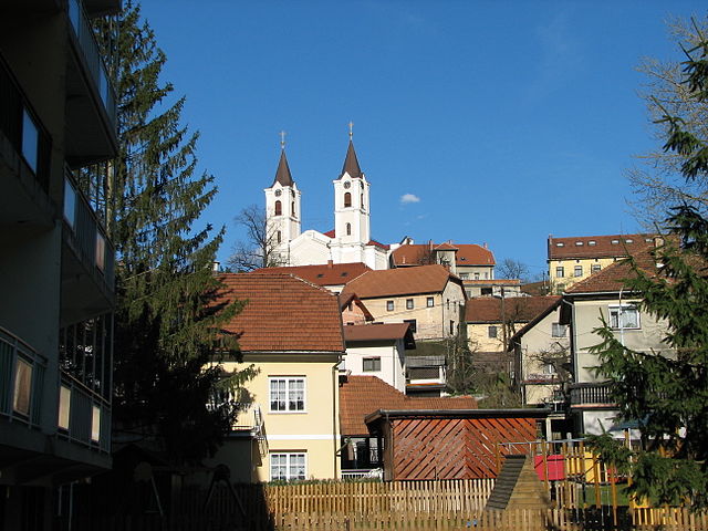
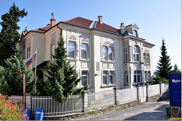
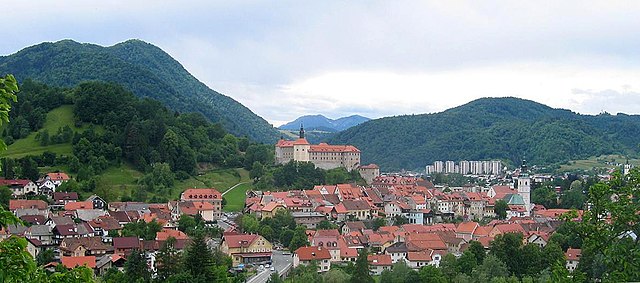
Hiking in Постойна
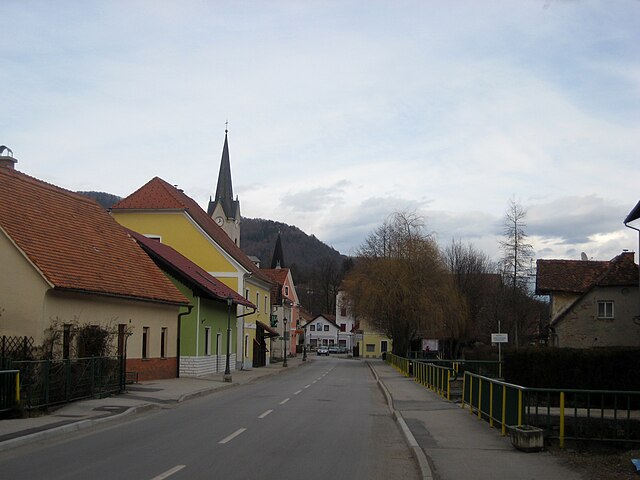
The Municipality of Postojna, located in Slovenia, is known for its stunning natural landscapes, rich biodiversity, and cultural heritage. It is a fantastic destination for hiking enthusiasts, offering various trails that cater to different skill levels and interests. Here are some highlights for hiking in the area:...
- Страна:
- Код автомобильного номера: PO
- Координаты: 45° 47' 0" N, 14° 13' 0" E
- GPS треки (wikiloc): [Ссылка]
- Высота над уровнем моря: 520 м m
- Площадь: 269.9 кв.км


Жрече
- община Словении
Hiking in Жрече
Zreče is a beautiful destination located in Slovenia, known for its stunning natural landscapes, mineral springs, and outdoor recreational opportunities. If you're considering hiking in this area, here are some highlights and tips:...
- Страна:
- Почтовый код: 3214
- Код автомобильного номера: CE
- Координаты: 46° 22' 30" N, 15° 23' 7" E
- GPS треки (wikiloc): [Ссылка]
- Высота над уровнем моря: 396 м m
- Площадь: 67 кв.км
- Веб сайт: [Ссылка]
Шкофья-Лока
- община Словении
Hiking in Шкофья-Лока
Hiking in the Municipality of Škofja Loka offers a diverse range of trails and stunning natural landscapes, making it a popular destination for both casual walkers and experienced hikers. Located in the northwestern part of Slovenia, the region features a mix of hilly terrain, forests, and cultural landmarks that provide a rich outdoor experience....
- Страна:
- Координаты: 46° 10' 0" N, 14° 18' 0" E
- GPS треки (wikiloc): [Ссылка]
- Площадь: 145.0 кв.км


Шенчур
Hiking in Шенчур
The Municipality of Šenčur, located in Slovenia, offers a beautiful setting for hiking enthusiasts. Nestled in the Gorenjska region, it features a mix of picturesque landscapes, forested areas, and views of the surrounding mountains....
- Страна:
- Почтовый код: 4208
- Код автомобильного номера: KR
- Координаты: 46° 14' 17" N, 14° 25' 24" E
- GPS треки (wikiloc): [Ссылка]
- Высота над уровнем моря: 394 м m
- Площадь: 43.2 кв.км
- Веб сайт: [Ссылка]


Lovrenc na Pohorju Municipality
Hiking in Lovrenc na Pohorju Municipality
The Municipality of Lovrenc na Pohorju is a picturesque area in Slovenia, located in the Pohorje mountain range, known for its natural beauty, lush forests, and diverse hiking trails. Here are some key points to consider for hiking in this region:...
- Страна:
- Почтовый код: 2344
- Код автомобильного номера: MB
- Координаты: 46° 31' 22" N, 15° 23' 7" E
- GPS треки (wikiloc): [Ссылка]
- Высота над уровнем моря: 786 м m
- Площадь: 84.4 кв.км
- Веб сайт: [Ссылка]
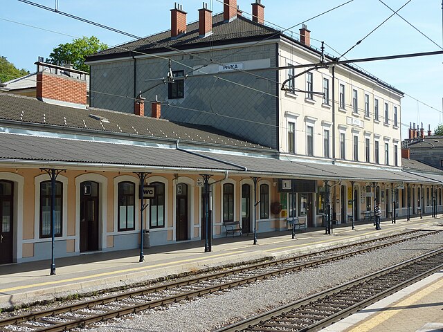

Пивка
Hiking in Пивка
The Municipality of Pivka, located in Slovenia, is a region of diverse landscapes, rich history, and a variety of hiking opportunities. It offers an excellent setting for outdoor enthusiasts looking to explore nature and enjoy the scenic beauty of the area....
- Страна:
- Почтовый код: 6257
- Код автомобильного номера: PO
- Координаты: 45° 40' 58" N, 14° 14' 8" E
- GPS треки (wikiloc): [Ссылка]
- Высота над уровнем моря: 576 м m
- Площадь: 223.3 кв.км
- Веб сайт: [Ссылка]


Чрна-на-Корошкем
Hiking in Чрна-на-Корошкем
The Municipality of Črna na Koroškem, located in the northern part of Slovenia, is a beautiful area known for its stunning natural landscapes and outdoor activities, making it an excellent destination for hiking enthusiasts. Here's what you can expect when hiking in this region:...
- Страна:
- Почтовый код: 2398
- Код автомобильного номера: SG
- Координаты: 46° 27' 51" N, 14° 49' 17" E
- GPS треки (wikiloc): [Ссылка]
- Высота над уровнем моря: 877 м m
- Площадь: 156 кв.км
- Веб сайт: [Ссылка]
Бовец
Hiking in Бовец
The Municipality of Bovec, located in the northwestern part of Slovenia, is renowned for its stunning natural beauty and diverse hiking opportunities. Nestled in the Julian Alps, Bovec offers breathtaking landscapes, lush valleys, and impressive mountain scenery, making it a popular destination for both novice and experienced hikers....
- Страна:
- Координаты: 46° 20' 0" N, 13° 33' 0" E
- GPS треки (wikiloc): [Ссылка]
- Площадь: 367.3 кв.км
- Веб сайт: [Ссылка]


Апаче
Hiking in Апаче
The Municipality of Apače, located in Slovenia, offers a variety of hiking opportunities in a beautiful natural environment. The area is characterized by rolling hills, vineyards, and picturesque landscapes that attract both novice and experienced hikers....
- Страна:
- Код автомобильного номера: MS
- Координаты: 46° 41' 57" N, 15° 54' 31" E
- GPS треки (wikiloc): [Ссылка]
- Площадь: 53.5 кв.км
- Веб сайт: [Ссылка]


Айдовшчина
- город и община в Словении
Hiking in Айдовшчина
Hiking in the Municipality of Ajdovščina, located in Slovenia's western region of Primorska, offers beautiful landscapes, rich history, and diverse trails suitable for all skill levels. Here are some highlights and recommendations for hiking in this area:...
- Страна:
- Почтовый код: 5270
- Код автомобильного номера: GO
- Координаты: 45° 53' 9" N, 13° 54' 46" E
- GPS треки (wikiloc): [Ссылка]
- Высота над уровнем моря: 107 м m
- Площадь: 245.2 кв.км
- Веб сайт: [Ссылка]

Руше
Hiking in Руше
The Municipality of Ruše, located in Slovenia, is an excellent destination for hiking enthusiasts. This beautiful area is characterized by its picturesque landscapes, including rolling hills, forests, and views of the surrounding mountains. Here are some key points and popular hiking options in the region:...
- Страна:
- Координаты: 46° 32' 18" N, 15° 30' 55" E
- GPS треки (wikiloc): [Ссылка]
- Площадь: 60.8 кв.км


Radenci Municipality
Hiking in Radenci Municipality
The Municipality of Radenci, located in Slovenia, is known for its beautiful landscapes and a variety of outdoor activities, including hiking. The area features rolling hills, vineyards, and natural springs, making it an attractive destination for hikers who appreciate both scenic views and a peaceful environment....
- Страна:
- Почтовый код: 9252
- Код автомобильного номера: MS
- Координаты: 46° 37' 38" N, 16° 2' 54" E
- GPS треки (wikiloc): [Ссылка]
- Высота над уровнем моря: 217 м m
- Площадь: 34.1 кв.км
- Веб сайт: [Ссылка]


Креншовцы
Hiking in Креншовцы
The Municipality of Črenšovci is a picturesque area located in Slovenia, known for its beautiful landscapes, lush greenery, and serene environment. Although it's a smaller municipality, it offers several opportunities for hiking enthusiasts to explore the scenic countryside and nearby nature....
- Страна:
- Почтовый код: 9232
- Код автомобильного номера: MS
- Координаты: 46° 34' 32" N, 16° 17' 23" E
- GPS треки (wikiloc): [Ссылка]
- Площадь: 33.7 кв.км
- Веб сайт: [Ссылка]
Костел
Hiking in Костел
The Municipality of Kostel, located in Slovenia, is a beautiful area for hiking enthusiasts. Nestled in the foothills of the Southern Alps, this region offers stunning scenery, diverse landscapes, and a range of hiking trails suited for various skill levels....
- Страна:
- Почтовый код: 1336
- Код автомобильного номера: LJ
- Координаты: 45° 29' 22" N, 14° 52' 16" E
- GPS треки (wikiloc): [Ссылка]
- Высота над уровнем моря: 627 м m
- Площадь: 56.09 кв.км
- Веб сайт: [Ссылка]

Любляна
- городская община Словении
Hiking in Любляна
Hiking in the City Municipality of Ljubljana offers a fantastic combination of nature, history, and beautiful landscapes. While Ljubljana is primarily known as the capital city of Slovenia, it is also surrounded by stunning natural areas that provide ample opportunities for outdoor enthusiasts. Here are some key points about hiking in and around Ljubljana:...
- Страна:
- Почтовый код: 1005; 1000
- Координаты: 46° 3' 33" N, 14° 30' 33" E
- GPS треки (wikiloc): [Ссылка]
- Высота над уровнем моря: 299 м m
- Площадь: 275.0 кв.км
- Веб сайт: [Ссылка]

Марибор
- городская община Словении
Hiking in Марибор
Maribor, located in northeastern Slovenia, is known for its beautiful landscapes, rich history, and vibrant culture, making it an excellent destination for hiking enthusiasts. The area offers a variety of hiking trails that cater to different skill levels, offering everything from leisurely walks to challenging hikes. Here are some highlights:...
- Страна:
- Почтовый код: 2000
- Координаты: 46° 33' 27" N, 15° 38' 46" E
- GPS треки (wikiloc): [Ссылка]
- Площадь: 147.5 кв.км
- Веб сайт: [Ссылка]
Разкрижье
Hiking in Разкрижье
The Municipality of Razkrižje, located in Slovenia, is a hidden gem for hikers and nature enthusiasts. Nestled amidst picturesque landscapes, this area offers a variety of trails that cater to different skill levels, from leisurely walks to more challenging hikes....
- Страна:
- Координаты: 46° 31' 26" N, 16° 16' 19" E
- GPS треки (wikiloc): [Ссылка]
- Высота над уровнем моря: 169 м m
- Площадь: 9.8 кв.км
Нова Горица
Hiking in Нова Горица
Mestna občina Nova Gorica, located in Slovenia, is a beautiful region offering various hiking opportunities. Nestled near the border with Italy and situated along the Soča River, the area is known for its stunning natural landscapes, diverse flora and fauna, and rich cultural heritage. Here are some key highlights for hikers in this region:...
- Страна:
- Почтовый код: 5000
- Координаты: 45° 57' 55" N, 13° 43' 41" E
- GPS треки (wikiloc): [Ссылка]
- Высота над уровнем моря: 685 м m
- Площадь: 309.0 кв.км

Kanal ob Soči Municipality
Hiking in Kanal ob Soči Municipality
Občina Kanal, located in Slovenia, is a beautiful destination for hiking enthusiasts. The area is characterized by its stunning natural landscapes, rich biodiversity, and cultural heritage. Here are some highlights for hiking in Občina Kanal:...
- Страна:
- Координаты: 46° 5' 23" N, 13° 38' 35" E
- GPS треки (wikiloc): [Ссылка]
- Высота над уровнем моря: 246 м m
- Площадь: 146.5 кв.км
Горни-Петровцы
Hiking in Горни-Петровцы
Gornji Petrovci is a picturesque municipality located in Slovenia, characterized by its lush landscapes, rolling hills, and tranquil environments, making it a great destination for hiking enthusiasts. Here are some key points about hiking in this area:...
- Страна:
- Почтовый код: 9203
- Код автомобильного номера: MS
- Координаты: 46° 49' 3" N, 16° 12' 48" E
- GPS треки (wikiloc): [Ссылка]
- Высота над уровнем моря: 343 м m
- Площадь: 66.8 кв.км
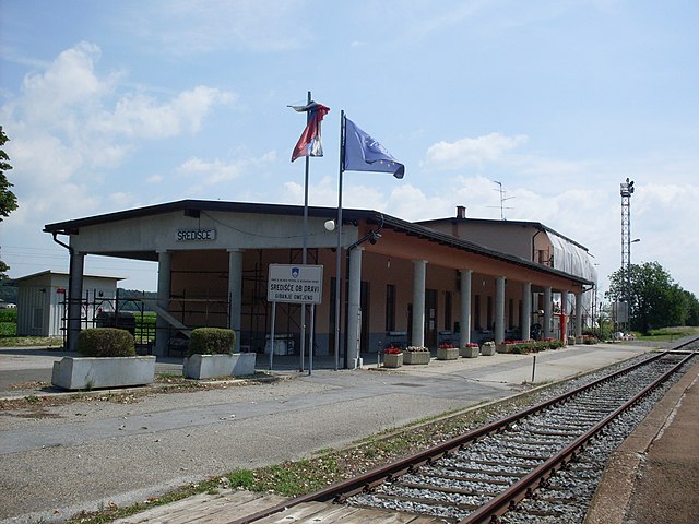
Središče ob Dravi
Hiking in Središče ob Dravi
Občina Središče ob Dravi, located in Slovenia, is known for its picturesque landscapes along the Drava River and its rich natural environment. Here are some key points about hiking in this region:...
- Страна:
- Координаты: 46° 23' 59" N, 16° 15' 16" E
- GPS треки (wikiloc): [Ссылка]
- Высота над уровнем моря: 198 м m
- Площадь: 32.7 кв.км

Ptuj City Municipality
Hiking in Ptuj City Municipality
Hiking in the City Municipality of Ptuj, Slovenia, offers a fantastic way to explore the region's natural beauty and historical sites. Known for its picturesque landscapes and rich cultural heritage, Ptuj is a wonderful destination for hiking enthusiasts....
- Страна:
- Почтовый код: 2250
- Координаты: 46° 25' 11" N, 15° 52' 11" E
- GPS треки (wikiloc): [Ссылка]
- Площадь: 66.7 кв.км

Словень-Градец
- городская община Словении
Hiking in Словень-Градец
Slovenj Gradec is a picturesque municipality in Slovenia, located in the northern part of the country. It's known for its rich cultural heritage, historical architecture, and beautiful natural surroundings, making it an excellent destination for hiking enthusiasts....
- Страна:
- Почтовый код: 2380
- Координаты: 46° 31' 0" N, 15° 5' 0" E
- GPS треки (wikiloc): [Ссылка]
- Высота над уровнем моря: 478 м m
- Площадь: 173.7 кв.км
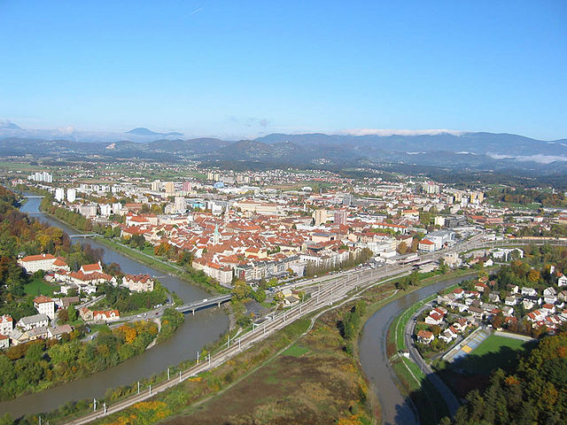

Целе
Hiking in Целе
The City Municipality of Celje, located in Slovenia, offers a range of hiking opportunities that cater to both novice and experienced hikers. The region is characterized by beautiful landscapes, including the Savinja River, rolling hills, and nearby mountainous areas, making it an attractive destination for outdoor enthusiasts....
- Страна:
- Почтовый код: 3000
- Координаты: 46° 14' 0" N, 15° 16' 0" E
- GPS треки (wikiloc): [Ссылка]
- Площадь: 94.9 кв.км
- Веб сайт: [Ссылка]

Idrija Municipality
Hiking in Idrija Municipality
Hiking in the Municipality of Idrija, located in Slovenia, offers a wonderful experience for outdoor enthusiasts, combining natural beauty with rich cultural heritage. The area is known for its diverse landscapes, including forests, hills, and the picturesque Idrijca River Valley, making it ideal for various hiking trails suited to different skill levels....
- Страна:
- Почтовый код: 5280
- Код автомобильного номера: GO
- Координаты: 46° 0' 5" N, 14° 1' 20" E
- GPS треки (wikiloc): [Ссылка]
- Высота над уровнем моря: 326 м m
- Площадь: 293.7 кв.км

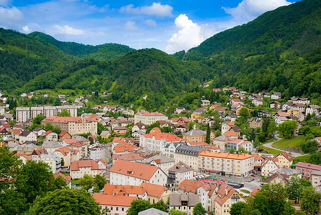
Веленье
Hiking in Веленье
Hiking in the City Municipality of Velenje, Slovenia, offers a variety of scenic trails and outdoor experiences due to its beautiful natural landscapes and varied terrain. Here are some aspects to consider when planning a hike in this region:...
- Страна:
- Почтовый код: 3320
- Код автомобильного номера: CE
- Координаты: 46° 21' 44" N, 15° 6' 38" E
- GPS треки (wikiloc): [Ссылка]
- Высота над уровнем моря: 400 м m
- Площадь: 83.5 кв.км
Metlika Municipality
Hiking in Metlika Municipality
Občina Metlika, located in Slovenia, is an excellent destination for hiking enthusiasts. Nestled in the southern part of the country, this region is characterized by its picturesque landscapes, rolling hills, vineyards, and the beautiful Kolpa River....
- Страна:
- Код автомобильного номера: NM
- Координаты: 45° 38' 51" N, 15° 19' 4" E
- GPS треки (wikiloc): [Ссылка]
- Площадь: 108.9 кв.км

Крань
- городская община Словении
Hiking in Крань
The City Municipality of Kranj, located in Slovenia, is an excellent destination for hiking enthusiasts. Nestled at the confluence of the Sava and Kokra rivers and surrounded by beautiful natural landscapes, Kranj offers a variety of hiking opportunities ranging from easy strolls to more challenging trails....
- Страна:
- Почтовый код: 4000
- Код автомобильного номера: KR
- Координаты: 46° 14' 32" N, 14° 21' 28" E
- GPS треки (wikiloc): [Ссылка]
- Высота над уровнем моря: 358 м m
- Площадь: 148 кв.км
Чрномель
Hiking in Чрномель
The Municipality of Črnomelj, located in Slovenia, offers a variety of hiking opportunities for outdoor enthusiasts. It is situated in the southeastern part of the country, known for its picturesque landscapes, diverse flora and fauna, and rich cultural heritage....
- Страна:
- Почтовый код: 8340
- Код автомобильного номера: NM
- Координаты: 45° 34' 0" N, 15° 12' 0" E
- GPS треки (wikiloc): [Ссылка]
- Высота над уровнем моря: 174 м m
- Площадь: 339.7 кв.км


Кршко
- муниципалиет в Словении
- Страна:
- Почтовый код: 8270
- Код автомобильного номера: KK
- Координаты: 45° 57' 0" N, 15° 29' 0" E
- GPS треки (wikiloc): [Ссылка]
- Высота над уровнем моря: 163 м m
- Площадь: 344.9 кв.км
Šentrupert Municipality
Hiking in Šentrupert Municipality
The Municipality of Šentrupert, located in Slovenia, is characterized by its beautiful landscapes, rich natural resources, and a variety of hiking opportunities. Here’s what you should know about hiking in the area:...
- Страна:
- Координаты: 45° 58' 57" N, 15° 5' 24" E
- GPS треки (wikiloc): [Ссылка]
- Высота над уровнем моря: 280 м m
- Площадь: 49 кв.км

Моравске Топлице
Hiking in Моравске Топлице
Moravske Toplice is a picturesque municipality located in Slovenia, known for its natural beauty and thermal springs. While it is primarily recognized for its spa resorts and wellness tourism, the region also offers some lovely hiking opportunities suitable for various skill levels....
- Страна:
- Почтовый код: 9226
- Код автомобильного номера: MS
- Координаты: 46° 43' 3" N, 16° 16' 25" E
- GPS треки (wikiloc): [Ссылка]
- Высота над уровнем моря: 287 м m
- Площадь: 144.5 кв.км
- Веб сайт: [Ссылка]


Дравоград
Hiking in Дравоград
Hiking in the Municipality of Dravograd offers a range of beautiful trails and stunning natural scenery, making it an attractive destination for outdoor enthusiasts. Located in Slovenia, Dravograd is nestled in the picturesque landscape of the northern part of the country, near the border with Austria. Here are some highlights:...
- Страна:
- Почтовый код: 2370
- Код автомобильного номера: SG
- Координаты: 46° 35' 24" N, 15° 1' 22" E
- GPS треки (wikiloc): [Ссылка]
- Высота над уровнем моря: 367 м m
- Площадь: 105.0 кв.км

Камник
Hiking in Камник
The Municipality of Kamnik is a picturesque region located in Slovenia, known for its stunning natural landscapes, historical significance, and a variety of hiking opportunities that cater to different skill levels. Here are some highlights about hiking in this area:...
- Страна:
- Почтовый код: 1240
- Координаты: 46° 14' 39" N, 14° 40' 2" E
- GPS треки (wikiloc): [Ссылка]
- Высота над уровнем моря: 702 м m
- Площадь: 266.0 кв.км
- Веб сайт: [Ссылка]


Šmarješke Toplice Municipality
Hiking in Šmarješke Toplice Municipality
Šmarješke Toplice is a picturesque municipality located in Slovenia, known for its beautiful natural landscapes, therapeutic thermal waters, and opportunities for outdoor activities, including hiking. Here are some key points about hiking in the area:...
- Страна:
- Координаты: 45° 51' 44" N, 15° 13' 17" E
- GPS треки (wikiloc): [Ссылка]


Бохинь
Hiking in Бохинь
Hiking in the Municipality of Bohinj, located in Slovenia's Triglav National Park, offers breathtaking landscapes, diverse trails, and a rich blend of natural and cultural experiences. Here are some highlights and tips for hiking in this beautiful area:...
- Страна:
- Почтовый код: 4265
- Код автомобильного номера: KR
- Координаты: 46° 17' 42" N, 13° 55' 26" E
- GPS треки (wikiloc): [Ссылка]
- Высота над уровнем моря: 585 м m
- Площадь: 333.7 кв.км
- Веб сайт: [Ссылка]


Вузеница
Hiking in Вузеница
Vuzenica, located in Slovenia near the border with Austria, offers a variety of hiking opportunities that showcase the stunning natural landscapes of the region. Here are some key points to consider if you're planning a hiking trip to Vuzenica:...
- Страна:
- Почтовый код: 2367
- Код автомобильного номера: SG
- Координаты: 46° 36' 0" N, 15° 10' 0" E
- GPS треки (wikiloc): [Ссылка]
- Высота над уровнем моря: 338 м m
- Площадь: 50.1 кв.км
- Веб сайт: [Ссылка]
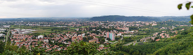

Шемпетер-Вртойба
Hiking in Шемпетер-Вртойба
The Municipality of Šempeter-Vrtojba, located in Slovenia, offers a delightful setting for hiking enthusiasts. Nestled in a region that blends natural beauty with cultural heritage, there are several trails and areas for hikers of all levels. Here are some key points about hiking in this municipality:...
- Страна:
- Почтовый код: 5290
- Код автомобильного номера: GO
- Координаты: 45° 55' 0" N, 13° 39' 0" E
- GPS треки (wikiloc): [Ссылка]
- Высота над уровнем моря: 71 м m
- Площадь: 15 кв.км
- Веб сайт: [Ссылка]


Шентиль
Hiking in Шентиль
The Municipality of Šentilj, located in northeastern Slovenia near the border with Austria, offers a variety of hiking opportunities that cater to different skill levels and interests. The region is characterized by beautiful landscapes, rolling hills, vineyards, and forests, making it an excellent destination for nature lovers and hikers....
- Страна:
- Почтовый код: 2212
- Код автомобильного номера: MB
- Координаты: 46° 41' 18" N, 15° 43' 3" E
- GPS треки (wikiloc): [Ссылка]
- Высота над уровнем моря: 292 м m
- Площадь: 65 кв.км
- Веб сайт: [Ссылка]


Шкоцьян
Hiking in Шкоцьян
Hiking in the Municipality of Škocjan offers a unique opportunity to explore stunning natural landscapes, rich biodiversity, and remarkable geological features. This area, located in Slovenia, is particularly famous for the Škocjan Caves, which is a UNESCO World Heritage Site. Here are some highlights to consider for your hiking adventure:...
- Страна:
- Почтовый код: 8275
- Код автомобильного номера: NM
- Координаты: 45° 55' 11" N, 15° 18' 5" E
- GPS треки (wikiloc): [Ссылка]
- Высота над уровнем моря: 267 м m
- Площадь: 60.4 кв.км
- Веб сайт: [Ссылка]

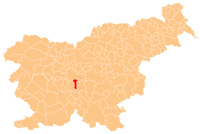
Шкофлица
Hiking in Шкофлица
The Municipality of Škofljica, located in Slovenia, offers a variety of scenic hiking trails that cater to both beginners and more experienced hikers. Nestled near the capital city of Ljubljana, it features beautiful landscapes, lush greenery, and a mix of cultural and natural attractions....
- Страна:
- Почтовый код: 1291
- Код автомобильного номера: LJ
- Координаты: 45° 57' 30" N, 14° 34' 38" E
- GPS треки (wikiloc): [Ссылка]
- Высота над уровнем моря: 290 м m
- Площадь: 43.3 кв.км
- Веб сайт: [Ссылка]


Шмарье-при-Елшах
Hiking in Шмарье-при-Елшах
Šmarje pri Jelšah is a picturesque town located in Slovenia, known for its beautiful natural landscapes and hiking opportunities. The region is characterized by rolling hills, forests, and vineyards, providing a scenic backdrop for outdoor activities....
- Страна:
- Почтовый код: 3240
- Код автомобильного номера: CE
- Координаты: 46° 13' 41" N, 15° 31' 5" E
- GPS треки (wikiloc): [Ссылка]
- Высота над уровнем моря: 234 м m
- Площадь: 107.7 кв.км
- Веб сайт: [Ссылка]


Шмартно-об-Паки
Hiking in Шмартно-об-Паки
Šmartno ob Paki is a charming village located in Slovenia and is known for its beautiful natural landscapes, making it a great destination for hiking enthusiasts. Here are some key points about hiking in and around Šmartno ob Paki:...
- Страна:
- Почтовый код: 3327
- Код автомобильного номера: CE
- Координаты: 46° 20' 35" N, 15° 1' 50" E
- GPS треки (wikiloc): [Ссылка]
- Высота над уровнем моря: 467 м m
- Площадь: 18.2 кв.км
- Веб сайт: [Ссылка]


Шторе
Hiking in Шторе
Štore is a small town in Slovenia, located in the Savinja Valley, which is surrounded by picturesque landscapes and offers various hiking opportunities. Here are some key points about hiking in the Štore area:...
- Страна:
- Почтовый код: 3220
- Код автомобильного номера: CE
- Координаты: 46° 12' 4" N, 15° 19' 38" E
- GPS треки (wikiloc): [Ссылка]
- Высота над уровнем моря: 495 м m
- Площадь: 28.1 кв.км
- Веб сайт: [Ссылка]
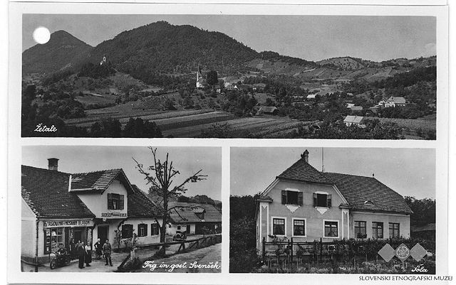
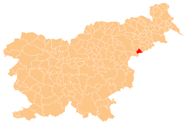
Жетале
Hiking in Жетале
Žetale is a charming village located in Slovenia, known for its picturesque landscapes and tranquility. While it may not be one of Slovenia's most prominent hiking destinations compared to places like the Julian Alps or Triglav National Park, it offers some beautiful trails and natural scenery that can provide a satisfying hiking experience....
- Страна:
- Почтовый код: 2287
- Код автомобильного номера: MB
- Координаты: 46° 16' 56" N, 15° 48' 21" E
- GPS треки (wikiloc): [Ссылка]
- Высота над уровнем моря: 323 м m
- Площадь: 38 кв.км
- Веб сайт: [Ссылка]


Жири
- община в Словении
Hiking in Жири
The Municipality of Žiri, located in Slovenia, is a fantastic destination for hiking enthusiasts due to its stunning natural landscapes, diverse terrain, and well-marked trails. Here are some aspects to consider if you're planning a hiking trip in the area:...
- Страна:
- Почтовый код: 4226
- Код автомобильного номера: KR
- Координаты: 46° 3' 6" N, 14° 6' 56" E
- GPS треки (wikiloc): [Ссылка]
- Высота над уровнем моря: 493 м m
- Площадь: 49.0 кв.км
- Веб сайт: [Ссылка]


Жировница
- община Словении
Hiking in Жировница
The Municipality of Žirovnica, located in Slovenia, is known for its picturesque landscapes and a variety of hiking trails that cater to different skill levels. Nestled near the foothills of the Julian Alps and close to the beautiful Lake Bled, Žirovnica provides an idyllic setting for outdoor enthusiasts....
- Страна:
- Почтовый код: 4274
- Код автомобильного номера: KR
- Координаты: 46° 24' 0" N, 14° 8' 0" E
- GPS треки (wikiloc): [Ссылка]
- Высота над уровнем моря: 90 м m
- Площадь: 42.6 кв.км
- Веб сайт: [Ссылка]


Ново-Место
- община в Словении
Hiking in Ново-Место
Hiking in the City Municipality of Novo Mesto, located in Slovenia, offers a wonderful blend of natural beauty and rich cultural heritage. This region is characterized by its scenic landscapes, with a mix of hills, rivers, and forests that provide ample opportunities for both casual and experienced hikers....
- Страна:
- Почтовый код: 8000
- Координаты: 45° 47' 6" N, 15° 11' 54" E
- GPS треки (wikiloc): [Ссылка]
- Высота над уровнем моря: 234 м m
- Площадь: 298.5 кв.км

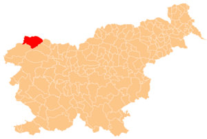
Краньска-Гора
Hiking in Краньска-Гора
Kranjska Gora, located in Slovenia, is a beautiful area renowned for its stunning alpine scenery and excellent hiking opportunities. Nestled at the foot of the Julian Alps, it offers a variety of trails suitable for hikers of all skill levels, from gentle walks to more challenging ascents....
- Страна:
- Почтовый код: 4280
- Код автомобильного номера: KR
- Координаты: 46° 27' 37" N, 13° 50' 19" E
- GPS треки (wikiloc): [Ссылка]
- Высота над уровнем моря: 1283 м m
- Площадь: 256.3 кв.км
- Веб сайт: [Ссылка]


Преддвор
Hiking in Преддвор
The Municipality of Preddvor, located in Slovenia, offers a variety of hiking opportunities with stunning natural landscapes and diverse terrain. Here are some highlights and tips for hiking in this beautiful area:...
- Страна:
- Почтовый код: 4205
- Код автомобильного номера: KR
- Координаты: 46° 19' 37" N, 14° 27' 52" E
- GPS треки (wikiloc): [Ссылка]
- Высота над уровнем моря: 1281 м m
- Площадь: 87.0 кв.км
- Веб сайт: [Ссылка]
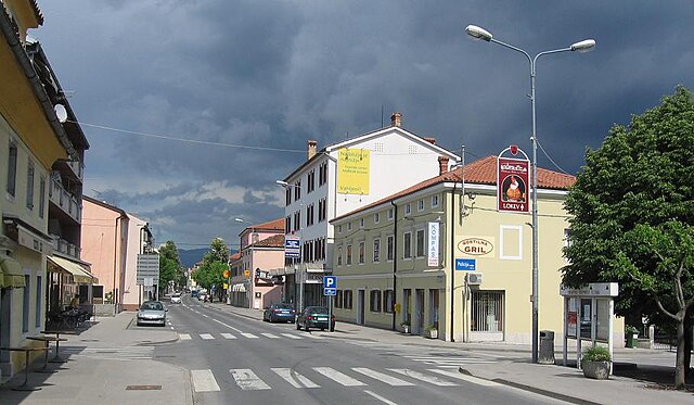
Сежана
Hiking in Сежана
The Municipality of Sežana, located in southwestern Slovenia near the border with Italy, offers a variety of hiking opportunities for outdoor enthusiasts. Here are some highlights and tips for hiking in this region:...
- Страна:
- Координаты: 45° 42' 0" N, 13° 52' 0" E
- GPS треки (wikiloc): [Ссылка]
- Площадь: 217.4 кв.км
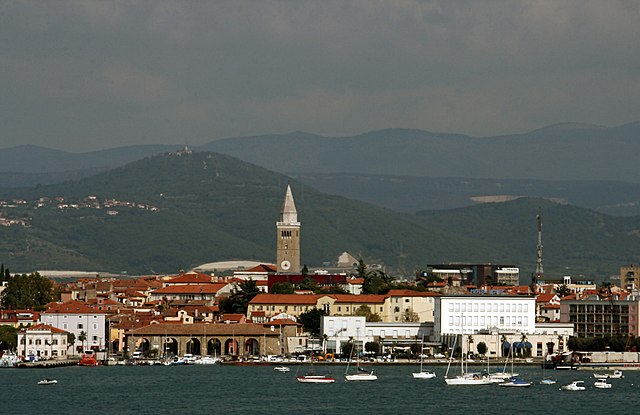
Koper City Municipality
Hiking in Koper City Municipality
Koper, located on the southwestern coast of Slovenia, is part of the Slovenian Littoral and offers various beautiful hiking opportunities that combine coastal scenery with the picturesque hills of the Karst region. Here are some highlights about hiking in the City Municipality of Koper:...
- Страна:
- Почтовый код: 6000
- Координаты: 45° 32' 53" N, 13° 43' 48" E
- GPS треки (wikiloc): [Ссылка]
- Площадь: 303.2 кв.км
- Веб сайт: [Ссылка]

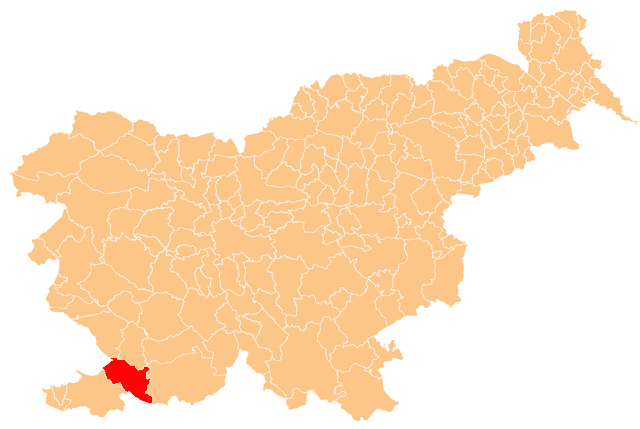
Хрпелье-Козина
- община Словении
Hiking in Хрпелье-Козина
The Municipality of Hrpelje-Kozina in Slovenia offers a variety of hiking opportunities characterized by scenic landscapes, diverse terrain, and rich natural and cultural heritage. Here are some highlights for hikers in this area:...
- Страна:
- Почтовый код: 6240
- Код автомобильного номера: KP
- Координаты: 45° 35' 0" N, 13° 59' 0" E
- GPS треки (wikiloc): [Ссылка]
- Высота над уровнем моря: 497 м m
- Площадь: 192.2 кв.км
- Веб сайт: [Ссылка]

Дивача
Hiking in Дивача
The Municipality of Divača, located in Slovenia, offers a variety of beautiful hiking trails and natural landscapes. Here are some highlights for hiking in this area:...
- Страна:
- Почтовый код: 6215
- Код автомобильного номера: KP
- Координаты: 45° 41' 4" N, 14° 1' 21" E
- GPS треки (wikiloc): [Ссылка]
- Высота над уровнем моря: 501 м m
- Площадь: 147.8 кв.км

Piran Municipality
Hiking in Piran Municipality
Občina Piran, located on the southwestern coast of Slovenia, is known for its stunning coastal scenery, rich cultural history, and mild Mediterranean climate. Hiking in this area can offer a unique blend of natural beauty, historical sites, and charming coastal towns. Here are some highlights and tips for hiking in Občina Piran:...
- Страна:
- Координаты: 45° 31' 42" N, 13° 34' 6" E
- GPS треки (wikiloc): [Ссылка]
- Площадь: 44.6 кв.км
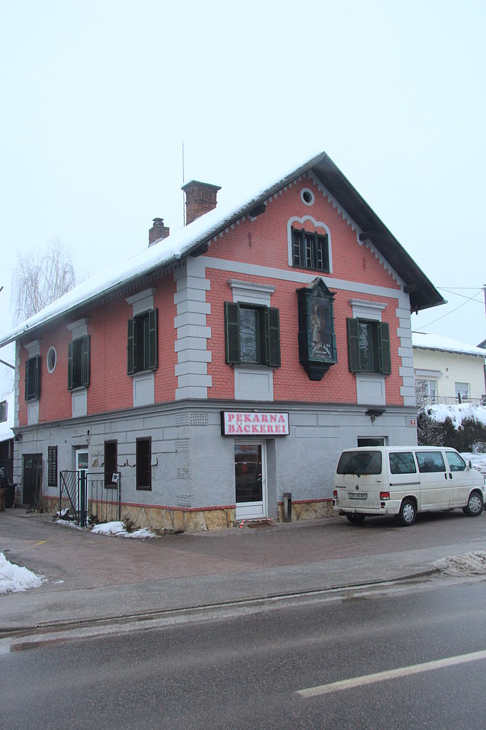

Gornja Radgona Municipality
Hiking in Gornja Radgona Municipality
Gornja Radgona, located in northeastern Slovenia, is known for its picturesque landscapes and natural beauty, making it a great destination for hiking enthusiasts. The area offers various trails and outdoor activities suitable for different skill levels....
- Страна:
- Почтовый код: 9250
- Код автомобильного номера: MS
- Координаты: 46° 38' 6" N, 15° 57' 34" E
- GPS треки (wikiloc): [Ссылка]
- Высота над уровнем моря: 251 м m
- Площадь: 75.0 кв.км


Дестрник
Hiking in Дестрник
The Municipality of Destrnik, located in Slovenia, offers a range of hiking opportunities thanks to its picturesque landscapes and serene natural environment. Nestled amidst rolling hills and lush forests, it provides several trails that cater to varying levels of hiking experience....
- Страна:
- Почтовый код: 2253
- Код автомобильного номера: MB
- Координаты: 46° 28' 52" N, 15° 52' 49" E
- GPS треки (wikiloc): [Ссылка]
- Высота над уровнем моря: 309 м m
- Площадь: 34.4 кв.км
- Веб сайт: [Ссылка]

Lendava Municipality
Hiking in Lendava Municipality
Občina Lendava, located in Slovenia, is a beautiful region known for its stunning landscapes, rich cultural diversity, and historical significance. It's situated near the borders with Hungary and Croatia, making it a unique area to explore....
- Страна:
- Почтовый код: 9220
- Код автомобильного номера: MS
- Координаты: 46° 33' 27" N, 16° 27' 25" E
- GPS треки (wikiloc): [Ссылка]
- Высота над уровнем моря: 160 м m
- Площадь: 123 кв.км
- Веб сайт: [Ссылка]

Poljčane Municipality
Hiking in Poljčane Municipality
Poljčane is a picturesque town located in Slovenia, surrounded by beautiful landscapes that are perfect for hiking enthusiasts. The region offers a variety of trails that cater to different skill levels, from leisurely walks to more challenging hikes....
- Страна:
- Почтовый код: 2319
- Код автомобильного номера: MB
- Координаты: 46° 18' 10" N, 15° 35' 53" E
- GPS треки (wikiloc): [Ссылка]
- Высота над уровнем моря: 266 м m
- Площадь: 37.5 кв.км
- Веб сайт: [Ссылка]


Рогашовци
Hiking in Рогашовци
Rogašovci is a picturesque village located in Slovenia, known for its beautiful landscapes and abundant nature, making it a great destination for hiking enthusiasts. While specific hiking trails might not be as well-known as in larger national parks, the surrounding areas offer a variety of scenic routes suitable for different skill levels....
- Страна:
- Почтовый код: 9262
- Код автомобильного номера: MS
- Координаты: 46° 48' 9" N, 16° 1' 28" E
- GPS треки (wikiloc): [Ссылка]
- Высота над уровнем моря: 281 м m
- Площадь: 40.1 кв.км
- Веб сайт: [Ссылка]


Renče–Vogrsko Municipality
Hiking in Renče–Vogrsko Municipality
The Municipality of Renče–Vogrsko, located in Slovenia, offers a beautiful setting for hiking enthusiasts. This area is rich in natural beauty, rolling hills, forests, and a variety of trails that cater to different skill levels. Here’s what you can expect when hiking in this region:...
- Страна:
- Почтовый код: 5292, 5293
- Код автомобильного номера: GO
- Координаты: 45° 53' 0" N, 13° 40' 0" E
- GPS треки (wikiloc): [Ссылка]
- Высота над уровнем моря: 51 м m
- Площадь: 29.5 кв.км
- Веб сайт: [Ссылка]
Мута
Hiking in Мута
The Municipality of Muta, located in Slovenia, offers a range of hiking opportunities that showcase its beautiful landscapes, rich natural resources, and cultural heritage. Here are some key points to consider when hiking in this area:...
- Страна:
- Почтовый код: 2366
- Код автомобильного номера: SG
- Координаты: 46° 37' 50" N, 15° 8' 10" E
- GPS треки (wikiloc): [Ссылка]
- Высота над уровнем моря: 511 м m
- Площадь: 38.8 кв.км
- Веб сайт: [Ссылка]

Горишница
Hiking in Горишница
The Municipality of Gorišnica is located in Slovenia and offers a range of hiking opportunities set against a backdrop of beautiful natural landscapes. Here are some highlights and tips for hiking in this area:...
- Страна:
- Почтовый код: 2253
- Код автомобильного номера: MB
- Координаты: 46° 24' 53" N, 16° 0' 50" E
- GPS треки (wikiloc): [Ссылка]
- Площадь: 61.2 кв.км
- Веб сайт: [Ссылка]
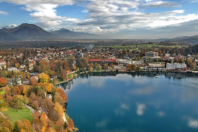
Блед
Hiking in Блед
The Municipality of Bled, located in Slovenia, is renowned for its stunning natural beauty and offers a variety of hiking opportunities suitable for all levels of hikers. Here are some highlights and tips for hiking in the area:...
- Страна:
- Код автомобильного номера: KR
- Координаты: 46° 22' 0" N, 14° 7' 0" E
- GPS треки (wikiloc): [Ссылка]
- Площадь: 72.0 кв.км
- Веб сайт: [Ссылка]

Превалье
Hiking in Превалье
Prevalje, located in Slovenia, offers a variety of beautiful hiking opportunities, particularly due to its picturesque landscapes and proximity to the Pohorje Mountains and the Koroška region. Here are some highlights for hiking in and around Prevalje:...
- Страна:
- Почтовый код: 2391
- Код автомобильного номера: SG
- Координаты: 46° 32' 48" N, 14° 58' 48" E
- GPS треки (wikiloc): [Ссылка]
- Высота над уровнем моря: 411 м m
- Площадь: 58.1 кв.км
- Веб сайт: [Ссылка]


Мирен-Костаньевица
Hiking in Мирен-Костаньевица
The Municipality of Miren-Kostanjevica, located in Slovenia, offers a variety of beautiful landscapes that are perfect for hiking enthusiasts. Nestled near the borders of Italy and Austria, this area is characterized by its rolling hills, vineyards, and scenic views of the Soča River Valley and the surrounding mountains....
- Страна:
- Почтовый код: 5291
- Код автомобильного номера: GO
- Координаты: 45° 51' 0" N, 13° 38' 0" E
- GPS треки (wikiloc): [Ссылка]
- Высота над уровнем моря: 44 м m
- Площадь: 62.8 кв.км
- Веб сайт: [Ссылка]

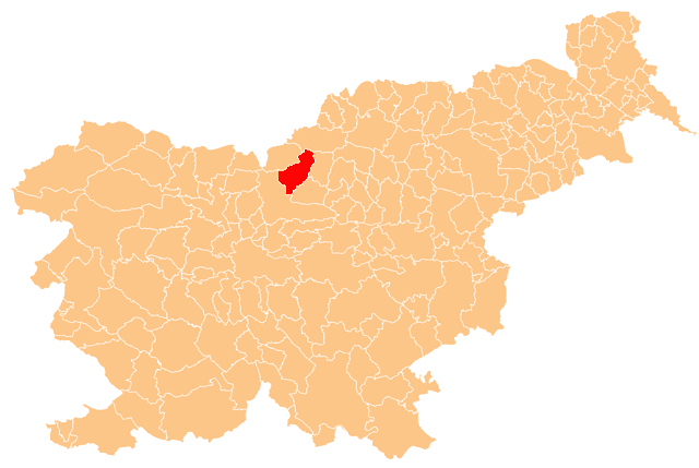
Люче
Hiking in Люче
The Municipality of Luče, located in Slovenia, is a picturesque area known for its stunning natural landscapes and outdoor recreational opportunities, making it a great destination for hiking enthusiasts. Here are some key points to consider when hiking in this region:...
- Страна:
- Почтовый код: 3334
- Код автомобильного номера: CE
- Координаты: 46° 21' 4" N, 14° 43' 59" E
- GPS треки (wikiloc): [Ссылка]
- Высота над уровнем моря: 593 м m
- Площадь: 109.5 кв.км
- Веб сайт: [Ссылка]


Мозирье
Hiking in Мозирье
Mozirje, located in Slovenia, is a picturesque town surrounded by stunning natural landscapes, making it an excellent destination for hiking enthusiasts. Here are some highlights and tips for hiking in this beautiful area:...
- Страна:
- Почтовый код: 3330
- Код автомобильного номера: CE
- Координаты: 46° 20' 0" N, 14° 58' 0" E
- GPS треки (wikiloc): [Ссылка]
- Высота над уровнем моря: 340 м m
- Площадь: 83.6 кв.км
- Веб сайт: [Ссылка]

Mežica Municipality
Hiking in Mežica Municipality
Občina Mežica, located in Slovenia, is a beautiful area known for its stunning natural landscapes and rich history. The region offers various hiking opportunities suitable for different skill levels....
- Страна:
- Почтовый код: 2392
- Код автомобильного номера: SG
- Координаты: 46° 31' 14" N, 14° 51' 13" E
- GPS треки (wikiloc): [Ссылка]
- Площадь: 26.4 кв.км

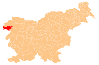
Кобарид
Hiking in Кобарид
The Municipality of Kobarid, located in Slovenia, is a stunning destination for hiking enthusiasts. Nestled in the Soča Valley, it offers a unique combination of picturesque landscapes, rich history, and diverse trails suitable for various skill levels. Here are some highlights about hiking in the area:...
- Страна:
- Почтовый код: 5222
- Телефонный код: 05
- Координаты: 46° 13' 30" N, 13° 38' 40" E
- GPS треки (wikiloc): [Ссылка]
- Высота над уровнем моря: 601 м m
- Площадь: 192.7 кв.км
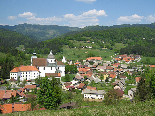

Горний Град
Hiking in Горний Град
The Municipality of Gornji Grad, located in Slovenia, offers a variety of hiking opportunities that cater to different levels of experience. Nestled in the picturesque landscapes of the Slovenian countryside, this area features rolling hills, lush forests, and stunning views....
- Страна:
- Почтовый код: 3342
- Код автомобильного номера: CE
- Координаты: 46° 17' 21" N, 14° 48' 3" E
- GPS треки (wikiloc): [Ссылка]
- Высота над уровнем моря: 544 м m
- Площадь: 90.1 кв.км
- Веб сайт: [Ссылка]


Раче-Фрам
Hiking in Раче-Фрам
The Municipality of Rače-Fram is located in Slovenia and offers a variety of hiking experiences for outdoor enthusiasts. This region is characterized by its beautiful landscapes, rolling hills, and picturesque villages. Here are some highlights and tips for hiking in the area:...
- Страна:
- Почтовый код: 2327, 2313
- Код автомобильного номера: MB
- Координаты: 46° 27' 22" N, 15° 37' 45" E
- GPS треки (wikiloc): [Ссылка]
- Площадь: 51.2 кв.км
- Веб сайт: [Ссылка]


Брда
Hiking in Брда
The Municipality of Brda, located in the western part of Slovenia near the border with Italy, is renowned for its beautiful landscapes, vineyards, and gently rolling hills, making it a fantastic destination for hiking enthusiasts....
- Страна:
- Почтовый код: 5212
- Код автомобильного номера: GO
- Координаты: 46° 0' 27" N, 13° 32' 36" E
- GPS треки (wikiloc): [Ссылка]
- Высота над уровнем моря: 196 м m
- Площадь: 72.0 кв.км
- Веб сайт: [Ссылка]
Trzin Municipality
Hiking in Trzin Municipality
Občina Trzin is a charming municipality located in Slovenia, near the capital city, Ljubljana. While it may not be as widely recognized for hiking as some of the more famous national parks and tourist regions in Slovenia, it offers several opportunities for outdoor exploration and hiking enthusiasts....
- Страна:
- Координаты: 46° 7' 31" N, 14° 33' 9" E
- GPS треки (wikiloc): [Ссылка]
- Высота над уровнем моря: 307 м m
- Веб сайт: [Ссылка]

Любно
Hiking in Любно
Hiking in the Municipality of Ljubno, located in Slovenia, offers a wonderful experience for both nature enthusiasts and adventure seekers. This picturesque region is characterized by its stunning landscapes, lush forests, and mountain scenery, making it an ideal destination for outdoor activities....
- Страна:
- Почтовый код: 3333
- Код автомобильного номера: CE
- Координаты: 46° 22' 26" N, 14° 50' 22" E
- GPS треки (wikiloc): [Ссылка]
- Высота над уровнем моря: 676 м m
- Площадь: 78.9 кв.км
- Веб сайт: [Ссылка]

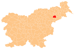
Кидричево
Hiking in Кидричево
The Municipality of Kidričevo is located in Slovenia, primarily known for its beautiful landscapes and proximity to the Pohorje Mountains. While it may not be as well-known as some other hiking destinations in Slovenia, it offers several opportunities for outdoor enthusiasts looking to explore less-traveled paths....
- Страна:
- Почтовый код: 2325
- Код автомобильного номера: MB
- Координаты: 46° 24' 13" N, 15° 47' 28" E
- GPS треки (wikiloc): [Ссылка]
- Высота над уровнем моря: 229 м m
- Площадь: 71.5 кв.км
- Веб сайт: [Ссылка]


Osilnica Municipality
Hiking in Osilnica Municipality
The Municipality of Osilnica is located in Slovenia, characterized by its beautiful natural landscapes, which makes it a great destination for hiking enthusiasts. The area is known for its pristine environment, lush forests, and the scenic Kolpa River, which provides opportunities for various outdoor activities....
- Страна:
- Почтовый код: 1337
- Код автомобильного номера: LJ
- Координаты: 45° 32' 56" N, 14° 43' 42" E
- GPS треки (wikiloc): [Ссылка]
- Высота над уровнем моря: 997 м m
- Площадь: 36.2 кв.км
- Веб сайт: [Ссылка]

Бельтинци
Hiking in Бельтинци
The Municipality of Beltinci, located in the northeastern part of Slovenia, offers a variety of hiking opportunities that showcase the beautiful countryside and natural landscapes of the region. Here are some highlights and tips for hiking in this area:...
- Страна:
- Координаты: 46° 36' 22" N, 16° 14' 15" E
- GPS треки (wikiloc): [Ссылка]
- Высота над уровнем моря: 177 м m
- Площадь: 62.2 кв.км
- Веб сайт: [Ссылка]


Бенедикт
- община Словении
Hiking in Бенедикт
The Municipality of Benedikt is located in Slovenia, known for its picturesque landscapes and outdoor activities. Hiking in this area offers a range of trails that cater to different skill levels, from casual strolls to more challenging hikes. Here are some highlights and tips for hiking in this region:...
- Страна:
- Код автомобильного номера: MB
- Координаты: 46° 36' 19" N, 15° 53' 30" E
- GPS треки (wikiloc): [Ссылка]
- Высота над уровнем моря: 287 м m
- Площадь: 24.1 кв.км
- Веб сайт: [Ссылка]


Брезовица
Hiking in Брезовица
The Municipality of Brezovica, located in Kosovo, is known for its stunning natural landscapes and diverse hiking opportunities. This area features beautiful mountains, lush forests, and pristine rivers, offering a variety of trails suitable for different skill levels. Here are some key highlights for hiking in this region:...
- Страна:
- Почтовый код: 1351
- Код автомобильного номера: LJ
- Координаты: 45° 56' 56" N, 14° 25' 28" E
- GPS треки (wikiloc): [Ссылка]
- Высота над уровнем моря: 296 м m
- Площадь: 91.2 кв.км
- Веб сайт: [Ссылка]


Церкле-на-Гореньскем
- община Словении
Hiking in Церкле-на-Гореньскем
The Municipality of Cerklje na Gorenjskem, located in Slovenia, offers a variety of hiking opportunities that cater to different skill levels and interests. Nestled at the foot of the Kamnik-Savinja Alps, this picturesque area boasts stunning natural scenery, lush forests, and numerous trails....
- Страна:
- Почтовый код: 4207
- Код автомобильного номера: KR
- Координаты: 46° 15' 0" N, 14° 30' 0" E
- GPS треки (wikiloc): [Ссылка]
- Высота над уровнем моря: 390 м m
- Площадь: 78.0 кв.км
- Веб сайт: [Ссылка]


Врхника
Hiking in Врхника
The Municipality of Vrhnika, located in Slovenia, offers a variety of hiking opportunities that cater to different skill levels and preferences. Set amidst beautiful natural landscapes, the area is characterized by rolling hills, forests, and scenic trails that are perfect for both leisurely walks and more challenging hikes....
- Страна:
- Почтовый код: 1360
- Координаты: 45° 58' 0" N, 14° 18' 0" E
- GPS треки (wikiloc): [Ссылка]
- Площадь: 126.3 кв.км


Кузма
Hiking in Кузма
The Municipality of Kuzma, located in northeastern Slovenia, offers various hiking opportunities that showcase its natural beauty and serene landscapes. Nestled at the border with Hungary, this area is characterized by rolling hills, lush forests, and picturesque valleys....
- Страна:
- Почтовый код: 9262
- Код автомобильного номера: MS
- Координаты: 46° 50' 28" N, 16° 5' 43" E
- GPS треки (wikiloc): [Ссылка]
- Высота над уровнем моря: 304 м m
- Площадь: 22.9 кв.км
- Веб сайт: [Ссылка]
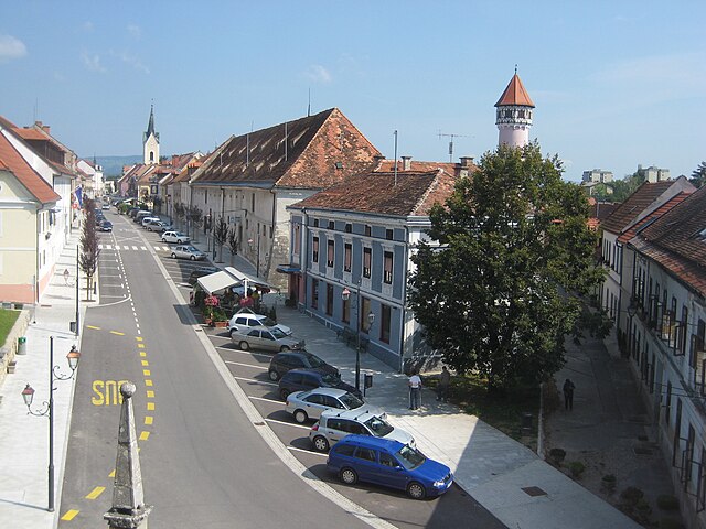
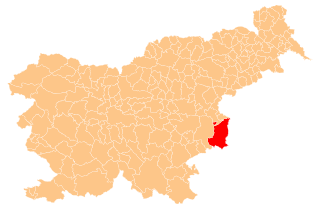
Брежице
Hiking in Брежице
Hiking in the Municipality of Brežice, located in Slovenia near the border with Croatia, offers a blend of scenic landscapes, cultural landmarks, and natural beauty. The region is characterized by rolling hills, rivers, and vineyards that provide a picturesque backdrop for outdoor activities....
- Страна:
- Почтовый код: 8250
- Код автомобильного номера: KK
- Координаты: 45° 54' 0" N, 15° 35' 0" E
- GPS треки (wikiloc): [Ссылка]
- Площадь: 268.1 кв.км


Иг
Hiking in Иг
The Municipality of Ig is located in Slovenia, known for its beautiful landscapes and natural features, making it a great destination for hiking enthusiasts. Here are some highlights about hiking in the area:...
- Страна:
- Почтовый код: 1292
- Код автомобильного номера: LJ
- Координаты: 45° 56' 9" N, 14° 30' 52" E
- GPS треки (wikiloc): [Ссылка]
- Высота над уровнем моря: 334 м m
- Площадь: 98.8 кв.км
- Веб сайт: [Ссылка]


Сельница-об-Драви
Hiking in Сельница-об-Драви
Selnica ob Dravi is a picturesque destination in Slovenia, located near the Drava River. It offers a tranquil setting for hiking enthusiasts. Here are some key points to consider for hiking in this region:...
- Страна:
- Почтовый код: 2235
- Код автомобильного номера: MB
- Координаты: 46° 34' 54" N, 15° 29' 43" E
- GPS треки (wikiloc): [Ссылка]
- Высота над уровнем моря: 702 м m
- Площадь: 64.5 кв.км
- Веб сайт: [Ссылка]


Святи-Юрий-об-Шчавници
Hiking in Святи-Юрий-об-Шчавници
Sveti Jurij ob Ščavnici is a picturesque village in Slovenia, situated in the northeastern part of the country, within the Styria region. The surrounding landscape is marked by rolling hills, lush forests, and scenic views, making it an excellent destination for hiking enthusiasts. Here are some insights into hiking in and around Sveti Jurij ob Ščavnici:...
- Страна:
- Почтовый код: 9244
- Код автомобильного номера: MS
- Координаты: 46° 34' 3" N, 16° 1' 36" E
- GPS треки (wikiloc): [Ссылка]
- Высота над уровнем моря: 207 м m
- Площадь: 51.3 кв.км
- Веб сайт: [Ссылка]

Puconci Municipality
Hiking in Puconci Municipality
Občina Puconci is a picturesque municipality located in northeastern Slovenia, known for its beautiful landscapes, rolling hills, and unique natural features. While it may not be as widely recognized as some other hiking destinations, it offers several opportunities for outdoor enthusiasts to explore the area's natural beauty....
- Страна:
- Координаты: 46° 42' 19" N, 16° 9' 31" E
- GPS треки (wikiloc): [Ссылка]
- Высота над уровнем моря: 264 м m
- Площадь: 107.7 кв.км
Odranci Municipality
Hiking in Odranci Municipality
Občina Odranci, located in Slovenia, offers a delightful experience for hikers looking to explore the beautiful landscapes of the region. The area is characterized by rolling hills, lush greenery, and scenic views, making it an ideal spot for hiking enthusiasts of all levels....
- Страна:
- Координаты: 46° 35' 12" N, 16° 16' 23" E
- GPS треки (wikiloc): [Ссылка]
- Высота над уровнем моря: 173 м m
- Площадь: 6.9 кв.км


Свети-Андраж
Hiking in Свети-Андраж
The Municipality of Sveti Andraž v Slovenskih Goricah is a picturesque area in Slovenia, known for its stunning landscapes, rolling hills, and rich natural beauty. Hiking in this municipality offers a variety of trails that cater to different skill levels and preferences, making it a great destination for nature enthusiasts and outdoor adventurers....
- Страна:
- Почтовый код: 2255
- Код автомобильного номера: MB
- Координаты: 46° 31' 0" N, 15° 58' 0" E
- GPS треки (wikiloc): [Ссылка]
- Высота над уровнем моря: 293 м m
- Площадь: 17.6 кв.км
- Веб сайт: [Ссылка]
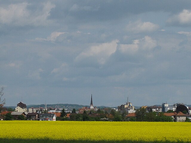
Мурска-Собота
Hiking in Мурска-Собота
Murska Sobota, located in the northeastern part of Slovenia, is a great spot for hiking enthusiasts looking to explore the natural beauty of the region. The area is characterized by its rolling hills, lush green landscapes, and a network of trails that cater to various skill levels. Here are some highlights for hiking in and around Murska Sobota:...
- Страна:
- Почтовый код: 9000
- Код автомобильного номера: MS
- Координаты: 46° 39' 29" N, 16° 9' 54" E
- GPS треки (wikiloc): [Ссылка]
- Высота над уровнем моря: 172 м m
- Площадь: 64.4 кв.км
- Веб сайт: [Ссылка]


Кобилье
Hiking in Кобилье
Kobilje, located in Slovenia, offers a variety of hiking opportunities that cater to different skill levels and preferences. The region is known for its natural beauty, including lush forests, rolling hills, and scenic vistas....
- Страна:
- Почтовый код: 9227
- Код автомобильного номера: MS
- Координаты: 46° 41' 9" N, 16° 23' 36" E
- GPS треки (wikiloc): [Ссылка]
- Высота над уровнем моря: 187 м m
- Площадь: 19.7 кв.км
- Веб сайт: [Ссылка]


Ползела
Hiking in Ползела
Polzela, located in Slovenia, offers some beautiful hiking opportunities that showcase the natural beauty of the region. The area is characterized by picturesque landscapes, rolling hills, and lush greenery, making it ideal for outdoor activities....
- Страна:
- Почтовый код: 3313
- Код автомобильного номера: CE
- Координаты: 46° 18' 15" N, 15° 5' 4" E
- GPS треки (wikiloc): [Ссылка]
- Высота над уровнем моря: 367 м m
- Площадь: 34.0 кв.км
- Веб сайт: [Ссылка]
община Луковица
Hiking in община Луковица
The Municipality of Lukovica, located in Slovenia near the borders of the scenic Kamnik-Savinja Alps, offers a variety of hiking opportunities that cater to different skill levels. The natural landscapes are rich with diverse flora and fauna, picturesque views, and well-marked trails....
- Страна:
- Почтовый код: 1225
- Код автомобильного номера: LJ
- Координаты: 46° 11' 0" N, 14° 46' 7" E
- GPS треки (wikiloc): [Ссылка]
- Высота над уровнем моря: 657 м m
- Площадь: 74.9 кв.км
- Веб сайт: [Ссылка]
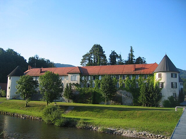
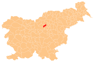
Назарье
Hiking in Назарье
Hiking in the Municipality of Nazarje, located in Slovenia, offers a range of beautiful trails and picturesque landscapes. Nestled between the Savinja River and the nearby mountains, Nazarje provides both novice and skilled hikers with opportunities to explore diverse terrains, from gentle hills to more challenging routes....
- Страна:
- Почтовый код: 3331
- Код автомобильного номера: CE
- Координаты: 46° 16' 54" N, 14° 54' 33" E
- GPS треки (wikiloc): [Ссылка]
- Высота над уровнем моря: 511 м m
- Площадь: 43.4 кв.км
- Веб сайт: [Ссылка]
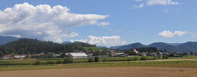

Коменда
Hiking in Коменда
The Municipality of Komenda, located in Slovenia, offers various opportunities for hiking enthusiasts due to its beautiful natural landscapes and proximity to the Julian Alps and the Karavanke mountain range. Here are some highlights and suggestions for hiking in the area:...
- Страна:
- Почтовый код: 1218
- Код автомобильного номера: LJ
- Координаты: 46° 12' 9" N, 14° 32' 40" E
- GPS треки (wikiloc): [Ссылка]
- Высота над уровнем моря: 335 м m
- Площадь: 24.0 кв.км
- Веб сайт: [Ссылка]


Света-Ана
Hiking in Света-Ана
Občina Sveta Ana, located in Slovenia's northeastern region, offers a variety of hiking opportunities amidst picturesque landscapes. This area is characterized by rolling hills, vineyards, and lush forests, making it a great destination for outdoor enthusiasts....
- Страна:
- Почтовый код: 2288
- Код автомобильного номера: MB
- Координаты: 46° 38' 51" N, 15° 50' 21" E
- GPS треки (wikiloc): [Ссылка]
- Высота над уровнем моря: 345 м m
- Площадь: 37.2 кв.км
- Веб сайт: [Ссылка]


Песница
Hiking in Песница
The Municipality of Pesnica, located in Slovenia, is known for its picturesque landscapes and rich natural heritage, making it a great spot for hiking enthusiasts. Here are some highlights and tips for hiking in the area:...
- Страна:
- Почтовый код: 2211
- Код автомобильного номера: MB
- Координаты: 46° 37' 33" N, 15° 42' 46" E
- GPS треки (wikiloc): [Ссылка]
- Высота над уровнем моря: 266 м m
- Площадь: 75.8 кв.км
- Веб сайт: [Ссылка]


Хайдина
Hiking in Хайдина
The Municipality of Hajdina, located in Slovenia, offers picturesque landscapes and a variety of hiking opportunities for outdoor enthusiasts. While it may not be as widely known as some of Slovenia's more famous hiking destinations, it still has its own charm and natural beauty....
- Страна:
- Почтовый код: 2288
- Код автомобильного номера: MB
- Координаты: 46° 25' 3" N, 15° 49' 38" E
- GPS треки (wikiloc): [Ссылка]
- Высота над уровнем моря: 237 м m
- Площадь: 21.6 кв.км
- Веб сайт: [Ссылка]
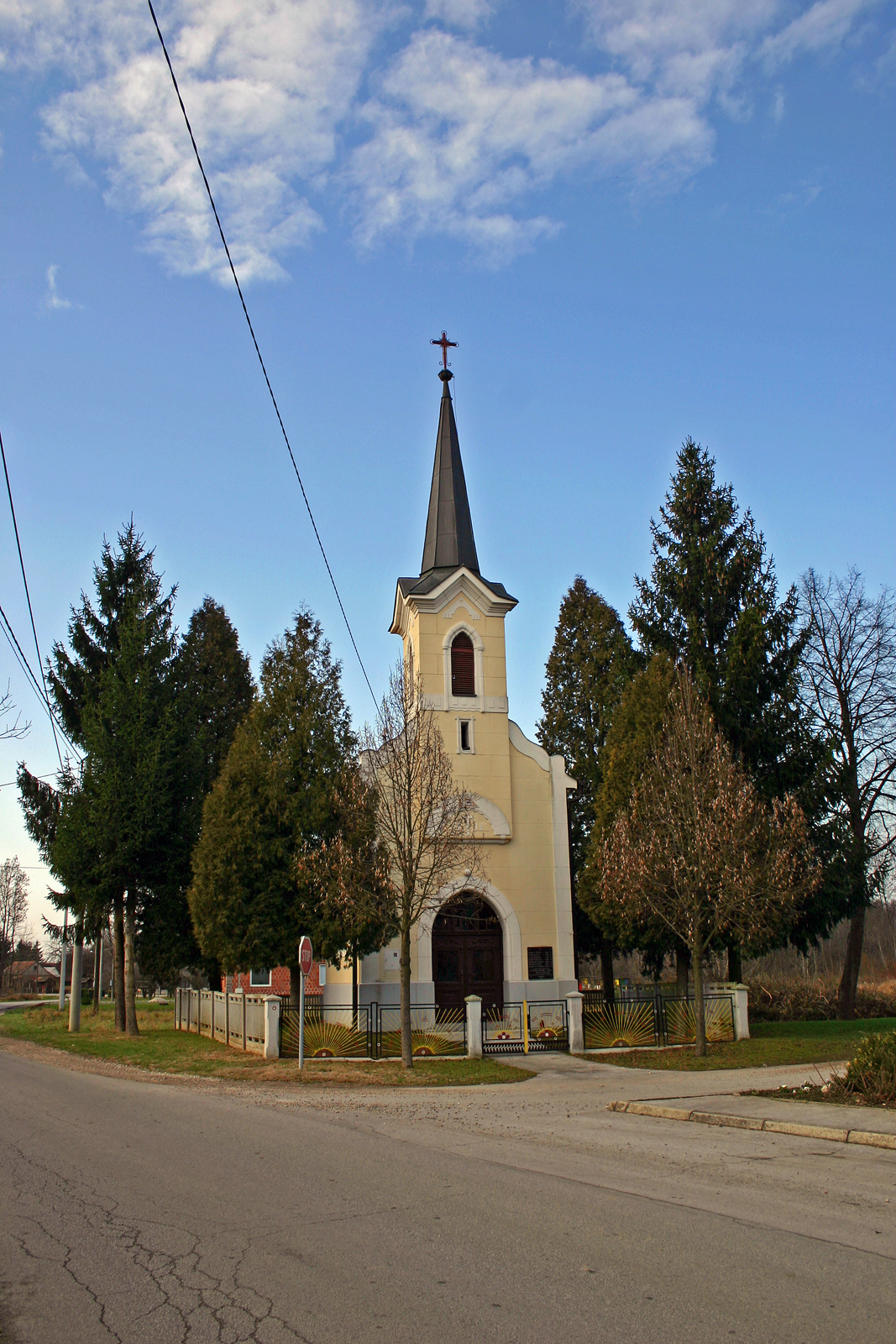

Велика-Плана
Hiking in Велика-Плана
Velika Polana is a beautiful hiking area located in Slovenia, known for its stunning landscapes and rich biodiversity. Nestled in the heart of the Triglav National Park, it offers a range of hiking opportunities suitable for various skill levels....
- Страна:
- Почтовый код: 9225
- Код автомобильного номера: MS
- Координаты: 46° 34' 43" N, 16° 21' 24" E
- GPS треки (wikiloc): [Ссылка]
- Высота над уровнем моря: 169 м m
- Площадь: 18.7 кв.км
- Веб сайт: [Ссылка]


Доль-при-Любляне
Hiking in Доль-при-Любляне
The Municipality of Dol pri Ljubljani, located near the capital city of Slovenia, offers a range of beautiful hiking opportunities that cater to various skill levels. Here are some highlights:...
- Страна:
- Почтовый код: 1262
- Код автомобильного номера: LJ
- Координаты: 46° 5' 51" N, 14° 40' 25" E
- GPS треки (wikiloc): [Ссылка]
- Высота над уровнем моря: 302 м m
- Площадь: 33.3 кв.км
- Веб сайт: [Ссылка]


Кунгота
Hiking in Кунгота
The Municipality of Kungota, located in Slovenia, is a beautiful area known for its picturesque landscapes and outdoor activities, including hiking. The region is part of the Drava region and boasts rolling hills, vineyards, and lush forests, offering a variety of trails for hikers of different skill levels....
- Страна:
- Почтовый код: 2201
- Код автомобильного номера: MB
- Координаты: 46° 38' 58" N, 15° 36' 35" E
- GPS треки (wikiloc): [Ссылка]
- Высота над уровнем моря: 290 м m
- Площадь: 49.0 кв.км
- Веб сайт: [Ссылка]
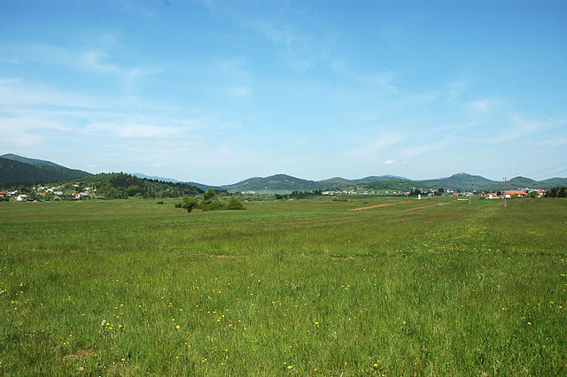

Лошка-Долина
Hiking in Лошка-Долина
The Municipality of Loška Dolina, located in Slovenia, is a picturesque area known for its natural beauty and various outdoor activities, including hiking. Nestled in the foothills of the Julian Alps, it features a mix of lush forests, rolling hills, scenic valleys, and stunning views, making it an excellent destination for both novice and experienced hikers....
- Страна:
- Почтовый код: 1386
- Код автомобильного номера: PO
- Координаты: 45° 42' 44" N, 14° 25' 42" E
- GPS треки (wikiloc): [Ссылка]
- Высота над уровнем моря: 588 м m
- Площадь: 166.8 кв.км
- Веб сайт: [Ссылка]

Табор
Hiking in Табор
Občina Tabor, located in Slovenia, offers a range of beautiful hiking opportunities that showcase the stunning natural landscapes of the region. While the area is less known than some of Slovenia's more famous hiking destinations, it has its own charm and unique trails....
- Страна:
- Почтовый код: 3304
- Код автомобильного номера: CE
- Координаты: 46° 13' 20" N, 15° 0' 52" E
- GPS треки (wikiloc): [Ссылка]
- Высота над уровнем моря: 357 м m
- Площадь: 34.8 кв.км
- Веб сайт: [Ссылка]


Подчертрек
Hiking in Подчертрек
Podčetrtek is a charming town located in Slovenia, known for its beautiful landscapes, thermal spas, and rich cultural heritage. The surrounding area offers a variety of hiking opportunities, suitable for various skill levels, and allows hikers to enjoy the natural beauty of the region....
- Страна:
- Почтовый код: 3254
- Код автомобильного номера: CE
- Координаты: 46° 8' 41" N, 15° 34' 37" E
- GPS треки (wikiloc): [Ссылка]
- Площадь: 60.6 кв.км
- Веб сайт: [Ссылка]


Лошки-Поток
Hiking in Лошки-Поток
The Municipality of Loški Potok is located in Slovenia and is known for its beautiful natural landscapes, which make it an excellent destination for hiking enthusiasts. The region features a mix of hills, forests, and rivers, providing a variety of trails suitable for different skill levels, from easy walks to more challenging hikes....
- Страна:
- Почтовый код: 1318
- Код автомобильного номера: NM
- Координаты: 45° 42' 0" N, 14° 35' 0" E
- GPS треки (wikiloc): [Ссылка]
- Высота над уровнем моря: 773 м m
- Площадь: 134.5 кв.км
- Веб сайт: [Ссылка]


Трновска-Вас
Hiking in Трновска-Вас
The Municipality of Trnovska Vas is located in Slovenia, offering a unique blend of natural beauty and cultural experiences for hiking enthusiasts. The area is characterized by its picturesque landscapes, rolling hills, forests, and diverse ecosystems, making it a great destination for both casual hikers and more experienced adventurers. Here are some highlights for hiking in Trnovska Vas:...
- Страна:
- Почтовый код: 2288
- Код автомобильного номера: MB
- Координаты: 46° 31' 4" N, 15° 54' 16" E
- GPS треки (wikiloc): [Ссылка]
- Высота над уровнем моря: 230 м m
- Площадь: 22.9 кв.км
- Веб сайт: [Ссылка]


Крижевци
Hiking in Крижевци
The Municipality of Križevci, located in Croatia, offers a variety of hiking opportunities that showcase its beautiful landscapes and rich cultural heritage....
- Страна:
- Почтовый код: 9242
- Код автомобильного номера: MS
- Координаты: 46° 33' 0" N, 16° 8' 0" E
- GPS треки (wikiloc): [Ссылка]
- Площадь: 46.2 кв.км
- Веб сайт: [Ссылка]


Добрна
Hiking in Добрна
The Municipality of Dobrna, located in Slovenia, is known for its stunning natural landscapes and hiking opportunities. The area is characterized by lush greenery, rolling hills, and scenic views, making it a great destination for outdoor enthusiasts....
- Страна:
- Почтовый код: 3204
- Код автомобильного номера: CE
- Координаты: 46° 21' 16" N, 15° 13' 34" E
- GPS треки (wikiloc): [Ссылка]
- Высота над уровнем моря: 591 м m
- Площадь: 31.7 кв.км
- Веб сайт: [Ссылка]


Mislinja Municipality
Hiking in Mislinja Municipality
Občina Mislinja, located in northern Slovenia, is known for its beautiful landscapes, rolling hills, and abundant nature. The area offers a variety of hiking opportunities for different skill levels, making it a great destination for both novice and experienced hikers....
- Страна:
- Координаты: 46° 27' 4" N, 15° 13' 26" E
- GPS треки (wikiloc): [Ссылка]
- Высота над уровнем моря: 758 м m
- Площадь: 112.2 кв.км


Дуплек
Hiking in Дуплек
The Municipality of Duplek, located in Slovenia, offers a variety of hiking opportunities that cater to both novice and experienced hikers. The region is characterized by its picturesque landscapes, rolling hills, and lush greenery, making it a great spot for outdoor enthusiasts....
- Страна:
- Почтовый код: 2241
- Код автомобильного номера: MB
- Координаты: 46° 31' 0" N, 15° 46' 0" E
- GPS треки (wikiloc): [Ссылка]
- Высота над уровнем моря: 229 м m
- Площадь: 40.0 кв.км
- Веб сайт: [Ссылка]
Граничит с регионами:

Италия
- государство на юге Европы, в центре Средиземноморья
Hiking in Италия
Hiking in Italy offers a diverse range of landscapes, trails, and experiences, making it a paradise for outdoor enthusiasts. From the breathtaking Dolomites in the north to the lush coastal paths of the Amalfi Coast in the south, Italy’s diverse geography provides something for everyone. Here are some highlights and tips for hiking in Italy:...
- Страна:

- Столица: Рим
- Код автомобильного номера: I
- Координаты: 43° 0' 0" N, 12° 0' 0" E
- GPS треки (wikiloc): [Ссылка]
- Площадь: 301338 кв.км
- Население: 60599936
- Веб сайт: [Ссылка]


Австрия
- государство в Западной Европе
Hiking in Австрия
Austria is a hiker's paradise, boasting a diverse range of landscapes, from the majestic Alps to picturesque valleys and lush forests. Here are some key aspects to consider when hiking in Austria:...
- Страна:

- Столица: Вена
- Код автомобильного номера: A
- Координаты: 48° 0' 0" N, 14° 0' 0" E
- GPS треки (wikiloc): [Ссылка]
- Площадь: 83878.99 кв.км
- Население: 8572895